Lofoten Islands and Sunshine
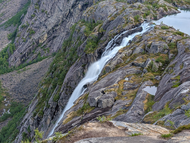
Travelling north from Bodo our first stop was Rago National Park, which has a fantastic hike to the Litlverivassfosen waterfall.
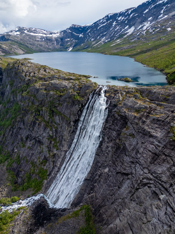
The hike to the glacier is a 13km long return and involves around 750m of elevation gain. The majority of the hike is through scrubby and boggy woodland but eventually you climb up a ladder out of a gully to the rim of a huge valley with a winding river at the bottom. As you move along the side of the valley a massive waterfall comes into view cascading down the side of the valley from a lake above.
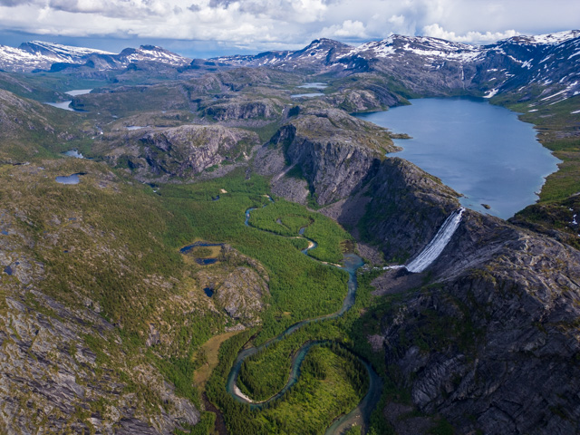
The path continues down to the lake and across a bridge over the top of the waterfall. It’s possible to loop around but at this point I decided to retrace my steps. This is one of the most beautiful and dramatic valleys that I have been to and in my opinion, rivals Lake O’Hara in Canada – and that’s saying something.
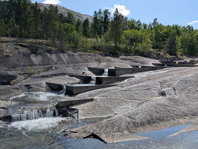
From Rago we continued on our way north, stopping at Tommerneset, the site of some ancient rock art – which is practically invisible from the viewing spot across the river – and the longest Salmon ladder in Norway.
Finally we reached Bognes from where you can take a short ferry ride to Londingen on the Lofoten Islands. Unlike Bodo, there was no queue here and we were ushered straight onto the ferry.
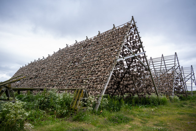
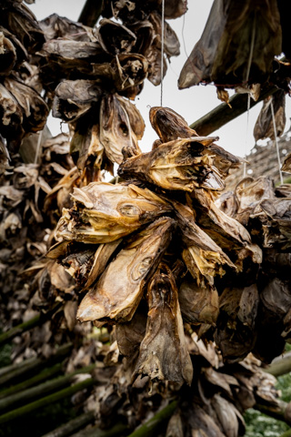
On arrival, we drove a short distance to a lake side spot for the night and in the morning, we headed towards the small, sparsely populated fishing village of Laukvik. This is the site of some huge drying racks for stockfish (the local name for cod), where we found the racks covered in bundles of fish heads! Apparently, most of the dried cod that is produced in Norway is sent to Nigeria and is considered a delicacy in Nigerian cooking.
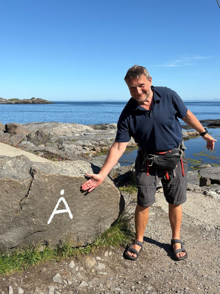
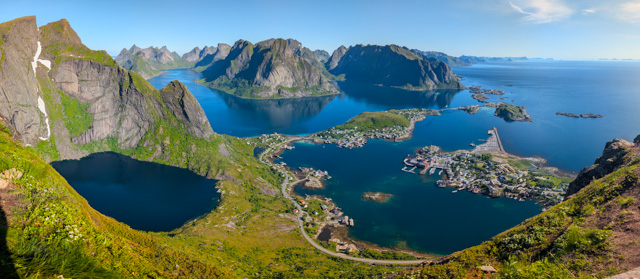
Our plan at this point was to drive the full length of the Lofoten islands to where the road ends at a town with the shortest possible name, A. We knew that better weather was forecast, so we were moving quite slowly as we wanted to see the dramatic scenery further south in good weather.
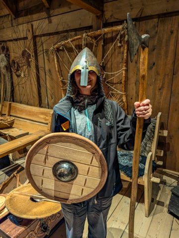
Before the good weather arrived though we had to occupy ourselves for yet another rainy day – so we went to the Lofotr Viking Museum (unfortunately it seemed everyone else had the same idea as the place was incredibly busy), where there is a re-creation of the longest long house ever discovered, only a few metres from the original ruin site.
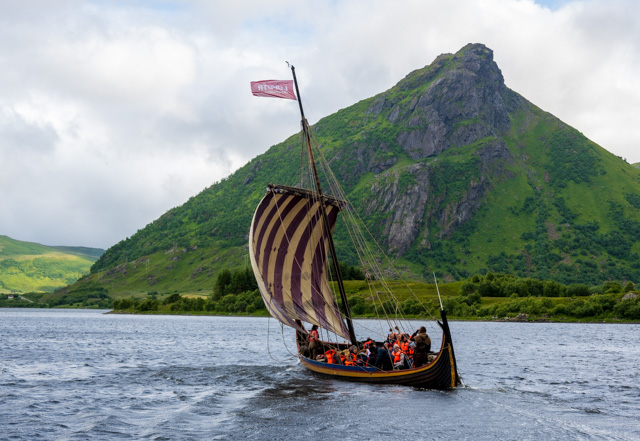
A short walk downhill from the longhouse there is a small rebuilt viking boat which is sailed on a lake here. It moved surprisingly fast.
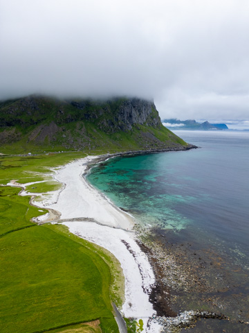
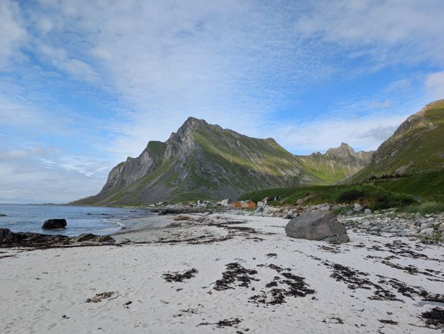
A bit further south from here are a pair of beautiful beaches on Vestvagoy, separated by a headland – with a tunnel through it of course. These were lovely in the low cloud and strong winds but I’m sure in good weather they are absolutely stunning.
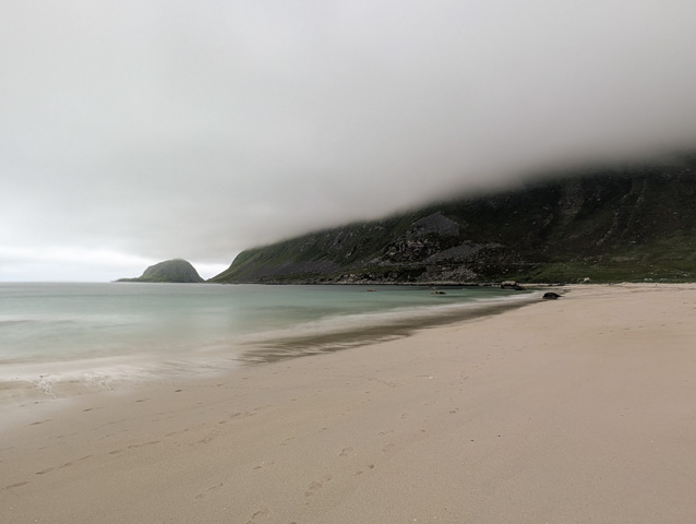
We checked them both out and went for short walks down both beaches but the weather was definitely not conducive to sitting on the beach so we moved on.
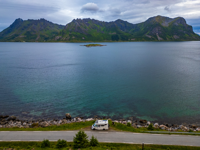
We found a park-up with great views of some mountains across the sea, just down the road from the village of Vikten. It was a small layby at the side of the road but the road was a dead end and there was barely any traffic. While we were there the clouds started to clear and when we awoke the next day it was actually sunny !
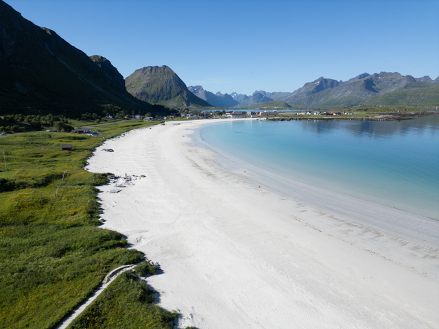
We carried on South with a spring in our step – it’s amazing how a little sunshine can lift your spirits. We stopped off at a beautiful white sand beach called Ramberg beach, excitedly dug out the swim shorts and bathers from the back of the wardrobe and actually sat on the beach in the sun for a couple of hours soaking up some long awaited vitamin D. Sarah even decided to go for a swim until she put her foot in the water and beat a hasty retreat. Apparently it was, “flipping freezing!”
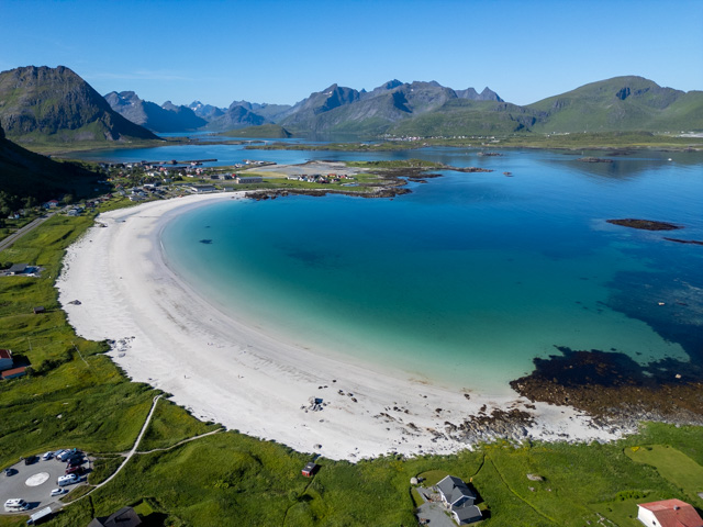
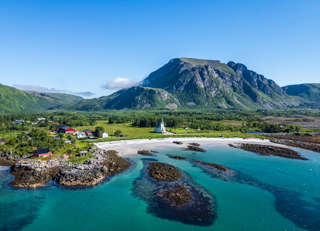
We stopped for lunch just down the road from Ramberg and I took the opportunity to send up the drone as the scenery was spectacular. The clear skies and sunshine had come just in time as we were entering the most dramatic landscapes of the Lofoten.
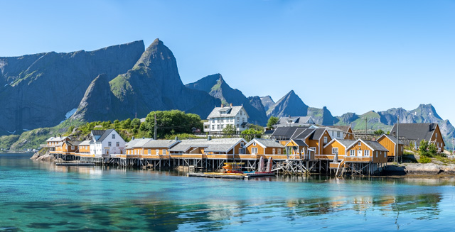
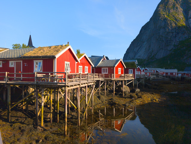
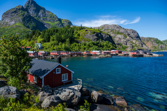
The next stop was Hamnoy, a small fishing village in a stunningly beautiful protected bay, with big mountains coming down to the water and the red timber buildings standing out against the deep blues of the water and greens of the land.

Also in this big bay is the small town of Sakriskoy, where we took a short break for a wander around.
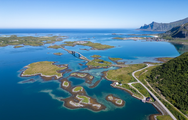
In this stretch of the highway we were making slow progress as we were stopping to take in the views whenever we could find somewhere to pull over.
We finally made it all the way down to A and walked to the end of land (not really but the trail ends here). The town of A itself is very scenic and there are a number of museums presenting the history of the town and the fishing industry here.
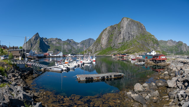
Unfortunately there is nowhere to park overnight around A so we headed back the way we came (there is only one road through the Lofotens) and stopped off at the town of Reine where you can park at the harbour.
From here I did the Reinebringen hike which is an absolute killer. It is only just over 500m of climbing from the bottom at the coast to the peak, but it’s up a staircase with deep steps which is absolutely exhausting. I headed up confidently at first but had really slowed down towards the top and even took a couple of breaks before reaching the viewpoints. The views are spectacular though and well worth the pain of the ascent.
A little way North of Reine is the town of Nusfjord, which is actually a museum town. You have to pay an entrance fee to walk around the town itself but it was a fun detour and well worth the money. The car park for the town is very small though and we were lucky to find a spot for the camper.
In the early 20th century Nusfjord was an important fishing village and at its peak had over 500 fishing boats based here and 1,500 fishermen, but today it houses just 28 residents.
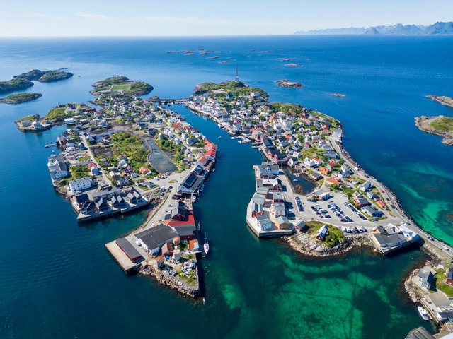
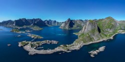
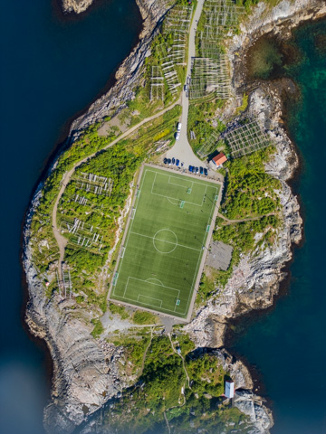
On our way South we had skipped the branch road that went to the town of Henningsvaer as we wanted to visit in good weather, mainly because I was keen to get a drone shot of its famous isolated football pitch on its own island !
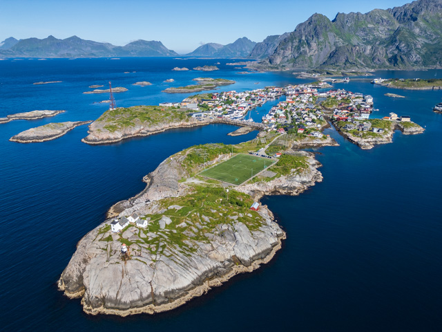
The town itself is split by a channel and there is a small harbour at one end of the town. It’s a very scenic town which looks great from the air.
Henningsvaer was our last stop on the Lofoten islands as we were soon to be turning North to visit the islands of Langoya and Andoya.
We really enjoyed our visit to this amazing chain of islands. The scenery definitely did not disappoint and it is clear why so many people visit this area. It did feel close to being in danger of over tourism, the local population is low and the towns are very small, which means that they can be easily overrun and I wonder how the locals feel about this annual summer influx. On the plus side, the weather itself must help to restrict this to only a few months of the year.
Fortunately there is no major port on any of the islands only small fishing harbours so the cruise ships that were so common further south cannot come into this area.
For those of you like us, who want to visit the Lofoten by motorhome, there aren’t that many campsites and the ones that we saw seemed to be very busy. However we didn’t have any problems finding wild camping spots for the night, although we would start to look for a place relatively early, around 4pm. If you do wild camp, there seem to be fewer motorhome services dotted around than on the rest of Norway but there are still enough to get by if you plan well.