Border Crossing: Argentina to Chile at Rio Bellavista
This takes the prize as not only the quickest border crossing that we’ve done but also the most fun.
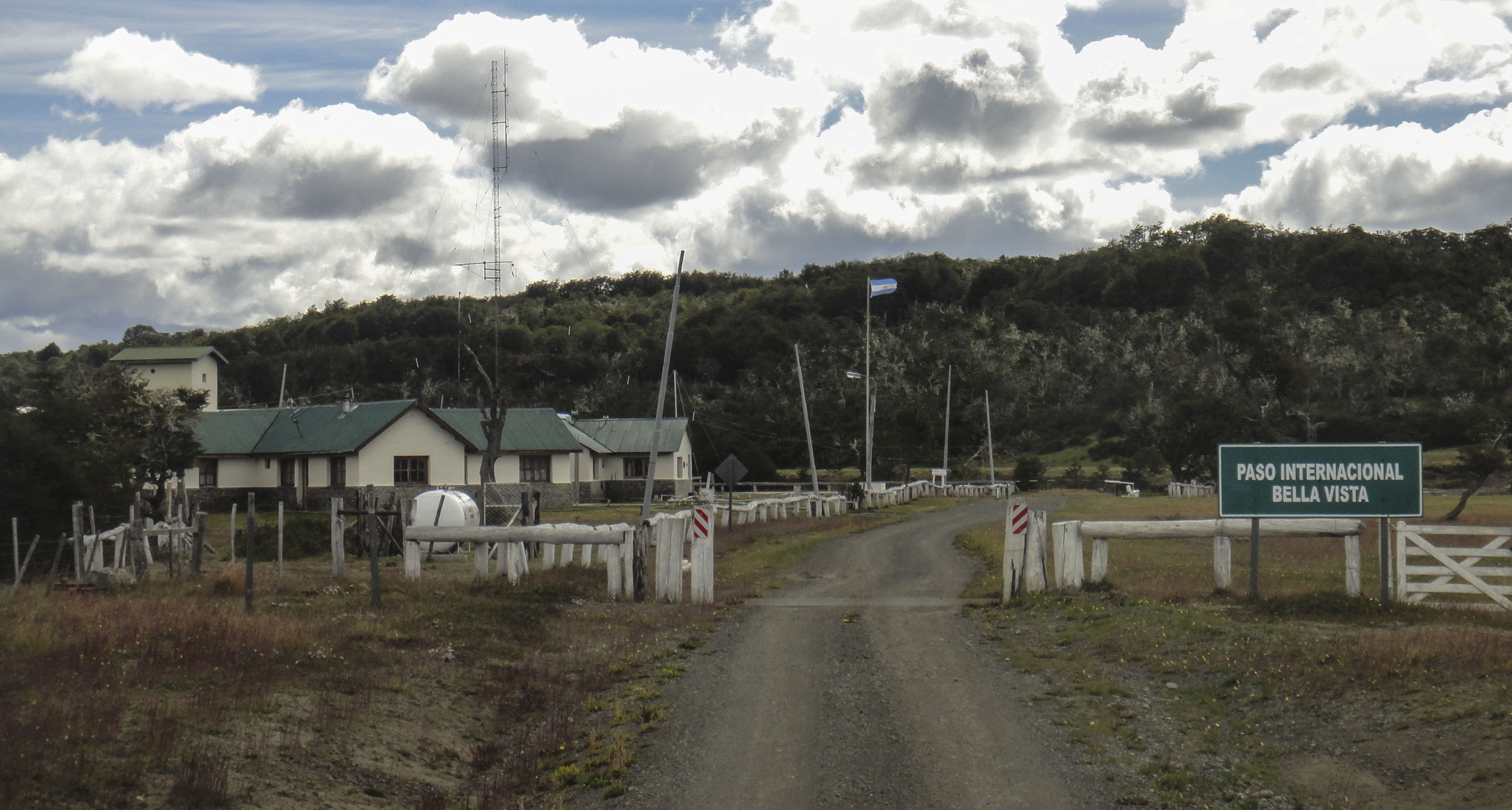
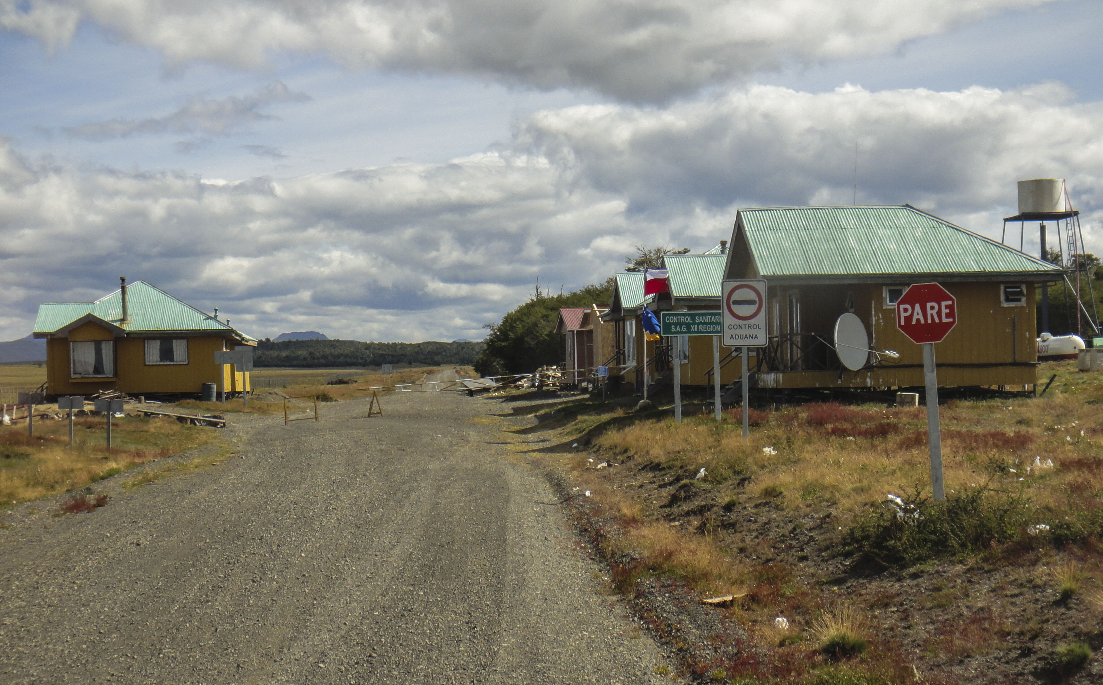
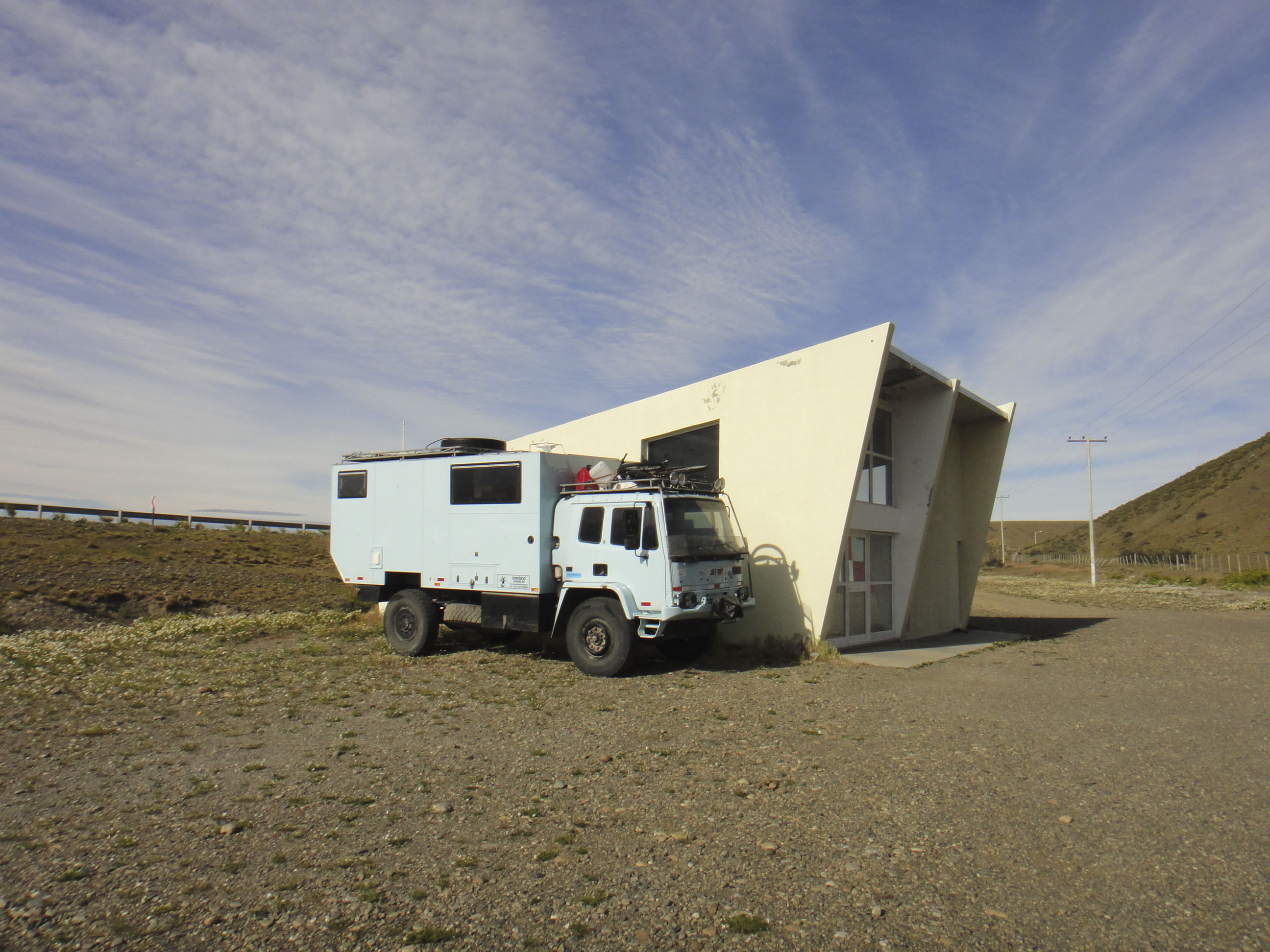
The Argentine side of the border is a reasonably big complex of buildings with a fairly dilapidated look about them. There is a boom across the road where you stop.
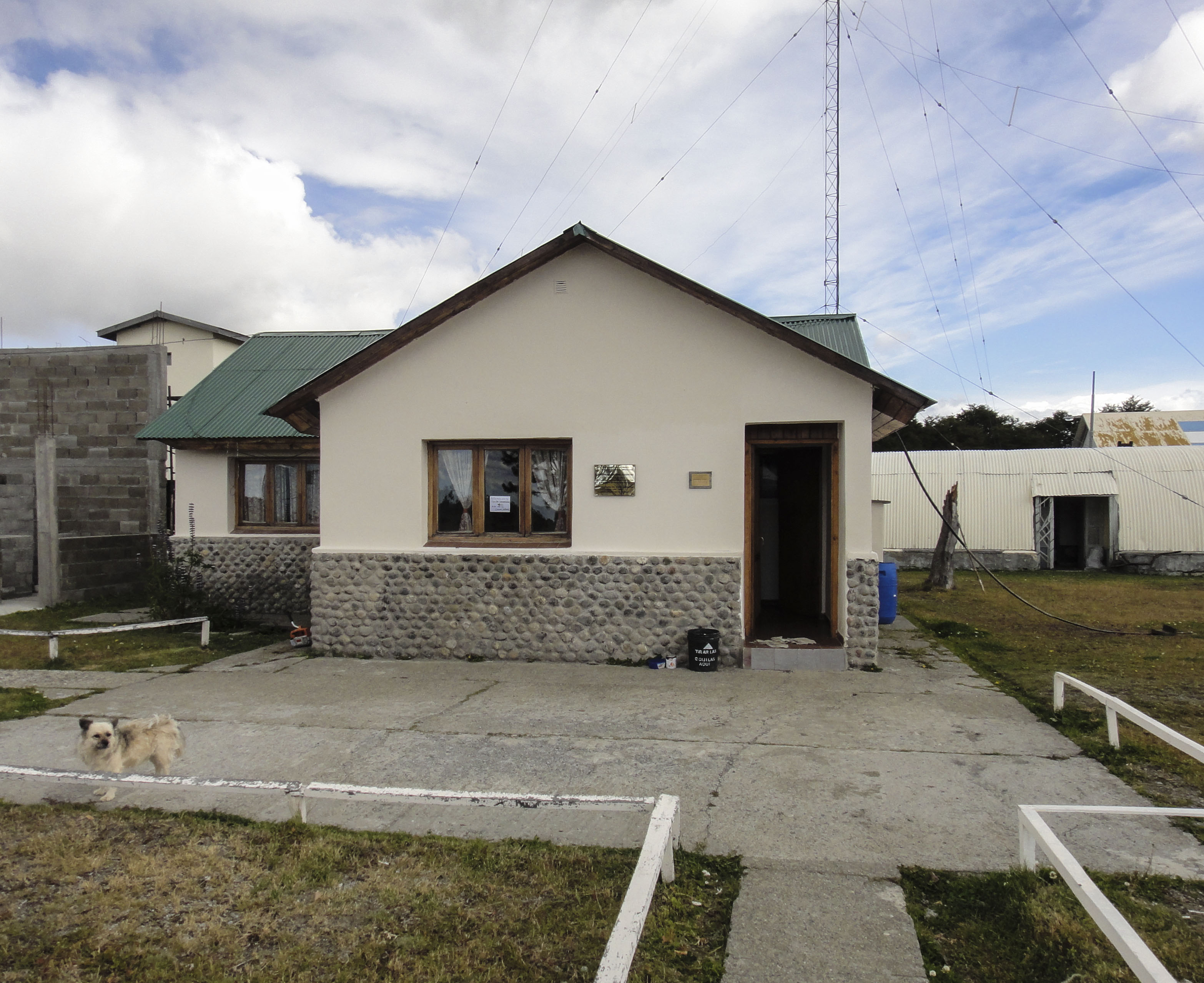
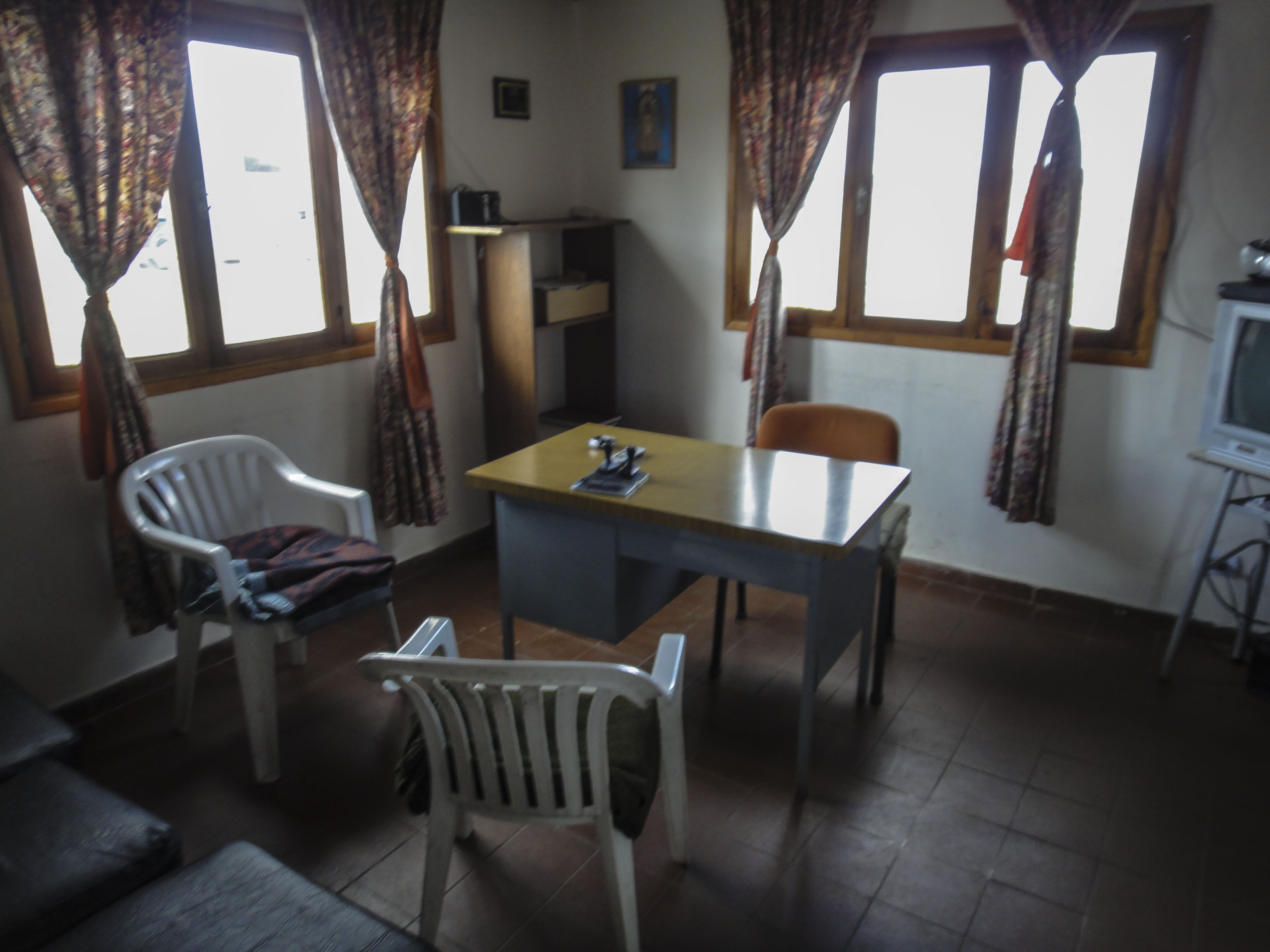
The actual border building looks more like someone’s house. When we arrived there was no one around but by the time we were out of the truck the Migracion guy had appeared and he wandered off to get the Aduana guy. The little dog was a nasty little thing and went absolutely mental at me.
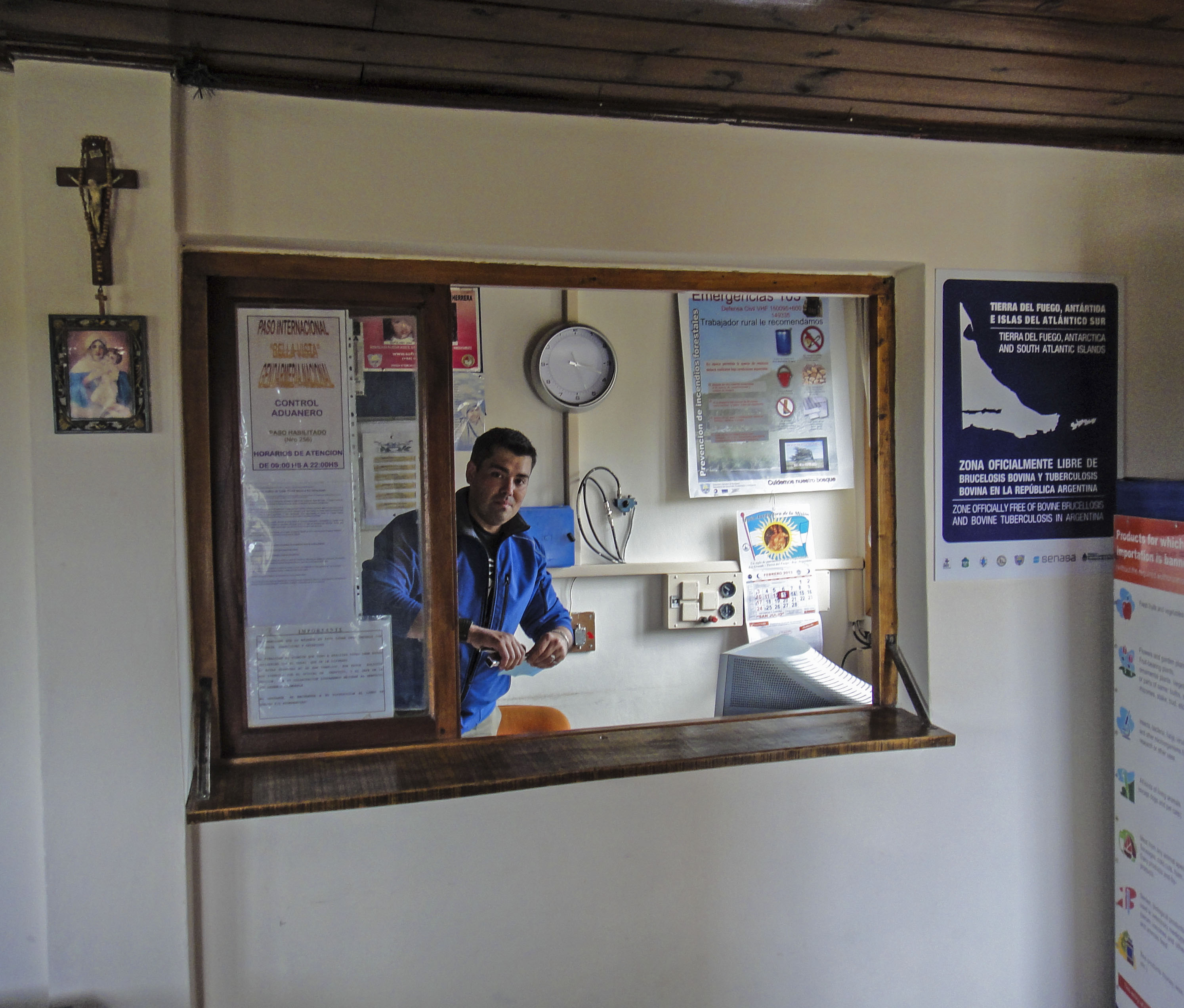
Once they were both there we handed over our passports and TIP. They stamped them and we were done in around 2 minutes. I wouldn’t get here too early in the morning though or you might be getting people out of bed !
One of the guys lifted the barrier for us and we were done.
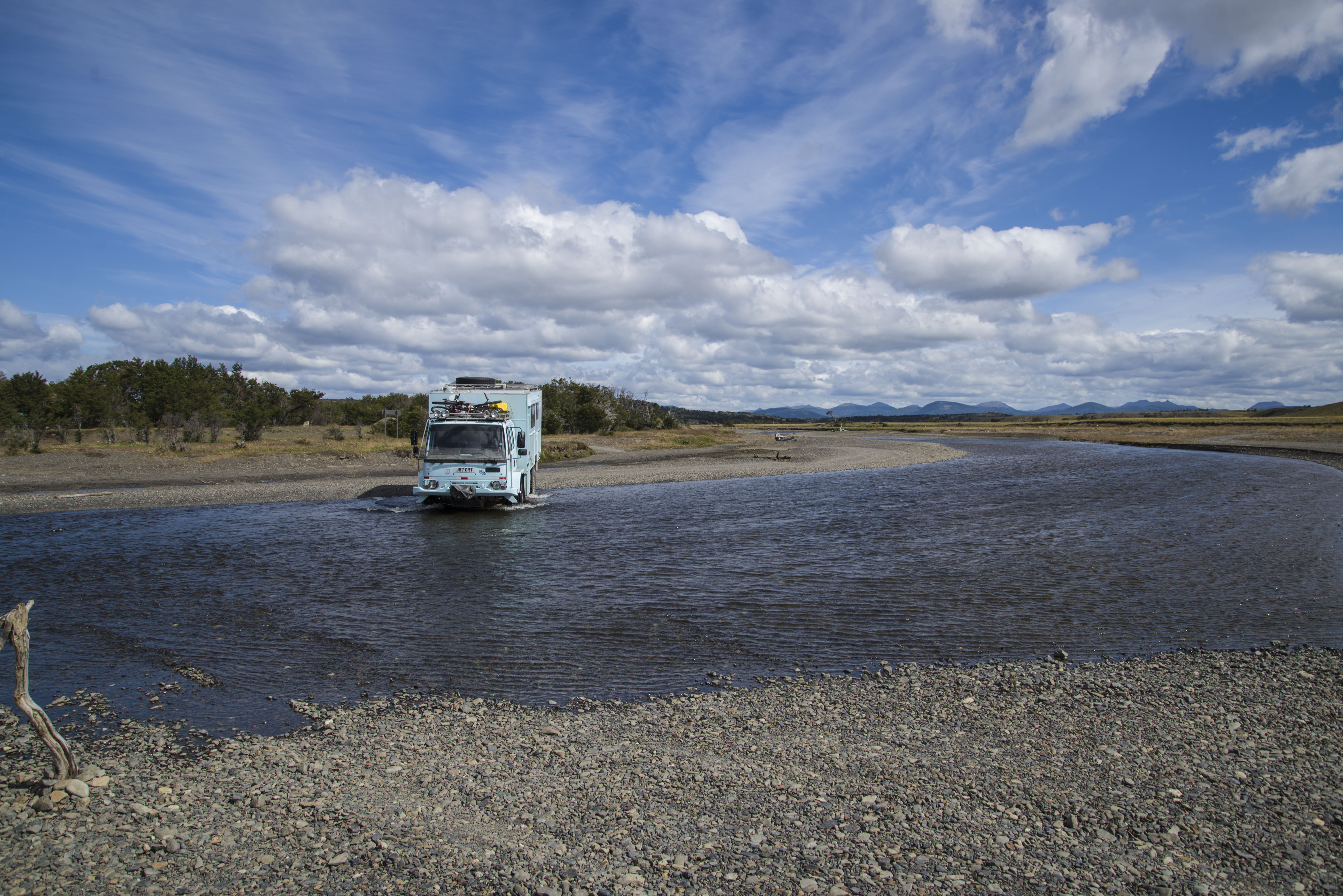
Between the two borders there is a river which needs to be crossed. There is a fairly shallow fording place which in good weather can probably be done on a motorbike.
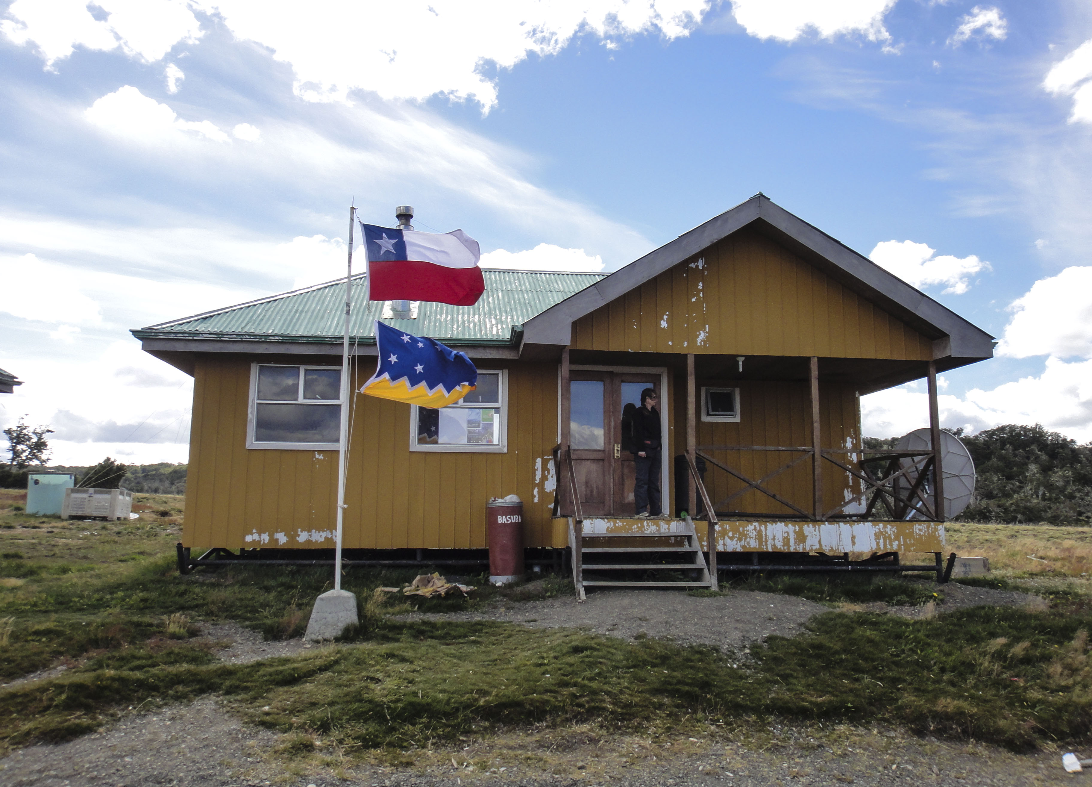
A couple of hundred metres after the river there is a small collection of buildings making up the Chilean side of the border. When we arrived there was no sign of life and the main building was locked.
However we knocked on the door of a building a bit further up and this roused the border staff. There were three guys – Migracion, Aduana and SAG. They opened up the locked building – not using a key but using a scrap of metal to jimmy the lock !
Again the border was really quick and easy . We were through in only a couple of minutes. The guys here were really friendly and gave us a bunch of tourist material for the Chilean side of Tierra del Fuego. They also told us that only 100 people a year use this border !
The SAG (food) check was the easiest we have had. We owned up to some potatoes and an onion. However when he came in he found some garlic we’d forgotten about and surprisingly let us keep it. He didn’t really look in any of the cupboards, only the fridge.
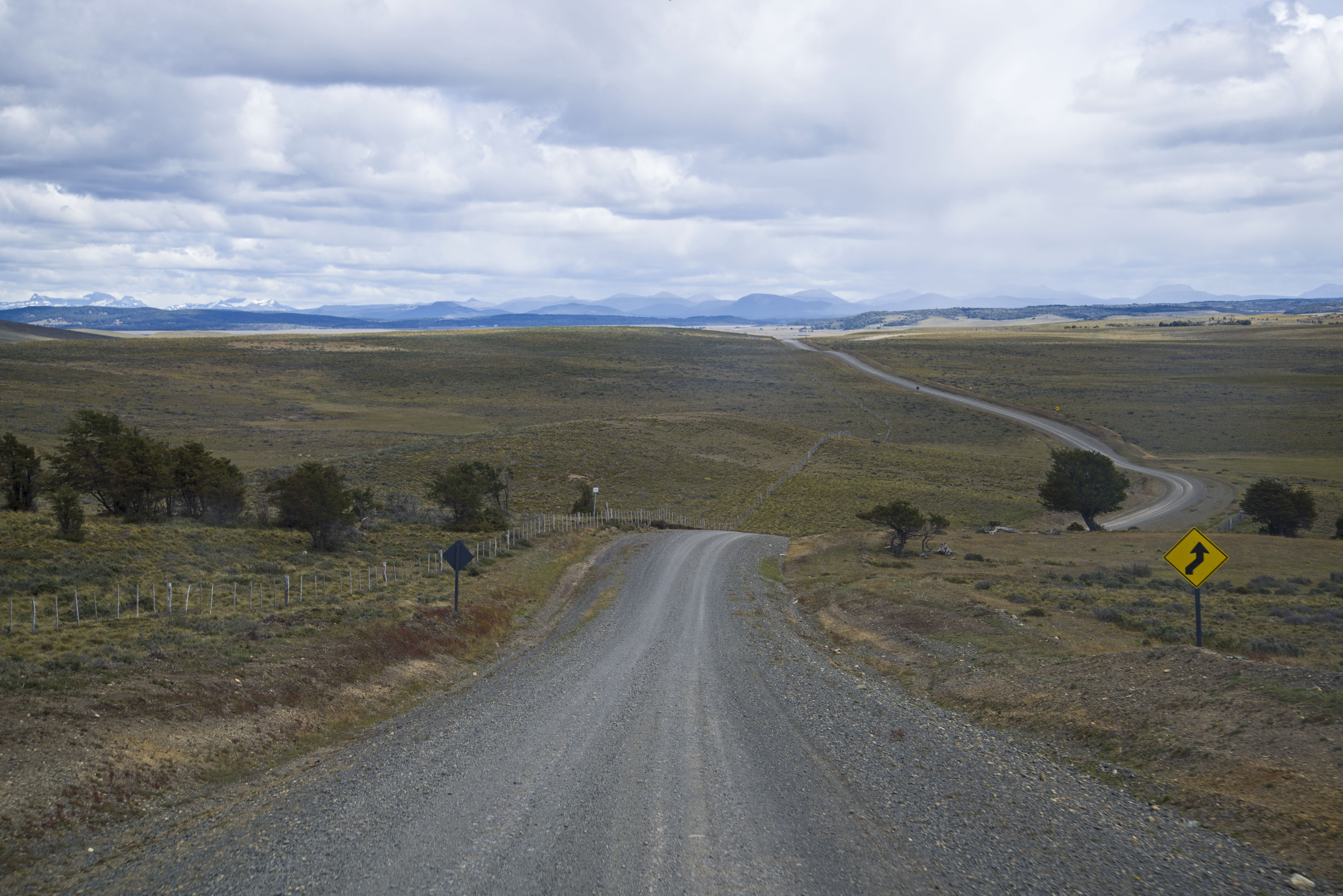
Total time for the border both sides was about 15 minutes making it the quickest border we have done on the whole trip. Although the road to and from the border is dirt it was in excellent condition the whole way.
Tierra Del Fuego
It took us a couple of nights to come down from our trip to Antarctica and get ready to be back on the road. Adjusting to a camper half the size of the room we’d had on Sea Spirit was only half of it.
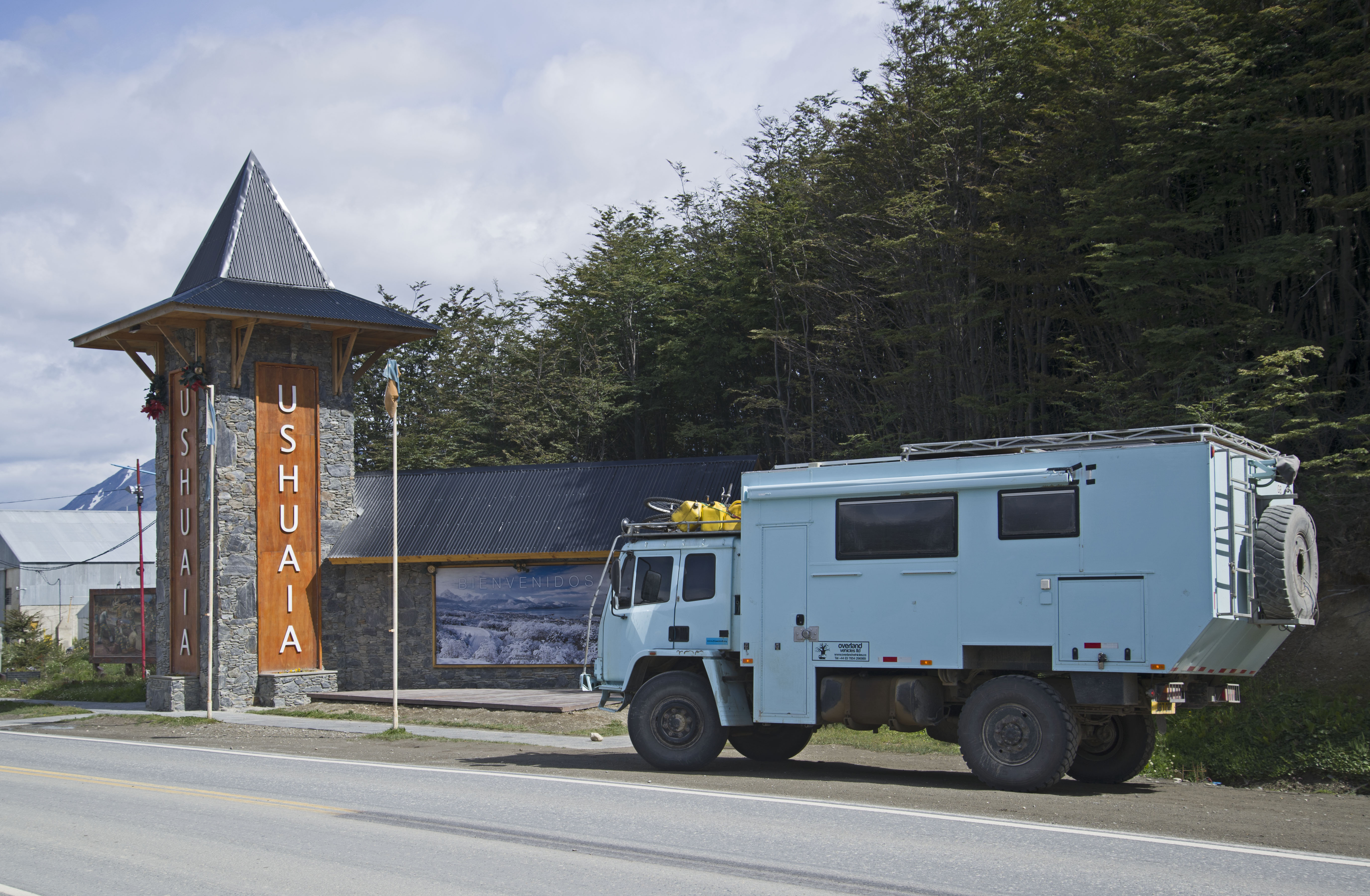
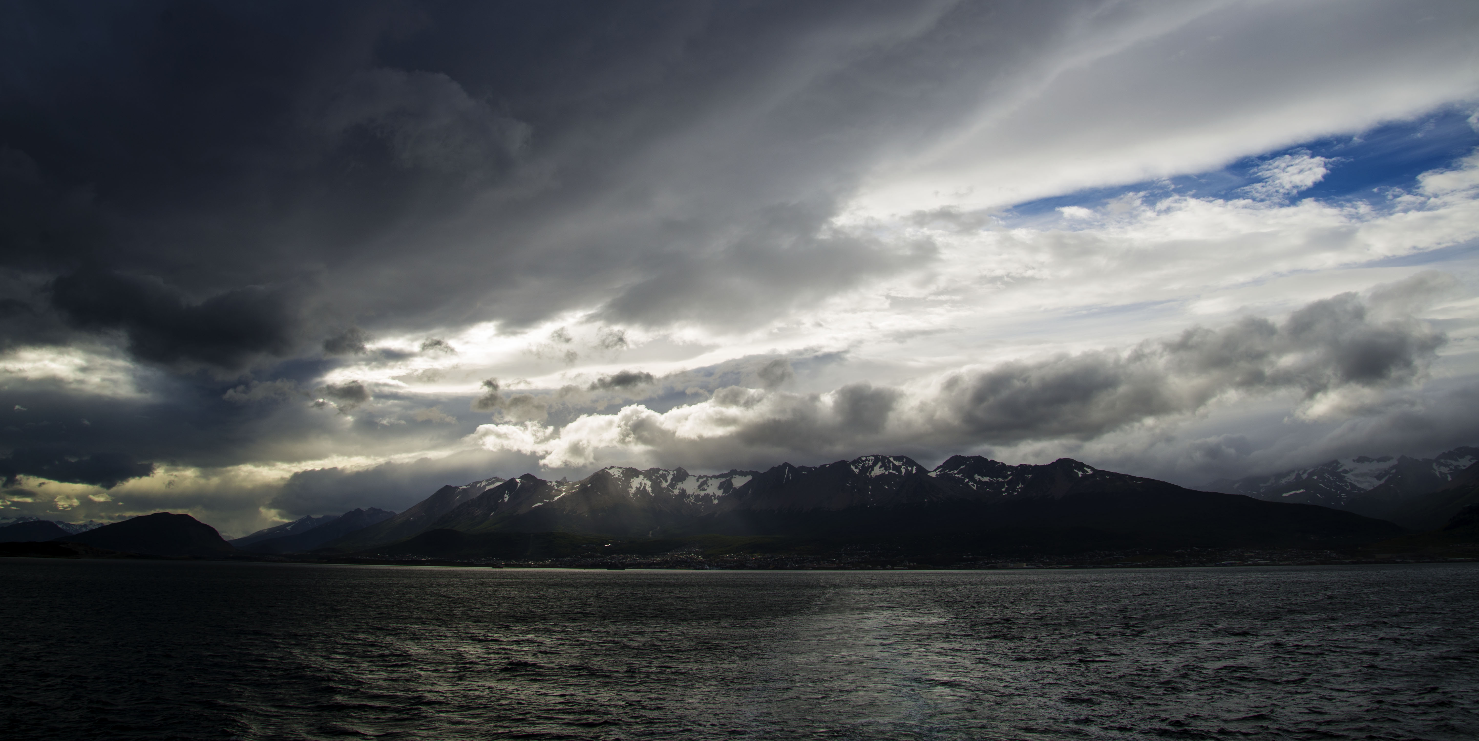
Soon enough however we had our energy back and were ready to head off. Before leaving the “End of the World” in Ushuaia we needed to go South a few Km’s to the end of Ruta 3 and the Southernmost point that we would drive to.
Ruta 3 becomes dirt after Ushuaia, but good dirt, and soon after this it passes through Tierra del Fuego National Park. This park is small and pretty expensive to get into but it holds the end of the road and this is somewhere we wanted to visit.
The major upside of the park though is free camping at a number of basic campsites (with toilets and grills) which offsets the cost somewhat.
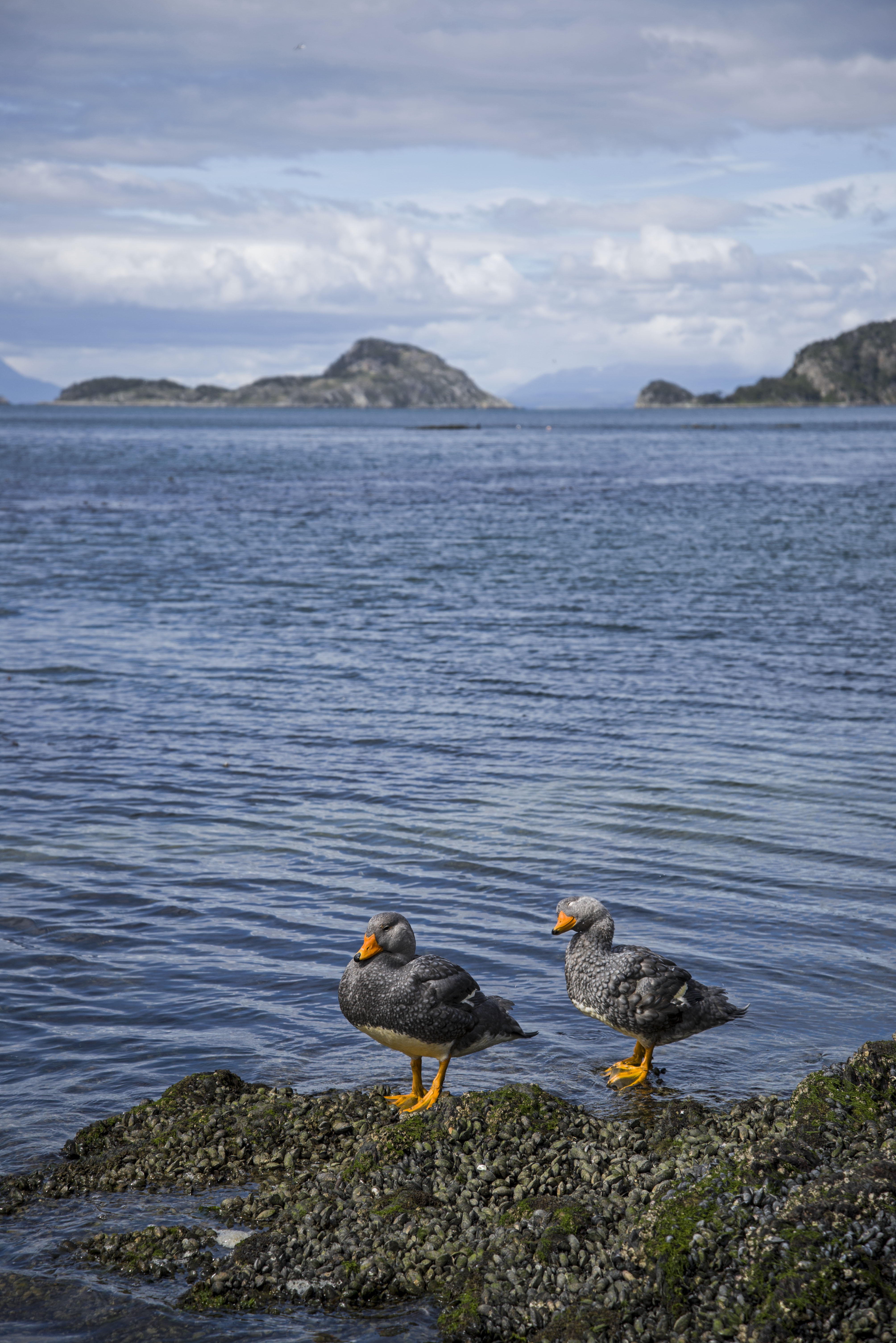
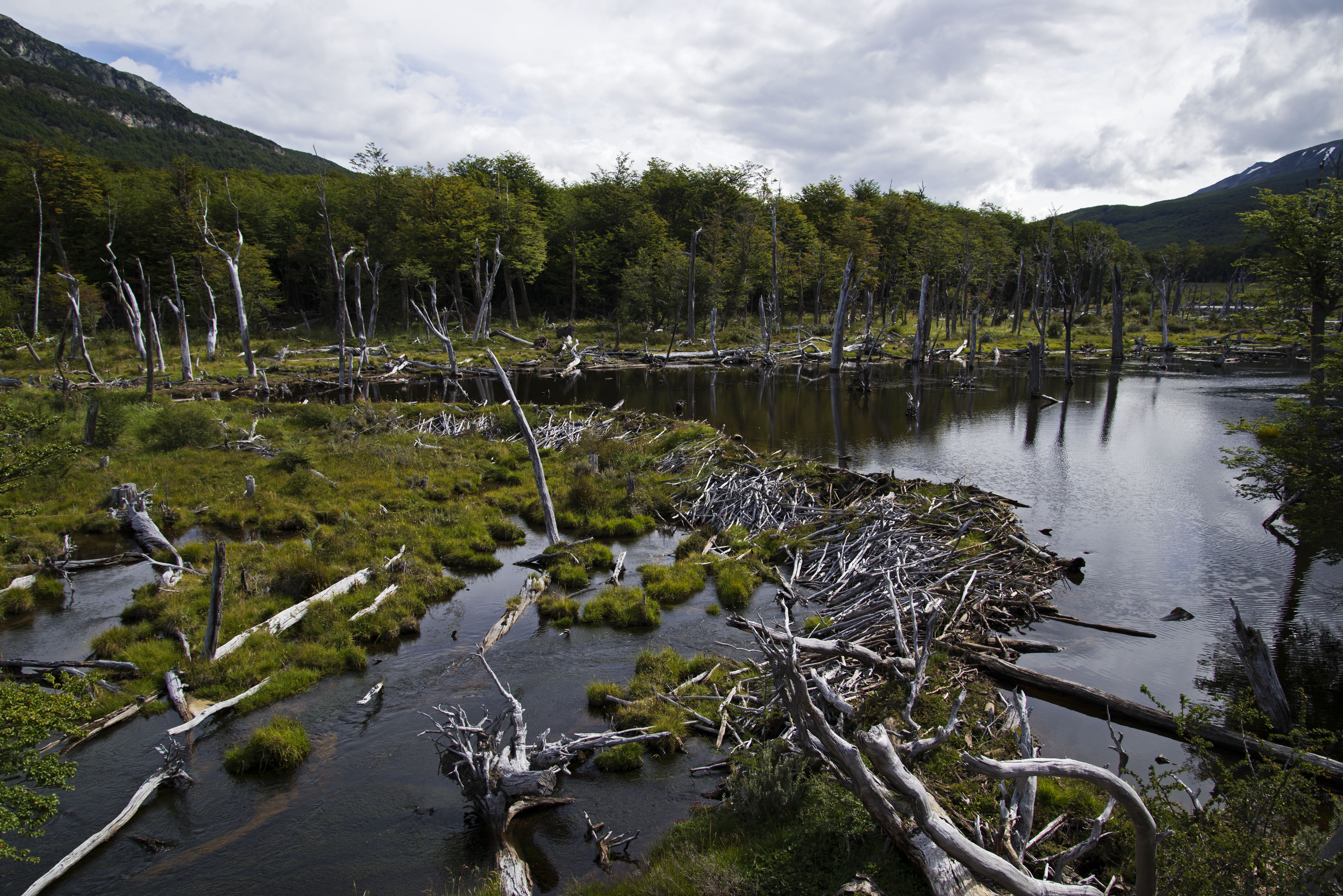
The park itself is pretty but not stunning with some coastline, rivers and forest. We only spent one night here as we wanted to get on with our trek North but it would be very easy to spend a few days hanging out here doing some walks and soaking up the sun (only of course if the weather is good!).
After leaving TdF NP we began our drive North but at Rio Grande instead of continuing North on the paved road we took the gravel road West to the very quiet Rio Bellavista border. This was our quietest border of the whole trip and crossing at 3pm we were the first customers of the day as we roused the officer to unlock the office and change the date on his stamp !
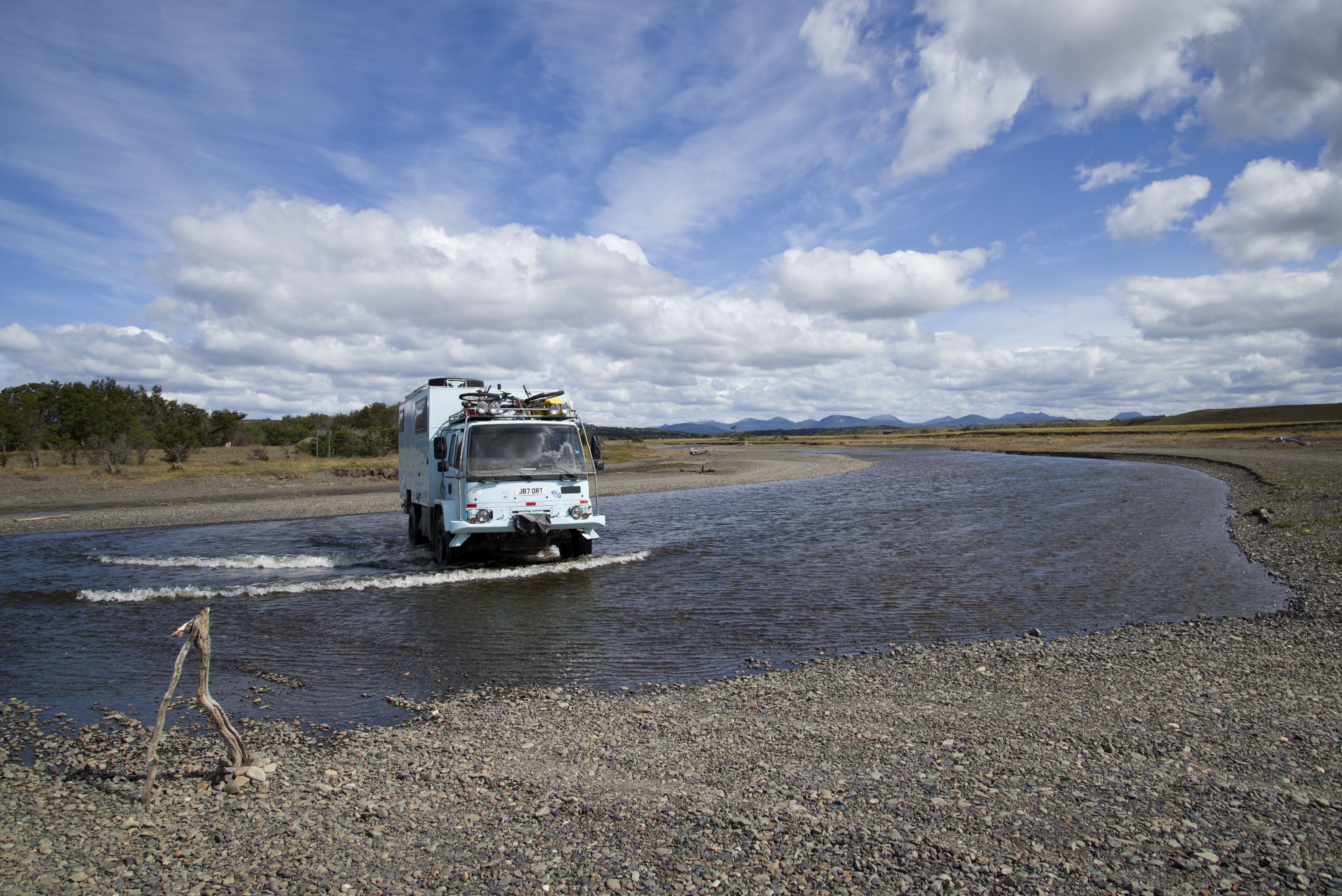
The gravel road to the border was in great shape and the border itself was quick and even involved a shallow river crossing.
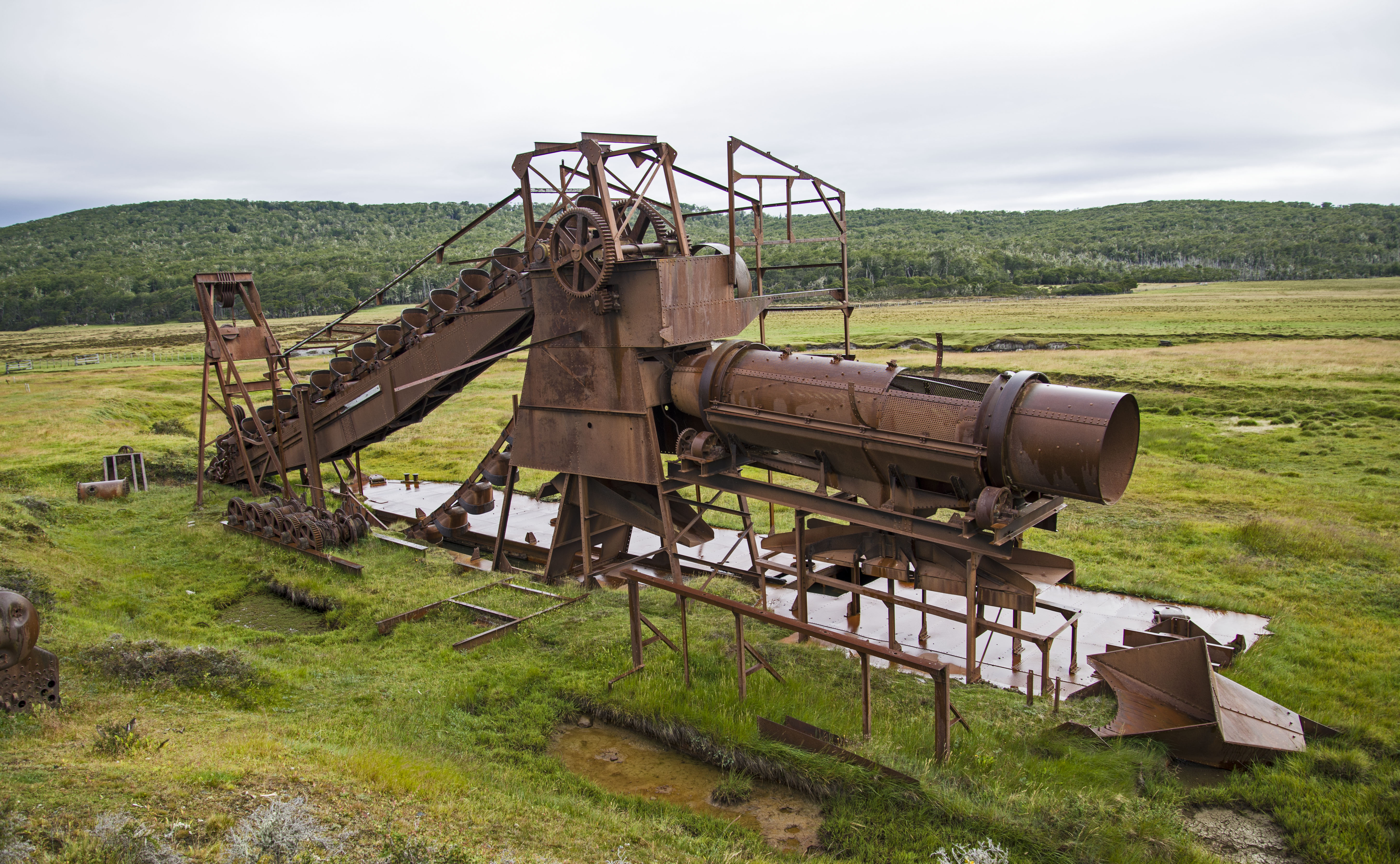
On the Chilean side of the border the road wasn’t quite as good but still better than most of ripio that we have driven. We soon came across the ruins of a gold dredge – like the ones we had seen in Alaska but much smaller.
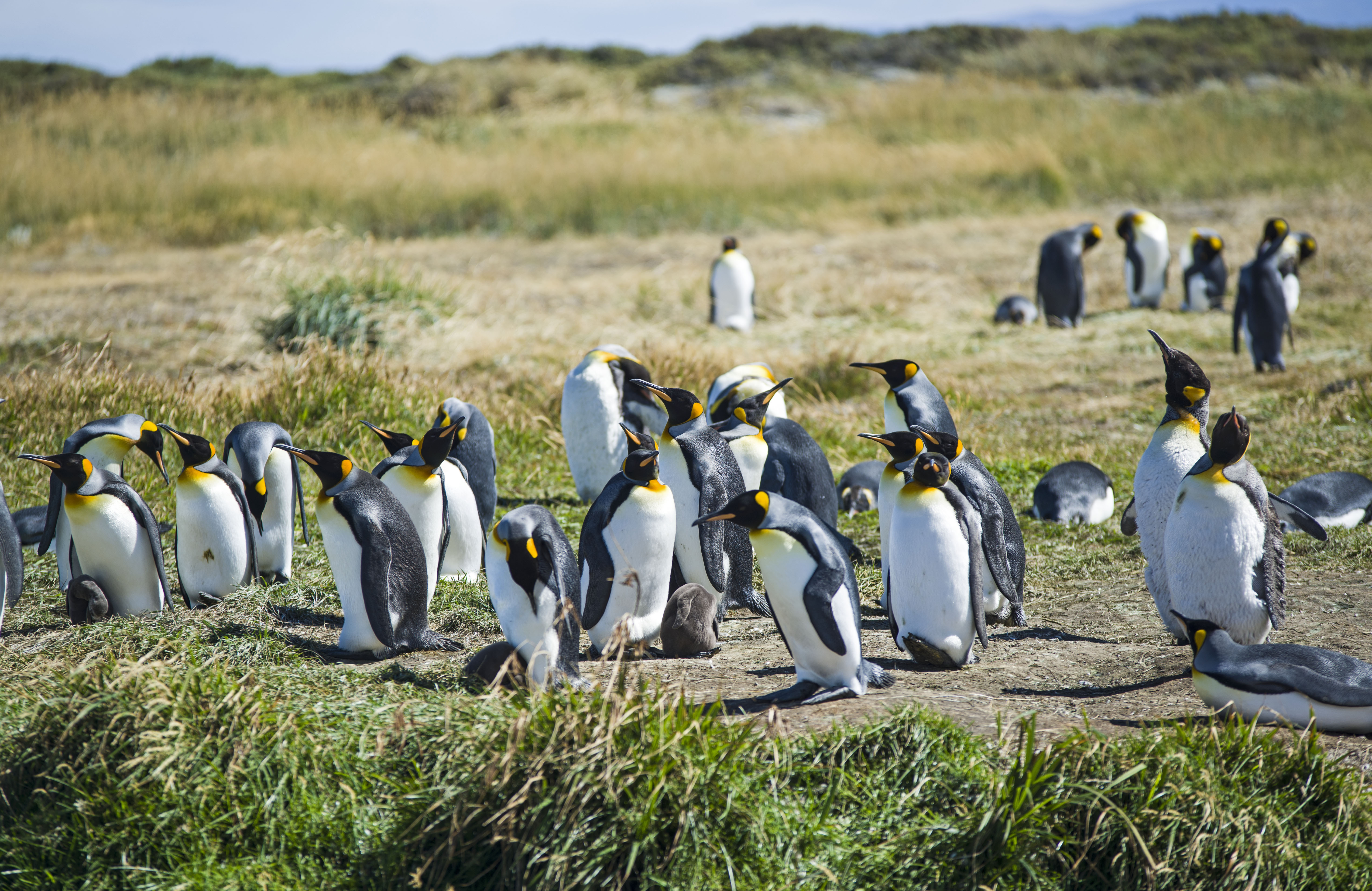
In Bahia Inutil (so called because it is useless for protecting ships from bad weather) we stopped off at what is the only mainland King Penguin colony in the world. This small (and quite expensive) colony has around 60 birds and scientists don’t understand what they are doing here as it is a long way from their usual home.
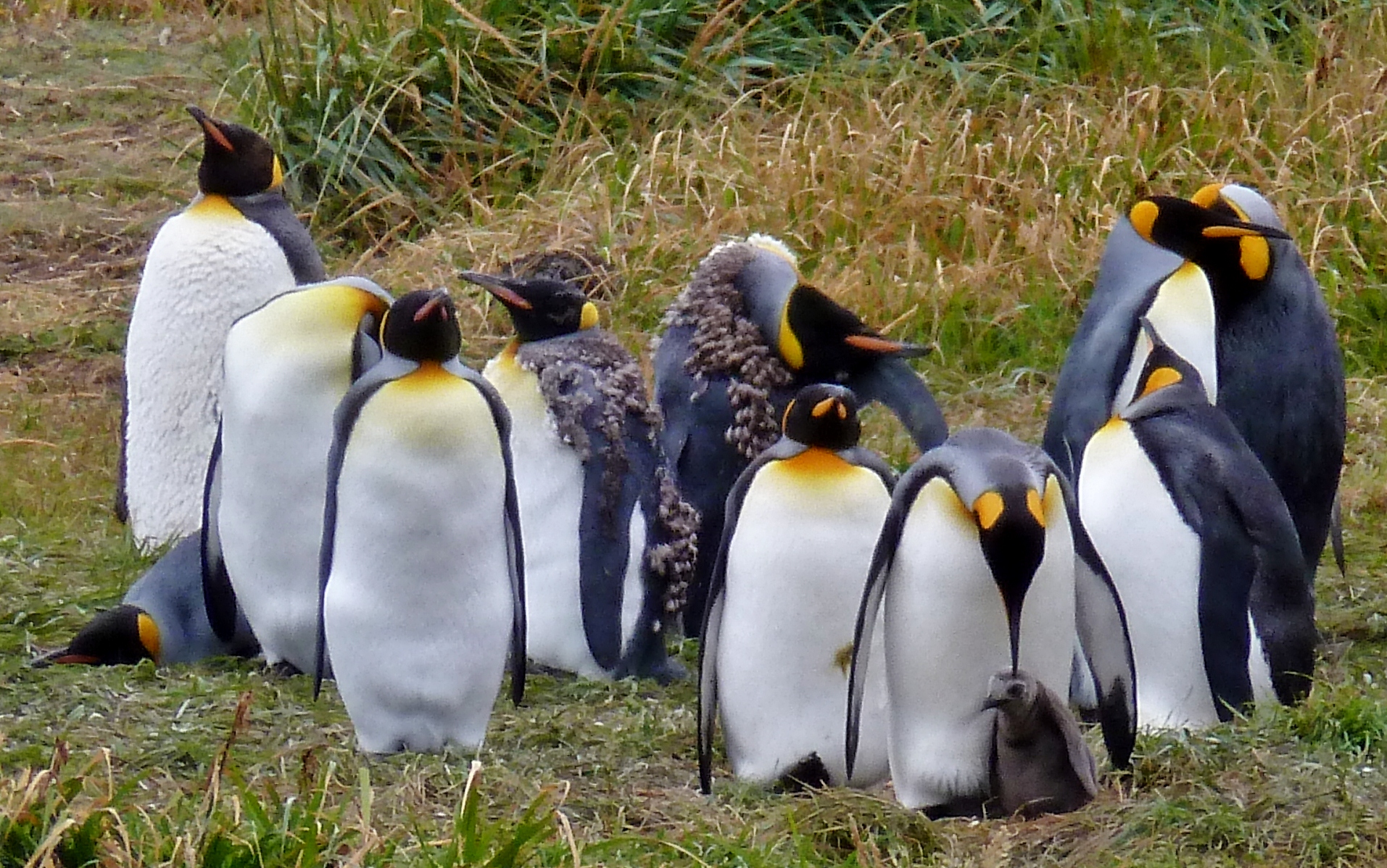
However they have been coming back for a number of years now and the colony is slowly expanding.
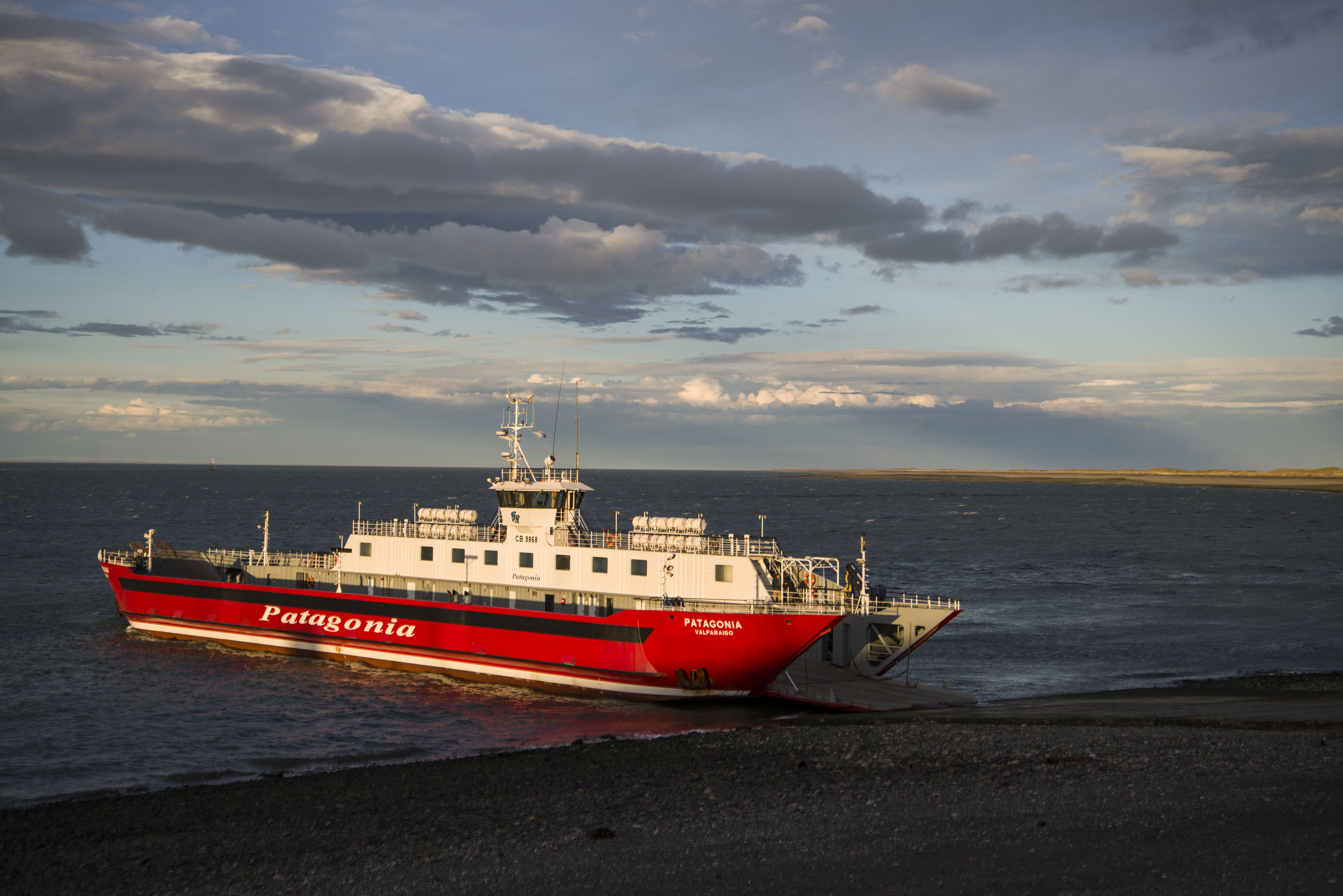
We had intended to catch the ferry from Porvenir to Punta Arenas however on arriving at the ticket office we found that the next ferry wasn’t until 7pm the following night which would put us ashore at dusk. Not wanting to drive at night we decided to drive up the coast to the other ferry in the North and take the long way around to Punta Arenas.
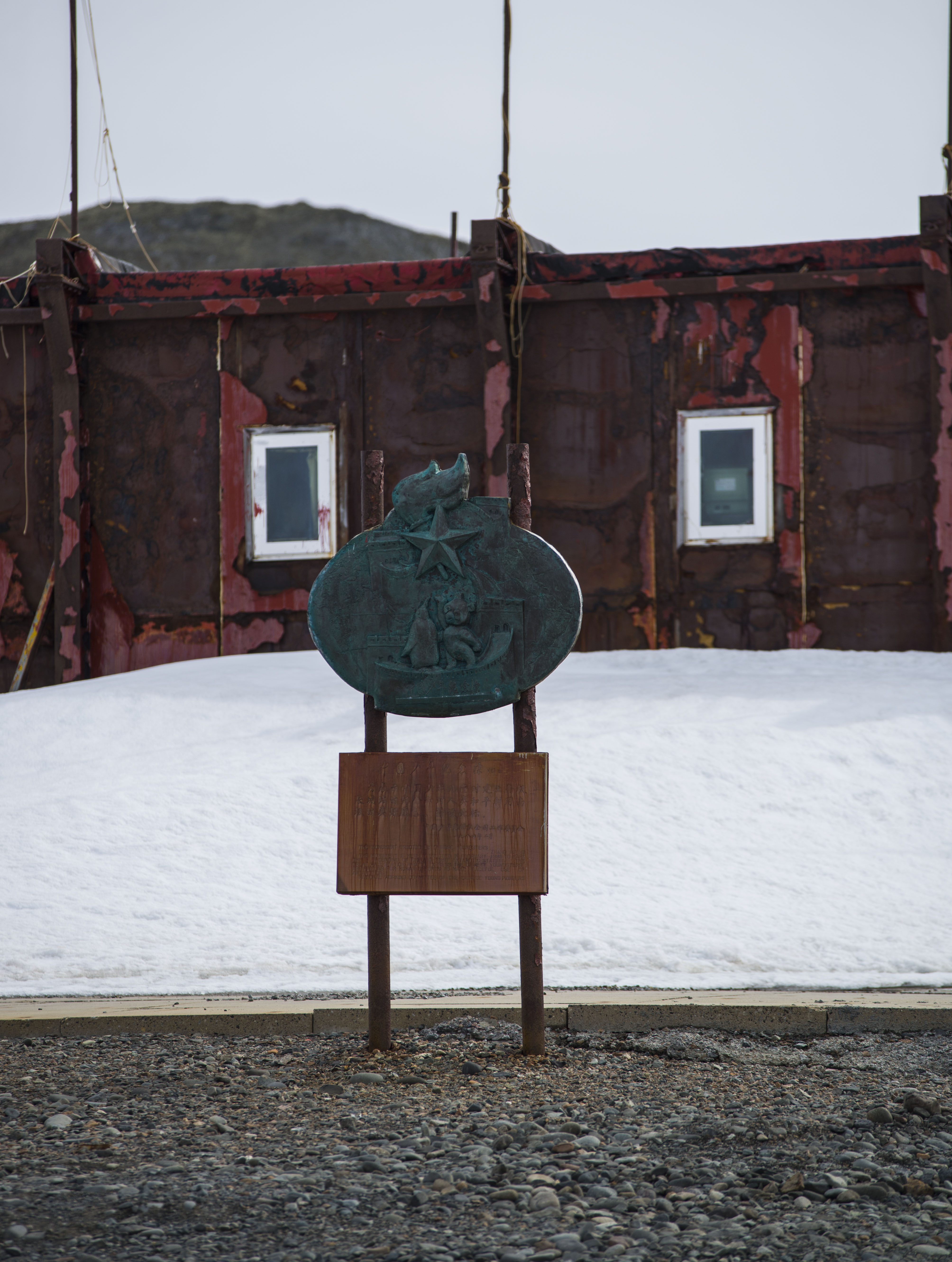
Antarctica: Almirante Brown & Orne Island
Our last day in the Antarctic had arrived but again we had a busy programme. The first stop was at an Argentine Station called Almirante Brown.
This station was notable for the story of the mad Naval doctor who on being told that he was staying over the winter at the base, waited for the boat to leave and then set fire to the base. The ship soon turned around and picked him up to take him home for a court martial !
We climbed up a snow covered slope from the station to a rocky pinnacle where we had a great view of the surrounding area. While at the top we saw a humpback whale swimming in the very clear water below.
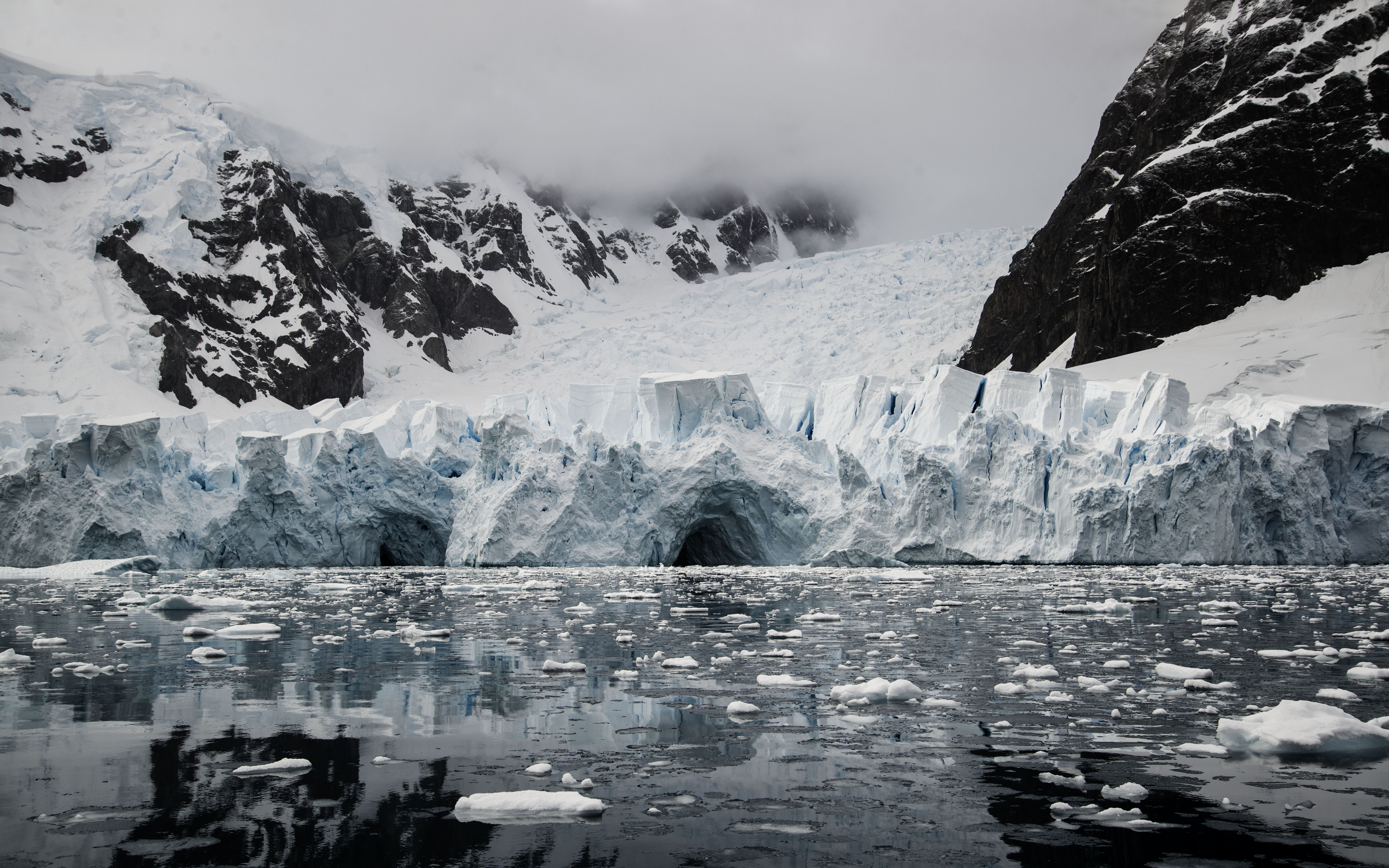
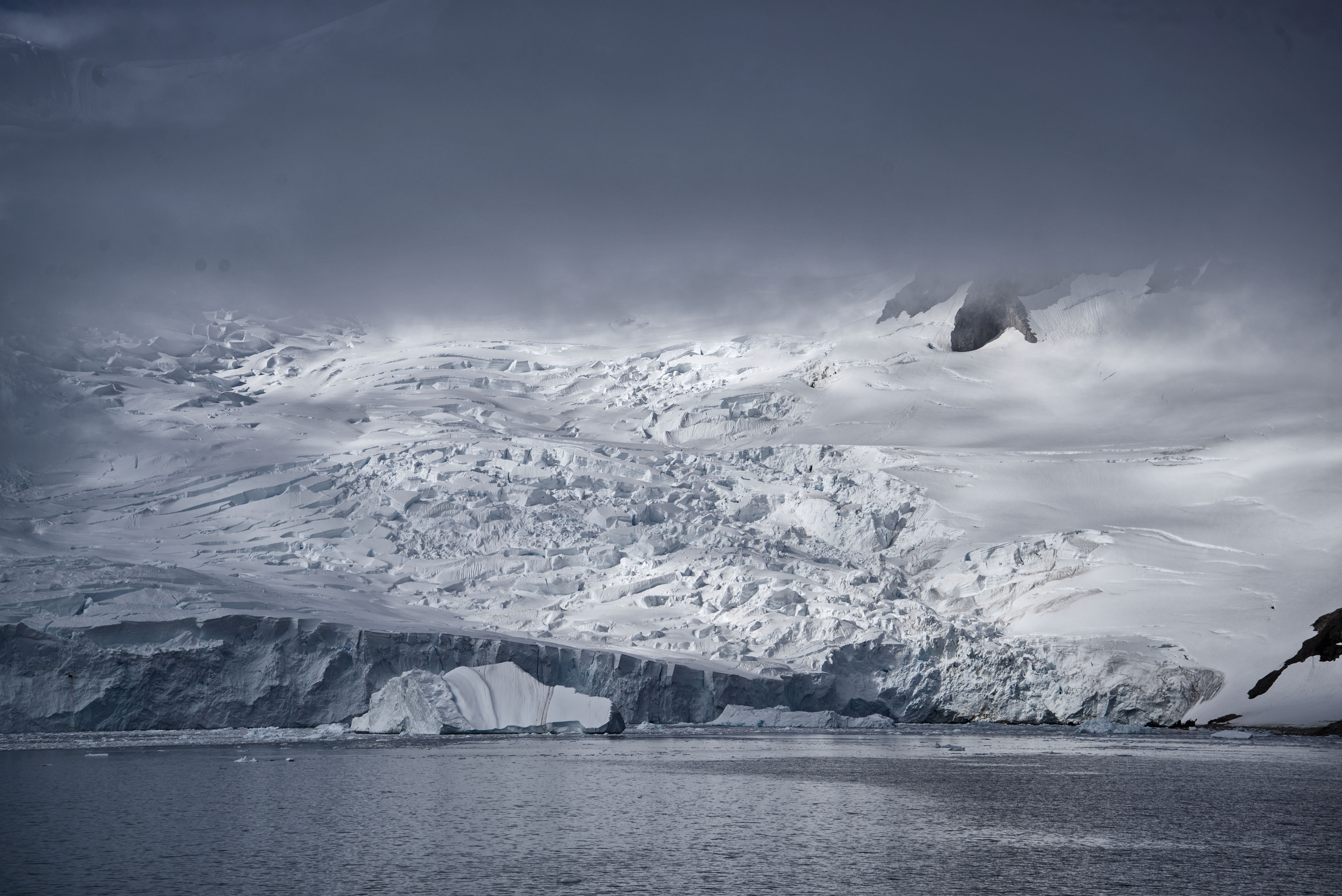
Our visit to the island was only around 45 minutes but after that we took a zodiac tour around the surrounding area and to look at a big glacier that came right down into the sea.
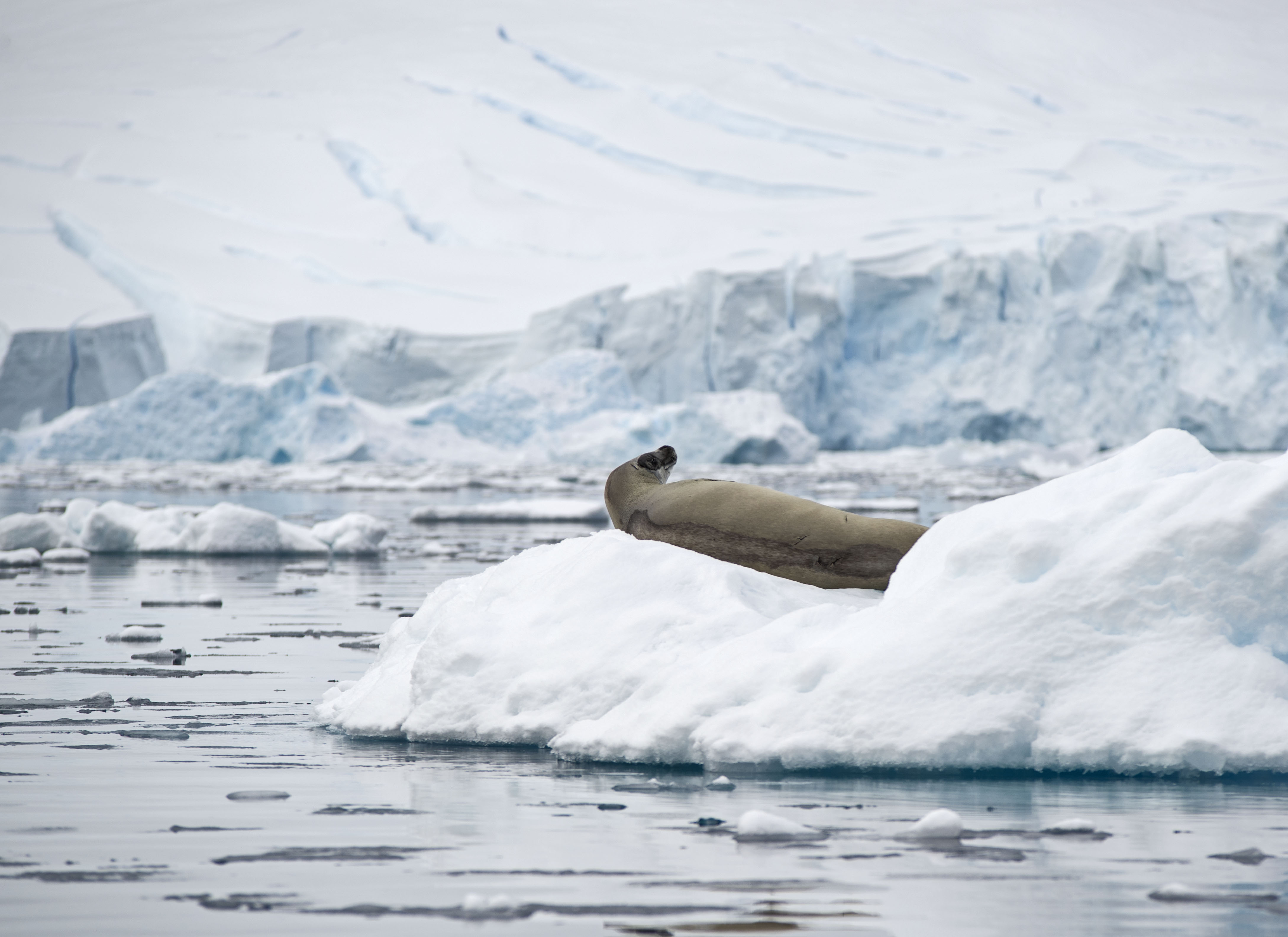
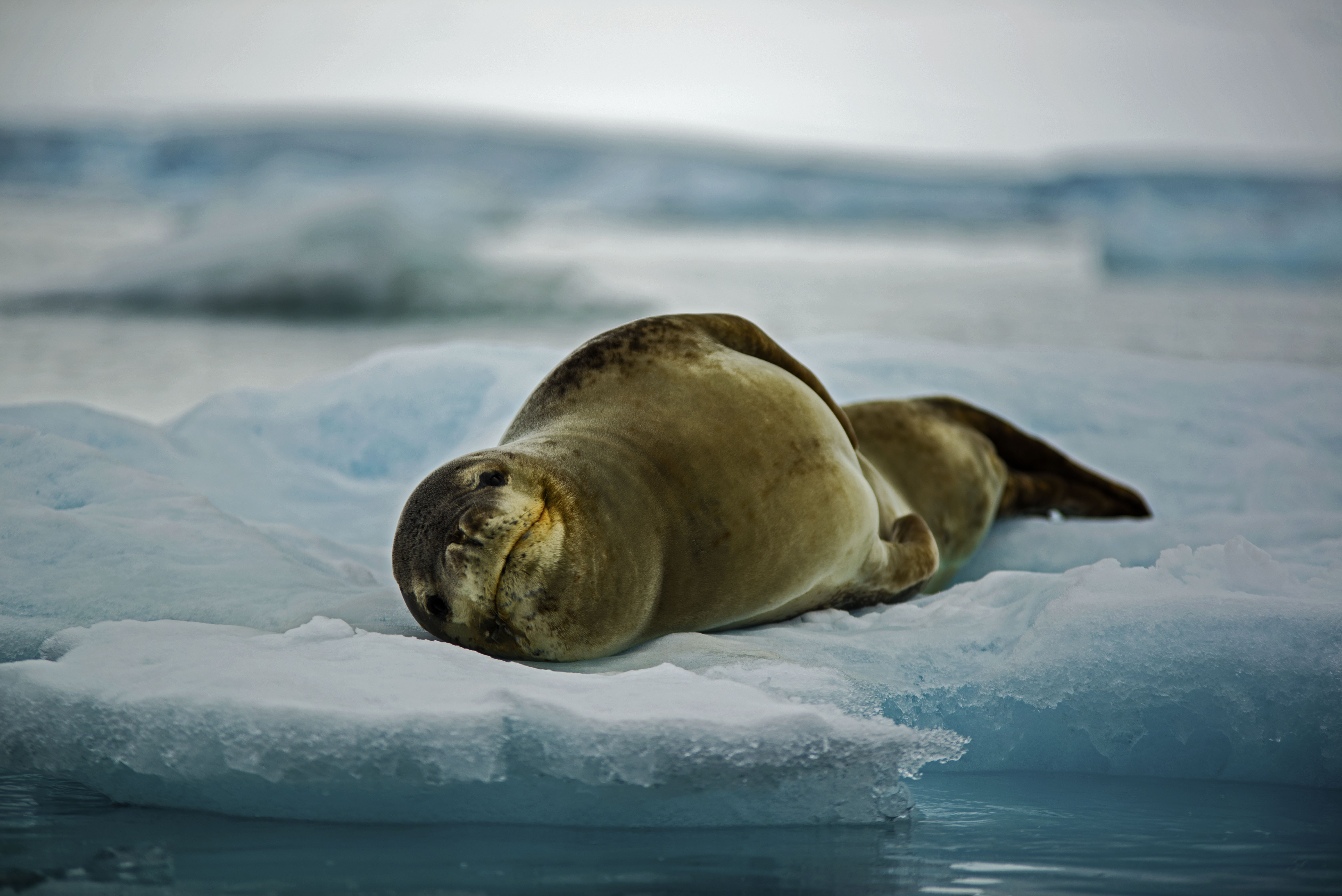
We also completed our sightings of Antarctic seals when we saw a Crabeater seal resting on some ice. The most numerous seal in the Antarctic, it is unusual to see one in the Peninsula area. Despite their name they don’t actually eat crabs at all.
Just before lunch we were offered the opportunity to go for a swim. That’s right in water hovering around 0 degrees C (as it is salt water it doesn’t freeze until -1.8c but don’t worry there was plenty of ice in the water!). I’d been looking forward to this as it was an appropriate mirror for my swim in the Arctic back at the very start of our trip when we were in Prudhoe Bay. However Sarah was absolutely adamant that this was the last thing she would ever consider doing.
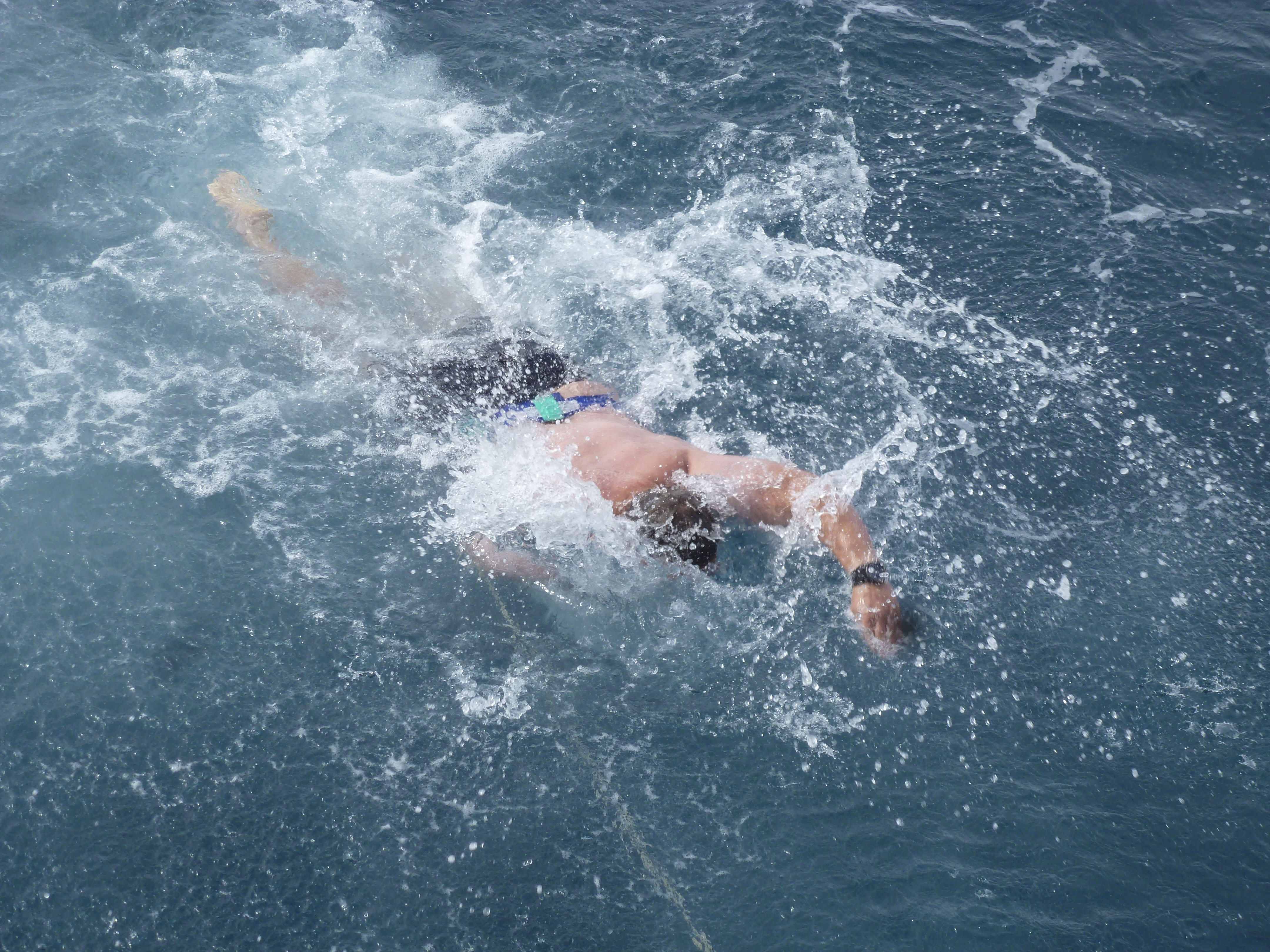
The swim was done off the back of the ship with a safety rope attached to you. I can happily report that the water was cold, salty and very clear. Fortunately on returning to the ship they had opened up the hot tub on the top deck which was very welcome.

We’d now seen almost all the wildlife of the Antarctic Peninsula area. However the glaring omission was Orca or Killer Whales. We had been looking for these nomadic creatures the whole time we were cruising through the sheltered waters. Now on our last day a call came from the Bridge that there were Orca off the Starboard side. Everyone ran out onto deck and for five minutes we enjoyed watching a pod of Orca paralleling the ship’s course. They didn’t come close but we did see them !

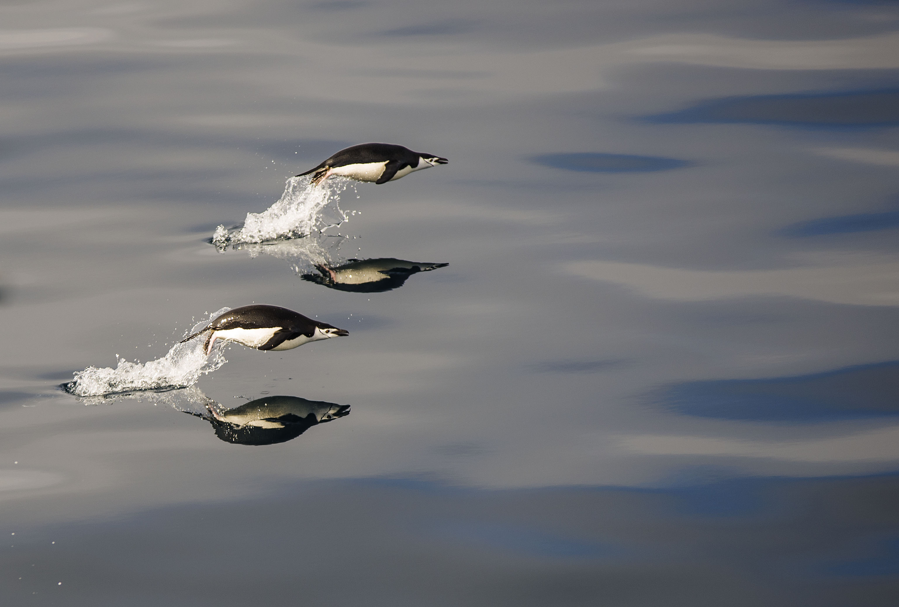
At the same time as we saw the Orca I managed to get a picture of leaping penguins. I’d been trying to do this all week but its pretty hard.
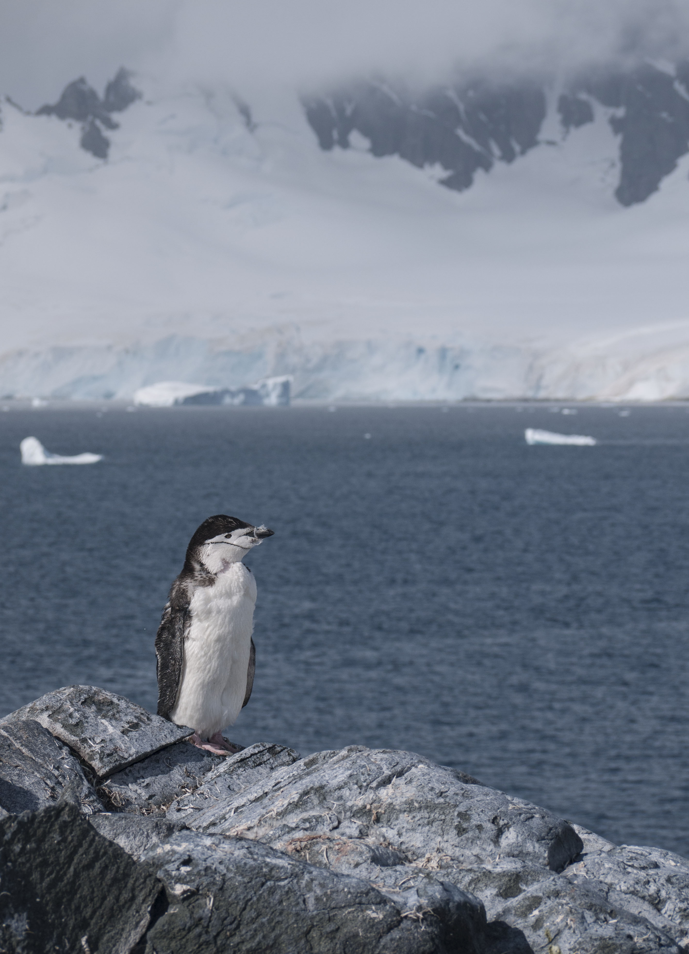
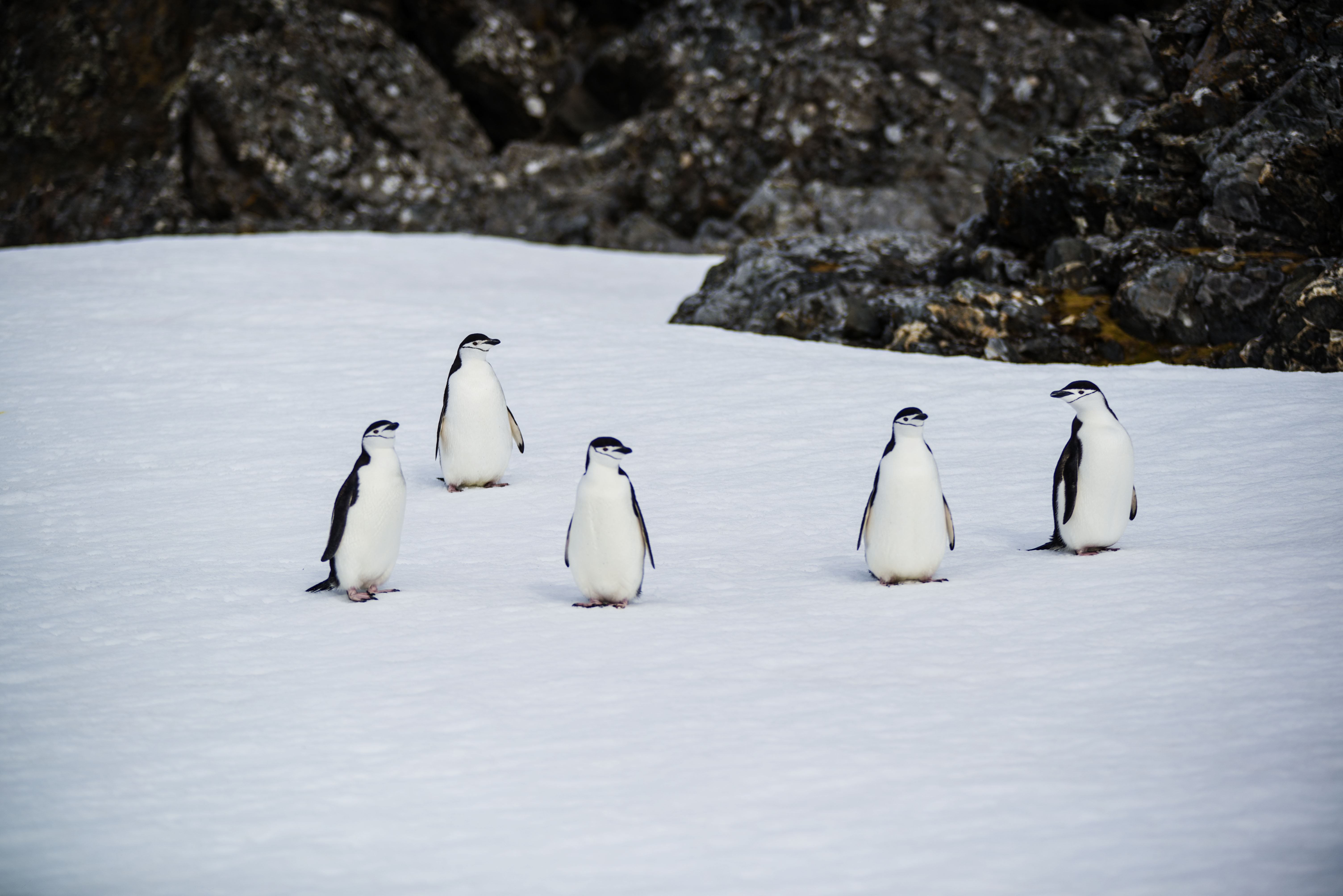
Our last landing of the trip was to Orne Island. This was a first for the crew but good weather allowed it. The island was quite large and home to a colony of chinstrap penguins.
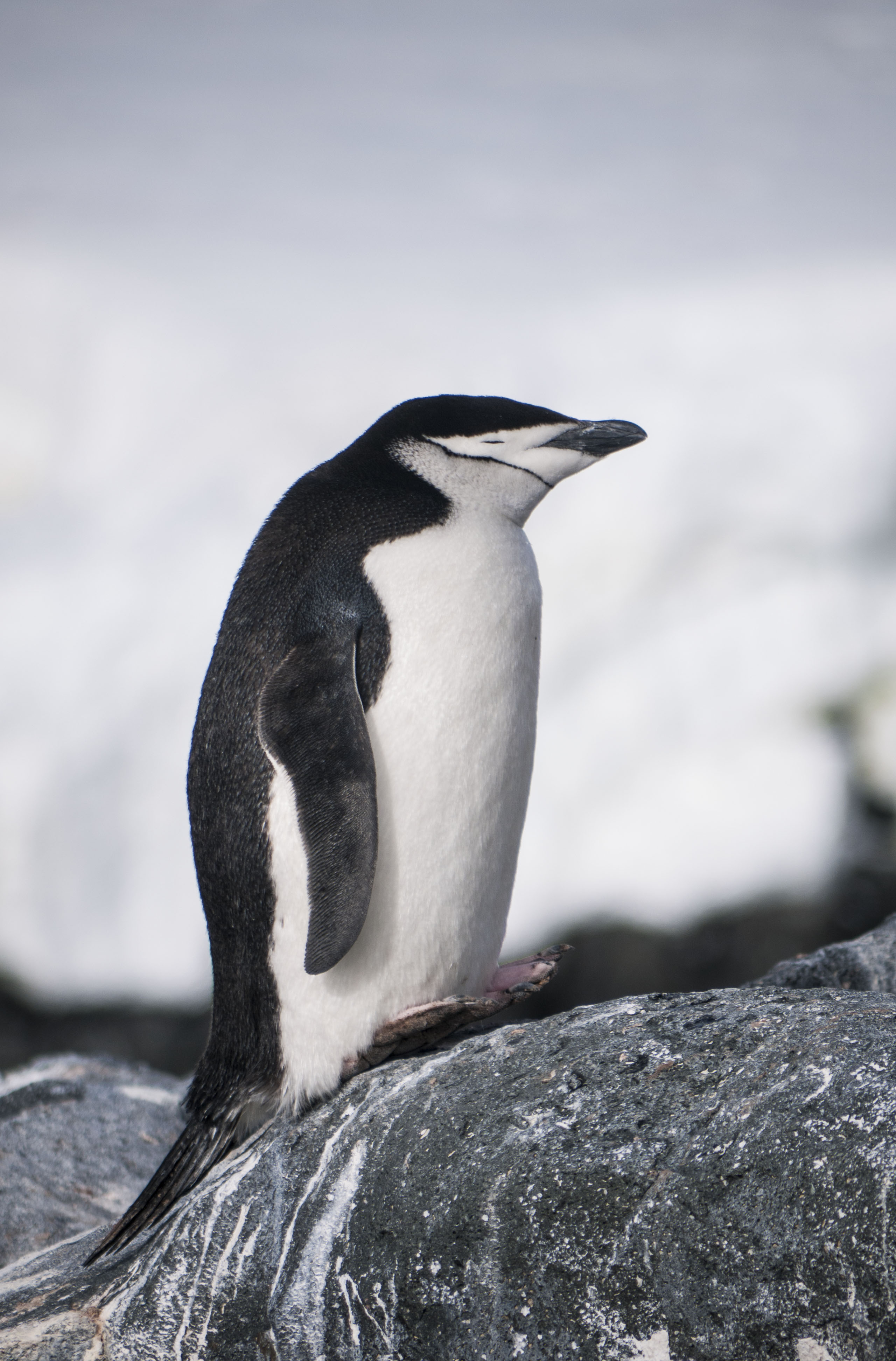
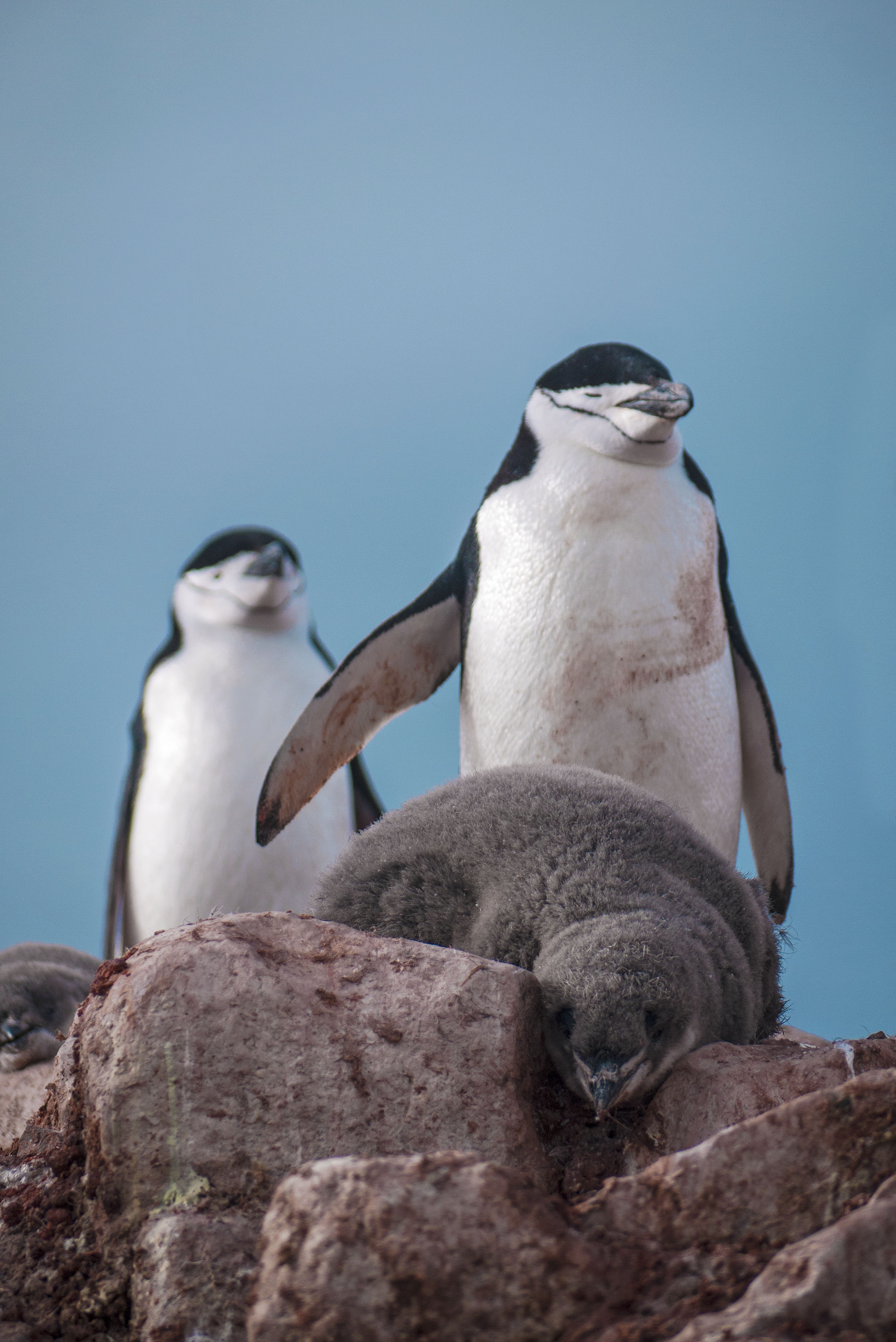
The older adolescent penguins were beginning their molting process but the parents of the chicks had a couple of weeks to wait until their fluffy little bundles of joy were ready for self sufficiency.
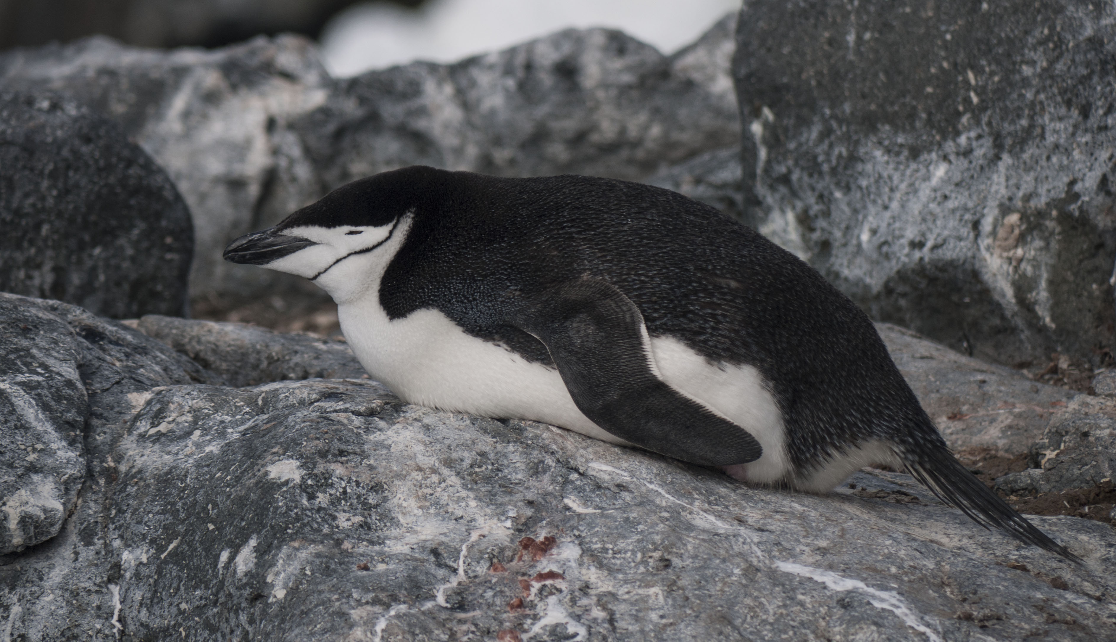
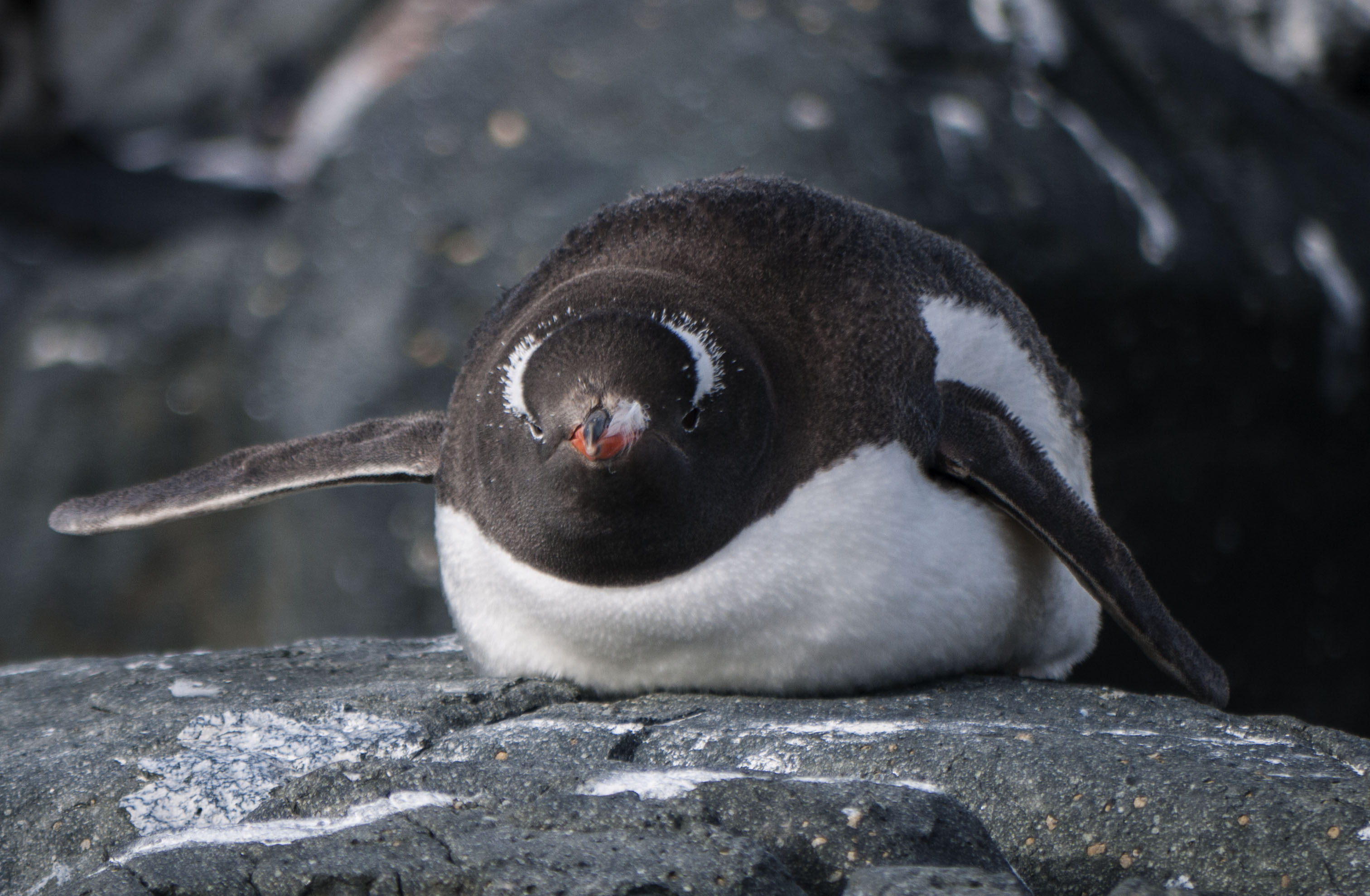
Just chillin’ !
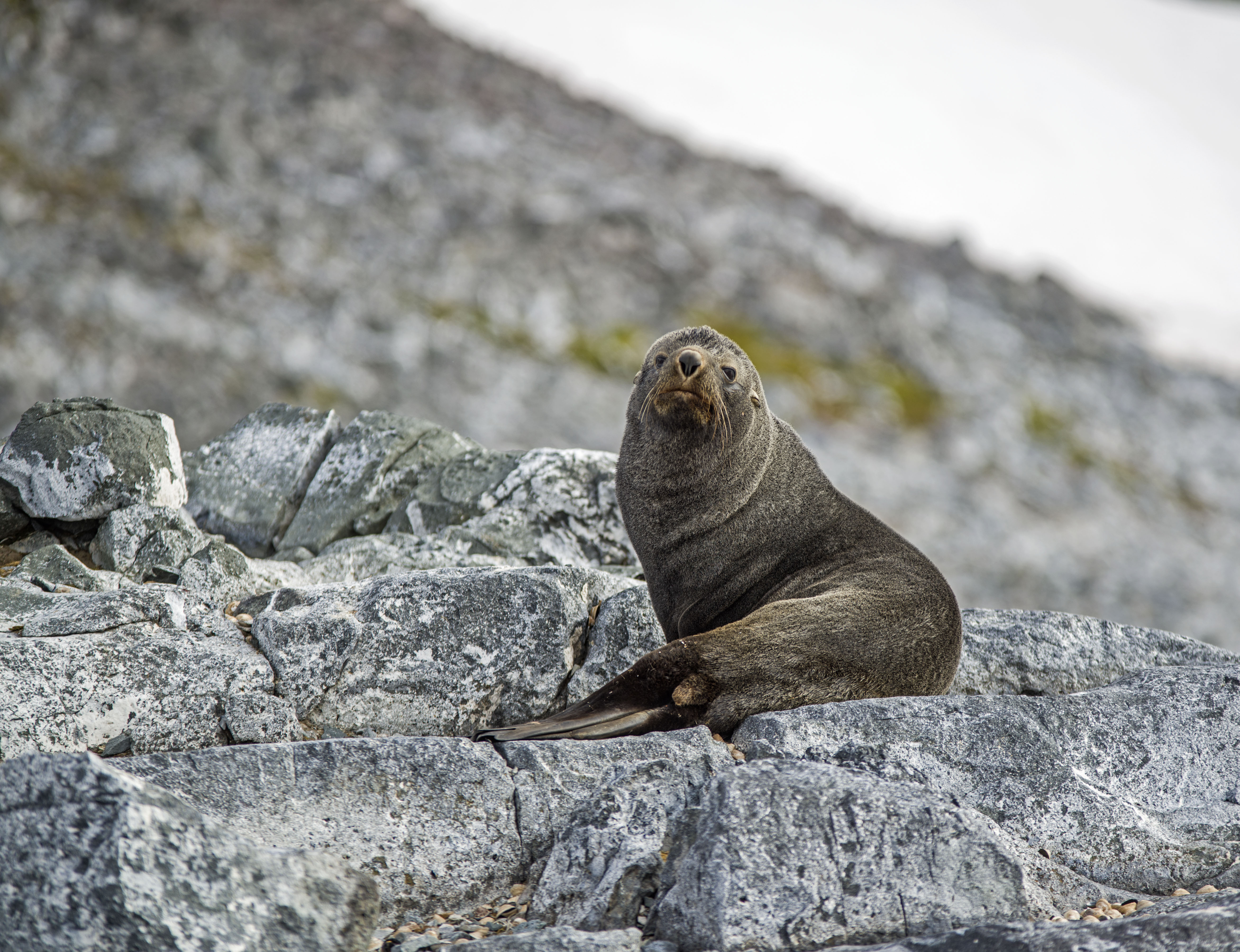
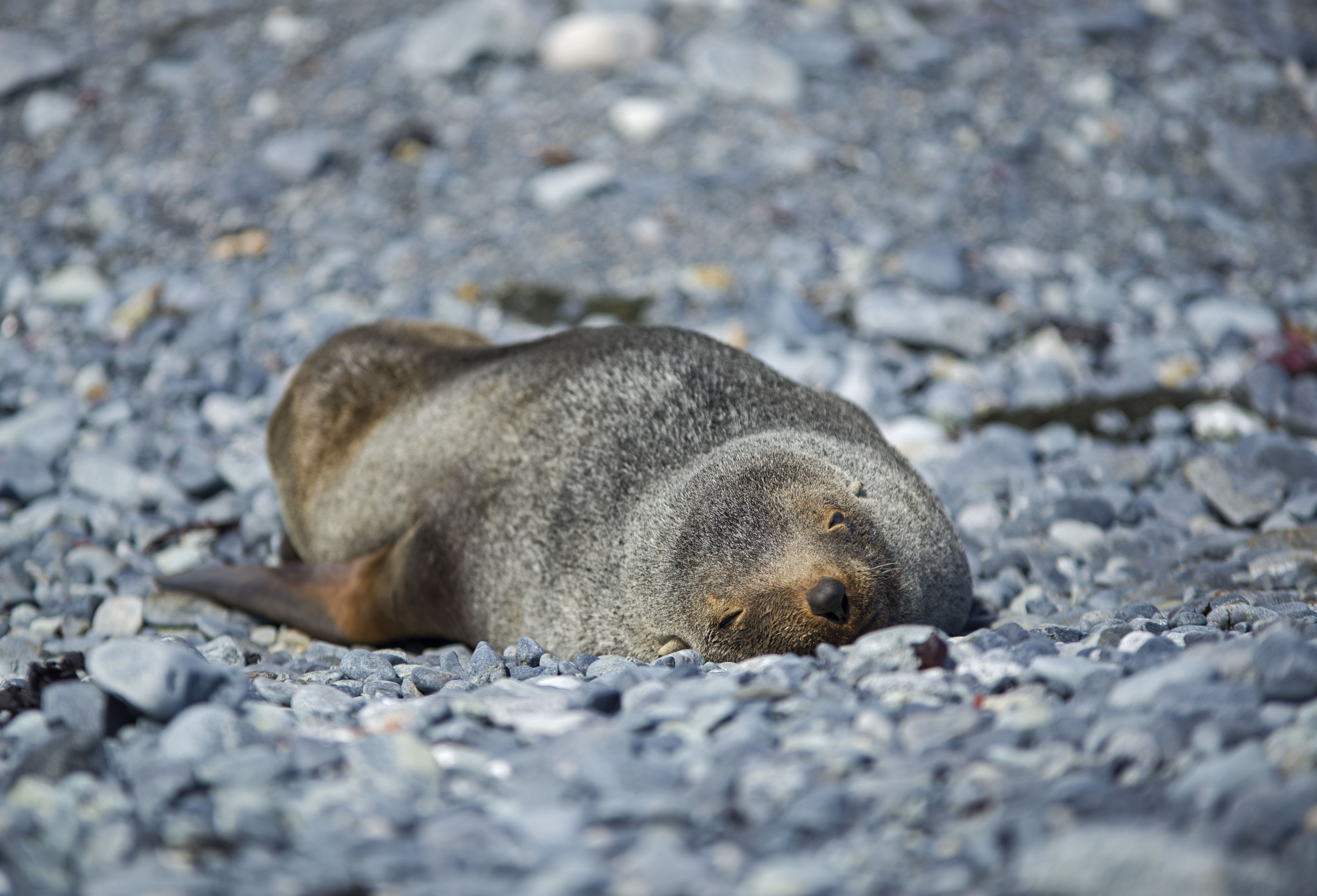
At one end of the island a Weddell seal had hauled its way up over the beach and at the other end of the island a couple of fur seals had the same idea.

The fur seals are very aggressive and you definitely want to keep your distance from them. Getting too close causes them to rise up and as they can move faster than running speed, and pack a bite I didn’t want to get any closer than this.
When you find Chinstrap penguins there always seem to be a few Gentoo penguins lolling around as well.
At the end of our last landing we returned to the ship with heavy hearts as we were departing Antarctica immediately to return to Ushuaia. Antarctica is definitely a magical place that gets inside you. No pictures can do the landscape justice or convey the tranquility and stark beauty of the continent.
It is definitely worth begging, borrowing or stealing to get out to Antarctica as its an experience you won’t forget.
Antarctica: Pleneau Island & Torgersen Island

We woke early on Day 7 of our Antarctic Expedition as the ship was due to transit the Lemaire channel at 7am. This tight channel between the continent and a large island is a tense time for the crew because of the potential for large icebergs, low lying growlers and the narrowness of the channel itself.

The progress through the Lemaire channel was slow but we got through on a zig zag course avoiding all the larger pieces of ice. The ship is ice strengthened but only to a low level allowing breaking of ice up to 20cm thick. This is a far cry from an icebreaker which can crunch through metres of ice.

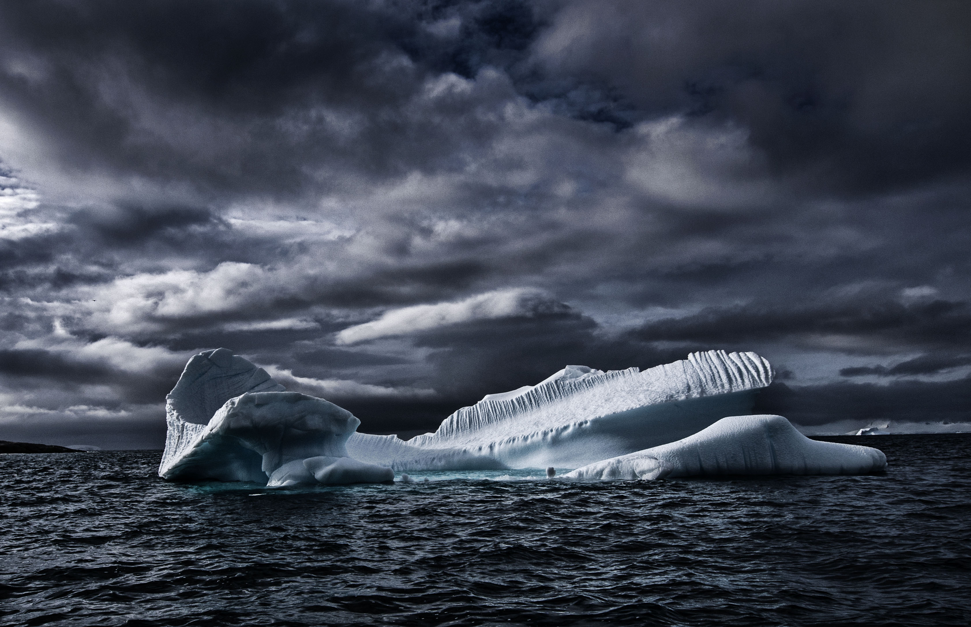
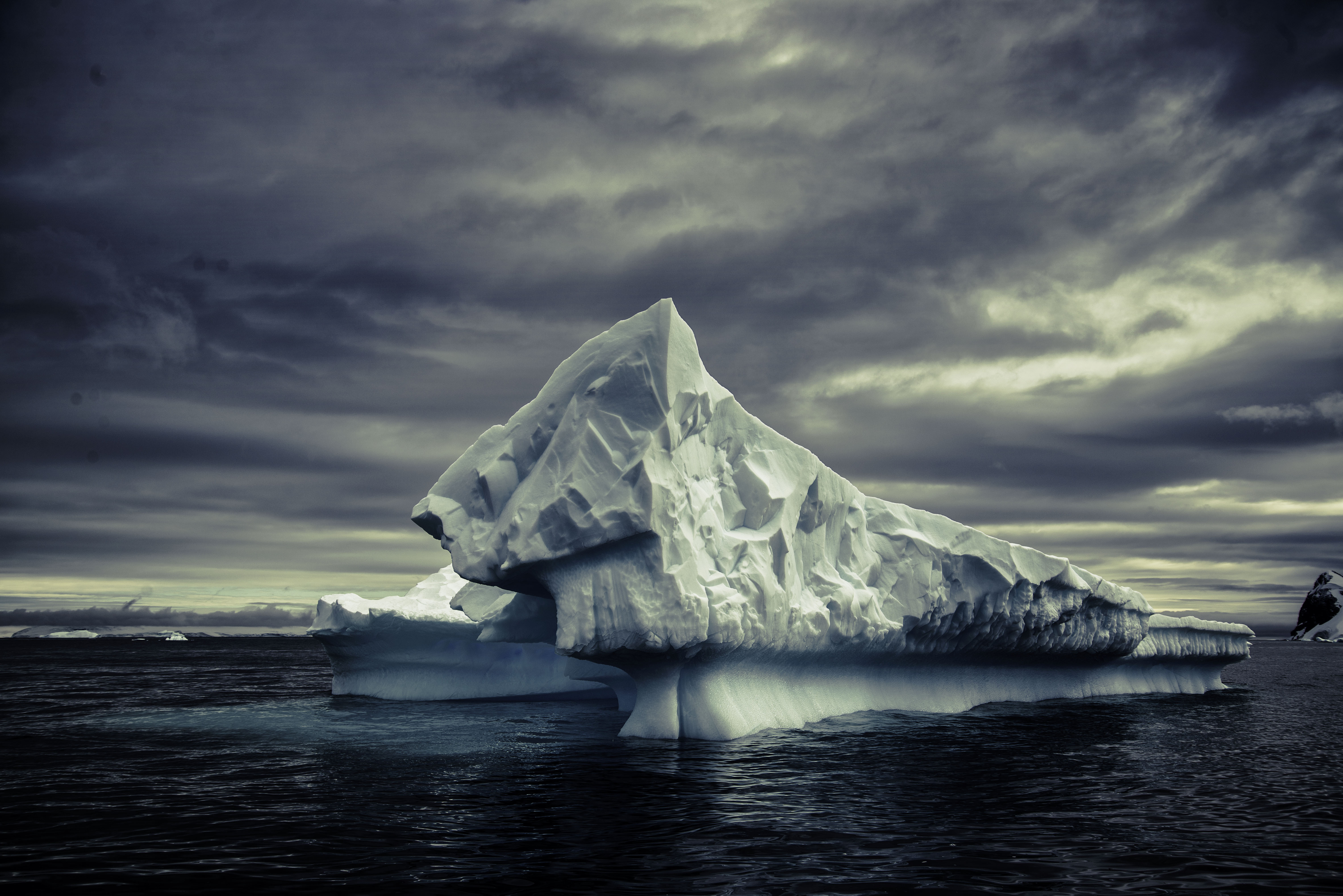
Once through the channel we had arrived at an area adjacent to Pleneau island which is known as the Iceberg Graveyard. Large icebergs from further North are blown here by the winds and become trapped, some for many years.
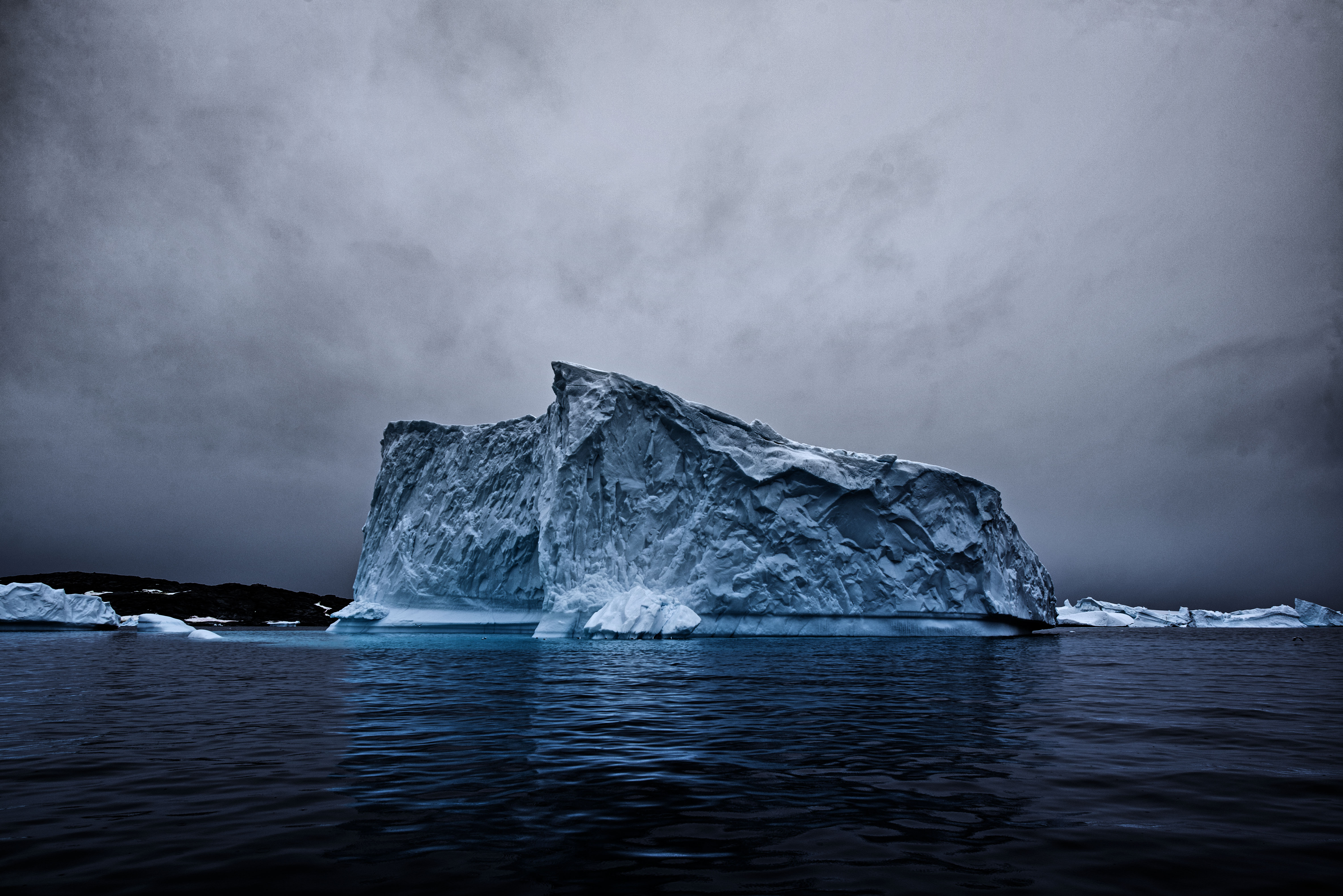
It was this area that was the destination for our first outing of the day in the form of a zodiac cruise.
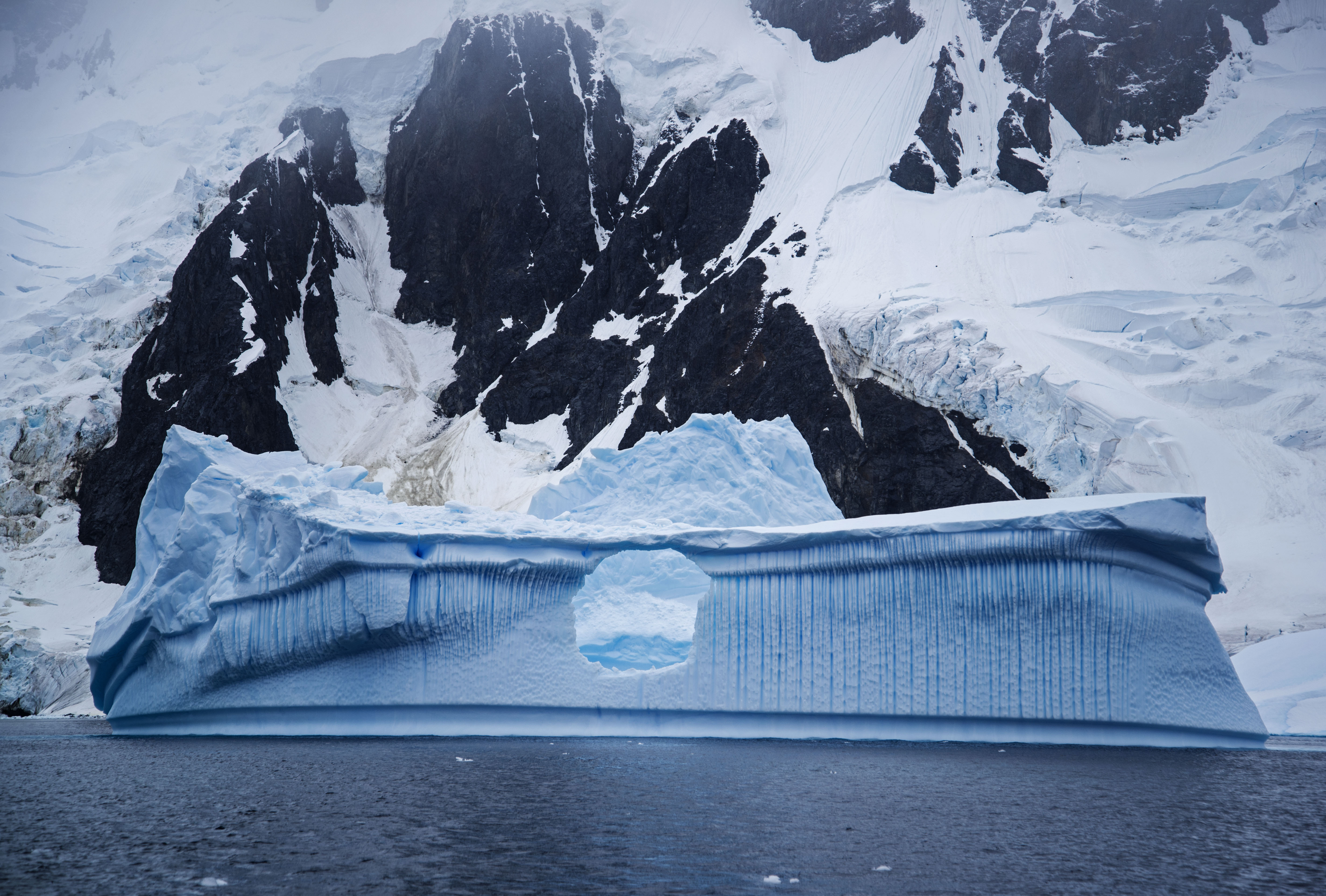
The icebergs here can be pretty large and many of them had been eroded by melting and the wind into fantastic shapes. Often they had feet sticking out many metres underwater from the above water walls.

However it wasn’t just the ice that was a highlight of this area. We saw some humpback whales cruising around doing shallow dives. The zodiac operators must turn off their engines when within 100m of whales and hope that the whales themselves move closer. On this occasion we were really lucky and one of the whales swam straight towards us. Instead of diverting to go around the zodiac the whale did a shallow dive around 5m in front of the zodiac and we could see it swim past just underneath the boat ! Amazing.

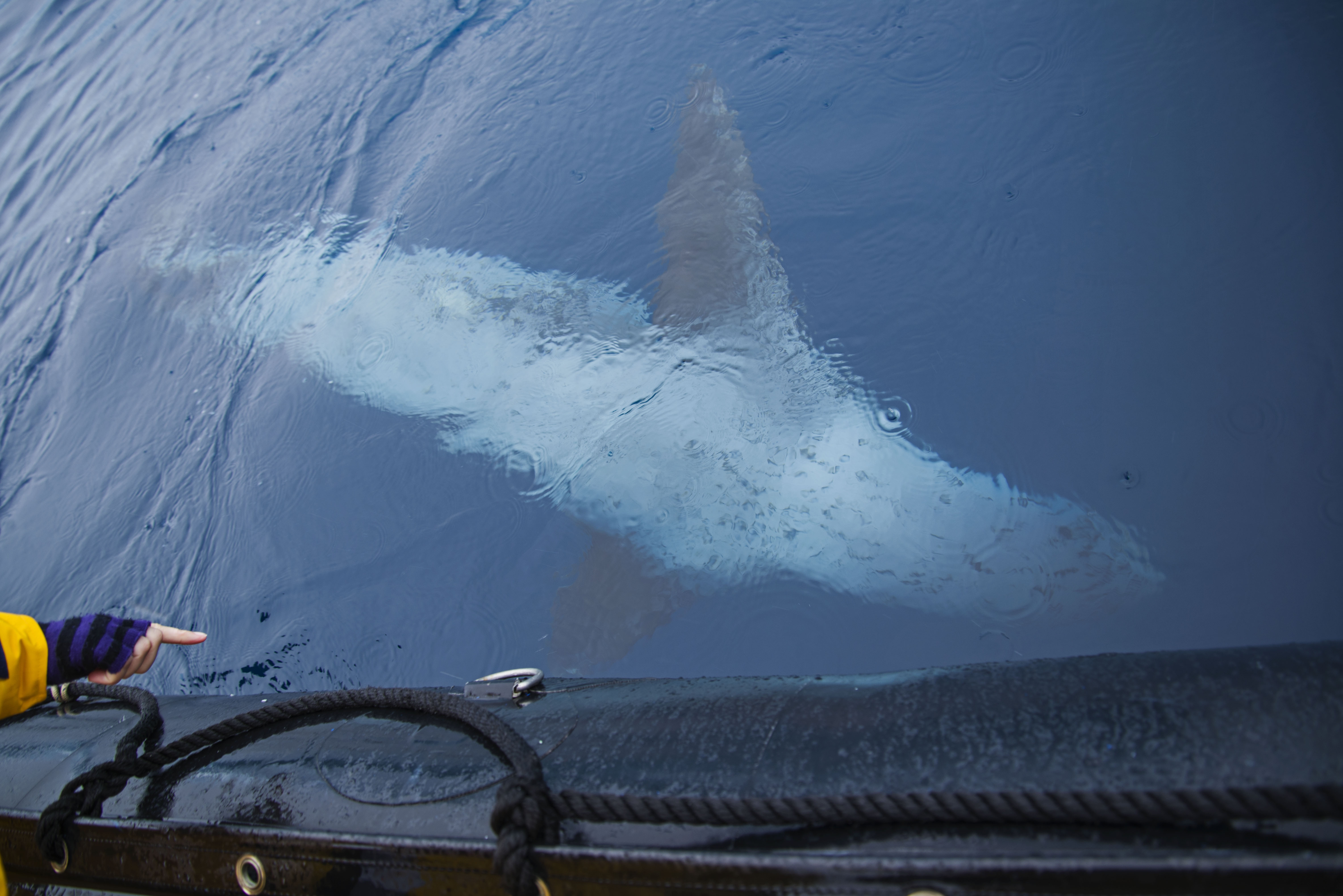
A few minutes later we came across a leopard seal swimming over a shallow ledge caused by the foot of a large iceberg. We approached right up to the edge of the foot to watch the seal – its dangerous to go over the feet because the glacier can roll or turn at any time.

The seal came right out to the zodiac to investigate and spent a couple of minutes diving under and around the boat. They have been know to attack zodiacs and bite the tubes (hard enough to burst them) but this guy was just curious.
In the afternoon we headed for a small island, called Torgersen, which is the site of an Adelie penguin colony. Adelie penguins are scarce on the peninsula preferring the colder regions of the main land mass.

The Adelie penguins were great as the chicks were adolescent and many had almost completed their molt and were only a few days away from swimming.

The parents were making the chicks chase them before feeding in order to help their muscles develop. This was hilarious as often the chick, or even the adult, would be sprinting along and fall over face first !

The distribution of the Adelie penguins has been moving further South over recent years which is a good indication of climate change.

The Adelie penguins seemed to have real personality to me and were definitely my favourite type of penguin.

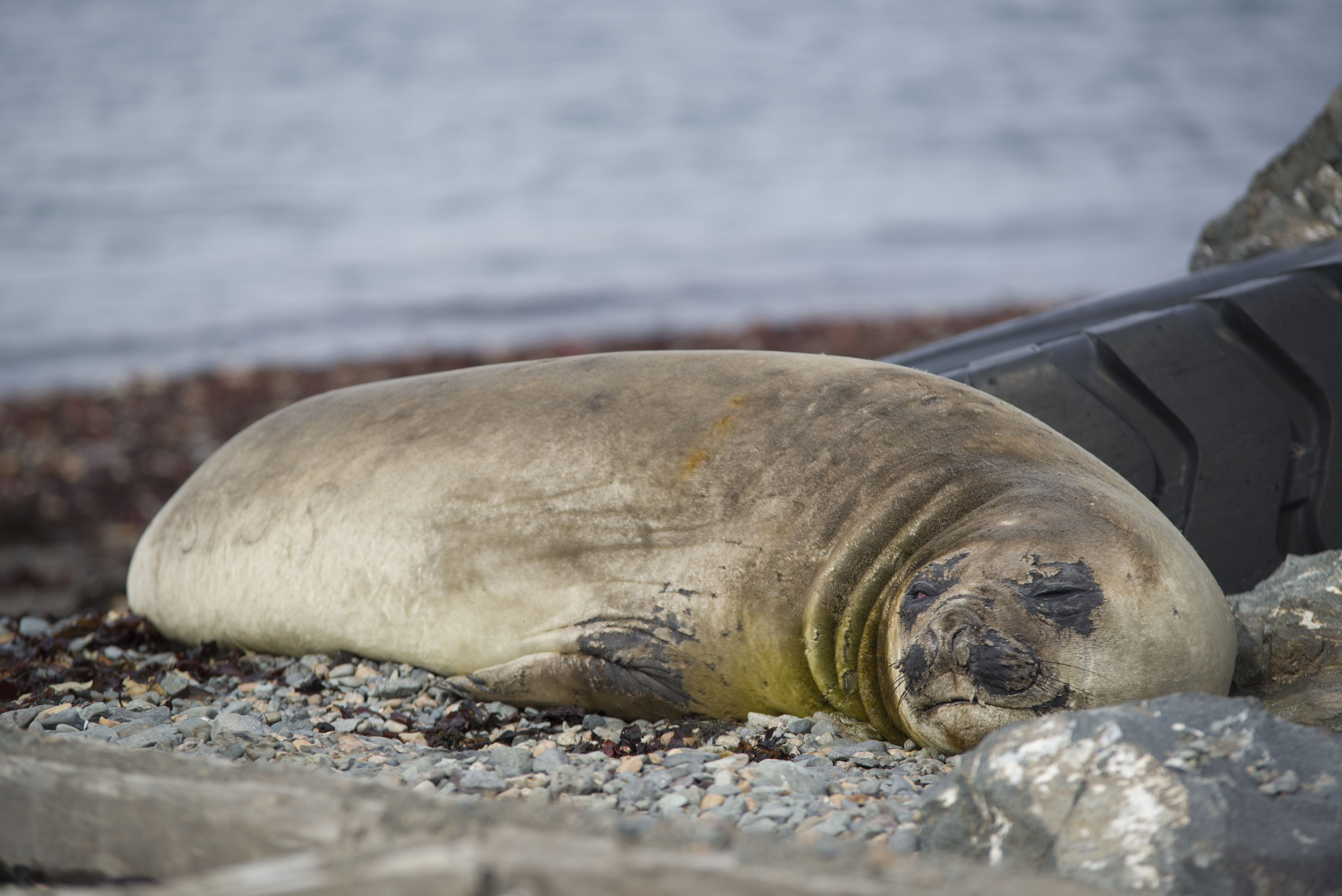
After leaving the island we did a quick tour in the zodiac before returning to the Sea Spirit. There was a small elephant seal wallow nearby with a few molting elephant seals in residence.

We also visited the wreck of the Bahia Paraiso that sunk in 1989. All that can be seen from the surface is the upturned hull but there is still oil leaking from the ship which can be seen on the surface of the sea.
Antarctica: Peltier Channel & Port Lockroy
After getting back from our night out camping we were pretty glad that the morning excursion was put back to a very sociable 11am. This gave us some time to relax and catch up on our sleep.
When we headed out it was for a zodiac cruise through the Peltier Channel which is a relatively narrow channel created by an island and the mainland.
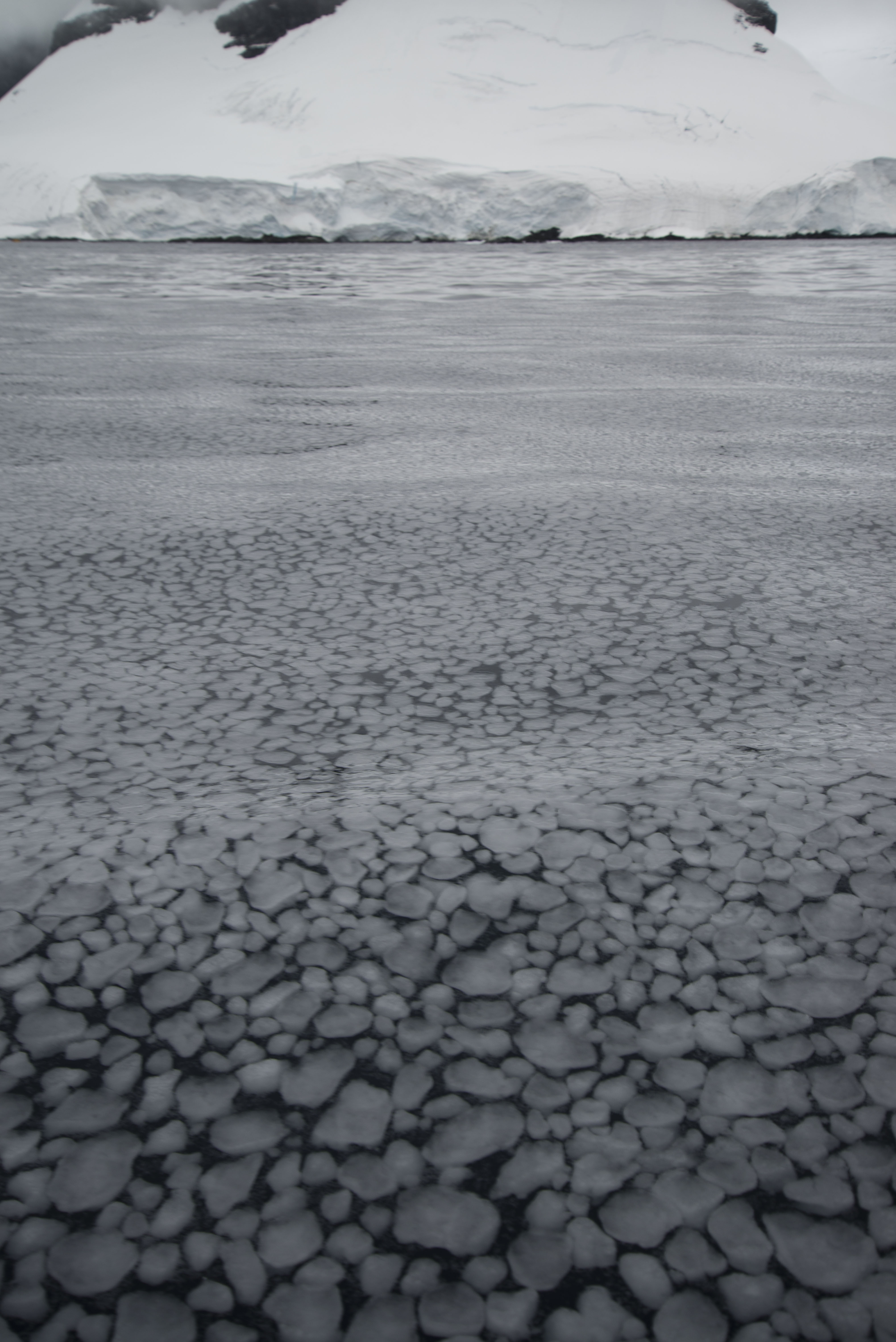
Our first surprise on boarding the zodiac was that the sea water was starting to freeze up – a clue as to how cold it had been the night before. Platelets were forming on the surface of the water as a prelude to a sheet of ice forming.
Once into the channel proper while dodging some fairly sizable icebergs we encountered a leopard seal sitting on a small sheet of ice. The seal wasn’t bothered at all by our presence – although we didn’t get too close !
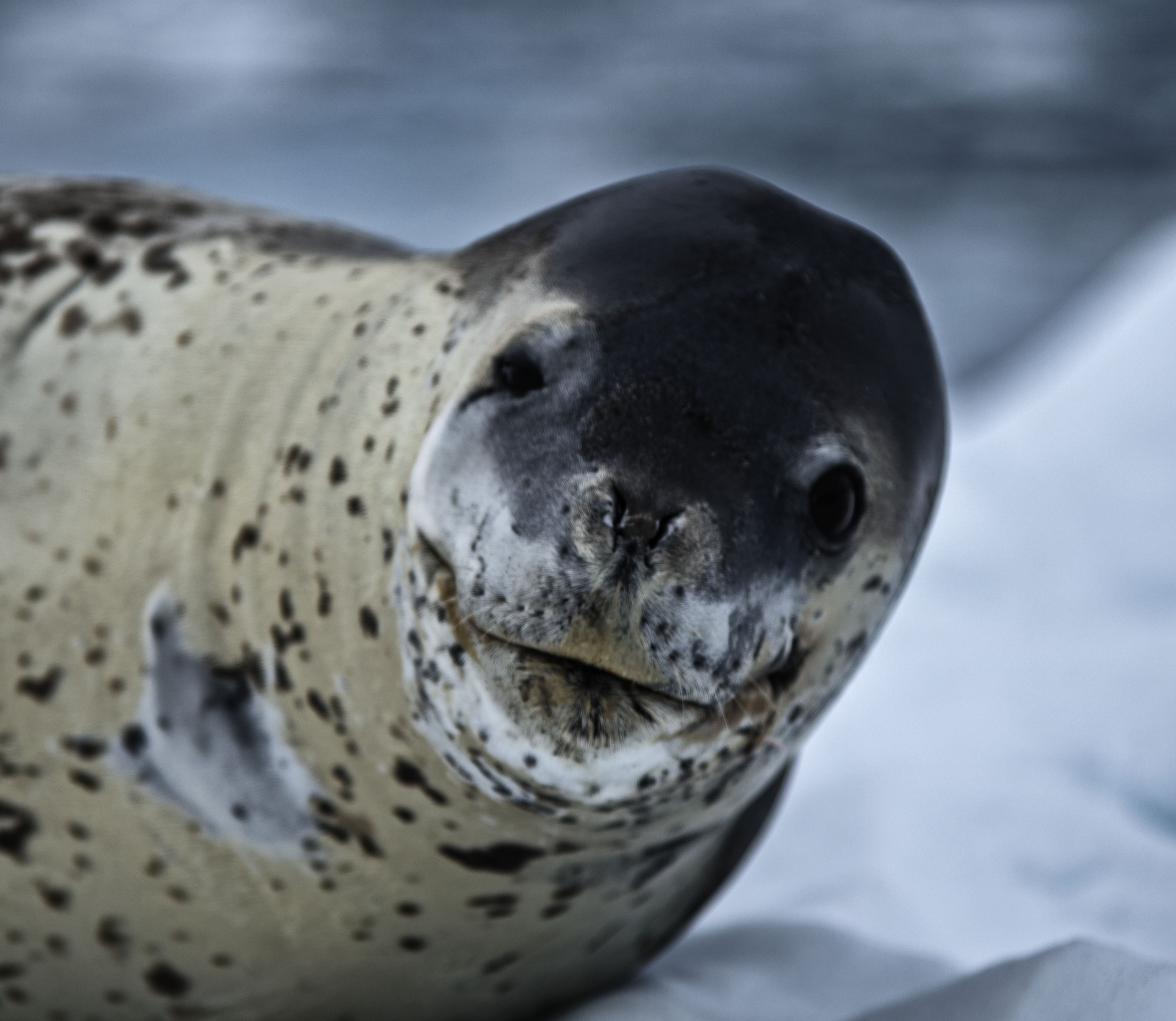
Shortly after we saw another Leopard seal sitting on some ice – we were learning that these guys are not rare at all.
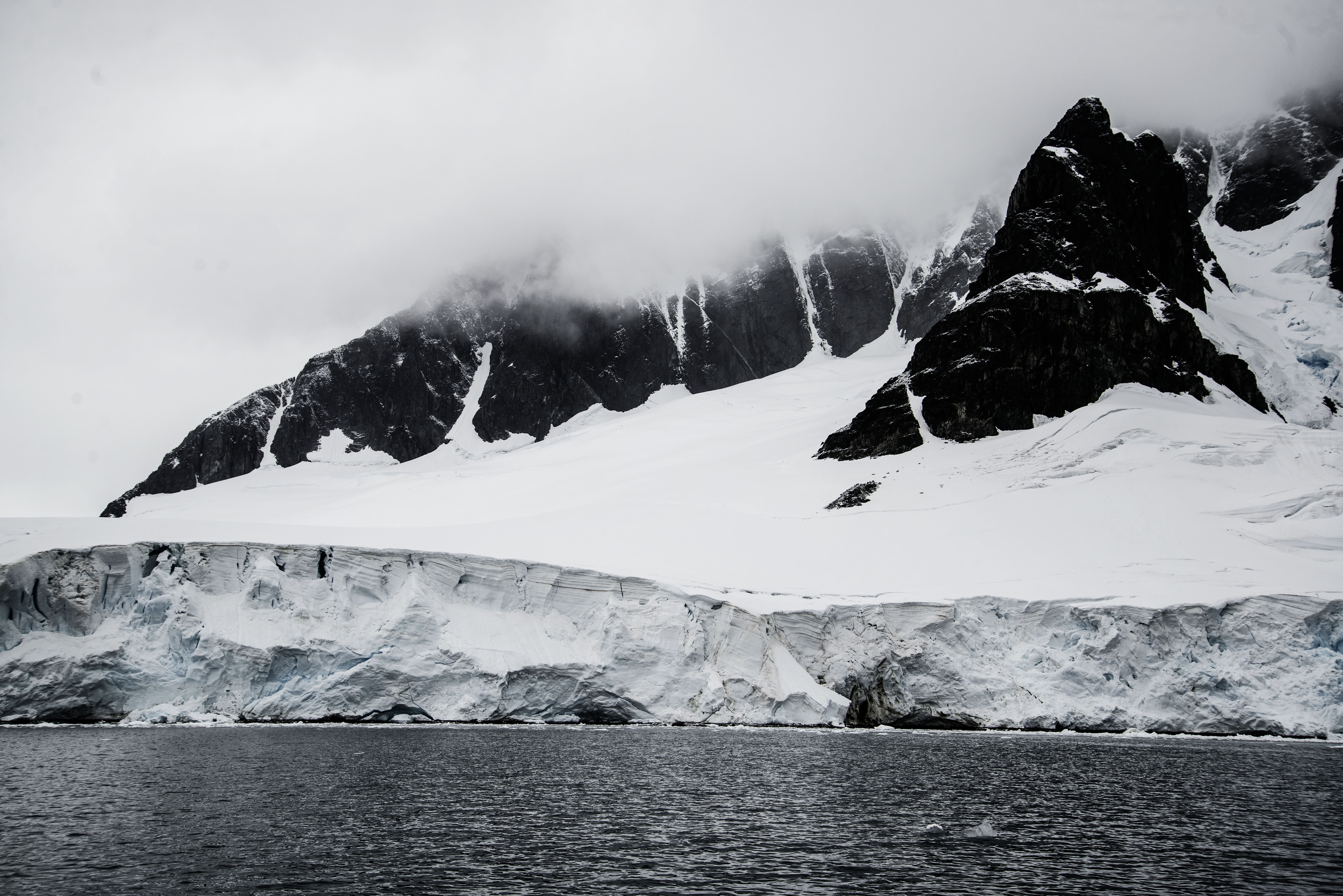
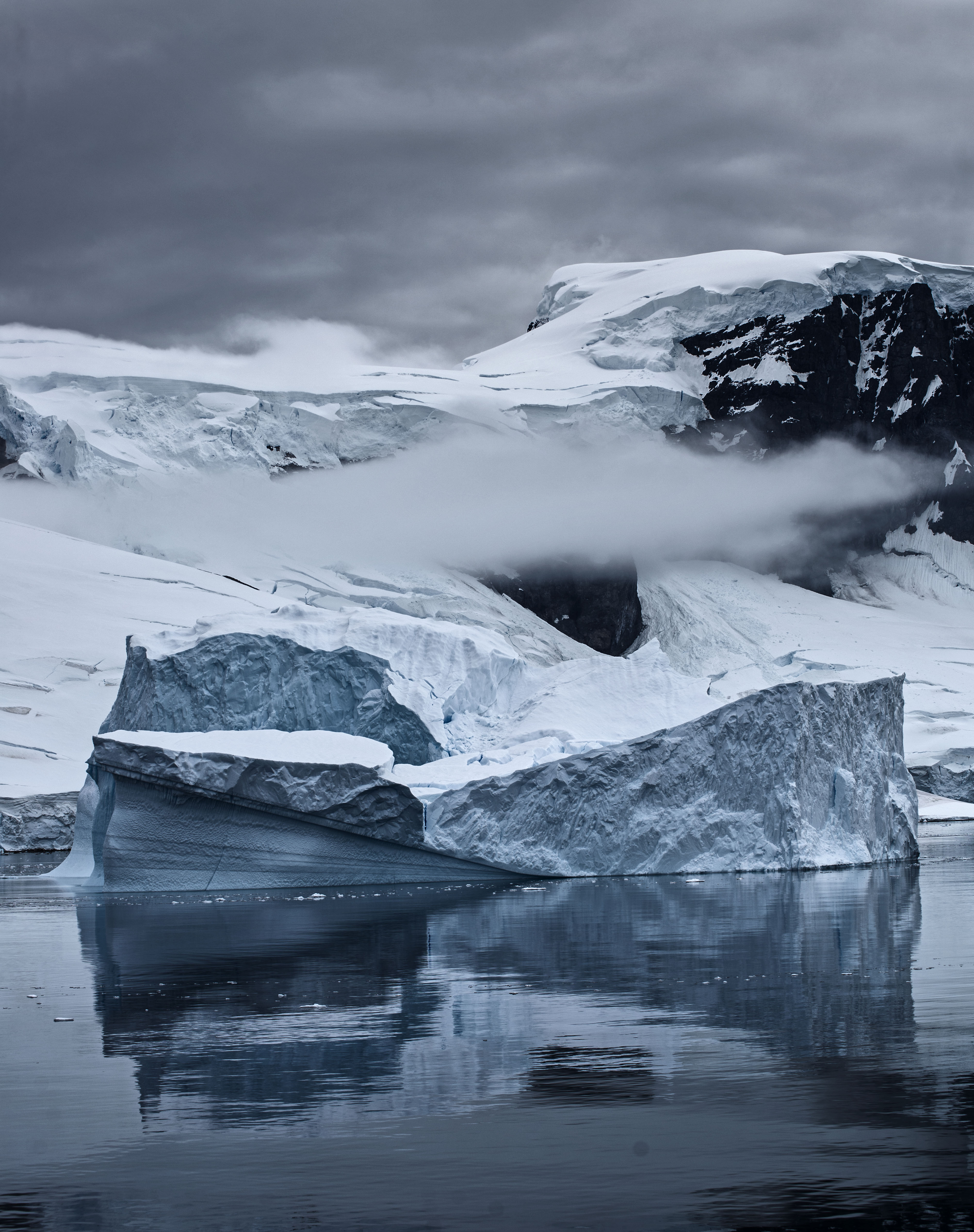
The highlight of the cruise was definitely the scenery however with glaciers on either side of the channel coming down right to the water.
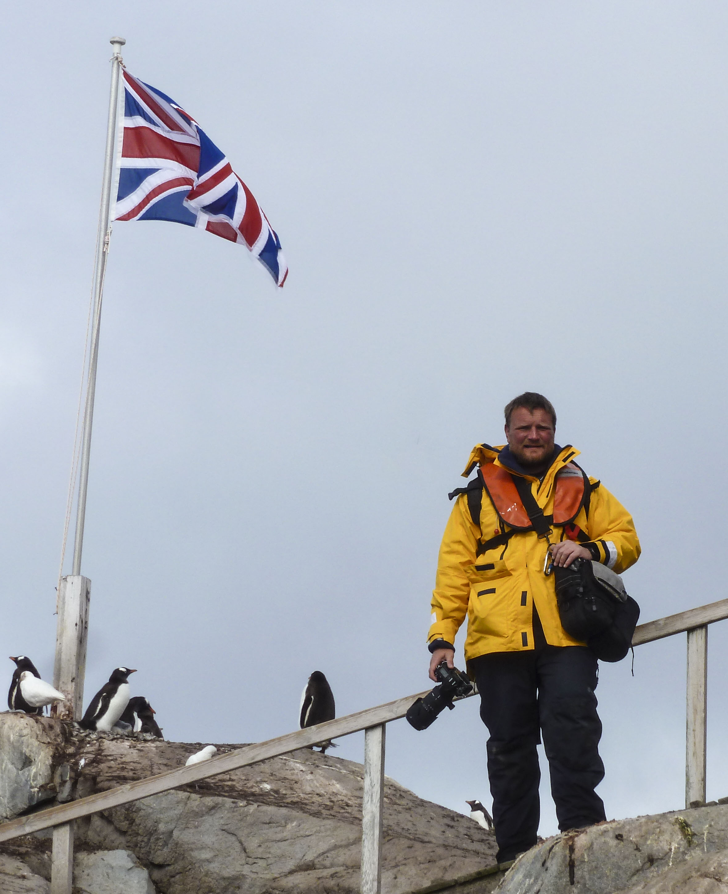
The afternoon landing was a bit disjointed as we were visiting Port Lockroy which is an historic British base. Only 40 people are allowed to land here so we had to split into three groups and had only 45 minutes on the island itself.
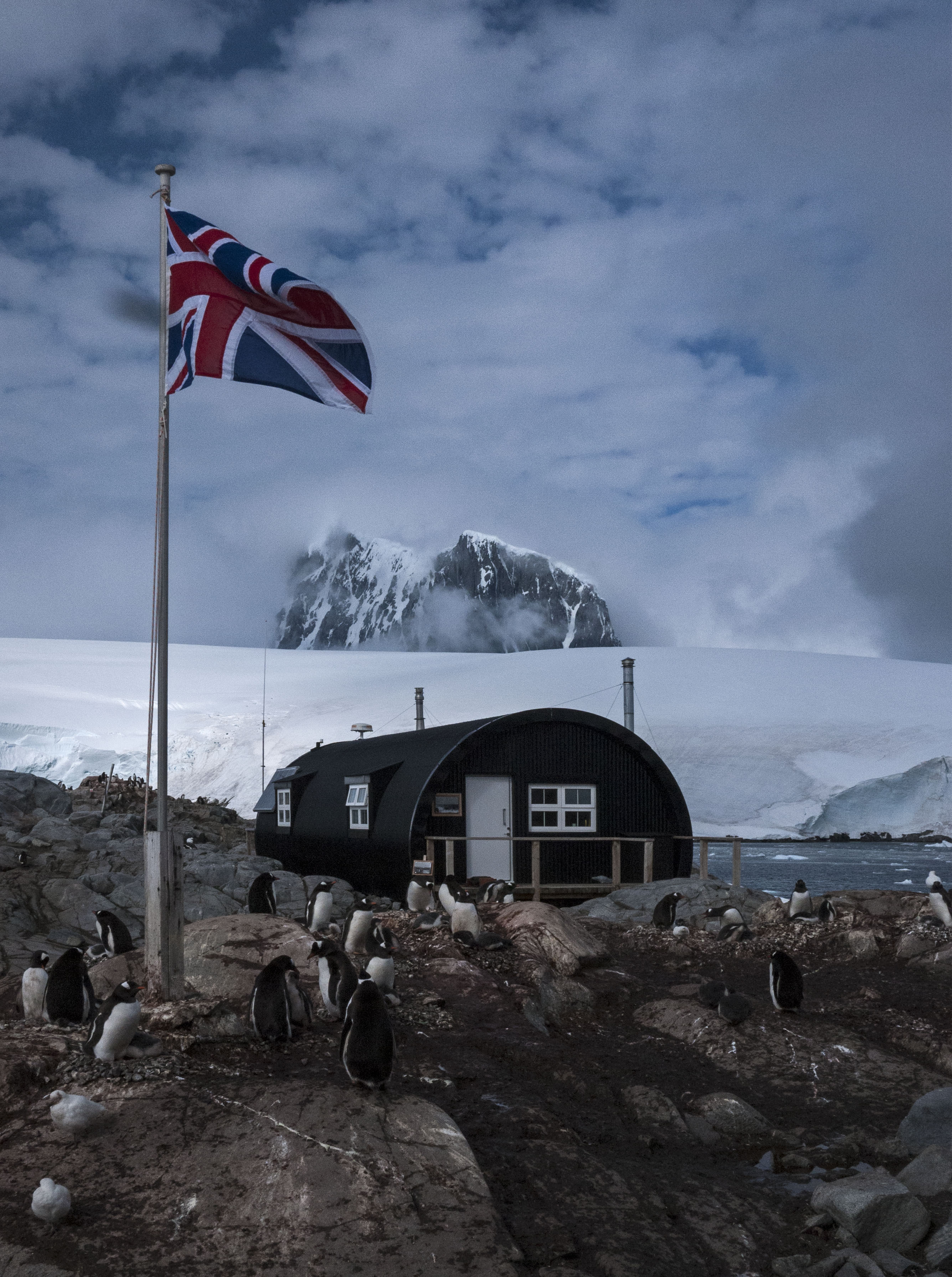
Port Lockroy was established as a British base during Operation Tabarin during WWII on the tiny island, Goudier, which is only around 200m across. Operation Tabarin was a mission designed to warn of any German use of Antarctica for U-boat supply and operations as well as bolster British claims to Antarctica. The 14 strong team also conducted some good scientific work.
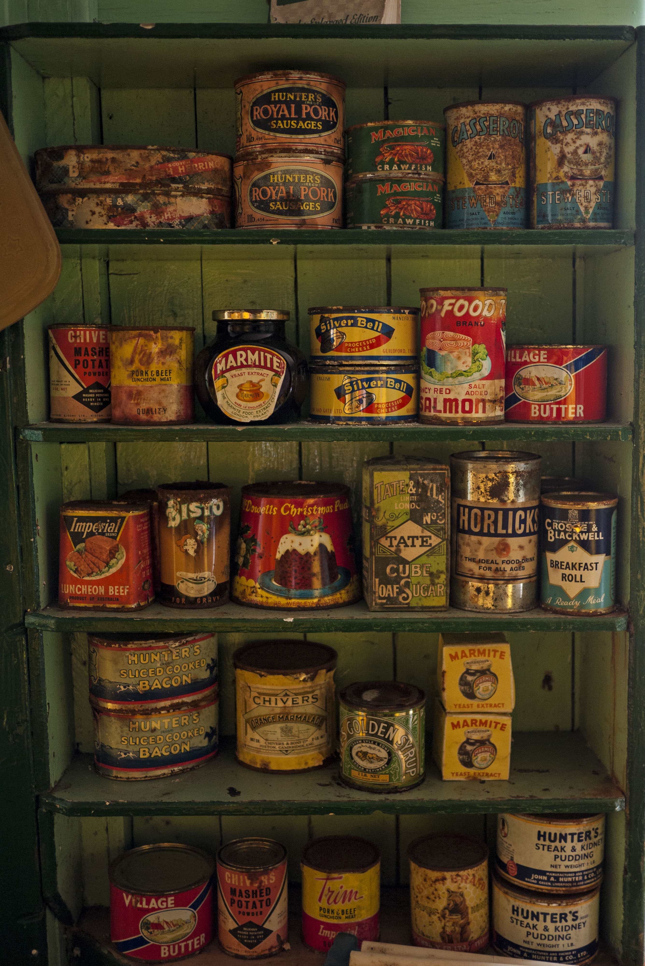
Port Lockroy today is a museum and a working British post office staffed by 4 people. We took our opportunity to send some postcards home from what must be the furthest flung British Post Office in the world. The base itself appears as frozen in time from when it was abandoned in the 1960’s.

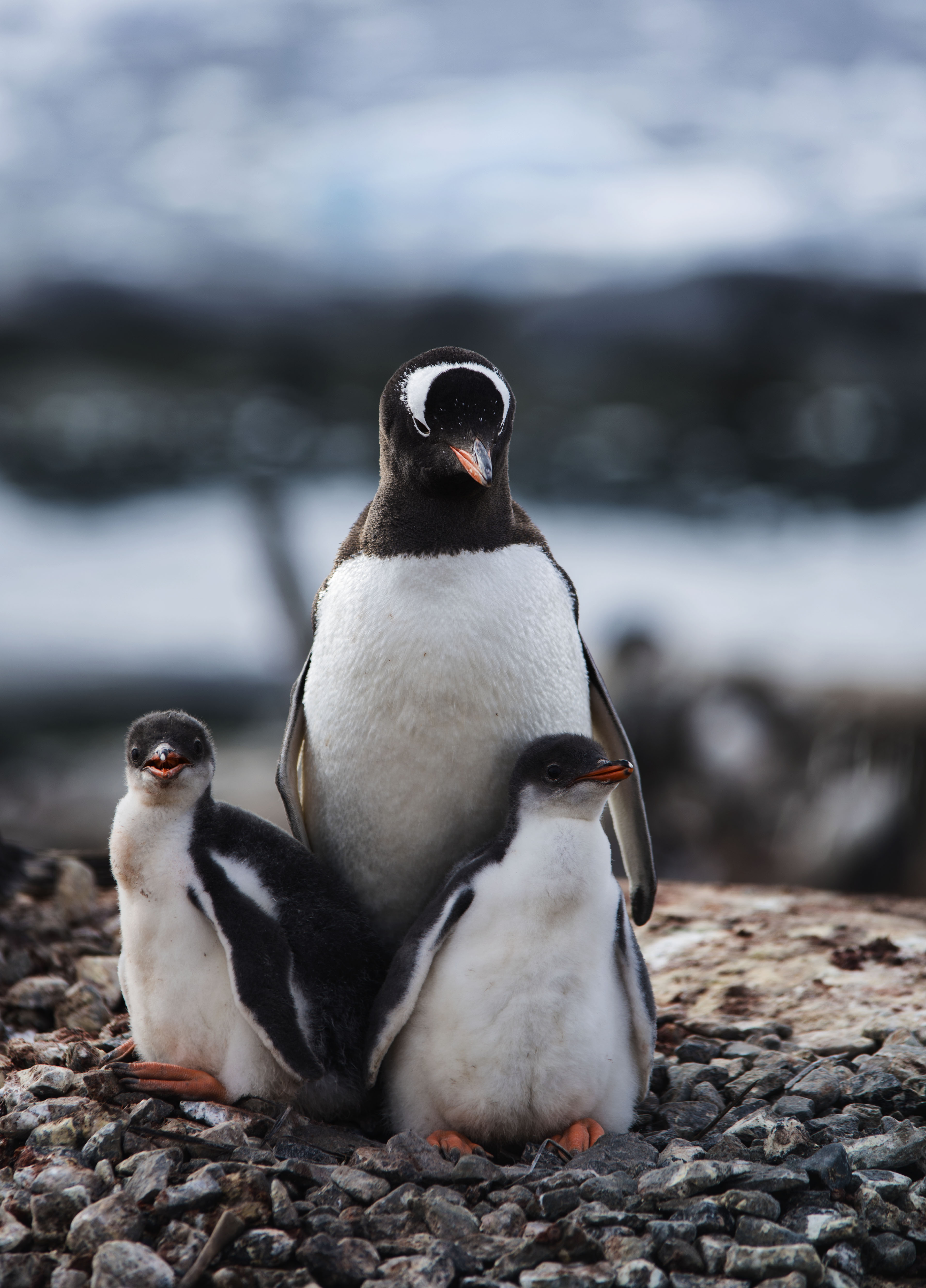
The island is also absolutely covered in penguins, mostly Gentoo penguins, and a study is being undertaken to determine impact of tourism of penguins. The means half the island is shut to tourists. The results of the 10 year study so far show that tourism is having a very limited impact on penguin behaviour.
After our tour of the island we took the zodiac to another nearby island where there is a large collection of whale bones. This included a whole whale skeleton that had been assembled in the past (albeit of several different species worth of whale bones).
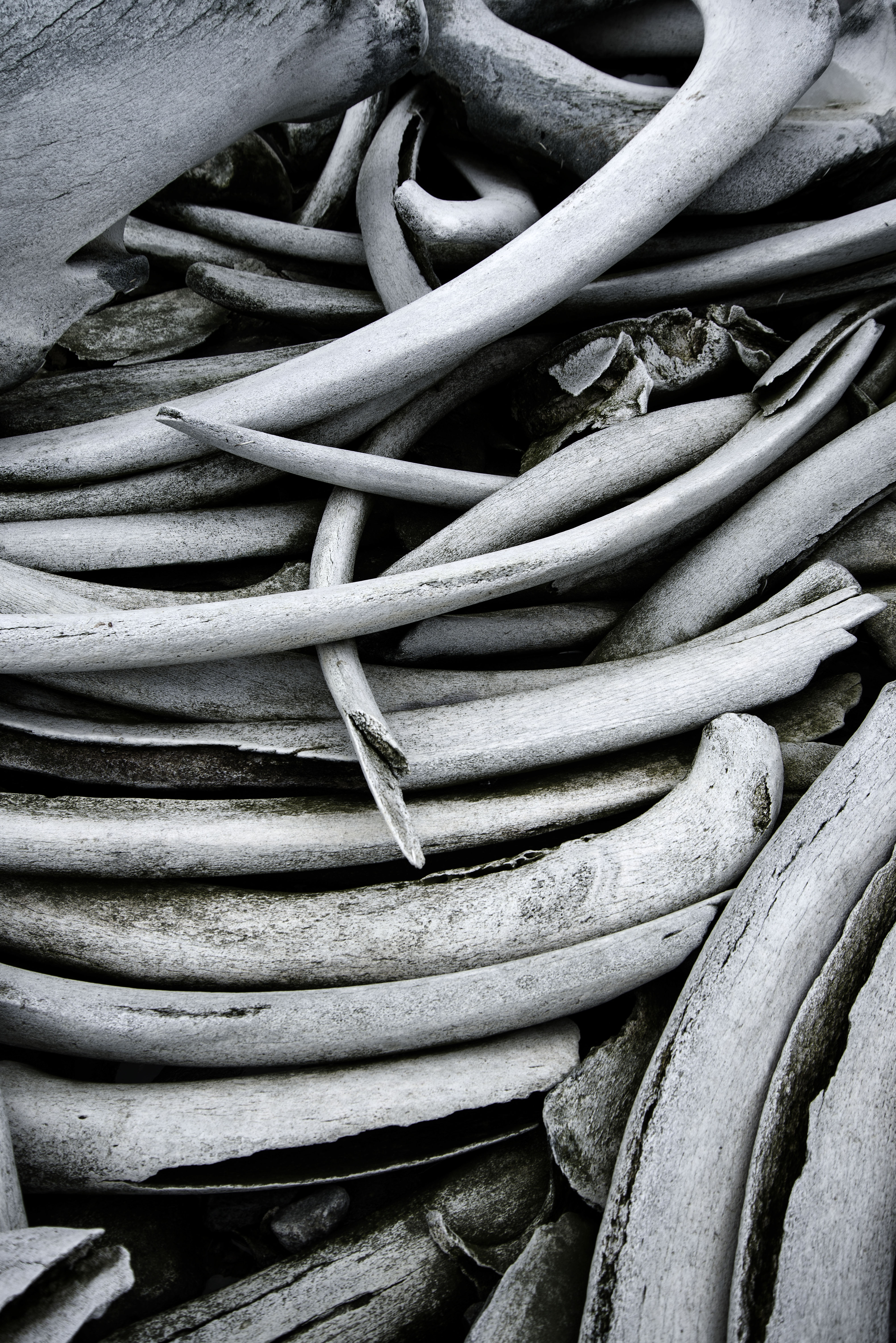
The small island was used by whalers, like many of the islands in this area. It is pretty common to find large numbers of whale bones on any beach and in the shallow water off beaches. The number of whales taken in the antarctic during whaling days boggles the mind at over 1 million.

To follow this all up we spent some more time cruising the area in the zodiac and encountering penguins and another leopard seal.
Antarctica: Camping on the Continent
One of the optional extras on our Antarctic adventure was to spend a night camping on the mainland of the Antarctic continent. We couldn’t pass this up, even if Sarah had reservations of how cold it might be.
We had a choice of whether to camp in bivvy bag or a tent and chose a tent for the night.
No food is allowed to be taken ashore, so after an early dinner the campers were ferried in zodiacs to a snow covered dome surrounded by water with glaciers all around, called Leith Cove. This didn’t technically feel like camping on the continent but, lo and behold, in the morning with the tide out we could see an outcrop of rock linking us to the mainland. In my mind that counts as camping on Antarctica !

Once we were dropped on site everyone spread out and set up their bivvys or tents for the night (camping is limited to 30 people and there were just under this). We were pleasantly surprised that we managed to get the tent up and our stuff inside within 10 minutes.
After everything was set we had around 2 hours or so before sunset to take in the views and enjoy the tranquility of the Antarctic. Just before we went to bed there was a huge calving event from the glacier in front of us, which caused a big wave to radiate outwards. We didn’t see it but as soon the calving happened apparently a penguin on the shore started sprinting for higher ground !

Over night we actually slept pretty well but were both drive out of the tent in the morning by the need to go to the toilet. There was a porta potti set up behind a snow wall to make sure we didn’t pollute Antarctica.
In the early morning we spent some time quietly watching a humpback whale which had swum into the lagoon. He eventually swam out through a channel only about 10m from shore giving us a great view.
The zodiacs arrived at 7am to take us back to the ship (which had retreated out of sight for the night) for a much needed hot shower and breakfast !
We didn’t get properly cold in the night but towards morning were beginning to feel a little bit chilly. We discovered talking to people back on the boat that most people didn’t find the bivvys very comfortable, primarily because it snowed for most of the night so some people got quite wet! We were glad that we chose a tent.
Antarctica: Cuverville Island and Neko Harbour
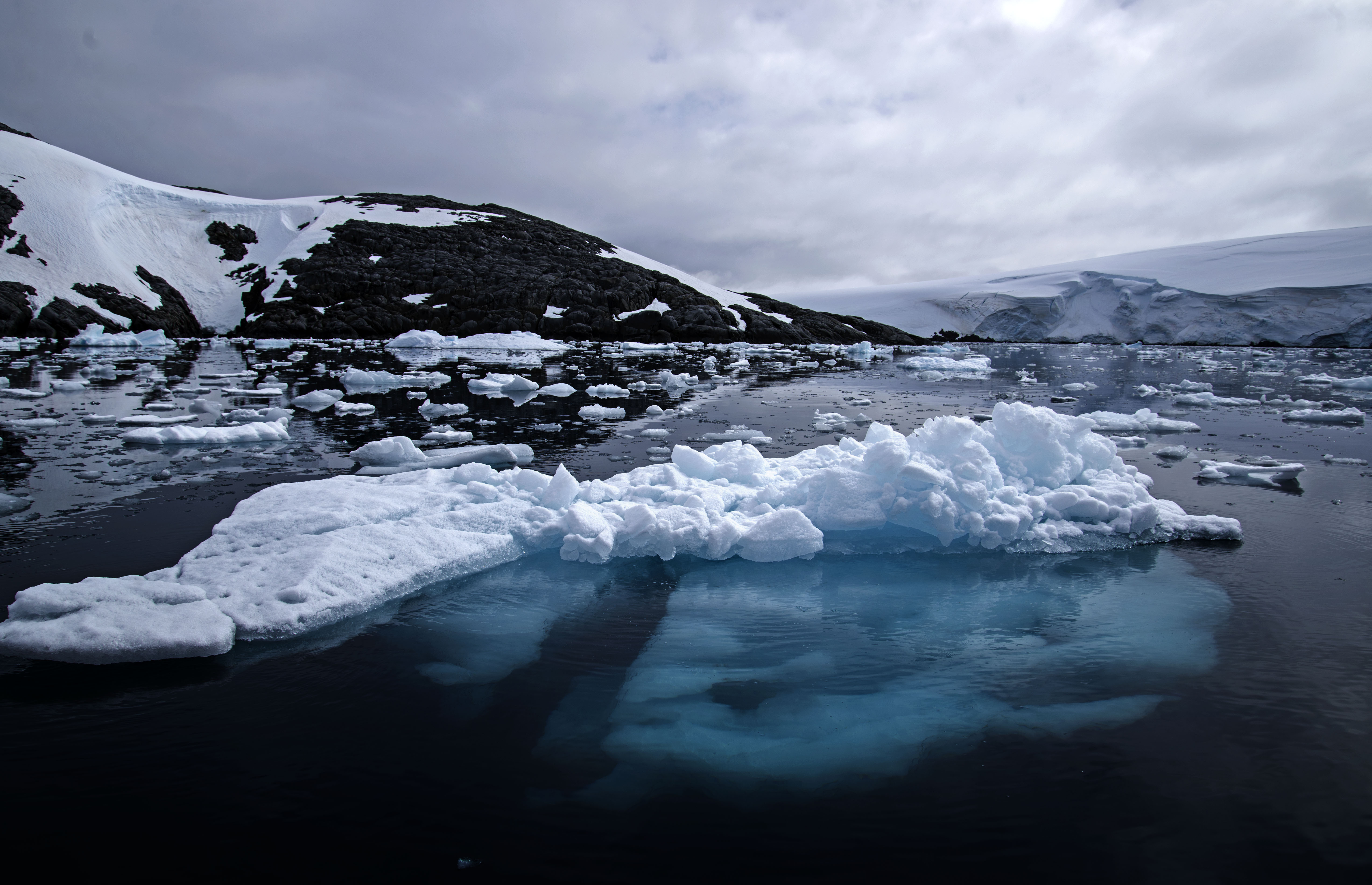
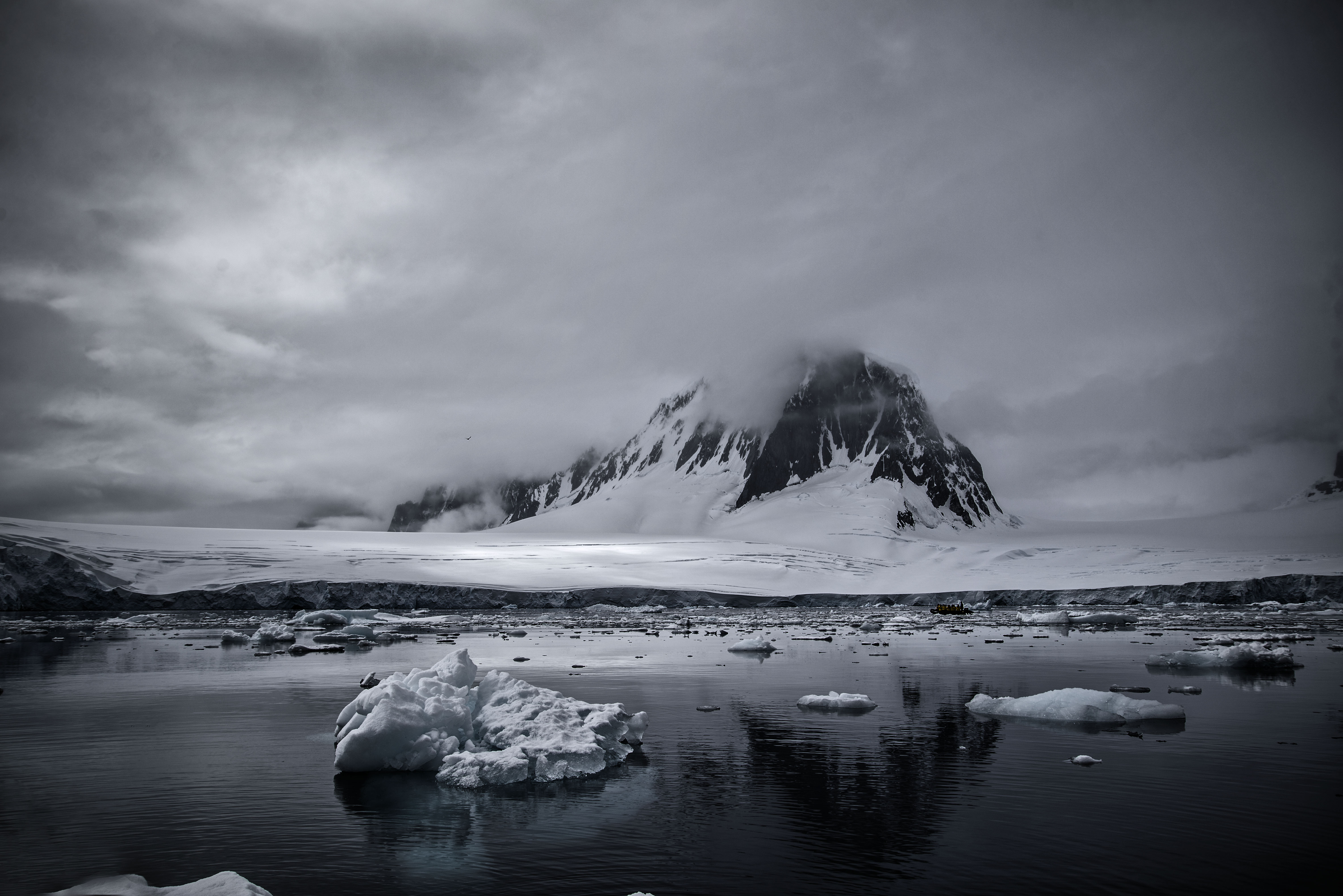
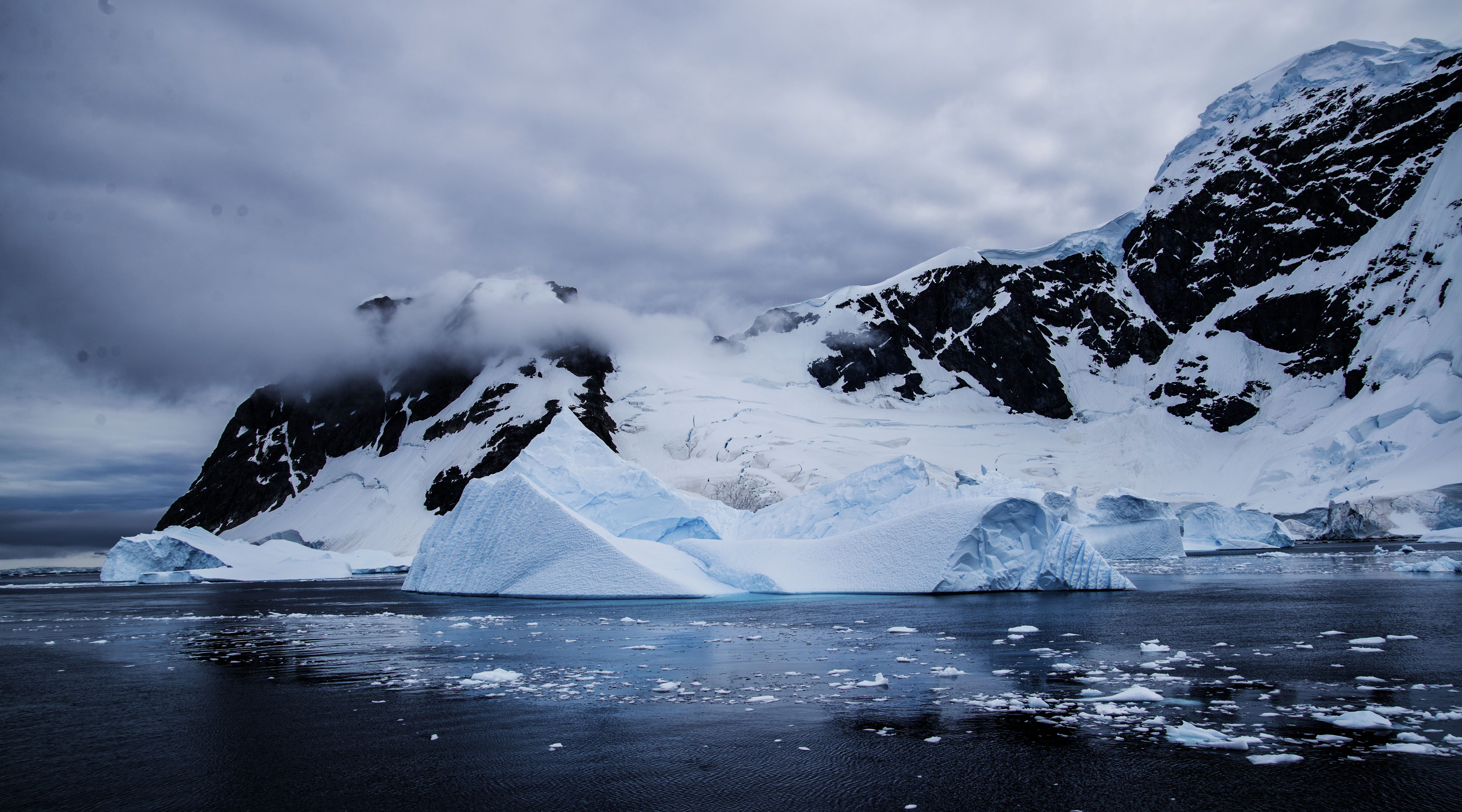
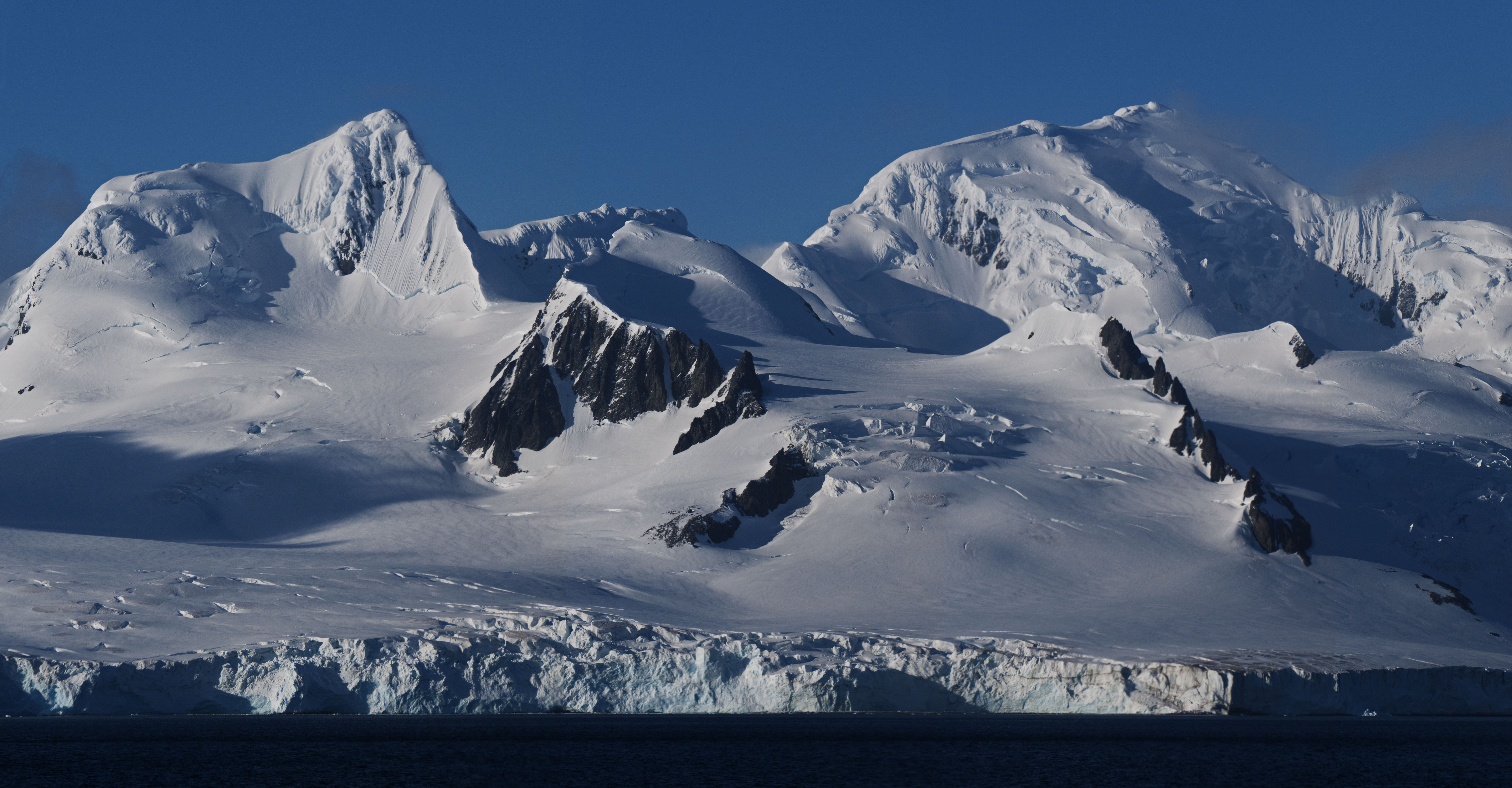
Overnight the ship steamed from the South Shetland Isles across to the Antarctic Peninsula. As we moved further South the temperature dropped noticeably and the quantity of ice in the water rose. The scenery of the peninsula is jaw-dropping with glaciers everywhere you look and ice covered mountains rising up from water littered with icebergs of all sizes.
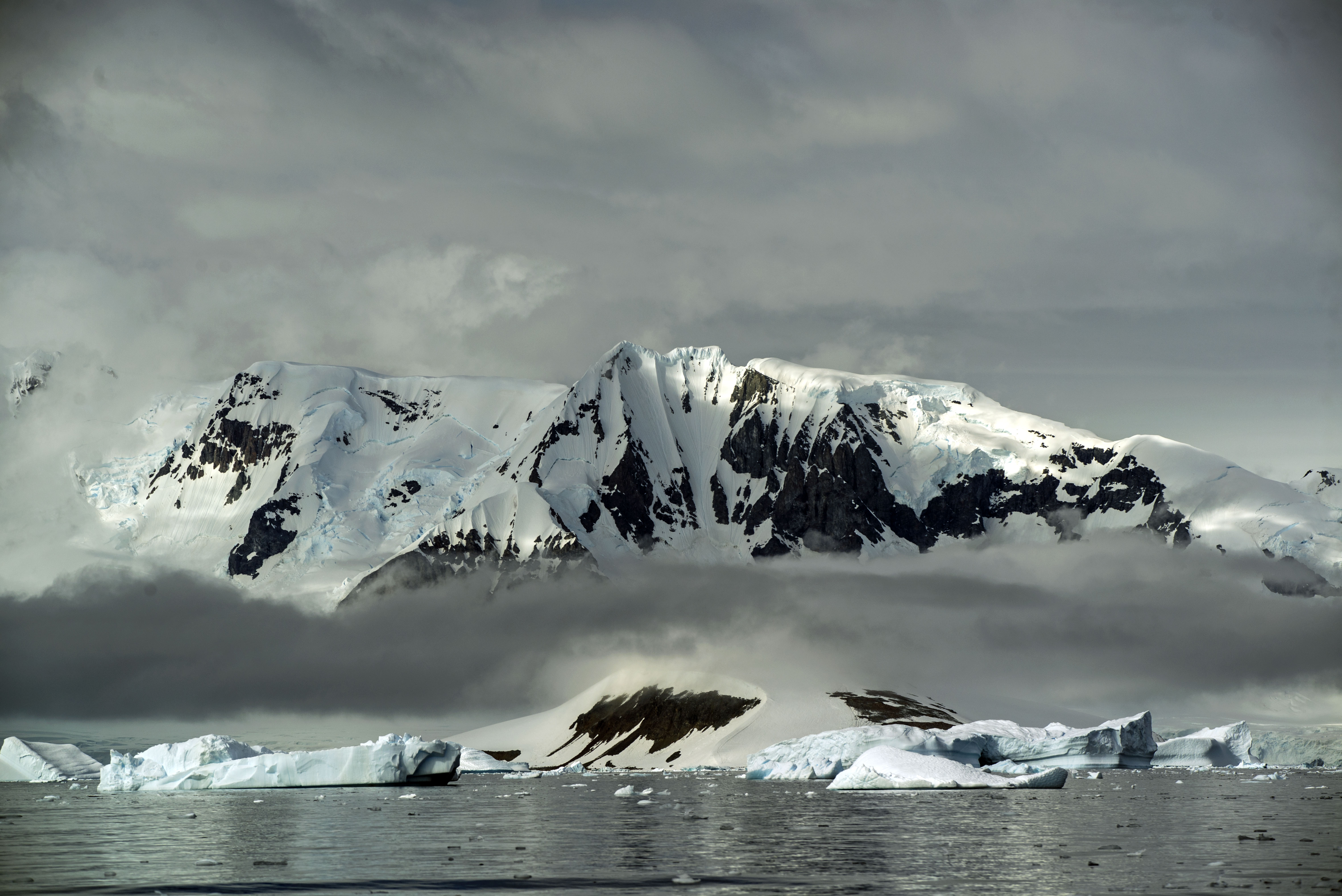
The amount of ice on the Antarctic Peninsula is actually a problem for the ships down here and too much ice means that landings can be cancelled or changed. We were lucky as we had lots of ice but it didn’t stop us going anywhere.
Our first stop of the day was Cuverville Island. This was a small landing area and the Sea Spirit did not have a permit to land all 100 passengers on the island. Instead half of us went on a zodiac tour whilst the other half visited the island, swapping just in time before those of us on the zodiac started to become hypothermic.

The zodiac tour was great getting us close to lots of medium size icebergs in the area. We saw plenty of Gentoo penguins in the water and even standing on the ice.
But it was really the ice that was the star of show.
When we landed on Cuverville Island itself the penguin stench was definitely up at another level . The Gentoos are definitely more stinky than the Chinstraps from the previous day.
After going back to the ship and having a great BBQ lunch on the back deck with amazing views of icebergs and glaciers there was another landing in the afternoon.
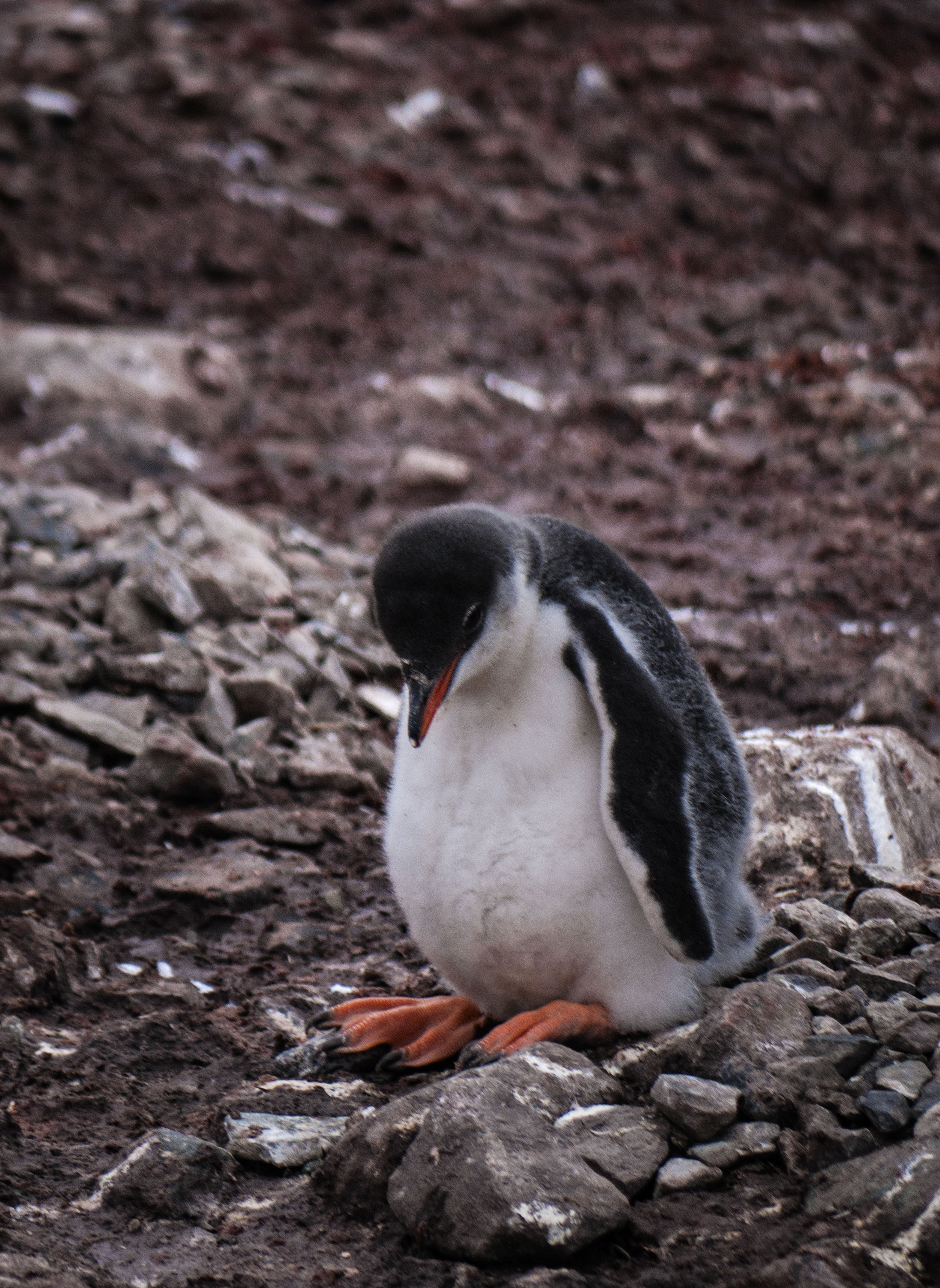
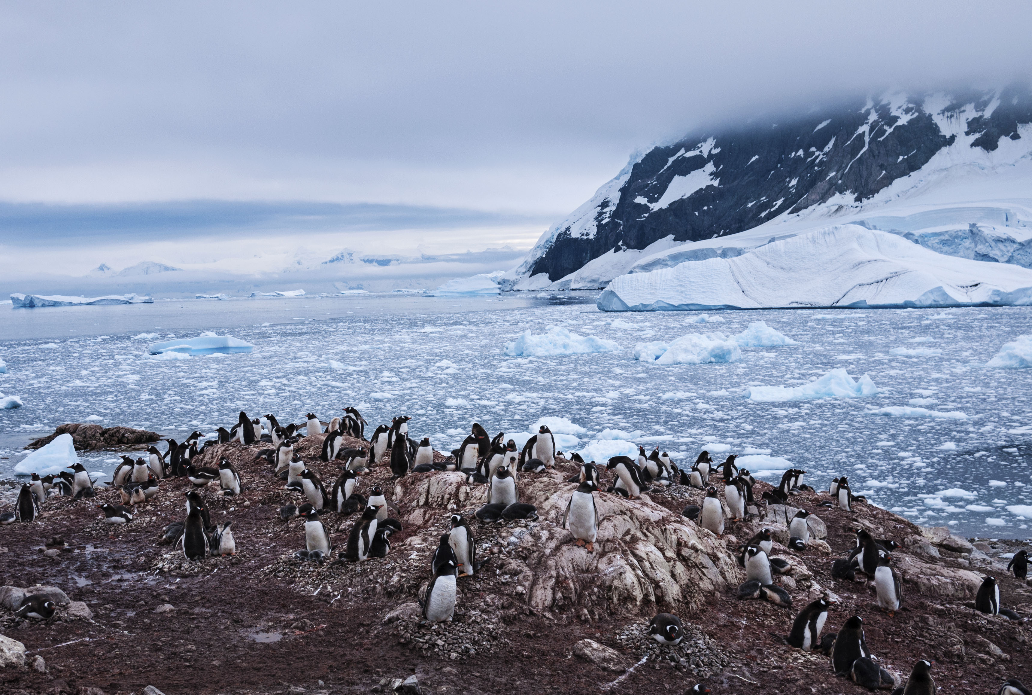
This was at Neko Harbour which was our first landing on the mainland of the Antarctic. The landing itself was surrounded by Gentoo Penguin Rookeries and the attached smell. Most of the penguins had chicks but we saw the guy below sitting on an egg. Even if the egg hatches it will be too late for the chick to mature before winter comes and the parents have to leave or be trapped by sea ice, so there’s no hope for this little fella.
Most of the penguins have two chicks but often only one survives. These Gentoo chicks are a week or two old before their molt starts, giving them a waterproof coat which means they can start to swim.
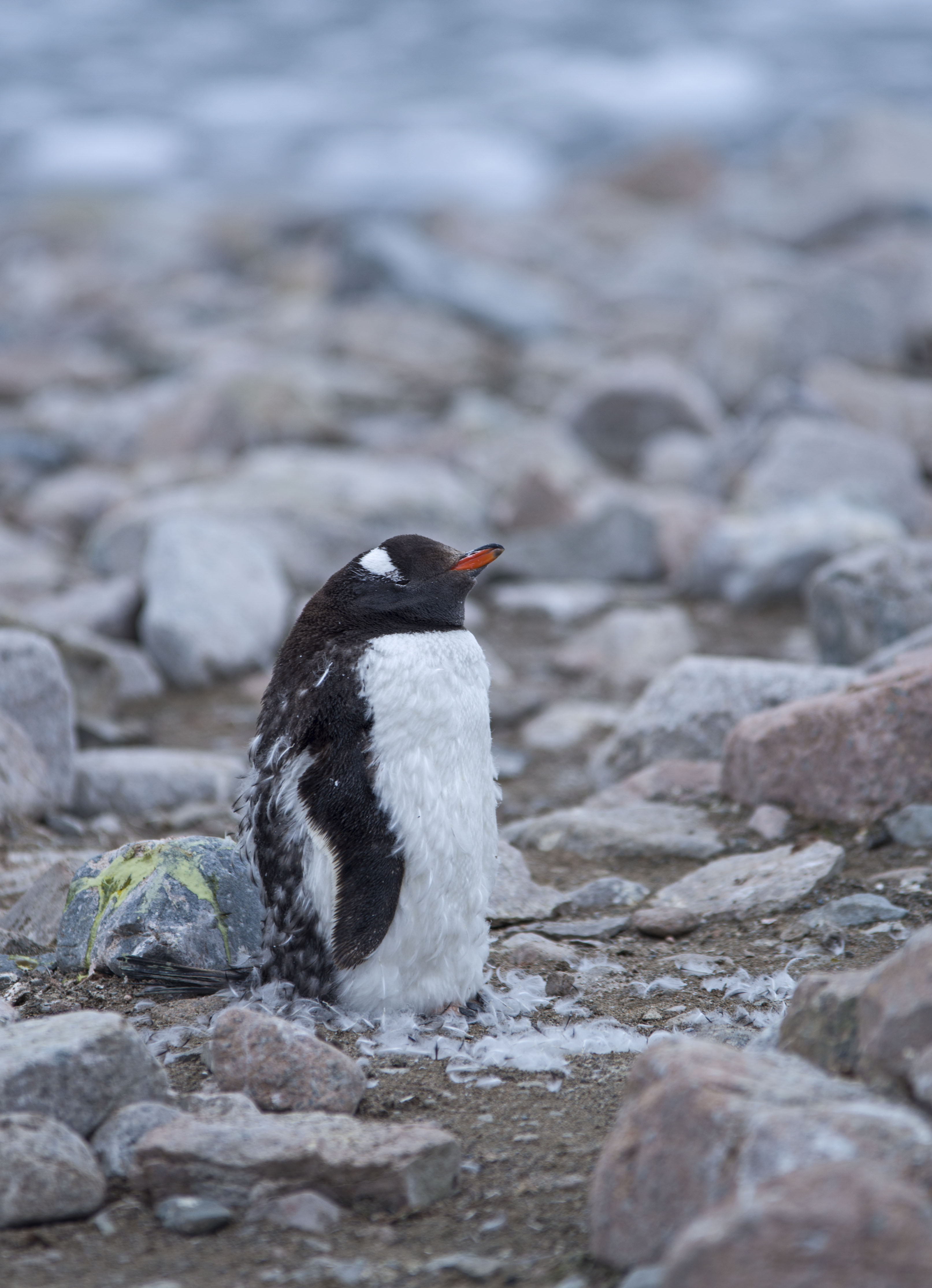
The penguins which don’t have surviving chicks and the ones that aren’t sexually mature will molt earlier than those with chicks. The molting process takes two weeks during which time they are not waterproof and they don’t move much. Disturbing them is problematic as they are living on stored fat and movement burns this more quickly so this can be quite a stressful time for them.
However there was more to this landing with a hike up a steep snow covered hill to a rocky promontory with amazing views of the surrounding glaciers.
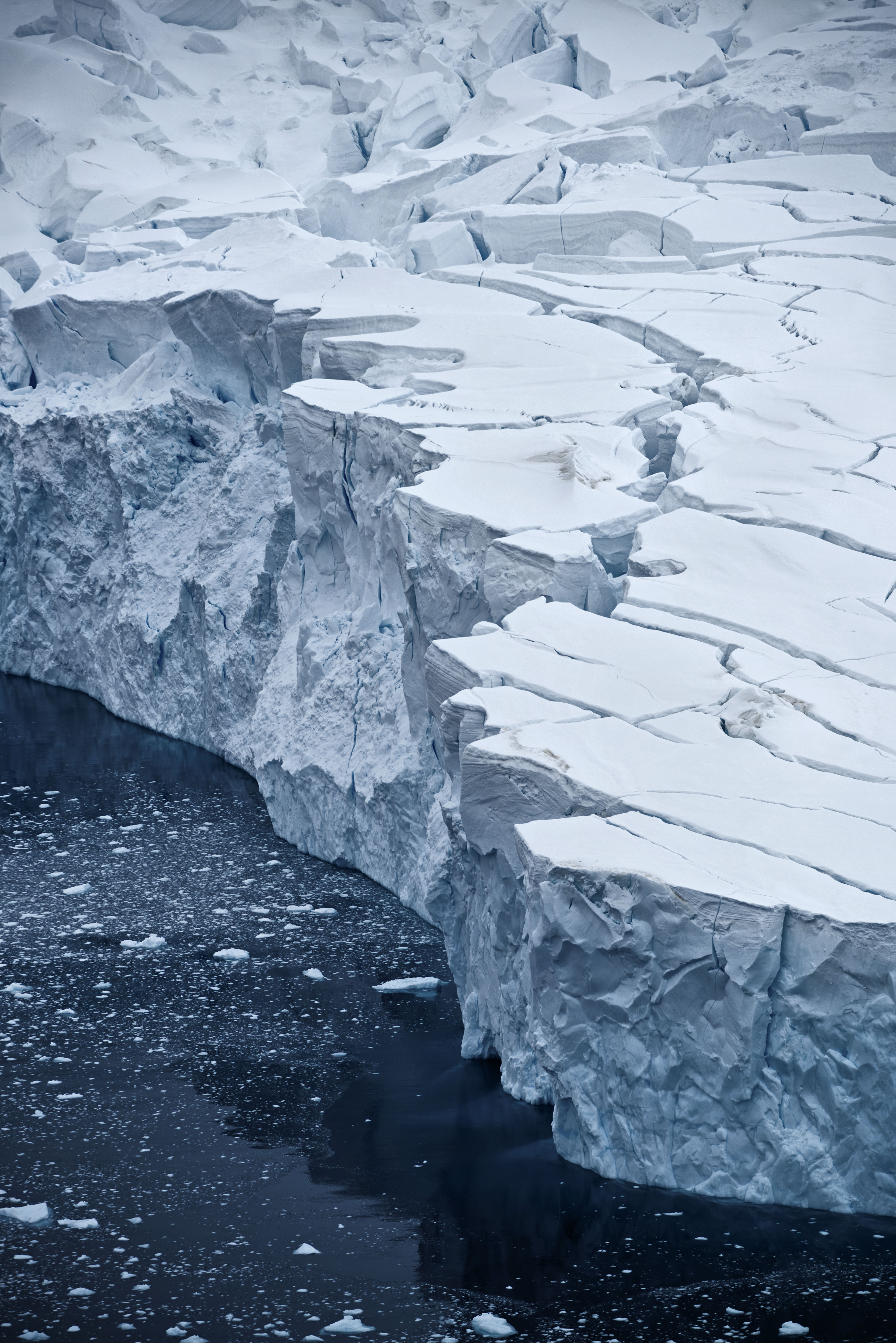
While we were up at the viewpoint we saw a couple of carving events from the glacier and a big avalanche along the upper snowy slopes from a high up hanging glacier hidden by cloud.
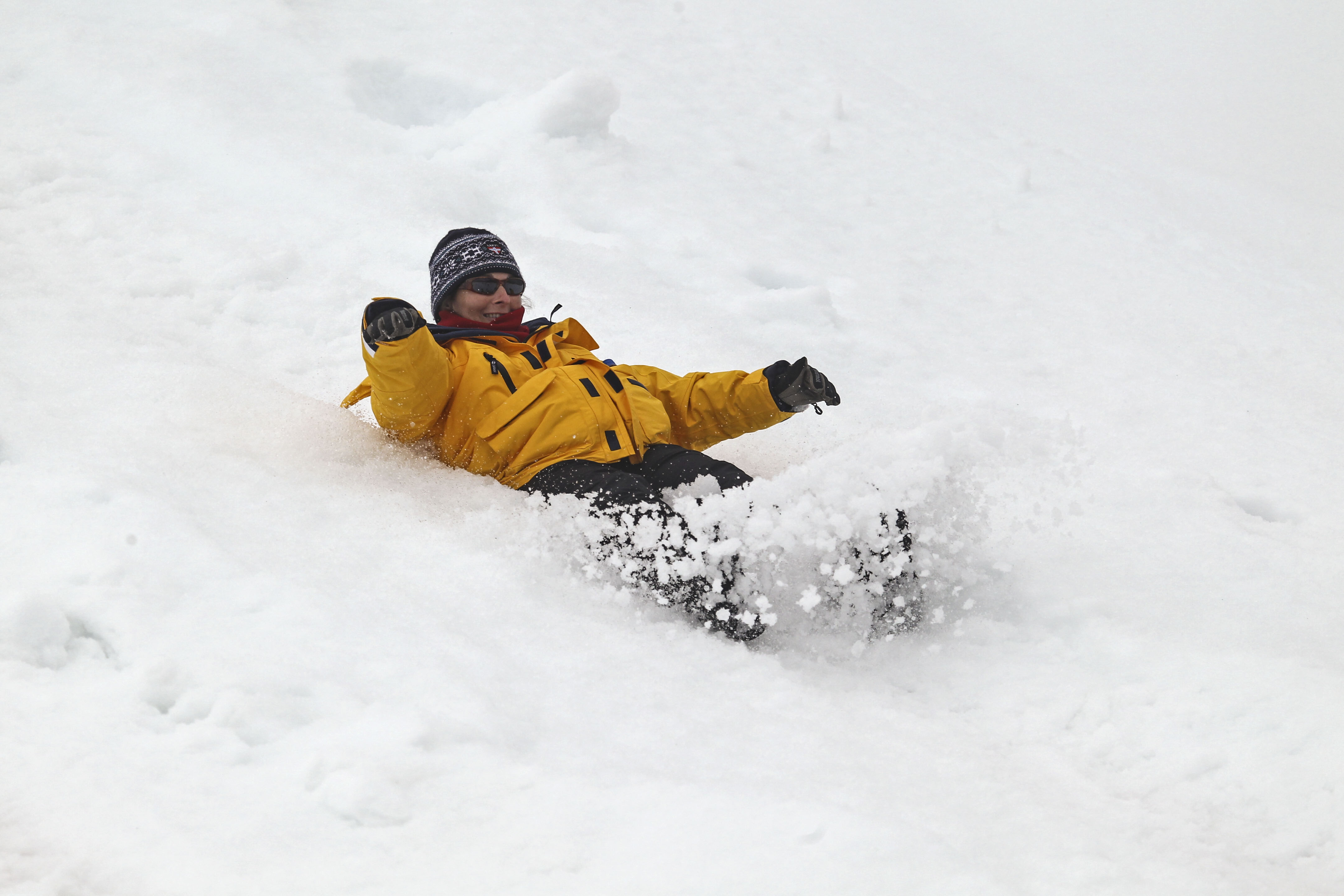
We hiked up to the top of the hill but on the way down we were encouraged to slide down the snowy slope. Chris, the onboard doctor, stood by at the bottom with a worried look on his face.
Antarctica: Half Moon Island and Deception Island
Our Second day in Antarctica we had moved to Half Moon Island which is still in the South Shetland Islands. This was to be our first proper landing on a fairly small island. However the landing area was big enough to absorb all the passengers at one time.
On stepping ashore we were assailed by the stench of penguin poop. This would become a familiar smell over the next few days. This was really a first taste of the Antarctic and we were blown away by the sights and sounds. There were animals everywhere with Chinstrap Penguins, Fur Seals and even a Weddell Seal.

The expedition team had been out to the island before any of the passengers landed. They had marked out a path across the island with fluorescent orange flags and placed 2 crossed flags in areas where the passengers were not allowed. They were very ecologically aware and focused on protecting both the environment and the wildlife.
In one of the briefings during the Drake Passage crossing they had explained the rules to us. The two most important were to stay 5m away from the animals (unless they approached you) and to give all animals the right of way.
Half Moon Island had snowy areas but also a lot of bare rock which is where the Penguins choose to nest. They build nests on the bare rock out of small stones and at the time we were in Antarctica (early February) many of the penguins had very cute, fluffy chicks.
This landing was great and we had almost 3 hours on the island giving loads of time to explore and also sit and soak in the atmosphere.
In the midst of Chinstrap penguins a lone Macaroni penguin was spotted. This guy has been coming to the island for a number of years and there are usually no other Macaronis here. However this year a juvenile has been spotted suggesting that a colony may form here in the future.
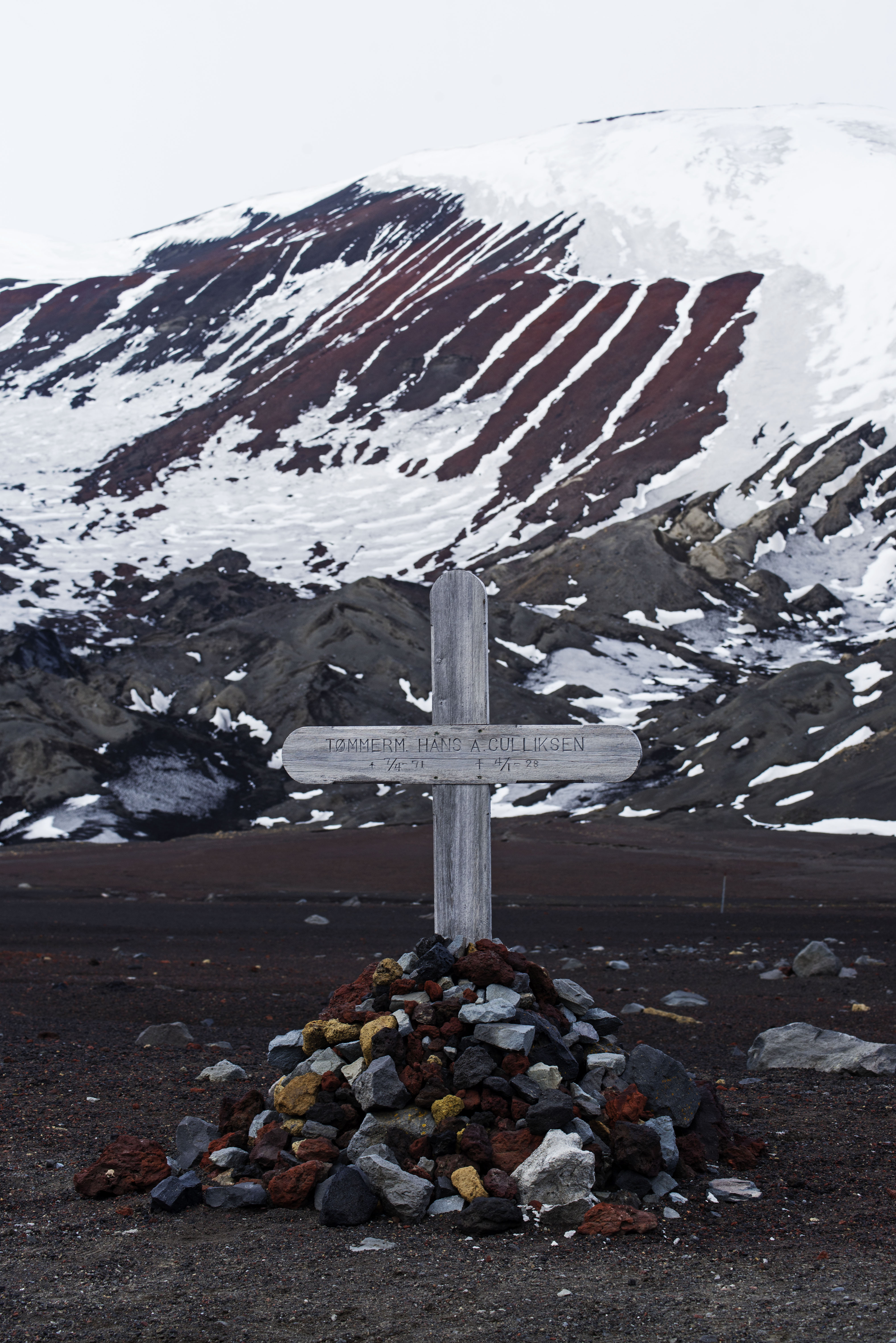
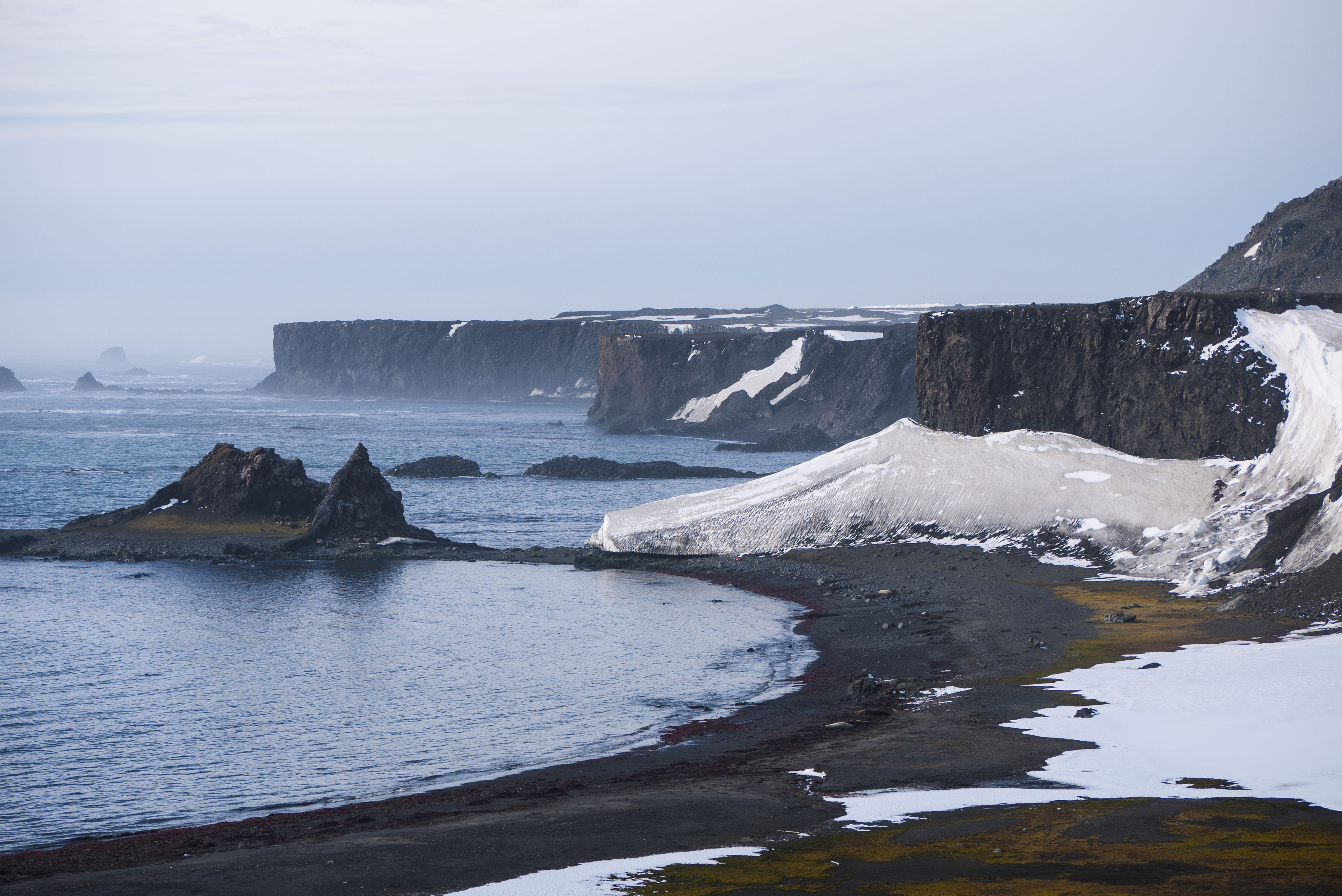
The second landing of the day was Deception Island. This island is an active volcano with a sea passage into the Caldera. As we came ashore clouds of steam rose at the water’s edge from thermal activity. I buried my hand in the sand and it was too hot to keep it there.
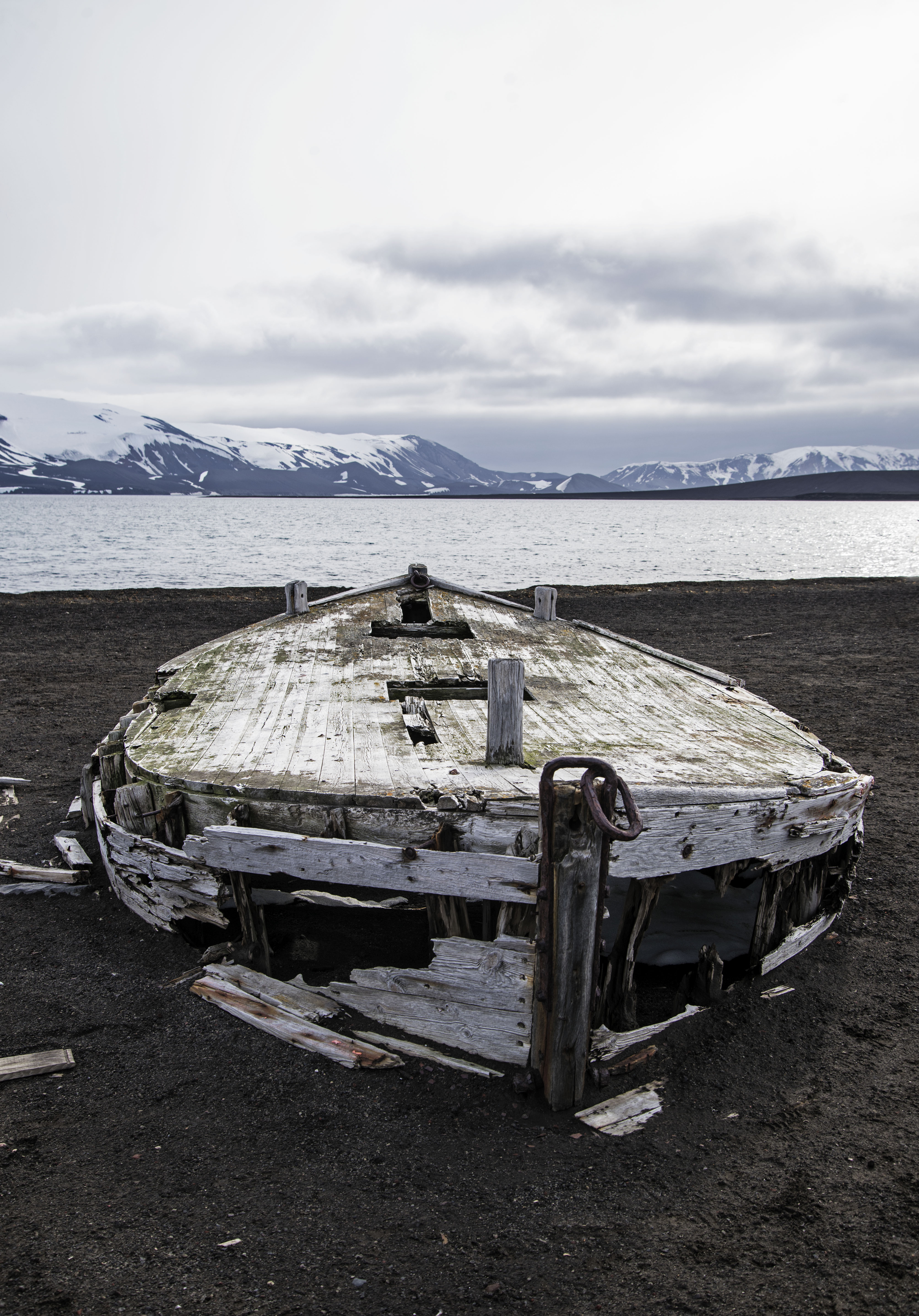
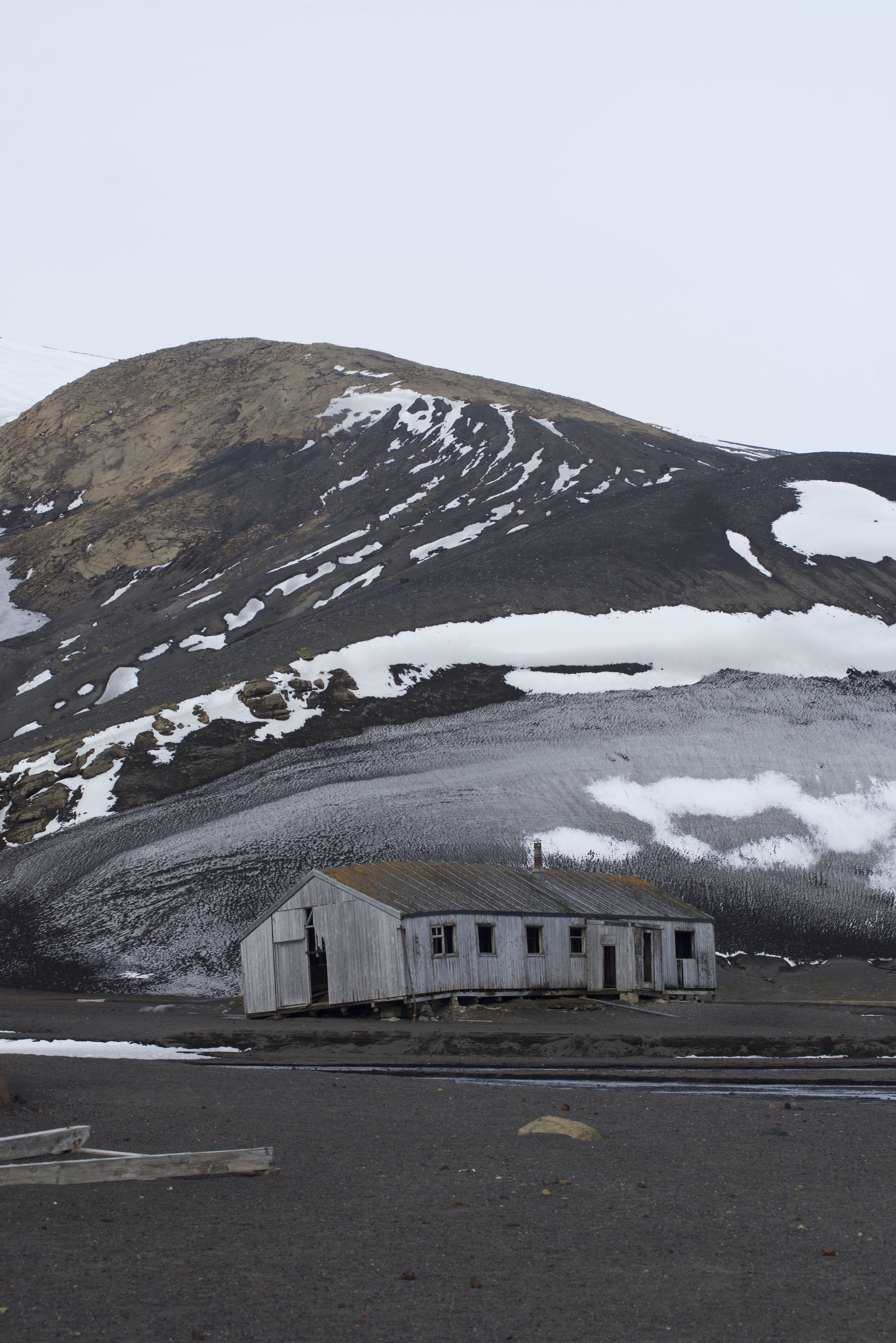
Whaler’s Bay in Deception Island was a hotspot for Whaling until the 1950’s when basically all the whales had been caught. There are the remains of buildings here from the whaling days including large tanks for whale oil and water boats that were used to collect fresh water from the other end of the island for use in rendering whales for oil.
We hiked up to the a dip in the crater wall, called Neptune’s Window, which gave us a view back over the bay and out to the open ocean. We were fortunate to be in the group with John, the expedition historian, and we are regaled with wonderful stories of the whaling days and early explorers who had visited Deception Island.
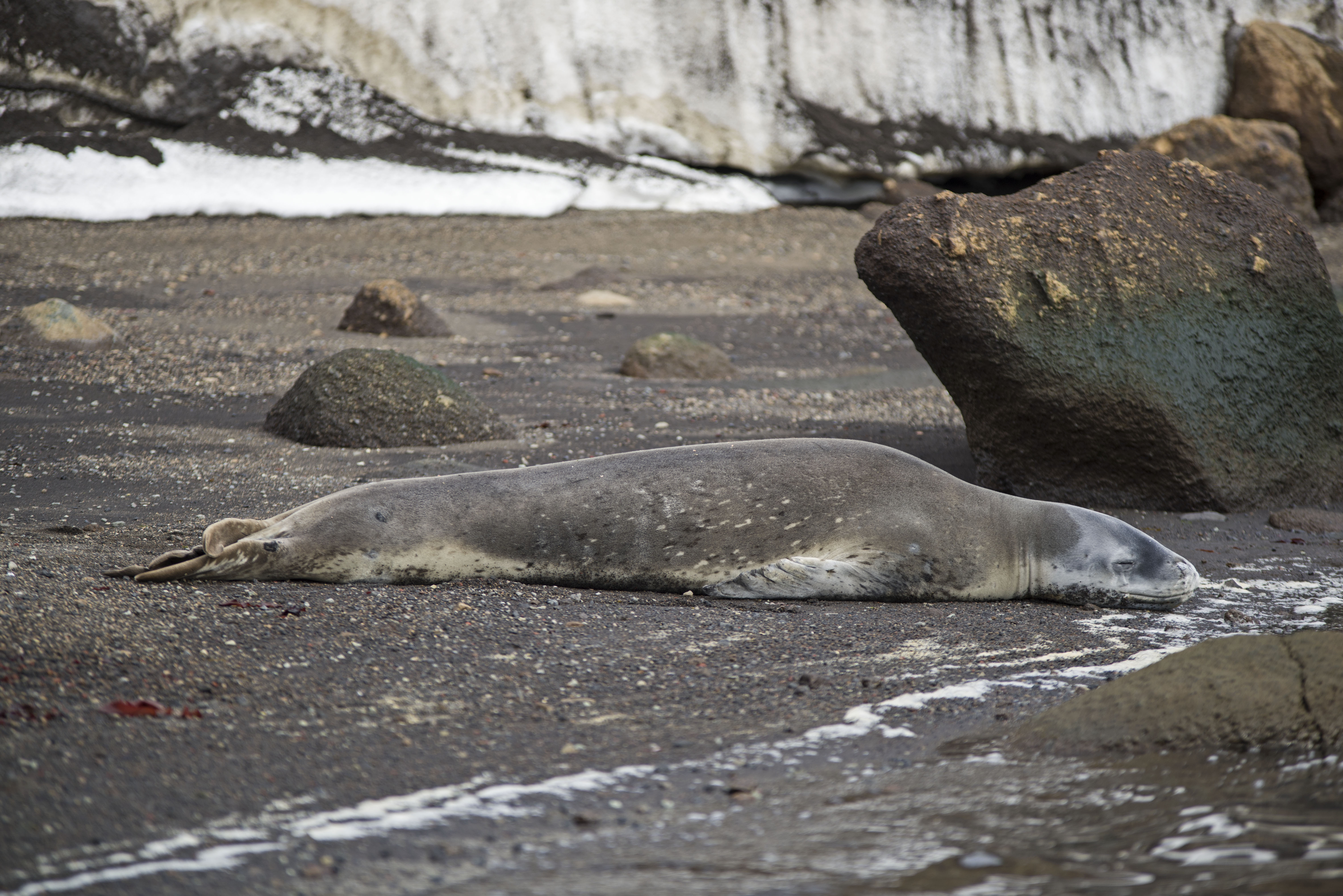
On walking back from Neptune’s window we came across a leopard seal that had hauled out on the beach. We kept a good 10m back from this guy as they can be very aggressive. A few years ago a woman from the British Antarctic Survey was drowned by a Leopard Seal while snorkeling. It was only playing but dragged her down to 70m before releasing her and she drowned attempting to surface !
As we walk the length of the beach we investigated the various buildings left over from the old days but we can’t go inside as they are all in various stages of collapse and definitely dangerous !
This site is a complete contrast to Half Moon Island but nevertheless fascinating.
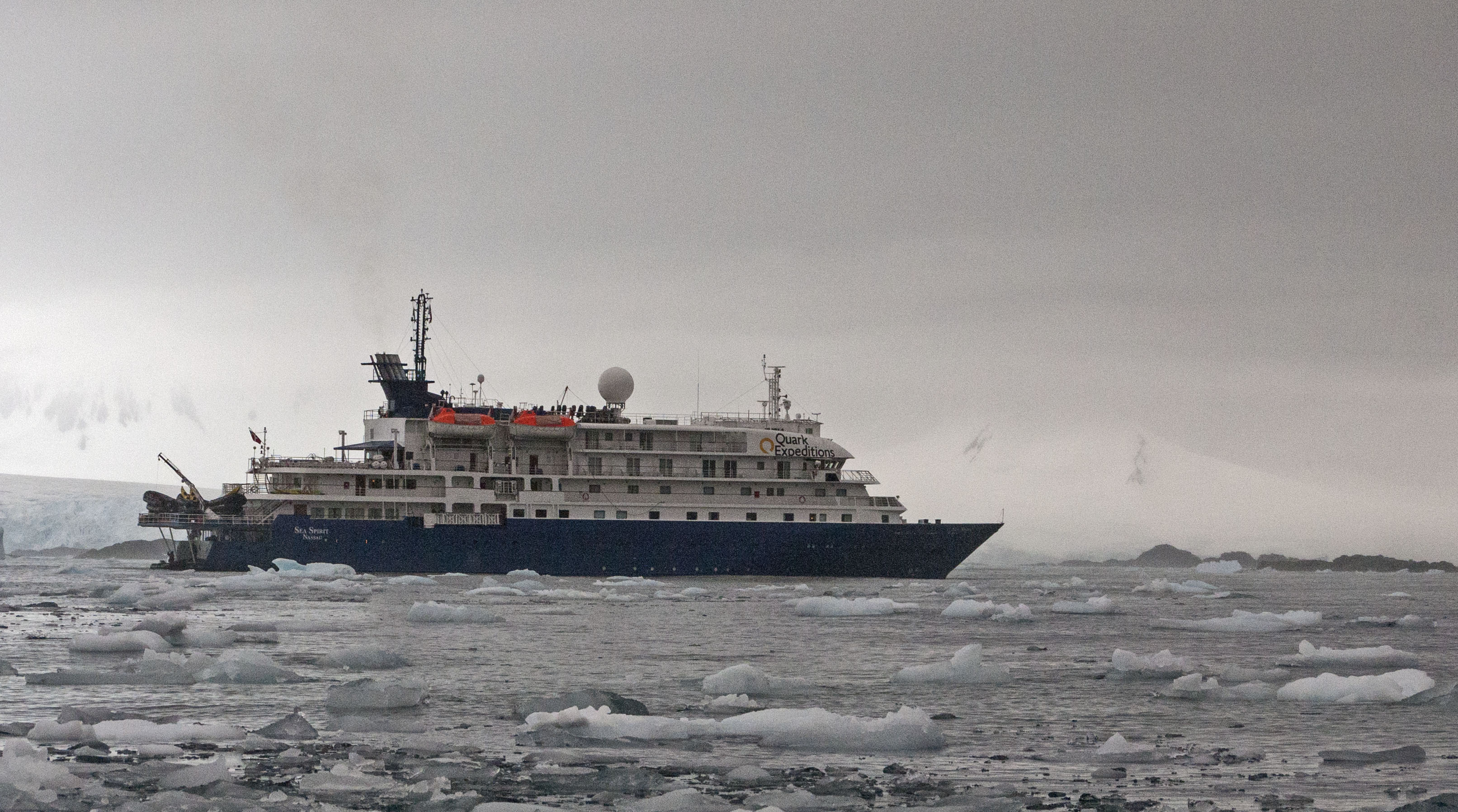
Antarctica: Boarding, Sailing and The Great Wall
We had arranged to travel to Antarctica on an 11 day trip (that gives 5 days in Antarctica) booked with Quark Expeditions on the ship Sea Spirit. In order to book it we had contacted Daniela at Ushuaia Tourismo (antarctica@ushuaiaturismoevt.com.ar) who was very helpful and responsive.
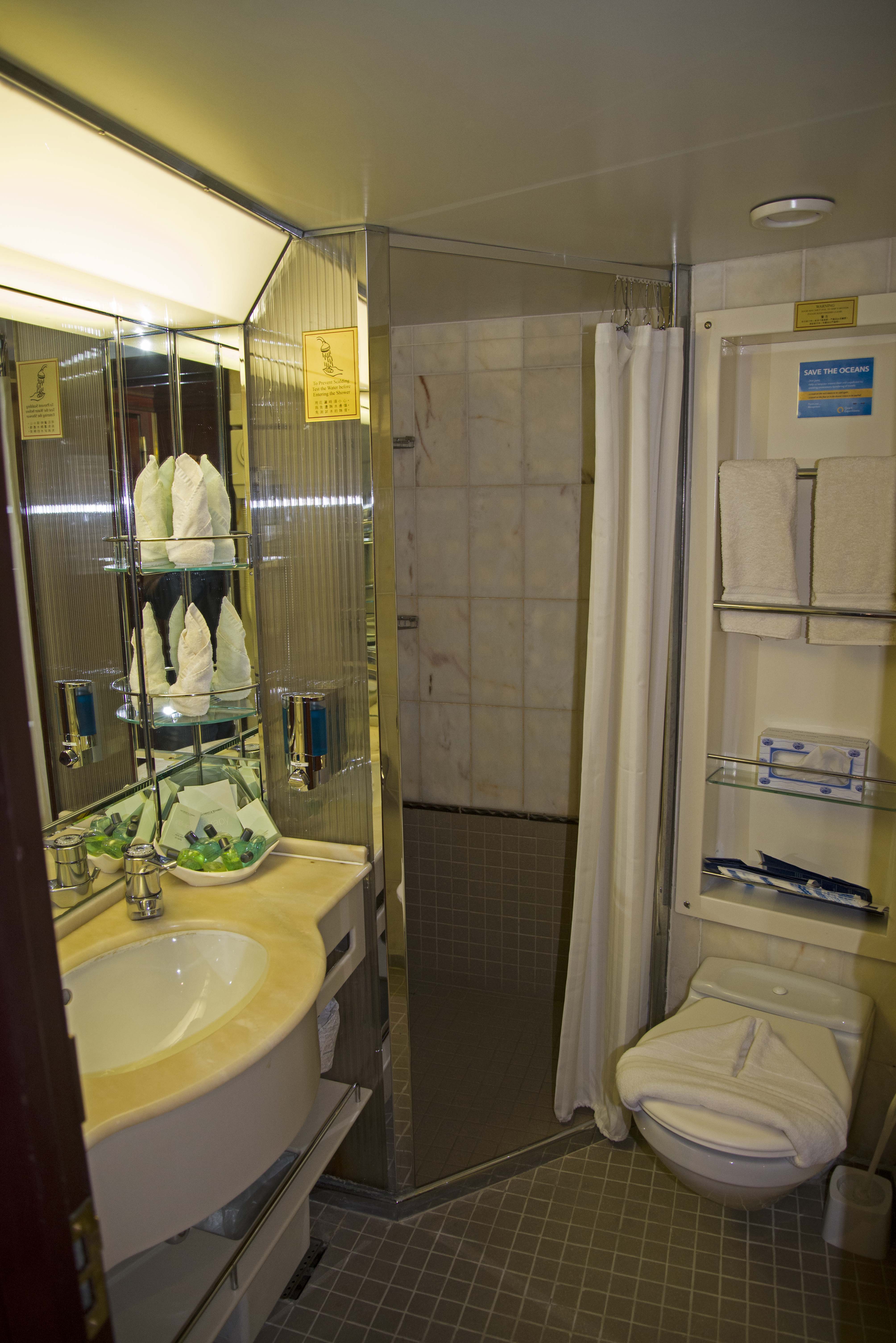
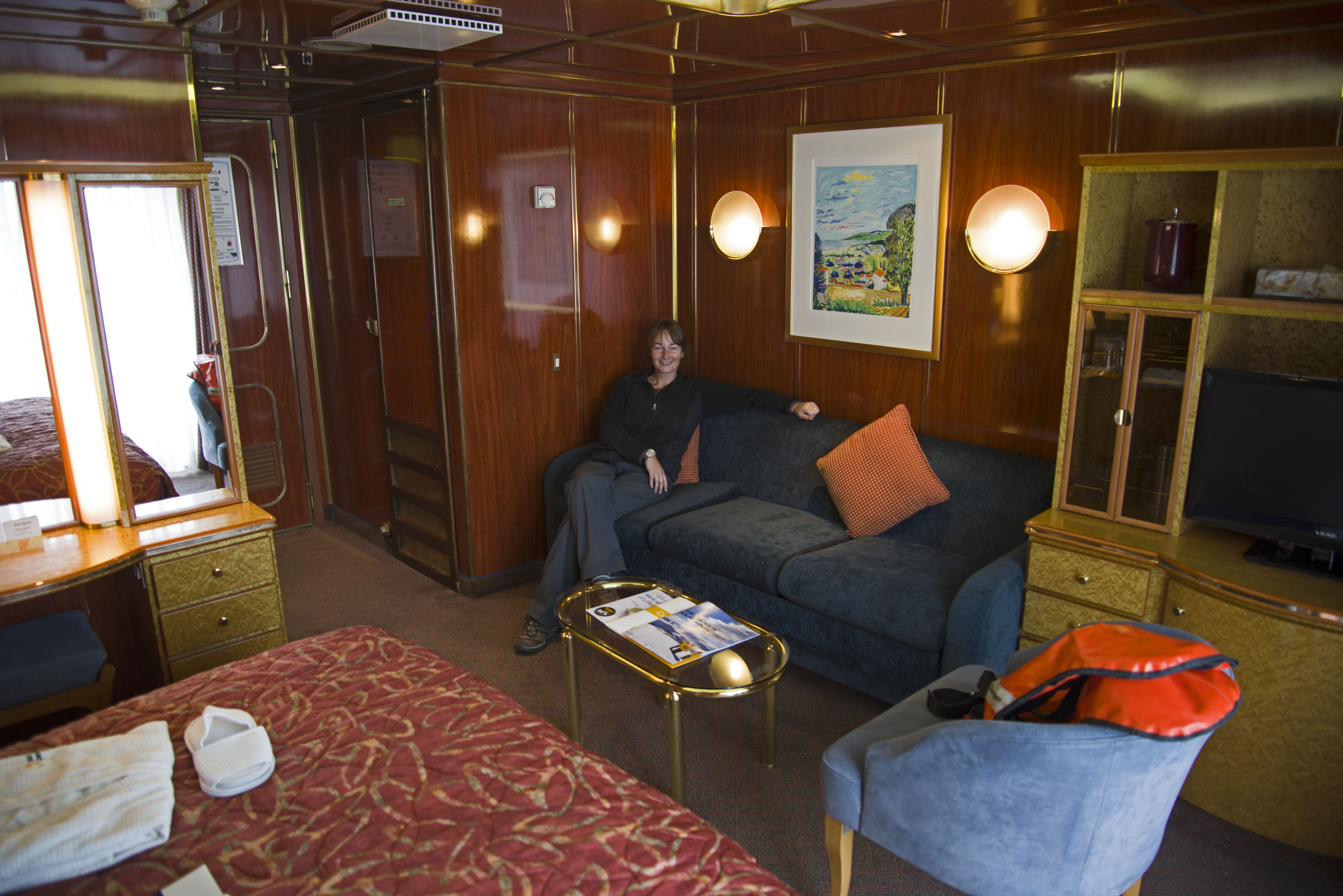
The big day finally arrived but it wasn’t time to board the boat until 4 pm. We had to meet in a car park outside the dock for a very short coach ride to the actual ship. Once on-board we were shown to our cabin by very welcoming staff and had our luggage delivered straight to our cabin.
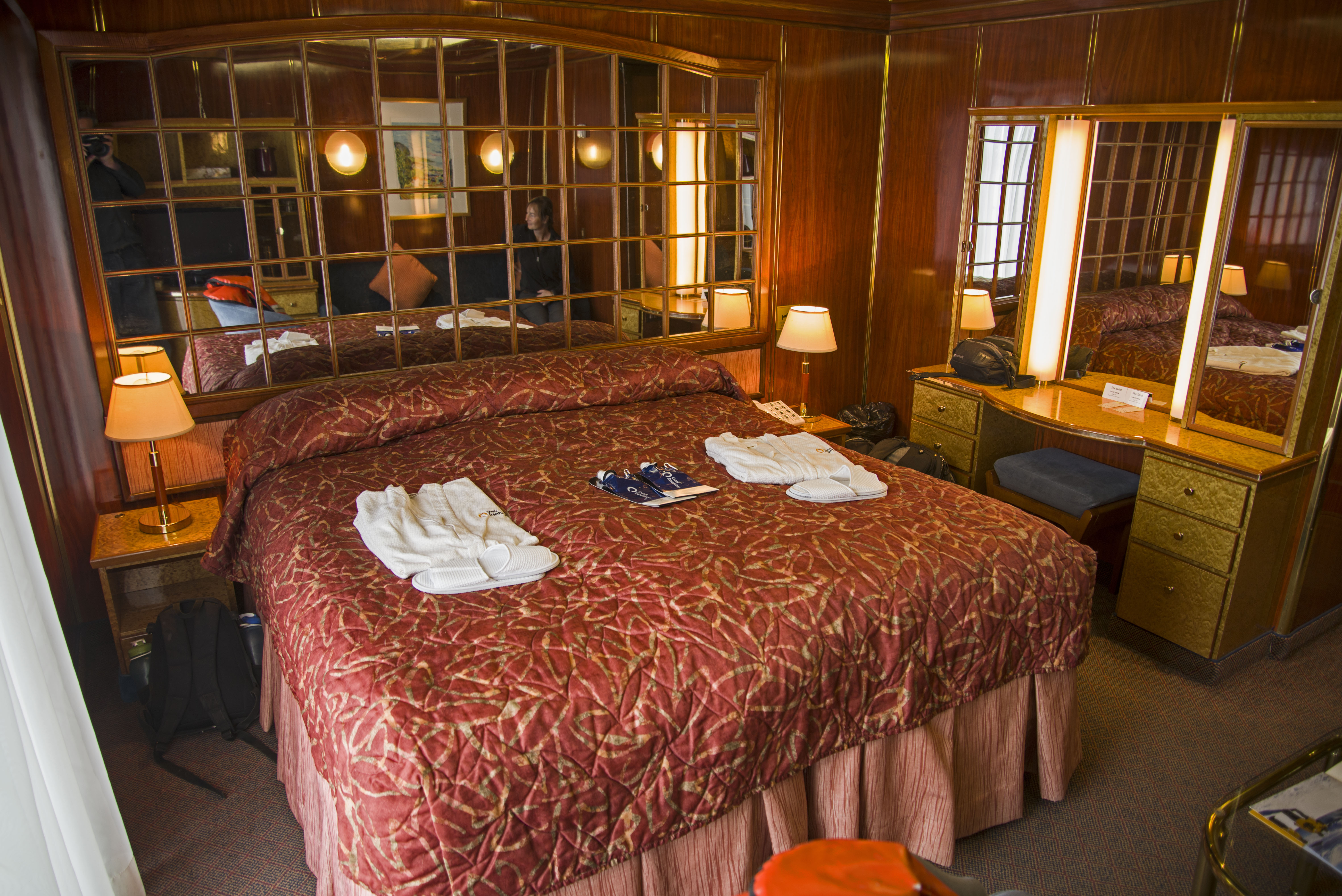
We had been upgraded to deck 5 which meant we had a balcony on our cabin which was very exciting. The room itself was pretty big with an en suite bathroom, walk-in wardrobe and even room for a sofa. However all the cabins on all 4 accommodation decks were large with en suites and really just the window/balcony varies between floors.
The sea spirit is smallish with only capacity for 114 in passengers and this is important because only 100 people are allowed to land at any given location in Antarctica (the kayaking program took 10 people so everyone landed every time).
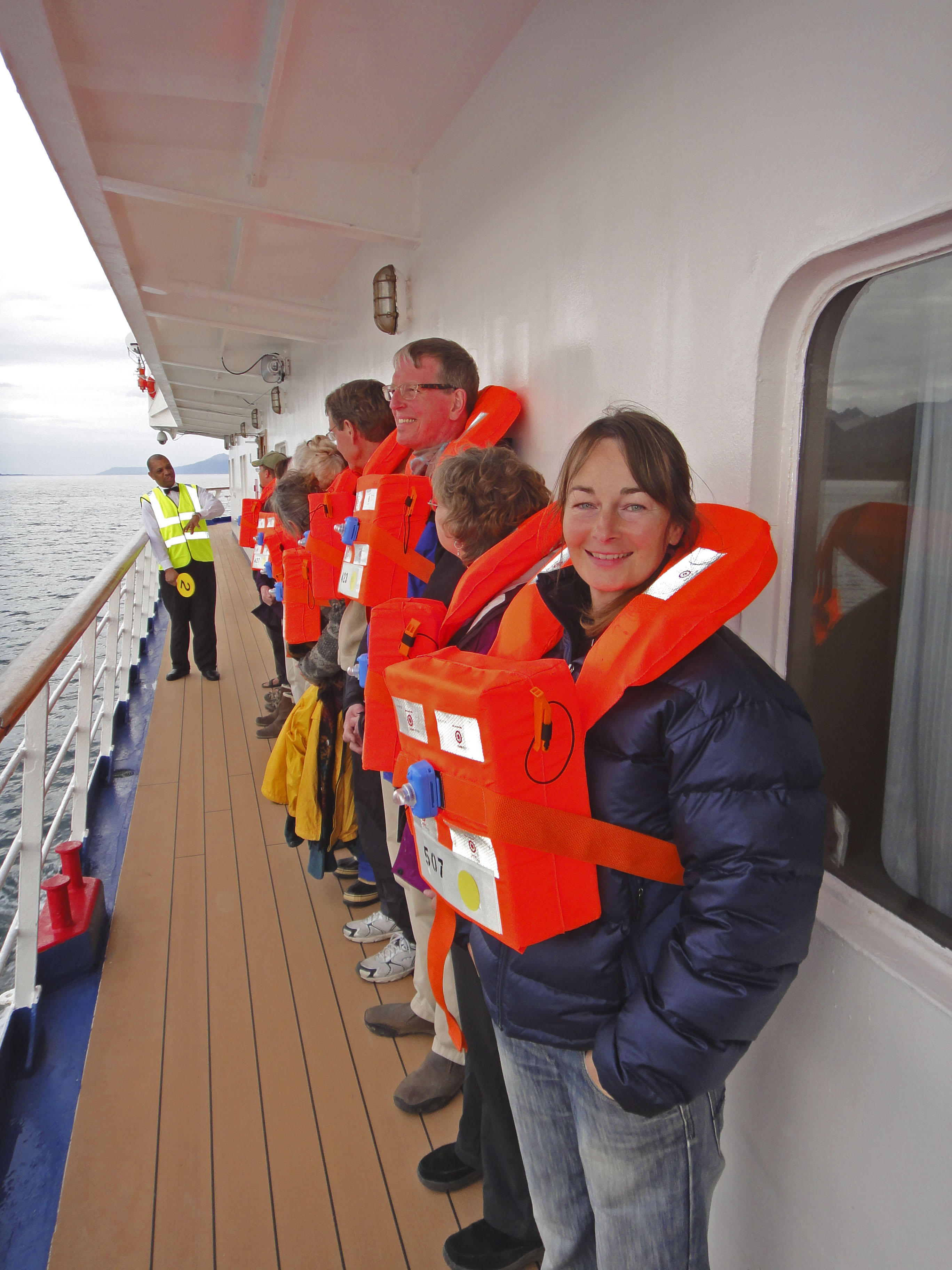
Shortly after getting on-board we had to attend a briefing meeting where we were introduced to the staff and given a full boat safety briefing. Via a mock striptease by two of the crew we were showing what clothes to wear and told that rubber boots and waterproof trousers were required. After this there was a lifeboat drill and then we were fed for the first time and seemingly endlessly from that point forward.
Dinner was great setting the trend for our whole time on the boat. A choice of soups followed by a choice of four different main course (and if you didn’t like these you could always order steak, chicken or salmon instead !). Then, of course, a choice of puddings with freshly made ice cream always available.
All this great food is coupled with a free bar and free wine at dinner.
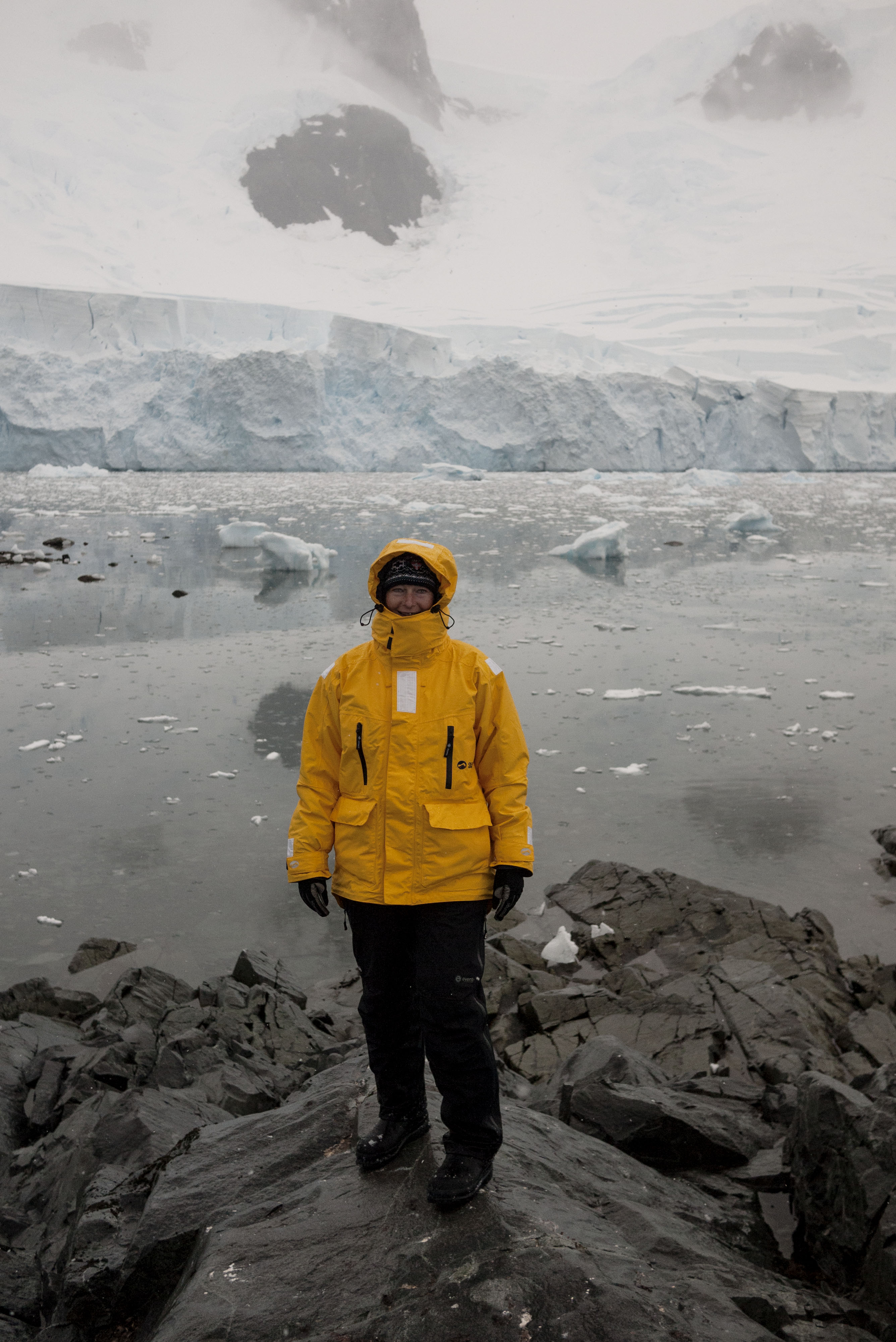
After dinner on the first night we were all given bright yellow parkas to wear during our shore expeditions (and to keep) and rubber boots for all landings were fitted out.
We left dock soon after everyone was on-board and proceeded up the Beagle Channel. It wasn’t long until we had exited the Beagle Channel and were into the Drake Passage. The Drake Passage (the piece of water between South America and Antarctica) has the reputation as the roughest piece of water in the world. It takes 2 days to cross the Drake to the South Shetland Islands. We were lucky in that we only had swell of around 3-4m for most of the crossing. The final morning it did build to over 4m and almost everybody retired to their cabins. I did make breakfast before succumbing, but there were only 4 other people there.
During our crossing of the Drake Passage there were lectures given by the expedition crew giving insight into glaciology, expedition history, marine mammals and sea birds, among others.
There are 12 expedition crew on board with a range of specialties including ornithologist, marine mammals, glaciology, photography and history. One of the crew even has a Nobel Peace Prize. They were a very impressive group of people.
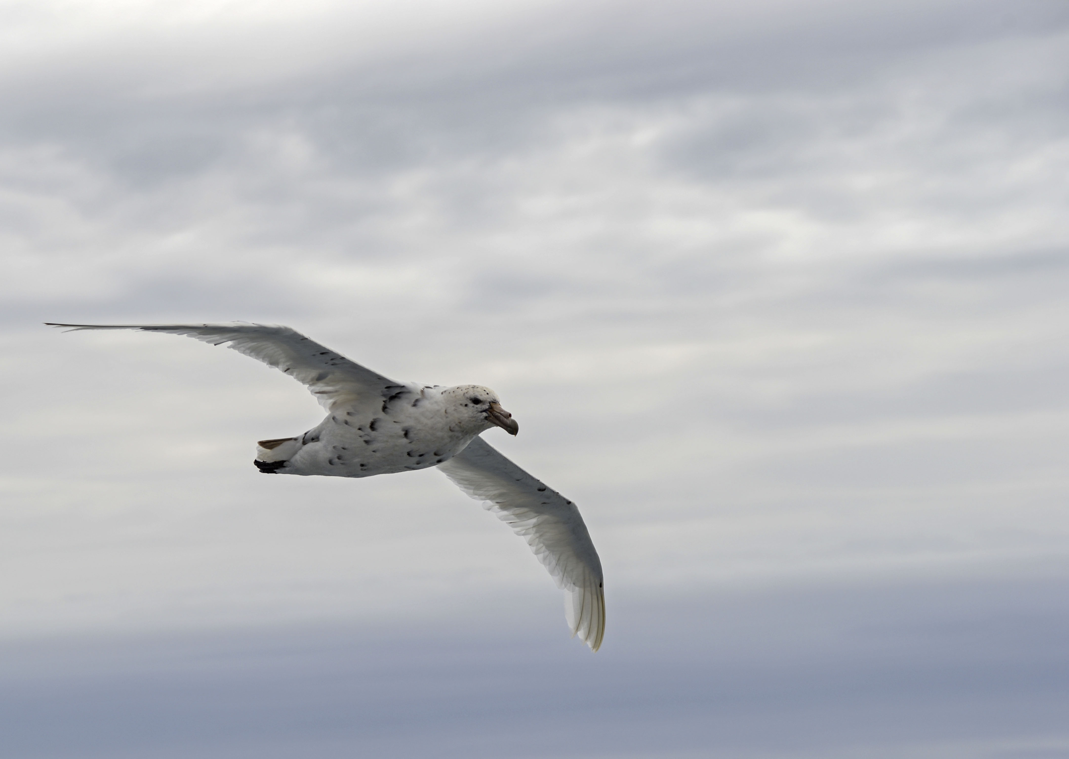
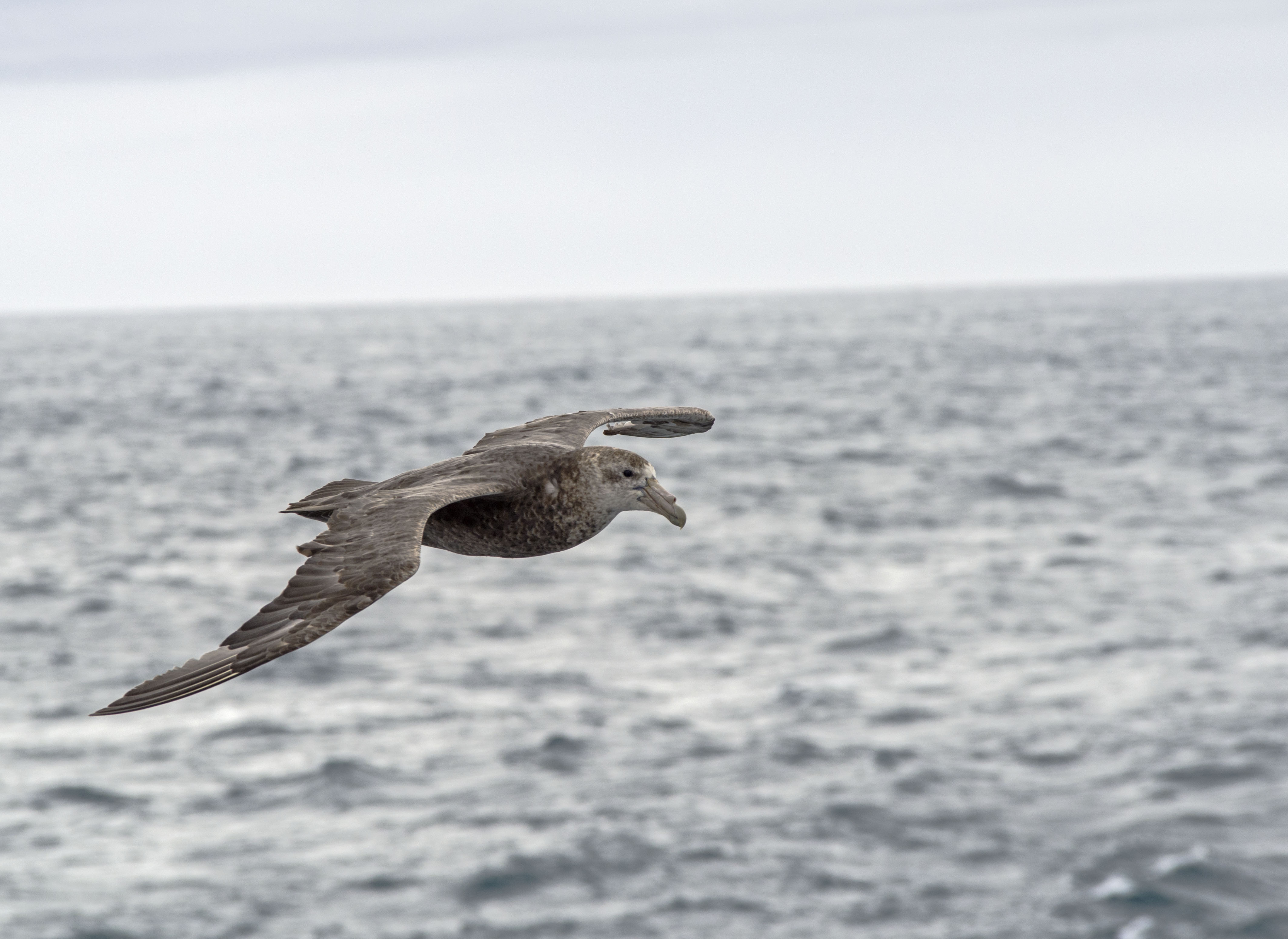
The crossing of the Drake is fairly boring but there are a large number of sea birds that end up following the boat so standing on deck to see the birds can offer some entertainment – if of course sea sickness allows !
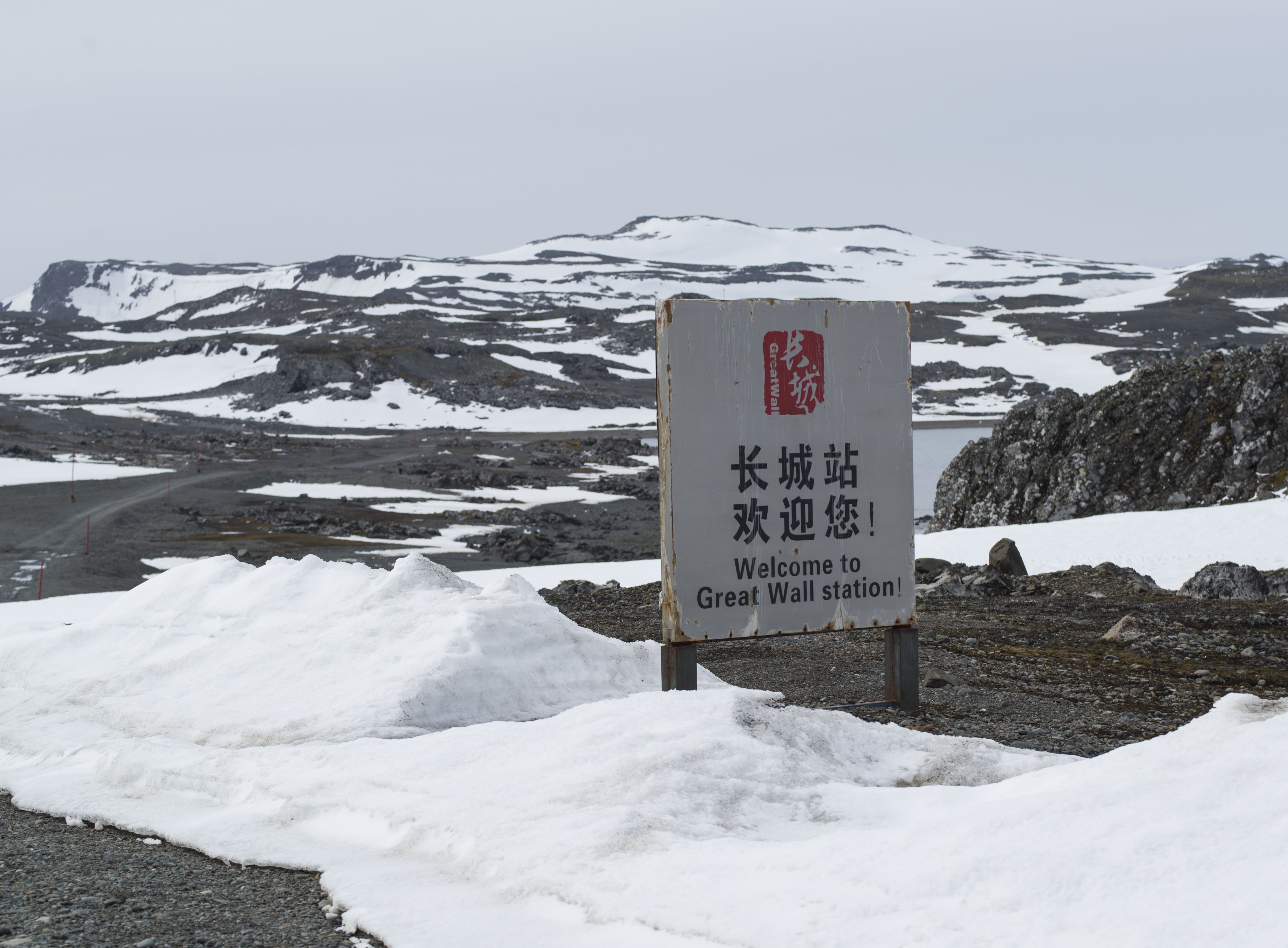
Despite the swell the Sea Spirit made excellent time through the Drake Passage and we arrived at the South Shetland Isles in the late afternoon of our second day at sea. As we had a 25 strong Chinese contingent on board we received permission to land at Maxwell Bay, King George Island, which is the site of a Chinese Antarctic base, called The Great Wall.
This was really lucky as a landing on the 2nd sea day is something that never happens. We had a choice of either hiking to an elephant seal wallow or visiting the base so we decided to go for the hike after being cooped up for 2 days in the boat.
We landed at the base by Zodiac (our method of transport all week) and immediately set off with a Chinese guide on a hike across the Island. We were very excited when only a few minutes into our hike we saw some penguins on the beach.
After only a couple of minutes with the penguins we carried on with the hike moving through deep snow and mud across the island with the Chinese guide setting a hell of a pace.
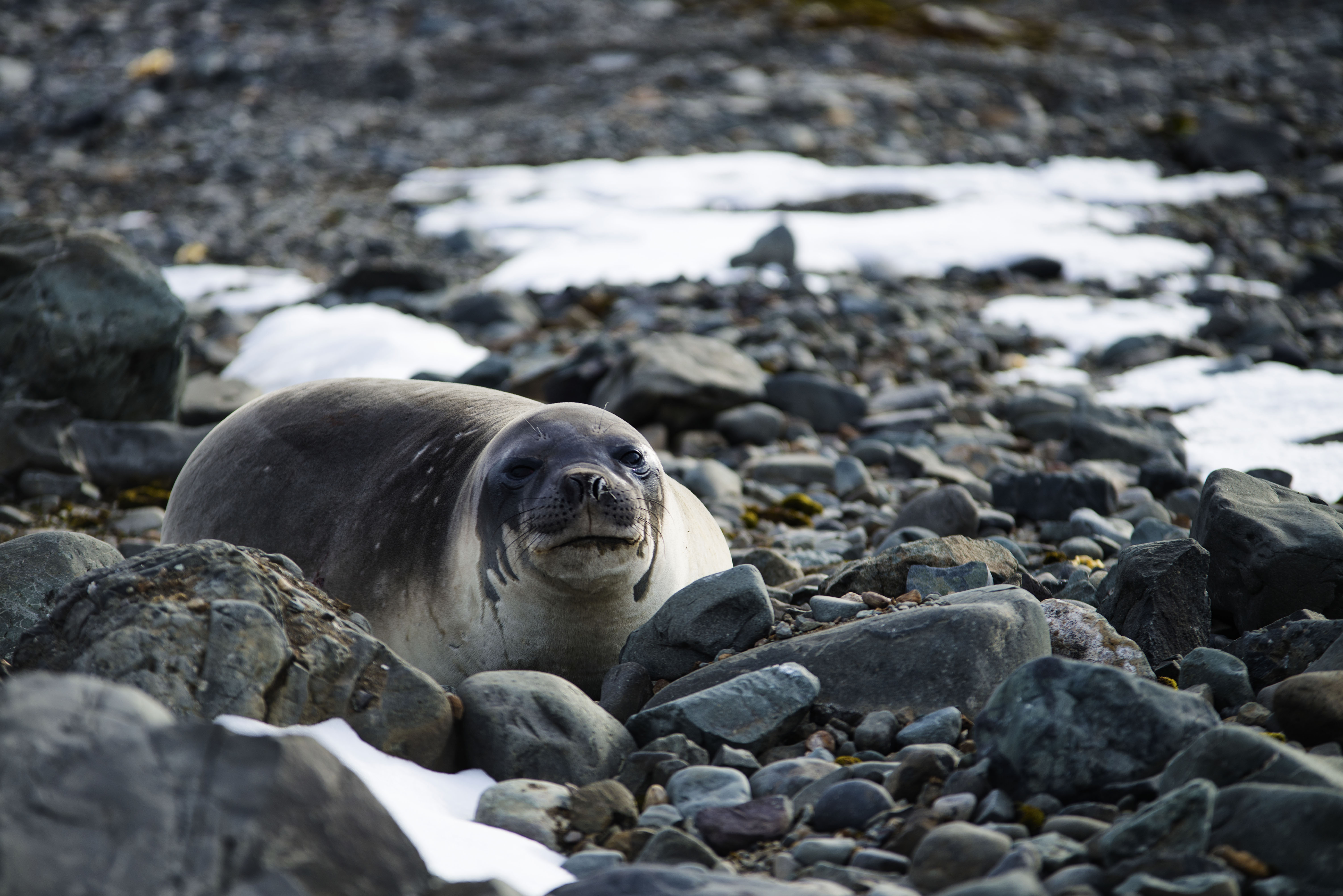
Once across the island we had some spectacular views and could view some molting elephant seals from cliff tops above the beach. The expedition crew did not let us climb down cliffs to the beach itself as they felt it was unsafe but we had a good view from above.
On returning to the landing we discovered a couple of elephant seals right on the beach where we had landed !
Sprint to the End of the World
Ever since the start of the trip we’ve been undecided about whether to go to Antarctica or not. The heart said yes but the head said it was a lot of money. Well when we were in El Calafate a fellow overlander, Mike the Biker, who had just got back from Antarctica, told us how brilliant it was and then capped it by saying
“You’ll remember the trip for the rest of your lives but you’ll forget about the cost”
This tipped us over the edge and we made a last minute booking on a ship departing to the Antarctic Peninsula from Ushuaia, Argentina in just under a week. We were still around 900km from Ushuaia and we’d have to cross over into Chile and back again before getting down there. In short we had to get a wriggle on.
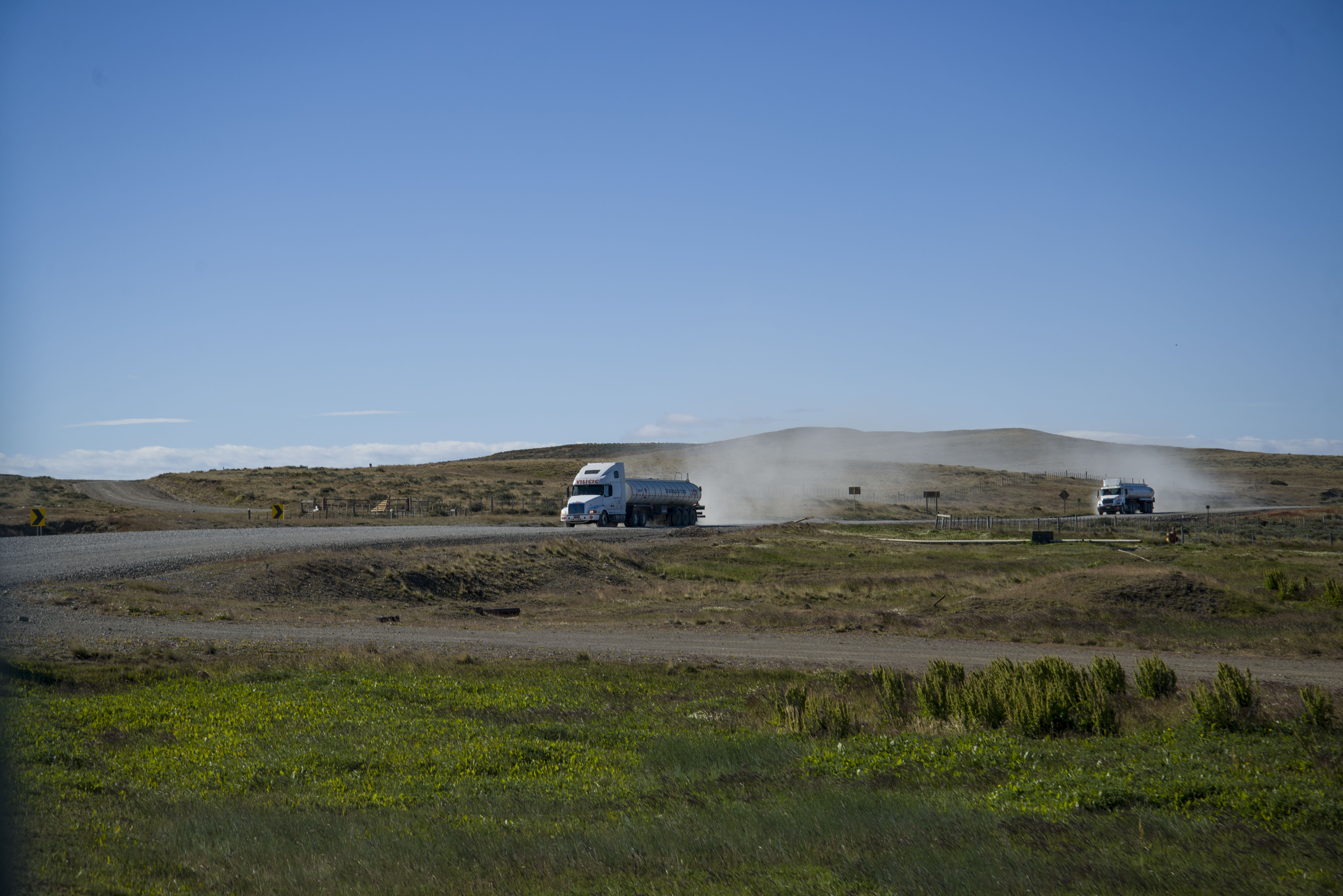
The first leg of our journey took us across Argentina to Rio Gallegos. This area of Patagonia is swept by incredibly strong winds and we sheltered for the night at a parking area with a number of shrines. Fortunately one of the shrines was big enough for us to hide behind.
The next day we carried on South crossed into Chile (via an incompetent border where both the Argentinian and Chilean migration forgot to stamp our passports. Fortunately we realised before leaving).
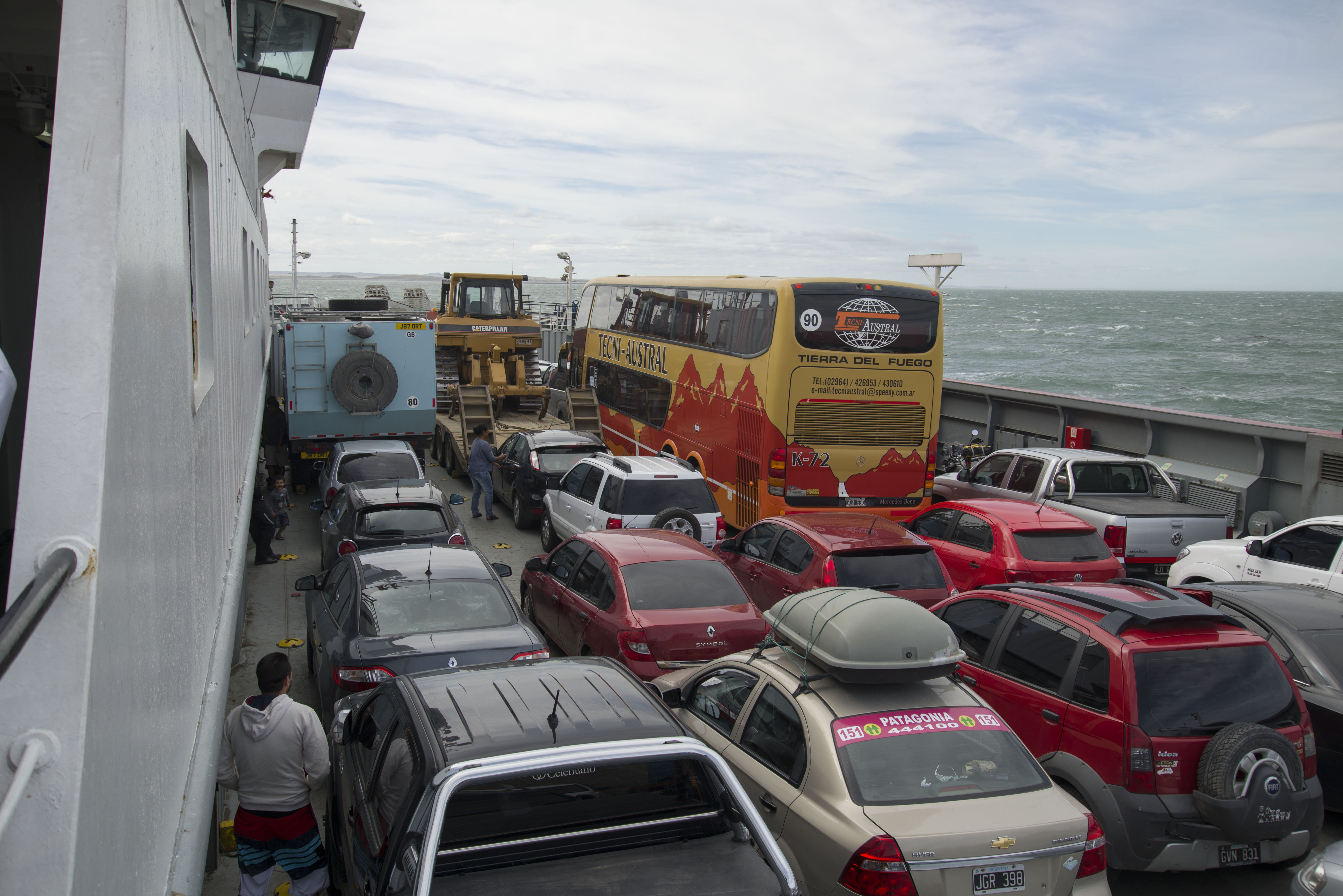
Then came a ferry crossing to Tierra Del Fuego. The short ferry in the North of Tierra Del Fuego is much cheaper than Punta Arenas – Porvenir ferry. It was cheaper than it should have been because we accidently paid the car fee instead of the camper fee (saving over half) and were let off with a warning to pay the full fee when we come back. The wind was so strong at the ferry crossing that the ferry arrived at the North side and then got pushed well East of the ramp needing to spend 20 minutes battling back against the wind.
We drove from the ferry to the small town of Cerro Sombrero where we spent the night on the town’s main square protected from the wind by the Museum of film. Leaving Cerro Sombrero we made a tactical mistake and drove the shortest route to the Argentinian border. This road was pretty rough and there were lots of trucks – the slightly longer route heading south from Cerro Sombrero is the much better road.
Another border and we were into Argentina again. This little sojourn in Chile had of course cost us most of our food so we were heading straight to Rio Grande to hit up a supermarket and restock. Rio Grande had the feel of a border town and wasn’t somewhere to hang out so we carried on South and stopped at the lakeside town of Tolhuin.
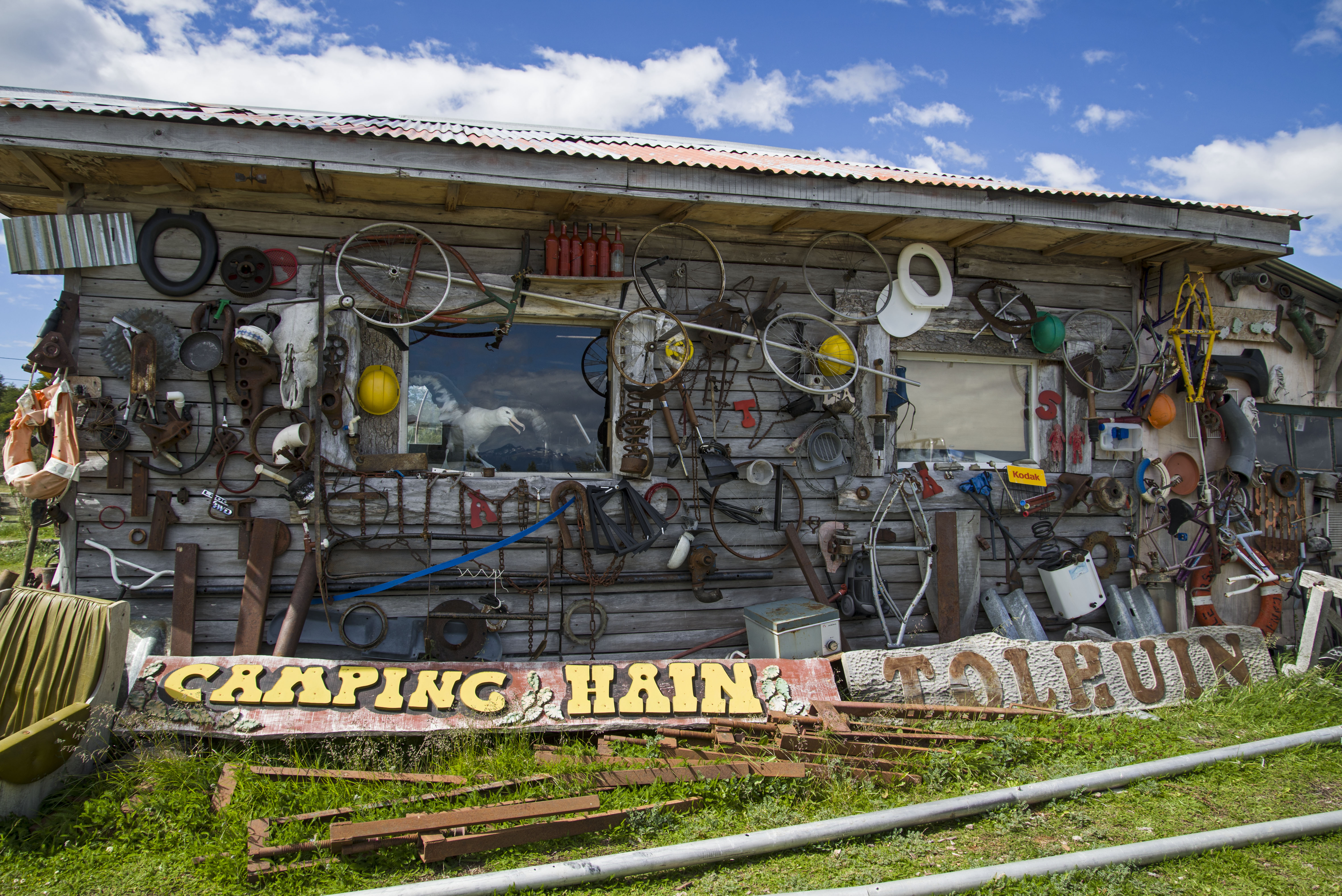
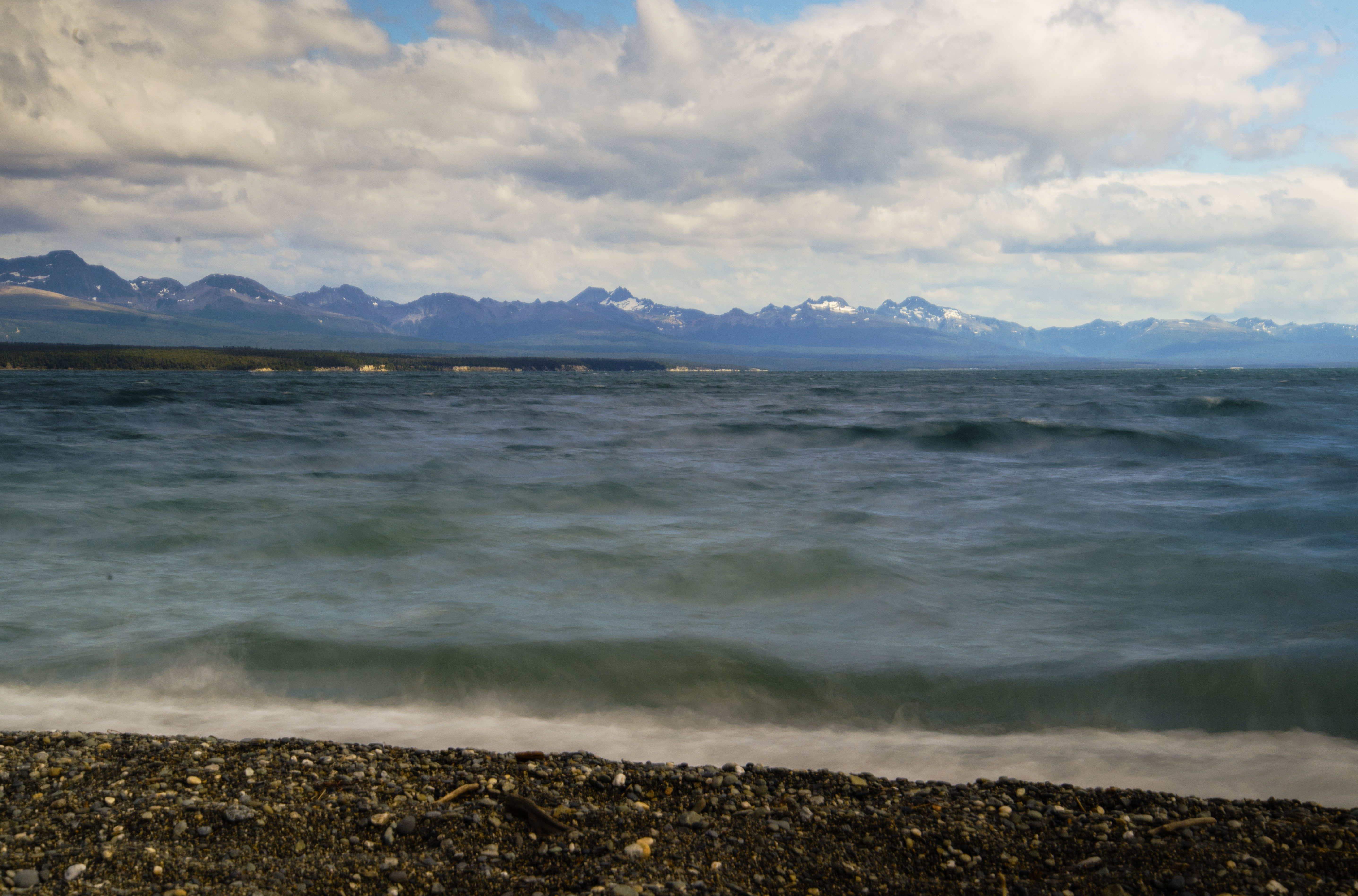
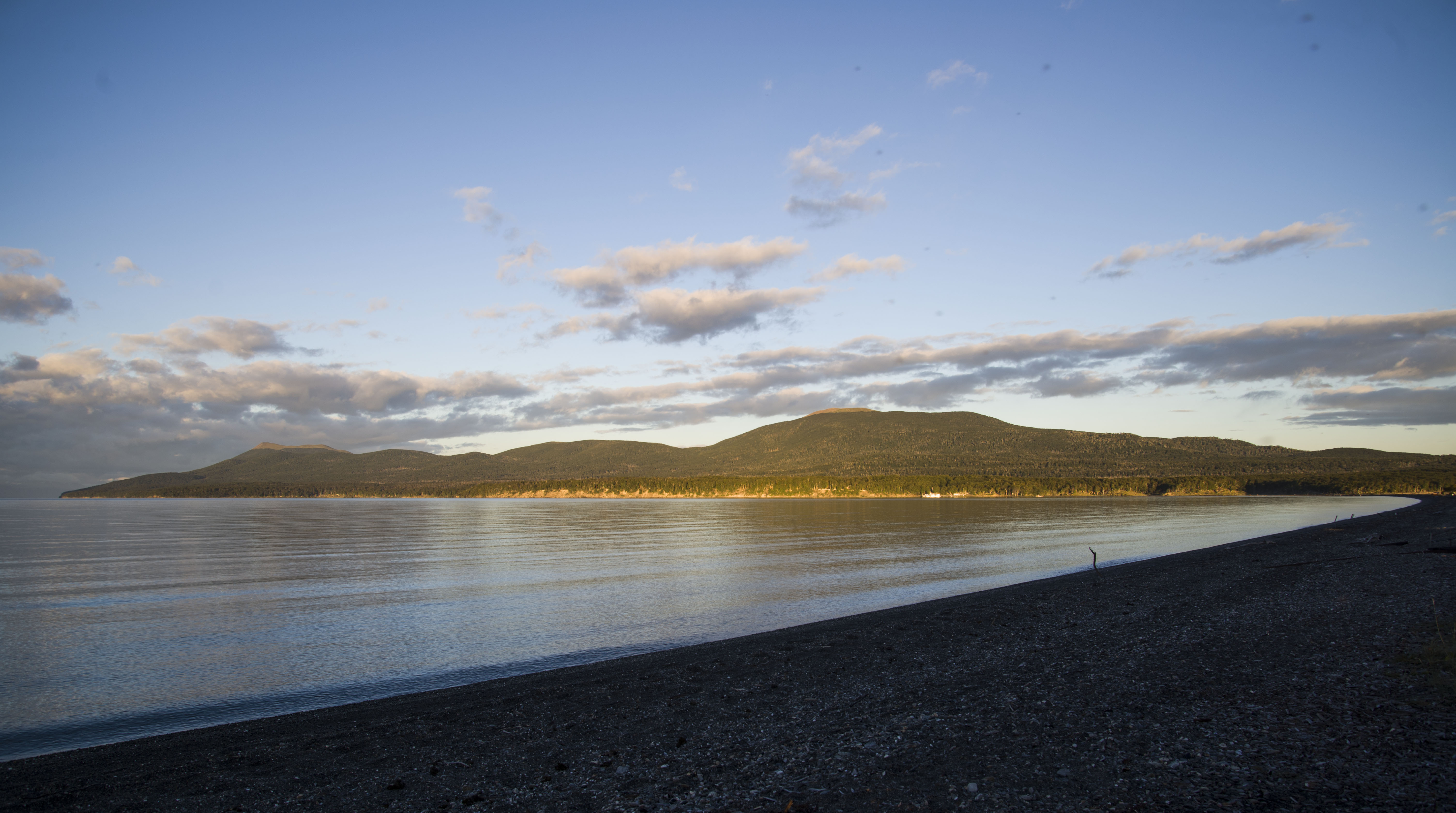
At Tolhuin we decided to stop for two nights at the characterful Camping Hain on Lago Fagnano. On first glance it seems like a junkyard but on closer observation driftwood and other discarded objets have been crafted into windbreaks against the almost constant wind from the lake. The lake itself has many moods and the colour changes constantly.
From Tolhuin we’re only 100km from Ushuaia which we drive quickly to arrive at the city that styles itself “The End Of The World”.