GPS Mapping in Latin America
We have met people who have been overlanding without GPS and everytime without fail we have a conversation with each other after the event where we call them crazy.
There are also people that we have met that just haven’t got the message that Garmin GPS is the only way to go. Tom Tom’s are great – but they just don’t have maps outside their Western markets.
Garmin and Tom Tom sell some commercial maps for overland zone countries – Forget them because they are bloody awful. We bought a backup Garmin in Peru which came with a commercial Peru map which inisisted on routing us through Lima wherever we wanted to go – even if it meant a 2000km journey to go 20km.
All is not lost however because there are a whole bunch of open source maps that do a much better job than their commercial cousins and the best thing is that they are all free – Yay !
Garmin GPS

We favour the Nuvi range of In car GPS. For overlanding purposes there is not much difference in the feature set between them so it is best to chose the cheapest available with a screen size that is comfortable for you and that includes the maps for any Western countries that you will be travelling in or live in. We also have a GPS from the GPSMap 62 series which we use for hiking and as a backup. However I don’t believe that this has a big enough screen for use for auto naviagation – it also does not have verbal turn by turn navigation.
There are 2 ways of getting maps into your GPS. The first is to find a .img file which can be directly placed on your GPS in the Garmin file. In order to do this the file must be named gmapsupp.img. This is a requirement of most Garmin GPS’ although some of the newer ones have relaxed this and also allow multiple maps The second is use Garmin software to load maps into the GPS.
Software
In order to manage your GPS through your computer there are two pieces of software that you can use.
Basecamp is a free piece of software that has all the functionality that you need – most importantly the ability to hold multiple maps and to download the bits you choose to your GPS. This is the most modern piece of software that Garmin have made. http://www.garmin.com/en-US/shop/downloads/basecamp is the download link.
Mapsource is the older commercial piece of software that is actually the one that we use. It comes free with additional maps purchased from Garmin. It can also be installed free of charge if you get a copy as long as you have installed Basecamp first.
The following link explains how to install mapsource for free: http://www.gpsfiledepot.com/tutorials/how-to-install-mapsource-if-it-didnt-come-with-your-gps/

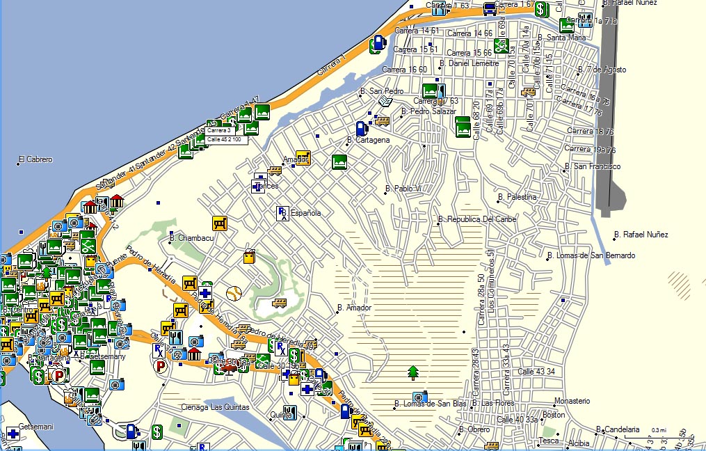
Both Mapsource and Basecamp can be used to download your daily tracks from your GPS. This can be stored in a file to build up a complete picture of your trip. Also many overlanders publish lists of their waypoints (particularly places to stay, supermarkets, good mechanics, fuel etc) which can also be imported into the Garmin products for easy browsing. In the picture above the grey line is one of our tracks.
Mapset Toolkit is a piece of freeware which is essential if you are managing a large number of maps from different sources. It allows you to sort out any incompatibilities between the maps and to rename any maps that have a less than obvious name.
Gimgunlock is another freeware piece of software that allows locked maps to be unlocked and therefore installed on your GPS.
Maps
Worldwide
Open Street Map
There is only one word for this and that is awesome. This is a completely free and opensource map of the entire world. It is of a very high quality and getting better every month as it is constantly updated. It is also possible to create a garmin map with topo information – although the file size can become pretty big so only try this when you have a really good download speed.
The challenge with open Street Map is getting it downloaded in the right format for installing it on your gps and pc. Fortunately there are some places that can help.
http://garmin.openstreetmap.nl/ is a very useful link that provides a webpage which will create executable files allowing installation of sections of the world from open street map into Mapsource. It will also produce .img files for direct installation in your GPS.
http://wiki.openstreetmap.org/wiki/OSM_Map_On_Garmin is a great link which gives you a rundown of all the software that can be used to to get open street maps onto a garmin device.
Smellybiker
Produced by a biker who has travelled the world extensively these maps are available for a small annual fee. They are split into three maps to cover the world. We found that these are ok but nowhere near the quality of the latest Open Street Map or indeed the country specific open source maps.
Central America
Mexico
Our US bought Garmin included the Garmin Mexico map that we found worked acceptably in Mexico.
Cenrut
This is an opensource map that we found to be just awesome. It coped with nearly everywhere we went. We kept this map on our GPS for the whole of the time we were in Central America and didn’t feel any need to try any other map. This map does not include Mexico.
To download the latest version – http://www.cenrut.org The latest version is 2.8 although we used 2.7.

South America
Colombia
Col Rut
Another opensource project which has produced a very good map of Colombia. This didn’t let us down at all.
To download this map go to http://www.colrut.com/ – the latest verion is 13.01.21 but we used 10.11.03.

Pamacol
This is a commercial map of Colombia of very high quality. The current version is 15.4 but it is updated frequently. Versions of this map may be found for free download on the internet however you are unlikely to get the most up to date version.
Ecuador
There is no Ecuador specific open source map available. We used Open Street Map while in Ecuador and this performed well for us.
Peru
We had first hand experience of the Garmin peru map – licensed from G-Map and its horrible. Fortunately there is a great open source alternative called Perut.
Perut is probably not quite up to the standard of the open source maps in Colombia and Central America however the performance was very acceptable and we seldom had problems.
The website for this map is www.Perut.org and the download link is on the homepage. We used Version 3.92.

Bolivia
Bolivia is more complicated as there are a number of alternatives. Open Street Map is a viable option and we used this for much of the country. However there is also a commercial alternative called Bolrut. This is very difficult to buy and does not seem to be available online.
However judicious searching on www.noeman.org may lead you to the download of a file of a previous version (ver.3.5) that can be downloaded directly to your GPS. This map is by no means perfect and I recommend using it in conjunction with Open Street Map.
I have discussed the maps useable for the Southwest circuit on my post of this area – https://fromatob.org/2012/11/09/an-overlanders-guide-to-bolivias-southwest-circuit/
Argentina & Chile
The maps that cover Argentina also cover off Chile and there is a bit of choice in this area. Of course Open Street Map is a good alternative as with the rest of South America. I have illustrated the different maps with a screenshot of Ushuaia, Argentina.
Conosur – There are available from www.gps.com.ar. This map is similar to Open Street Map in its level of coverage. Version 12.7 is the latest. This is a good map but we believe mapear is slightly better.

Mapear – So far we have found this to be the best map for Argentina and Chile. It contains much more detail on dirt roads and tracks than any of the other maps. V9.90 is the latest and the one that we have been using.

Viajeros Mapas – This is a non-routeable map that provides very good detail on dirt roads and tracks. It also has way more waypoints than the other maps – hotels and shops etc.

Open Street Map

Others
Brasil : Tracksource Brasil – Download from http://www.tracksource.org.br/
Venezuela : Venrut – latest version is 12.1 and easiest place to download is Noeman.org (registration is required).

Thanks for the excellent GPS information.
I’m glad you enjoyed our maps! Please note that Venrut is provided free at gpsyv.net and bolirut.com will be up soon!
David
Venrut, Colrut, Perut, Cenrut
dakrause(at)hotmail(dot)com
By the way, our english pages may be helpful:
Cenrut:
http://www.cenrut.org/adw/over.htm
Perut:
http://www.perut.org/english.htm
Some additions to you really nice blog entry:
QLandkarteGT: Good and free tool to manage and compile maps for Garmin devices like MapSource plus good planning (search for POI using OSM or Google) and routing abilities (online only, two OSM routers available)
gmaptool.eu : tweak garmin map data
http://wiki.openstreetmap.org/wiki/OSM_Map_On_Garmin/Download gives a list of precompiled maps for Garmin
Please contribute to OSM yourself to help it getting even better. Start with uploading you GPS-Data to OSM. Log very verbose – for logging in car I’d use an interval of 20 m or 2 seconds.
The Panam in OSM is still incomplete having at least one gap near La Palma. Routing from Alaska to Cape Horn is atm not possible: http://osrm.at/3dY
BTW: Although I contribute a lot to OSM and us the data with a Garmin device I’d call people crazy who only use GPS devices for big trips and no paper maps. A GPS can drop and fail or simply run out of energy. When a paper map drops you just pick it up. 😉
Additionally you have a much better overview using a map instead the 2-7 inch GPS display.