Cape Town
We were nearing the end of our trip to South Africa and had yet to visit Cape Town and the surrounding area, but first we wanted to visit Betty’s Bay, home to an African penguin colony.
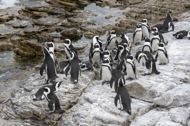
The African Penguin (previously known as the Jackass Penguin because of the braying donkey noise it makes) is the most northerly occurring penguin species and is the only penguin species that lives on the African Continent.
The African Penguin’s range is from Namibia in the North to Port Elizabeth in the East but there are very few mainland colonies, of which Betty’s Bay is one.
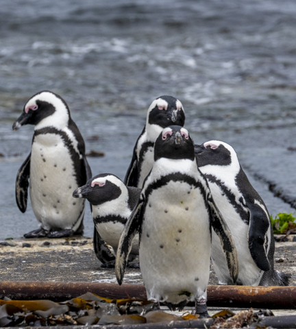
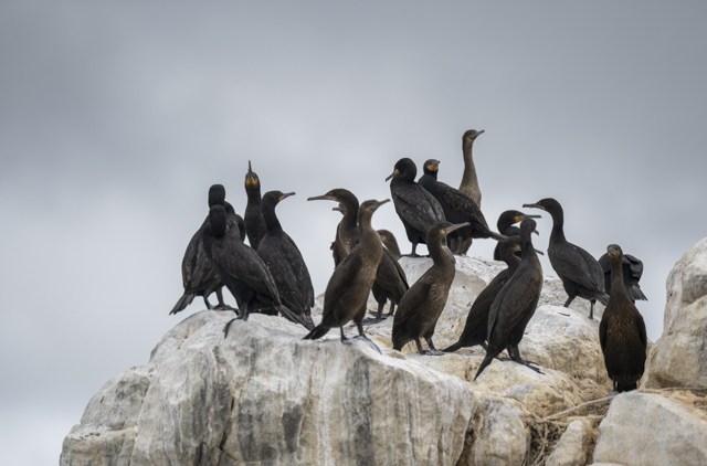
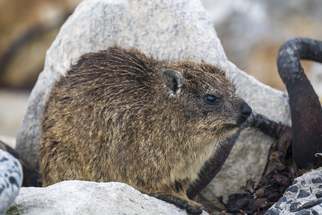
From the car park the penguins are only a few steps away and their numbers stretch along the rocky shoreline. There are also thousands of cormorants nesting amongst the rocks as well as quite a few Dassie (which look a bit like marmots but are apparently unrelated).
A boardwalk runs partway along the beach and there is a fee to access it, however the majority of the penguins were on the beach before we even reached the paying boardwalk and regardless, we had free access with our SANParks Wild Card. The wild card provides unlimited entrance to over 80 South African National Parks and Reserves for a year and has proven to be a great buy saving us quite a lot of money on this trip.
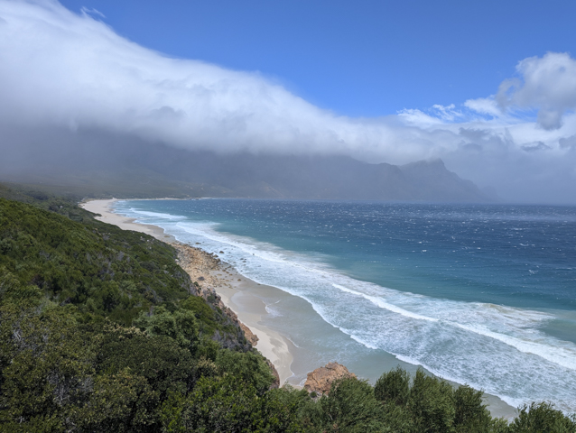
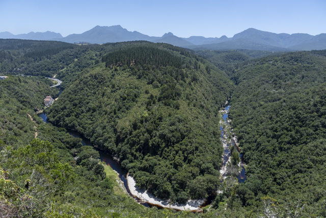
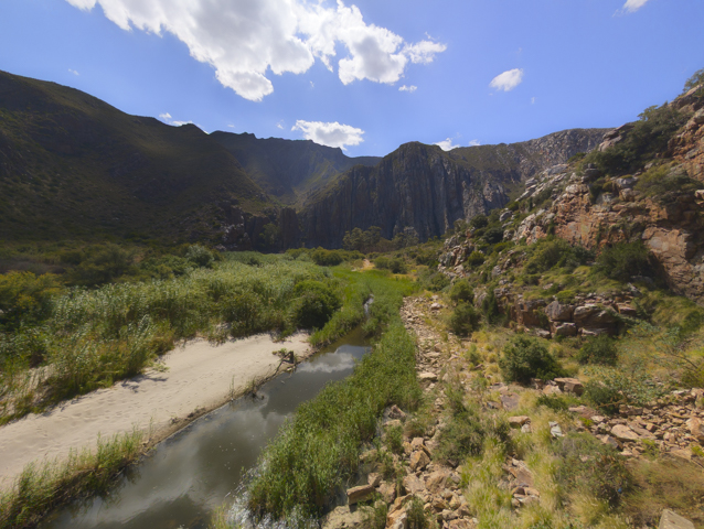
From Betty’s Bay we drove along the beautiful coastline towards Cape Town. The weather was raining on and off and it was incredibly windy but we had intermittent patches of blue sky and sunshine to enjoy the views.
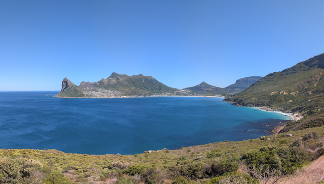
We were planning to spend a couple of nights in the town of Hout Bay which is just to the South of Cape Town itself. Hout Bay is a big protected bay and is primarily a commuter town for Cape Town. Despite it being protected however, the wind was so strong that the water was very choppy and full of whitecaps. When we woke the next morning we had to retrieve our patio furniture which had been blown right across the garden of our rental property.

We had planned to meet up with some friends in Cape Town (Adrian and Magda @admaadventures), fellow motor-homers who we met last year while travelling through Croatia, and were looking forward to catching up.
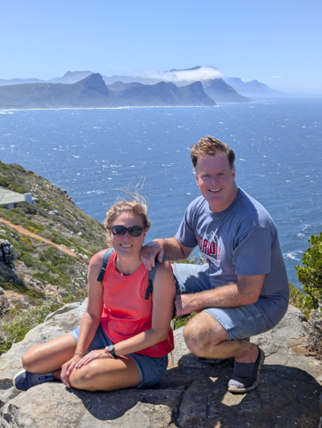
They drove over from Kommetjie, a lovely area to the south of Hout Bay, to pick us up and take us out for an epic day of sightseeing, starting with the very scenic Chapman’s Peak Drive along the Atlantic Coast. They even brought along various snacks for the drive which we learnt were called Padkos.
We had a great day with them as they showed us the sights of the Cape peninsula.
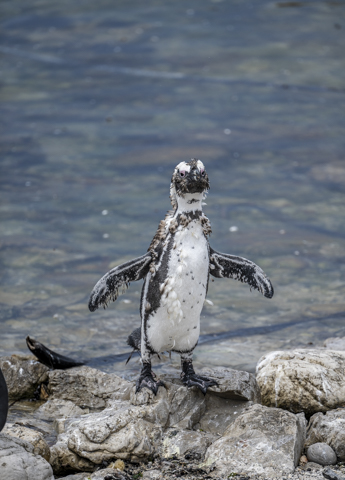
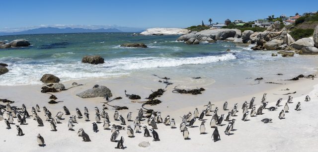
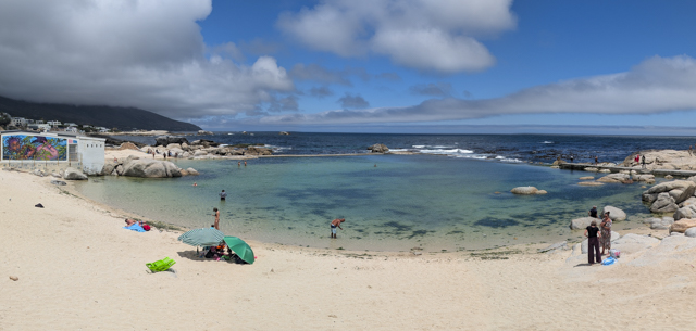
We visited a local fishing harbour and had a brief stop over at picturesque Simonstown to visit ‘Just Nuisance’ before heading to Boulder’s Beach to check out the famous penguin colony there. This is more touristy than the colony at Betty’s Bay but much more scenic because of the white sandy beach.
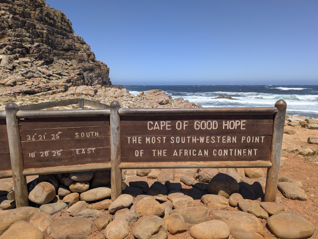
We then headed south to the Cape of Good Hope (the most south-western point of Africa) where we hiked as far south as it was possible to go. It was still incredibly windy and some of the viewpoints were actually a struggle to look over the parapet. You had to hang on really tight to your phone if you wanted a picture!
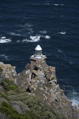
Cape point is expensive to visit for international visitors (£20 each) but we were pleased when our wild card was also accepted here. At the Southern tip you can hike to a lighthouse and some viewpoints (or there is a funicular if you don’t want to climb) plus a small museum and gift shop. There is also a path that leads out to another lighthouse on the cliffs at the waters edge but you can’t get all the way there.
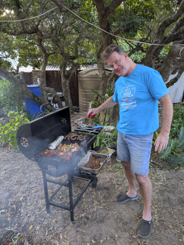
After visiting Cape Point Adrian and Magda took us to their beautiful local beach in Kommetjie before finishing up at Adrian’s parents house for a swim and real South African Braai.
We had an unforgettable day with Adrian and Magda and are really grateful that they took the time out to be so hospitable. Truly fantastic hosts and we look forward to seeing them again when we are all back in Europe!
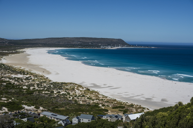
After parting ways with Adrian and Magda our next and final stop was to be Cape Town but on the way there Sarah’s Welshness couldn’t let her pass by Llandudno Beach without stopping (which to be fair was very pretty and well worth the visit) and after lazing on the beach for a while we stopped again a little further along the coast at Camp’s Bay where we had lunch in one of the many beachside restaurants.
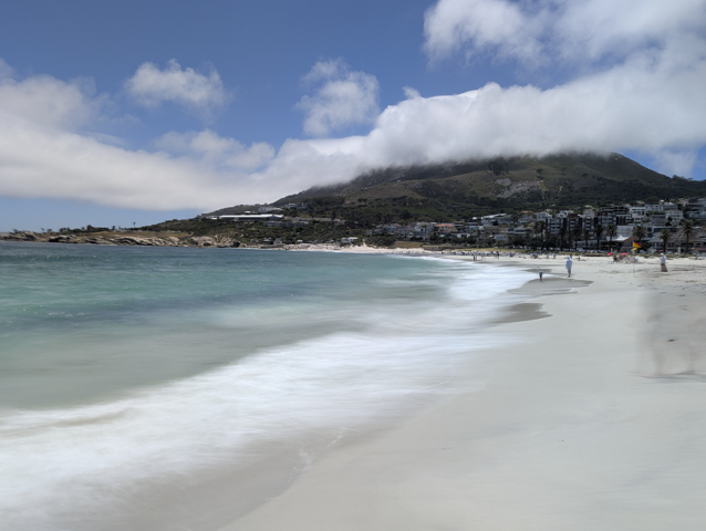
I’d been to Camps Bay before but in the winter when it was cold and pretty deserted. It is definitely more lively in the summer and the seawater pool looked very inviting.
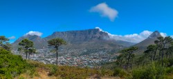
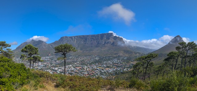
From here we headed into the centre of Cape Town where we had booked an apartment with views of Table Mountain but on the way into town we drove up Signal hill to take in the views of both the city and the surrounding mountains.
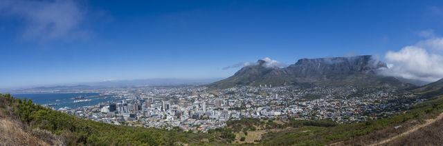
Fortunately we hit Cape Town on a relatively cloudless day and were able to see Table Mountain in all her glory.
Once in our apartment we cranked up the aircon and relaxed. We felt like we had been on the go every day for a while so an apartment with a kitchen, balcony and lounge area was very welcome.
We didn’t have long in Cape Town and coupled with the fact that we wanted to rest up before hitting Namibia where we would be really hectic we didn’t want to bite off more than we could chew.
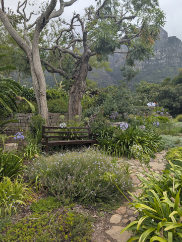
However the Kirstenbosch Botanical Gardens are considered to be the best botanical gardens in Africa and one of the best in the world and Sarah was really keen to go and check them out.
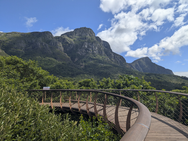
We had perfect weather for wandering around the gardens, which I have to admit were very nice, and a real oasis of peace and tranquillity that we didn’t expect to find so close to the city centre. There is even a cool elevated walkway through the trees with great views of the eastern slopes of Table Mountain.

Needless to say I had to prise Sarah away from here especially after she discovered the scones with jam and cream which were apparently, “very nice, but not as good as British scones”. I am sure Mary Berry will be delighted to hear that!
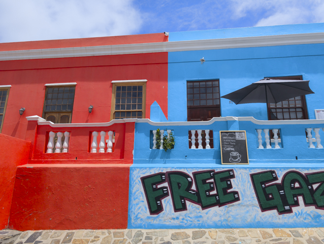
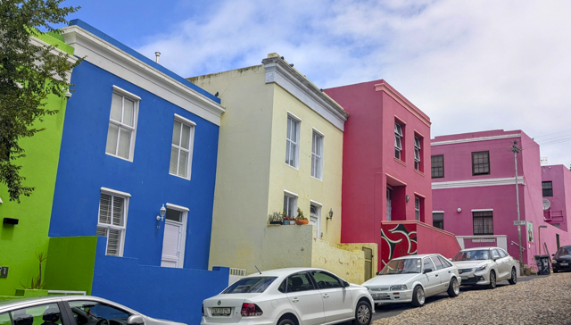
After the gardens we visited the colourful Bo-Kaap area of Cape Town. This is the oldest surviving neighbourhood in the city and was originally home to the Cape Malay people (slaves who were brought over from Malaysia).
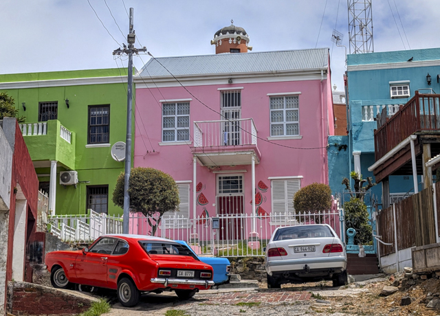
The houses are brightly coloured and the city actually pays the residents to keep them like this and to touch up the paint when it fades or peels.
We have had a fantastic time in South Africa and will definitely be back, in fact sooner than you think as we are due to visit Kruger National Park in a few weeks, but first we head to Namibia for more African adventures.
Meerkats, Wine and Beaches

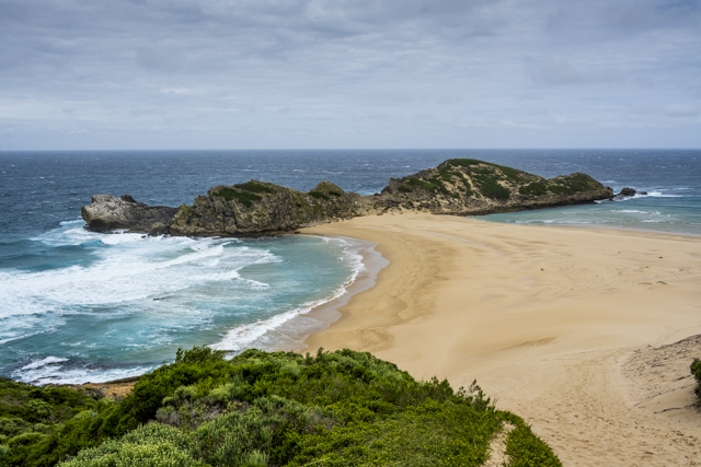
Before leaving Plettenberg Bay we visited Robberg Nature Reserve on the peninsula at the end of the Bay. This is where we had snorkelled with seals the previous day. There is a lovely hike here which takes you high on the cliffs above the colony and then back along the other coast where there is a “whale’s tail” island that you can climb. It was super windy and the top of the Tail was really precarious as the wind was strong and gusty but it’s an incredibly pretty place and definitely worth visiting.
Just 30km down the road from Plettenberg Bay is Knysna, another well known town on the Garden Route. There is a very nice viewpoint of the area called Knysna Heads that looks back across the lagoon towards the town. We also checked out Leisure Island – a small island which looks like a lovely place to have a house, and Knysna Waterfront with its pretty harbour and shopping.
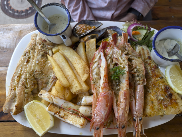
However Knysna was really just a stop over for us before heading inland to explore the Oudtshoorn area. We stayed at an inexpensive backpackers hostel and enjoyed a great meal out at Freshline Fisheries, a seafood restaurant attached to a fisheries warehouse at the edge of town. The tables were set out in a rustic tent on an artificial beach. It had a lovely atmosphere and the seafood was excellent, just note this is a BYO restaurant so don’t forget to take a nice bottle of wine with you to enjoy with your meal.
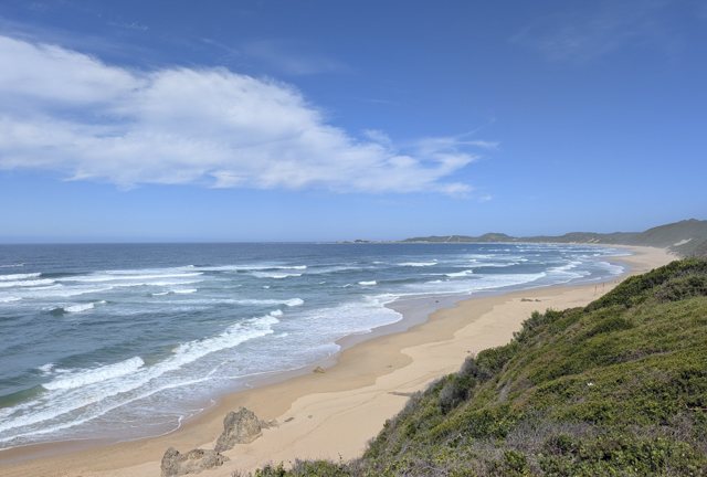
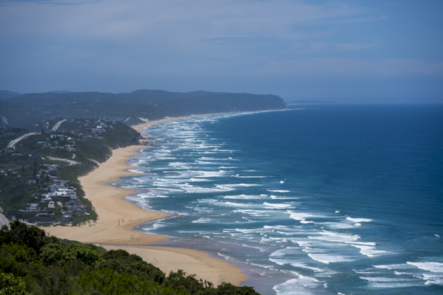
On our way through to Oudstshoorn, which is off the Garden route and inland, we decided to check out some of the beaches along the coast. These South African beaches are big, long, wild and mostly deserted. They would be perfect if it wasn’t for the sharks, strong currents and rip tides making you think twice before going in for a dip!
We visited Breton on Sea, Buffel’s Bay and Gerricke’s Point where Sarah had a rush of blood to the head and purchased a small plate from a beachside vendor – the selling point being that it can be used to grate garlic easily!
The last beach stop was probably the most beautiful at the small town of Wilderness. The beach here is as big and wild as any of them and seems to go on forever.
Above the town, down a gravel track is the launching point for paragliders as well as a viewpoint of a local attraction called The Map of Africa.
After retracing our steps down the gravel track we headed back out onto the main road to Oudtshoorn (a town whose name we really struggle to say – best we can figure is it’s pronounced Oats-warren?!). As we headed inland the temperature started to rise and by the time we arrived it was nudging 40c. Luckily for us our accommodation had a small but cool swimming pool to take the edge off.
The first thing we had arranged to do here was a trip to see Meerkats in the wild. This involved getting up very early as we had to be at the meeting point before sunrise. When we arrived, we picked up a camp chair at the meeting point and walked around 800m through the scrub to a burrow where a family of meerkats had slept the night before.
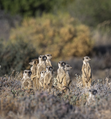
A meerkat family (called a mob) usually varies between 10 and 15 individuals in size and they move around between different burrows in their territory so that predators don’t learn where they are.
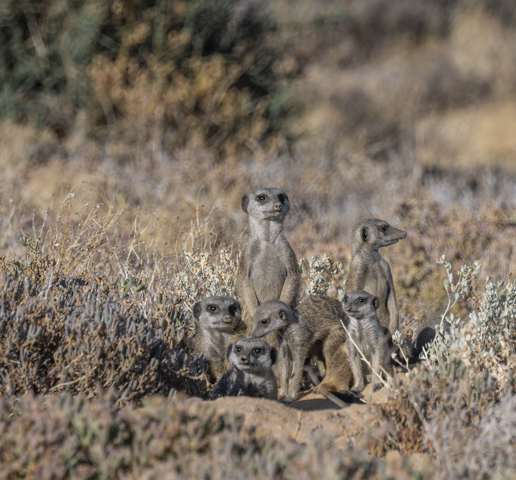
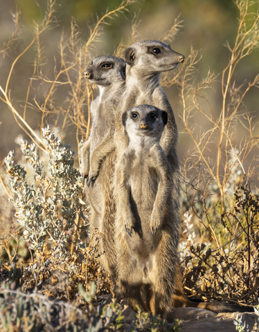
We set down our chairs in a rough semi-circle, at a good distance away so as not to disturb them (there were about 14 people in the group) and waited for the Meerkats to emerge. It didn’t take long before the first one appeared and sat back on his tail to survey the world.
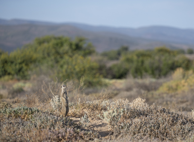
Meerkats like to warm up in the morning before starting their day and they stand up, resting on their hinged tails, with their bellies pointed to the sun to warm themselves for up to an hour before starting their day foraging for food.
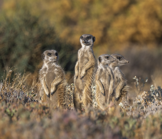
It wasn’t long until the whole family of 13 meerkats were up and about and sunning themselves.
We had a great view of their morning routine and we sat and watched them until they started to move off to forage. This group had set up home next to an Alfalfa field which hosts loads of the insects that they like to eat.
The very early start gave us plenty of time for other activities that day so after finishing with the Meerkats we drove to the Cango Wildlife Ranch, which is a cross between a zoo and a rescue centre for animals.
On arrival we had an hour long tour of the place with a knowledgeable guide who told us something about the animals including pygmy hippos (critically endangered), crocodiles and big cats.
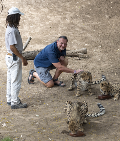
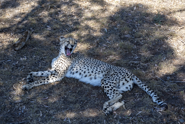
The main reason we decided to visit this place was because the ticket included an animal experience. I opted to meet the Cheetahs and Sarah opted for the Lemurs.
Sarah was up first and she was led into the Lemur enclosure where she got to sit with a couple of Lemurs for around 10 minutes while they were fed.
After that, I was led into the Cheetah pen and was allowed to stroke one of the cheetahs while it was occupied licking a popsicle made from blood! It was an amazing experience to be so close to such a beautiful predator and it is so sad that these lovely creatures are so endangered.
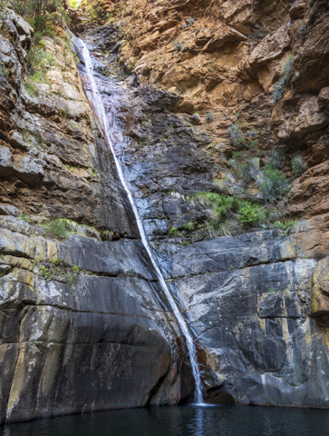
After finishing up at the Wildlife Ranch we headed off for a drive over Swarzberg Pass, a mountain pass on a gravel road. We were a bit dubious as to whether we had the right car for the job but as it turned out the road wasn’t too bad and the little Starlet did a great job. The scenery on this drive between Oudtshoorn and Prince Albert was stunning and if you are in the area we highly recommend it. You can do this as a loop drive and 5km from Prince Albert the road is paved all the way back to Oudtshoorn. There was also some much needed relief from the baking heat on the loop back with a cooling swim at Meiringspoort Waterfall, which was a quick climb up from the road and set in a beautiful canyon that felt like a real oasis.
After a long hot day we were happy to get back to our accommodation and sit in our pool with a nice cold beer.
The next morning we were up fairly early again as we had a long distance to cover. First up however was a visit to Safari Ostrich Farm just outside Outdshoorn. The town itself was actually built on ostrich wealth and there are several large old houses in town, known as ostrich palaces, that were built on wealth from ostrich farming when ostrich feathers and skins were highly prized in high society.
The tour itself started off on a tractor pulled trailer taking us through the pens of ostrich while our guide explained the differences between the different types of ostrich. Basically the original South African Ostrich is called the Southern Variety and it was cross bred with the Zimbabwe Blue Ostrich to create the South African Black Ostrich which had better plumage for the international market.
While we were driving past we could feed the ostriches with some kibble that we had bought earlier. Although we needed to keep a strong grip on the containers, as you can imagine there is a lot of force behind those big beaks!
After a tour of the pens we then alighted from the trailer and walked around the areas where the young and baby ostriches were housed. There was one particular newly born ostrich that was determined to escape his pen and actually managed to get out twice while we were there.
Overall it was an informative and interesting tour and gave us a good insight into the animals themselves and the trade that built the wealth of the area.
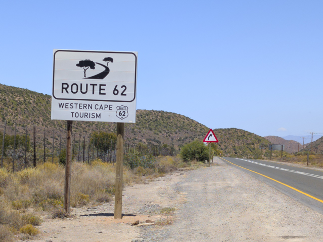
After learning all about ostriches our destination for the day was the town of Robertson, which is known as a wine producing town. This meant driving along Route 62 which is promoted by the tourism industry as the South African equivalent of route 66 in the USA. Think lots of restaurants and small towns trying to cash in.
A small section of the route is pretty and the road passes through a high pass which is attractive but overall the route was a bit disappointing. I guess we had high expectations after the stunning scenery of the Swarzberg Pass drive the previous day.
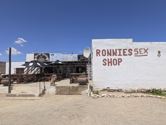
One stop that did stand out though was Ronnie’s Sex Shop. This is a bar in the middle of nowhere that started out as a shop. It was set up by the eponymous Ronnie, and as a joke, his friends later added the Sex moniker to the sign, which stuck.
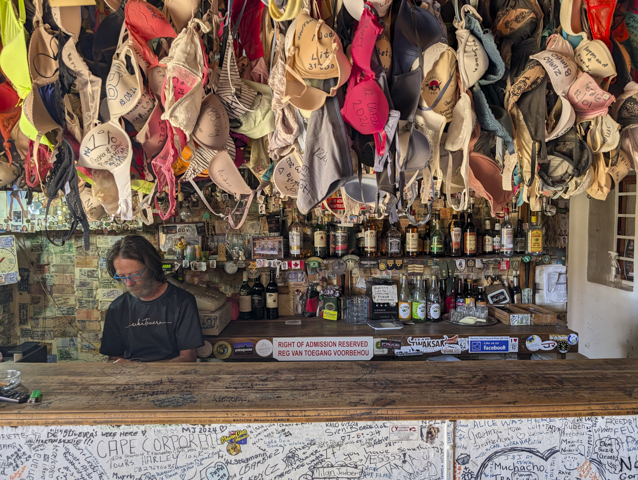
The bar itself is quite small and the walls are plastered with graffiti, bank notes and other things, and from the ceiling hang hundreds of signed bras donated by patrons. We stopped off for a drink and met the characterful Ronnie, his wife and son (who was behind the bar) before getting back on the road and continuing on our way.
We stopped off at a couple of towns on route but none that particularly enamoured us and ended the day in the town of Robertson where we arranged to go on a wine tour the following day.
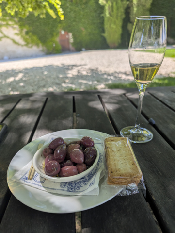
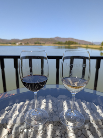
We were picked up by our driver at 10am and whisked to our first winery (which also turned out to be our favourite), Springfield. The winery is in an attractive lakeside setting with tables set out under shady trees. They were well set up for tastings and we were given a paper sheet where we could select 5 wines each for only 70 Rand (around £3). They also provide you with a carafe of water, crackers and some olives.
We were slightly surprised at the first glass which was about half a glass of wine and realised that planning four wineries might have been more than we could manage!
The Springfield wines were great, I think the reds were slightly better than the whites but the Cap Classique which is the South African Champagne was actually very tasty and definitely rivals some of the French Champagnes.
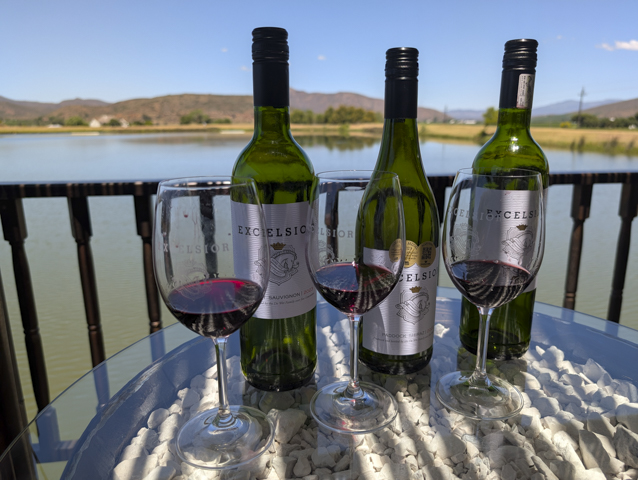
Our next winery was Excelsior which also had a beautiful lakeside setting. After tasting three wines which were ok but not as nice as the Springfield wines, we decided to have a go at blending our own wine. This involved tasting three more wines and then deciding how to mix them to create our own bespoke wine.
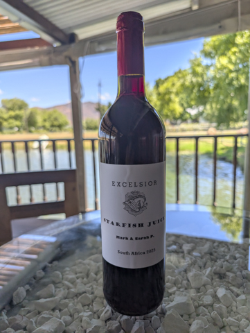
Taking a bottle we filled it with a mix of shiraz, cabernet and merlot to make our own blend, then we corked it using a corking machine and printed up a label to make our very own bottle – “Starfish Juice” – an in-joke with some friends of ours.
Our third and, as we were running out of time and feeling a bit squiffy, last winery of the day was Van Lovren, where we decided it would be a good idea to have a late lunch before carrying on with more tasting.
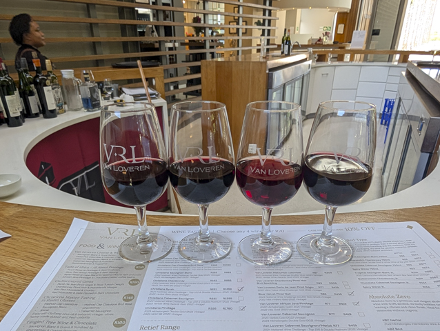
After lining our stomachs we went to the bar for another tasting selection of four wines. The Van Lovren wines were very good and we particularly enjoyed the reds.
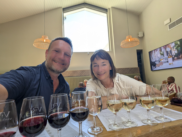
Luckily the wineries close by 4pm, there’s only so much wine you can drink in a day and by that time we were definitely ready to be driven back to our guesthouse where we crashed for the rest of the evening!
Addo and the Garden Route
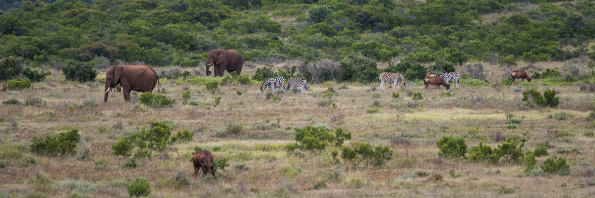
Before starting on the famous Garden Route we decided to visit Addo Elephant Park. Addo is the third biggest game park in South Africa and is home to around 600 elephants so we’d be pretty unlucky not to see one.
In order to visit Addo we’d booked into a guesthouse a 15 minute drive from the park entrance. The small cottages were set in a beautiful garden with a natural swimming pool which made for a very refreshing dip with the frogs at the end of a hot day – although they’d had a visiting cobra in the pool previously so although refreshing it wasn’t that relaxing!
Just a 3 minute drive away is a lovely restaurant that was recommended to us by the owner of the guesthouse, where I tried their slow roasted shank of Springbok which was excellent.
Addo is not like other parks in that the best time to see the animals is apparently from mid-morning onwards. We weren’t going to complain at the chance of a lie in, so we headed to the park around 11am. Unfortunately it was raining and forecast to rain for most of the day.
Addo is certainly busier than Mountain Zebra and there was actually a queue to check in at reception before we could go into the park proper (albeit not a very long one).
We set off with our map and started with one of the loops close to the main entrance. The landscape here is very different to Mountain Zebra National Park and a lot of the roads are surrounded by quite high scrubby bushes which make wildlife viewing much harder.
There are however places in the park where the landscape is more open and there are also a number of waterholes which can provide some good sightings.
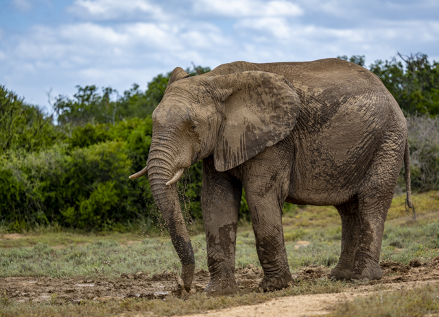
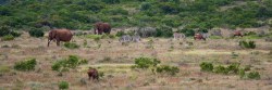
With the rain, the normal behaviours of the animals were disrupted and it was a bit more of a lottery as to where we would be seeing them. However after a slow start we began to get glimpses of the elephants.
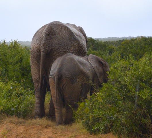
To start with it was a couple of bums here and there sticking out of the bushes but eventually we had a clear view of an elephant at a water hole and as the day went on we were treated to better and better sightings.
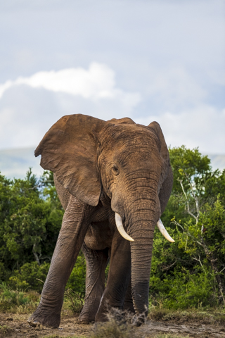
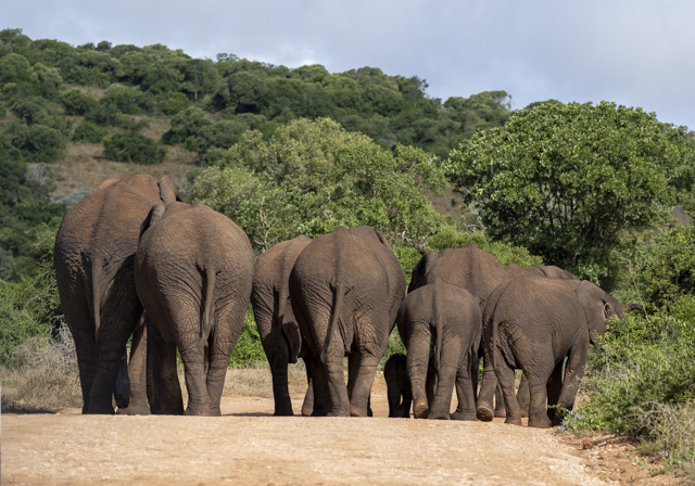
The highlight of the day was a family of around 20 which included a huge bull elephant and even a tiny baby. This family walked down the road and the big bull elephant walked past our car – close enough to touch if we had leaned out the window. There were definitely a few nervous moments as he stopped right next to us and swung his head from side to side.
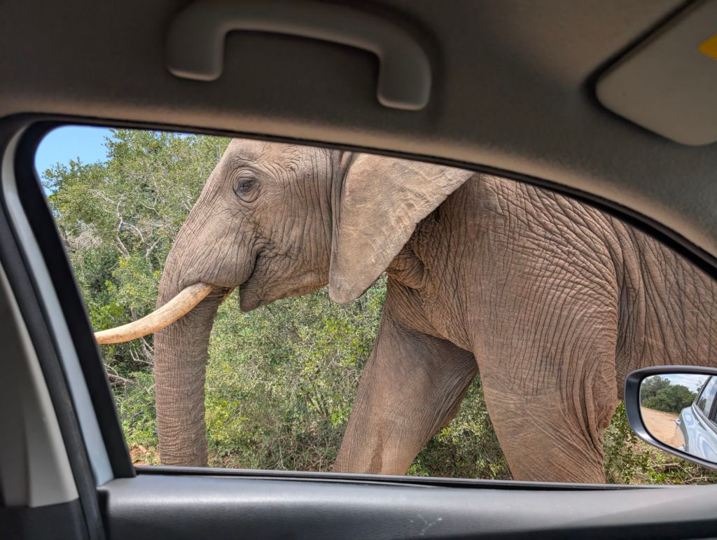
Addo is unusual for game parks in that the elephants are very relaxed. The advice when encountering them is to turn off your engine and stay very still. They will come very close but there has never been an incident of them damaging a car. In other parks you shouldn’t let elephants get too close and should drive away if they start to approach.
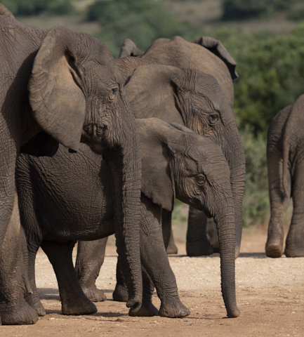
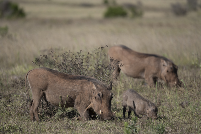
We spent two days in Addo in total. Our first day, despite raining on and off for most of the day was better in terms of the elephant sightings. On the second day we saw fewer elephants but all the zebras seem to have come out and we also saw lots of warthogs. Every day in a game park is a different day !
We left Addo by the southern gate and stayed the night in the suburbs of Port Elizabeth.
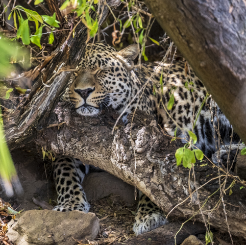
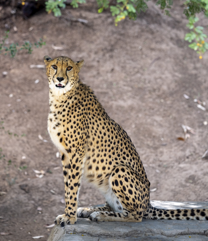
Form here we were heading for the coastal national park of Tsitsikamma or Storms River but first we headed inland to a remote highway where a café and animal sanctuary called the Daniell Cheetah Project resides. This is a rescue centre for big cats where they provide free guided tours of their residents.
Most of the cats that come to Daniell have been injured or mistreated in some way and can’t be released into the wild. For example, they have a brain damaged cheetah, cats that are blind or with severed limbs.
They do breed the cats though if possible and release them into the wild. In fact they had a leopard cub that was still dependant on its mother but was destined to be released when it was old enough.
The woman who gave us the tour was really knowledgeable and we learnt a lot about the various cats who live in the centre.
From here we headed back towards the coast with our first stop at Jeffrey’s Bay. This is one of the premier surfing locations in the world and we visited a beach called Supertubes which has big clean waves for surfing – in the winter. Right now there were no real waves and certainly no one out surfing. It was however a lovely beach.
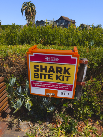
This being the first South African beach we had visited we were not accustomed to seeing Shark Bite Kits. Add to that the signs warning of dangerous currents and rip tides and it tends to make you think twice about going for a dip!
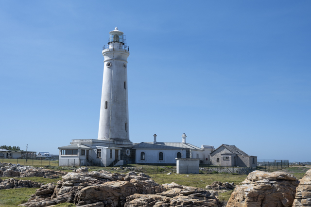
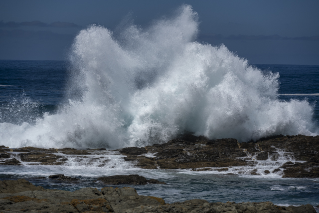
Our next stop was St Francis Bay or more accurately, the Seal Point Lighthouse. Built in 1878 this lighthouse is on the South Easternmost point of Africa (not the southernmost point) and is 28m high. There were no sign of any seals unfortunately but the coast was very dramatic with waves crashing against the rocks.
We ended the day at the small town of Storms River staying at a very eclectic Backpacker’s Hostel. Our room certainly wasn’t the nicest we’ve stayed in but the communal area was really rustic with lots of seating areas throughout the garden, a beautiful big dog wandering around demanding attention and even monkeys trying to raid the partially open-air kitchen. It had a very welcoming, relaxed vibe though and they provided delicious freshly baked beer bread every afternoon and pancakes for breakfast.
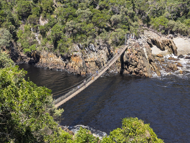
While staying there we decided to book a kayaking trip to Storms River Mouth and down the canyon.
Unfortunately it was too rough to kayak from the home base of the kayak company to the mouth of the river so we started with a kilometre walk along a boardwalk with lots of steps to the river mouth where there are a couple of famous suspension bridges across the river.
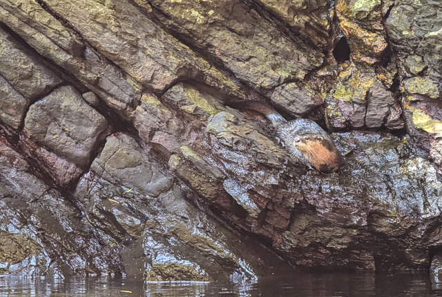
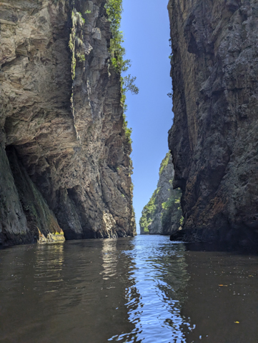
From here we boarded our kayaks and started kayaking down the river gorge which became quite narrow. There was a big cave inhabited by bats that we paddled into in the side of the gorge but the highlight of the paddle was definitely seeing a Cape Clawless Otter playing on the rocks at the side of the canyon.
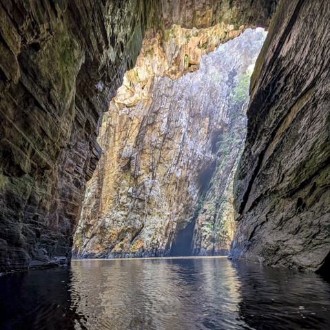
It wasn’t long before we reached a barrier of rocks, at which point we exited the kayaks and climbed over the rocks to collect an inflatable lilo for the next section of the canyon. These were super fun to lie on and zip around the now very narrow canyon using your arms for propulsion. We only really carried on another 500m or so to another rock barrier with a small waterfall.
This was our turnaround point as we headed back towards the kayaks. We did stop off for some cliff jumping into the river which was fun before reboarding the kayaks and heading back.
It was a fun trip in a beautiful place, but we felt a little short changed as the actual kayaking wasn’t very far. We had definitely expected a lot more kayaking and a lot less walking for what was billed as a kayaking trip.
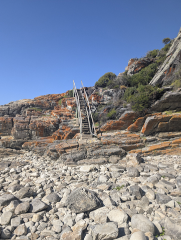
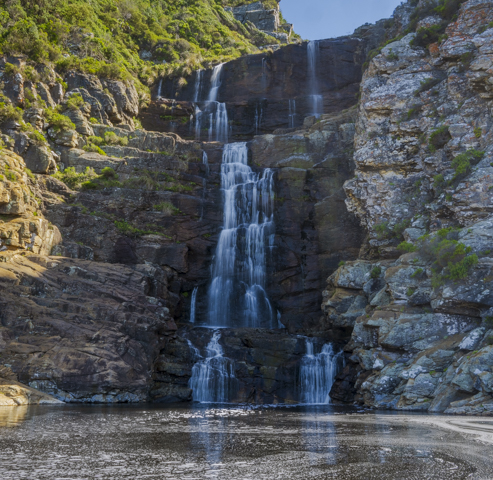
The other thing I did at Storms River was a reasonably strenuous coastal hike along part of the Otter Trail to a waterfall next to the beach. The hike was a little harder than expected as there was a lot of climbing up and over the cliffs and onto the beach itself where you had to rock hop over rough stones.
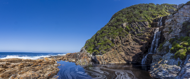
The waterfall itself was lovely and bigger than I expected. A perfect way to cool down after a hot hike.
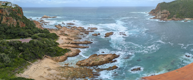
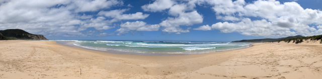
After leaving Storms River we were heading for Plettenberg Bay but we stopped off to explore a beautiful area called Natures Valley. There is a stunning beach here and if you walk across the beach there is a lovely, safe swimming spot in the lagoon. We didn’t have time on this trip to stay overnight here but we have made a note for the future that this is somewhere well worth visiting.
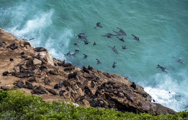
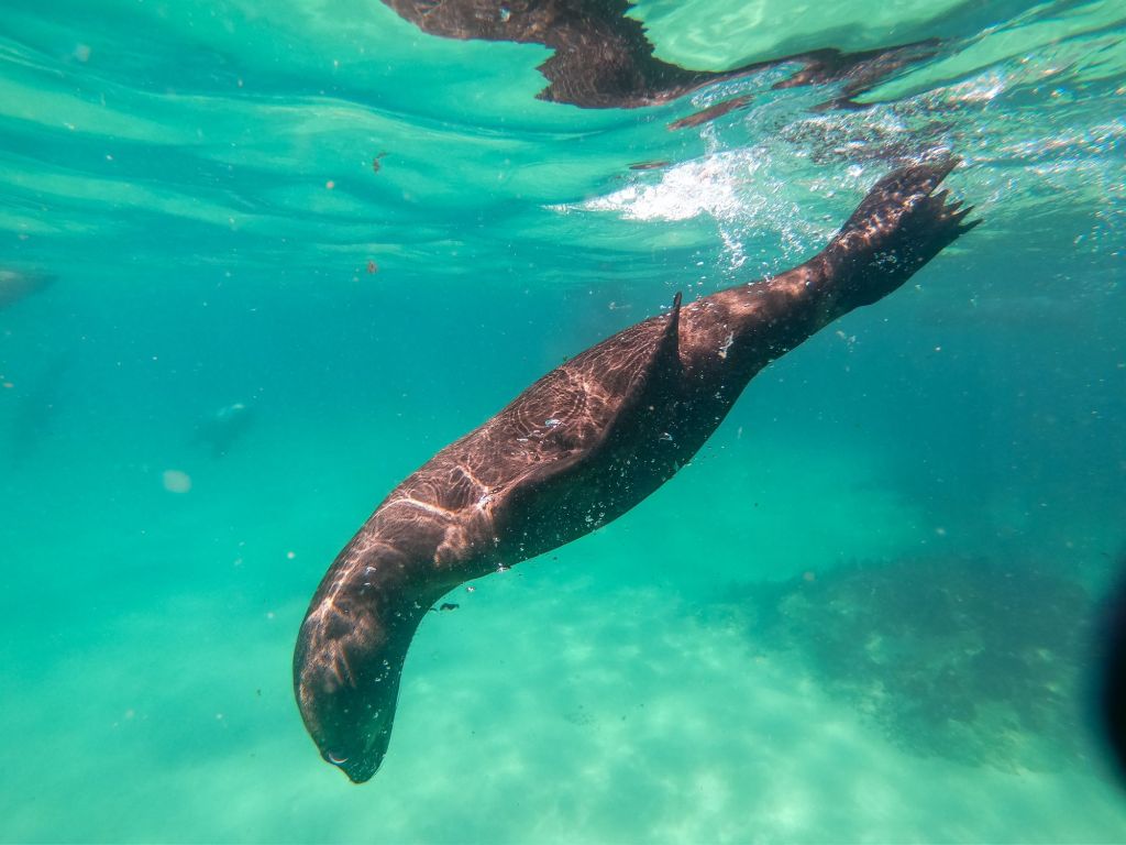
Plettenberg Bay is a bigger town on the Garden Route. We chose to come here because of the big seal colony and there are a number of companies that run seal swimming trips.
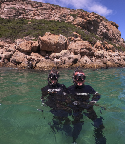
We had booked with Offshore Adventures which has their office right on the waterfront only a short walk from where they beach launch their boats.
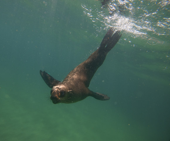
After a quick briefing, we were kitted out in wet suits and snorkelling gear and loaded onto the boat which was pushed into the water by a tractor. The seal colony was about a 15 minute boat ride away over calm seas. As we got closer we were excited to see lots of seals lounging around on the cliffs and swimming in the water and no other boats in sight.
We had a very enjoyable half hour snorkelling with the very active and playful seals as they cruised around us, sometimes very close. It was a very cool experience and highly recommended.
After travelling back to shore in the boat we were instructed to hold on tight for the landing. The boat lined up with the beach and then the captain applied full throttle, launching us towards the beach. We hit the sand, slid out of the water with a big jolt and lurched to a stop canted right over on one side. A pretty exhilarating end to the trip!
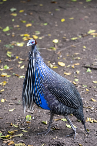
Plettenberg bay is also home to the largest free flight aviary in the world which has a massive netted area 2 hectares in size. It is absolutely stuffed with free roaming birds (although obviously no predators) and there is a boardwalk that traverses the netted area allowing you to get a close look at them.
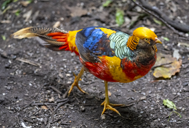
We spent a couple of hours here, walking very slowly and saw some weird and wonderful species. The Vulturine Guinea Fowl was probably the weirdest looking one. There were also lots that we didn’t see so this is the sort of place that rewards repeated visits. They house birds from all over the world, so Rainforest birds from South America rub shoulders with the local African birds.
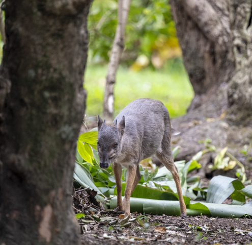
There were also cute little Blue Duiker, the smallest antelope in Southern Africa, running around beneath the trees.
Next door to Birds of Eden is Monkeyland which is another free roaming habitat which has 10 different types of monkeys living in some fairly big family groups. You aren’t allowed to free roam here but instead have a guided tour.
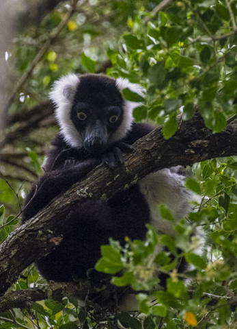
We were lucky to have a private guided tour as no one else was around when we arrived.
The most numerous monkeys are the ring tailed lemurs, who are apparently the morons of the monkey world, and these greeted us right at the start of the tour. However we also saw Black & White Lemurs, Capuchin monkeys, Vervet monkeys, Howler monkeys, Squirrel monkeys, a Gibbon and Indian Hanuman Langurs. The only monkey we didn’t get to see were the Spider monkeys.
The highlight of the tour was at the end when you cross a big suspension bridge in the canopy and sitting at the end was one of the White Handed Gibbons who proceeded to swing down the bridge right towards us. The guide said duck so we squatted down as the gibbon swung over our heads !
As an added bonus when we returned to our car a big family of wild baboons choose that moment to walk through the car park and very close to us as we stayed still so as not to spook them or indeed provoke a defensive reaction. A great end to what had been a lovely day.
The First Week in South Africa
With the excesses of Christmas firmly in the rear view mirror it was time to focus on another year of travel.
Our first stop was Heathrow – Terminal 5, for a British Airways flight to Johannesburg. We had a month in South Africa to look forward too. The 12 hour flight from London to Johannesburg wasn’t too bad but we arrived off the overnight flight having had only a couple of hours sleep each.
First stop once through immigration, was to pick up a SIM card which was easy enough as just outside the airside exit there were three telecoms shop all with different offerings. We opted for Vodacom and were online in a few minutes.

With that sorted we headed over to car rentals to pick up our wheels for the next few weeks. We’d opted for the cheapest car available from a company called Woodford. This turned out to be a Toyota Starlet and Woodford as it happens is the South African name for Alamo/National. Our car was pretty new and very clean (not for long) and we were soon on our way.
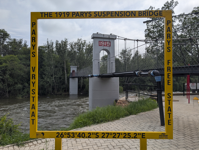
We’d decided to immediately head South away from Johannesburg and we drove for just over an hour to a small town called Parys, just over 100km from the city.
By this time fatigue was catching up with us so we had 40 winks before going for a wander around town and to find some food.
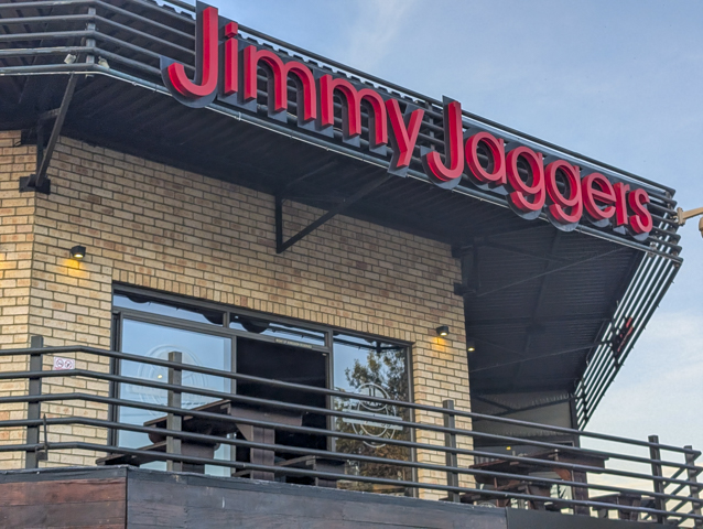
Our introduction to South African night life was at a bar called “Jimmy Jaggers” which seemed to be the most lively place in town. We had a fantastic burger each and a much less interesting beer – Castle Light – which we won’t be having again.
We were seriously flagging though so we headed back to the hotel – Le Grand Chateau (a misnomer if ever there was one but decent enough), for some much needed sleep.

The next morning we carried on heading south to our first proper destination of the trip. This was our introduction to South African roads or should I say to South African potholes. We followed google maps on the most direct path which seemed to be a main road but it was full of deep potholes and what should have been a 3 hour journey turned into 4.5 hours. We learnt our lesson though and will be sticking to the single digit highways where possible from now on rather than blindly trusting Google Maps.
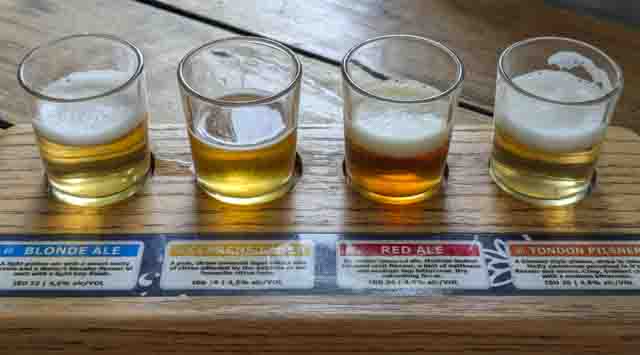
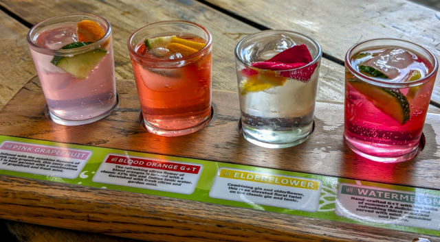
A little jaded by the drive and probably not yet recovered from the flight, we eventually arrived at Clarens. This very cute little town can’t help but lift your spirits with its large grassy square in the middle surrounded by restaurants, bars and shops. The receptionist at our hotel the night before had recommended the Clarens Brewery so we made this our first pit stop, where we very much enjoyed trying their flight of gins and flight of beers.
After pre-dinner drinks we went next door to a Portuguese restaurant which was great. We both ordered fish after overloading on red meat in the Balkans for 7 months. I ordered the Kingklip which I had on a previous trip to South Africa 20 years before and it was just as delicious as I’d remembered.
In the morning we were up early to head down the road to Golden Gates Highland National Park but when we got to the car we heard some noises coming from the engine. Somehow on our drive the previous day we had managed to pick up a hitchhiker. A small bird that had gone through the grill at the front of the car and was now sitting in the space in front of the radiator.
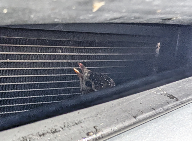
We spent about 30 minutes gently trying to coax him back out of the grill using 2 spoons from our accommodation but the more tried the more he hid at the back. We didn’t know what else to do so set off for our day at the National Park.

This park has some animals but it is really known for its scenery, so we headed off on some scenic drives through the park. We did see some Wildebeest but they were a long way from the road and we couldn’t get a clear look at them. The wildlife highlight of the day was seeing a baboon who galloped away when we drove past.
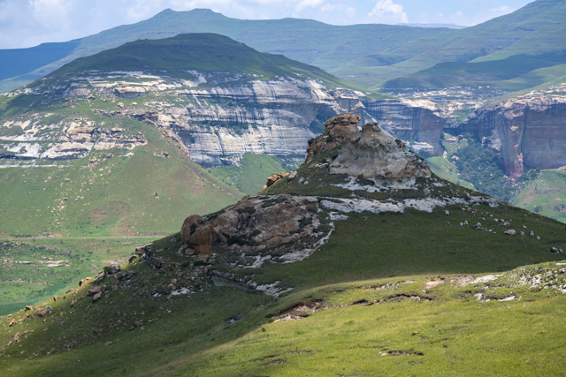
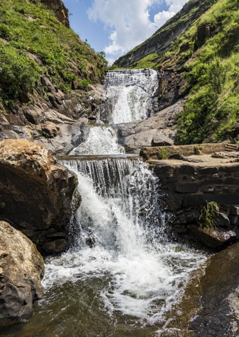
The park itself is spectacular though and we did a couple of short walks from the visitor centre to a narrow canyon called Echo Ravine and to some cliffs with Mushroom like overhangs. Also near the visitor centre is a waterfall with a natural pool underneath which was a perfect place to cool off on what had turned into a pretty hot day.
The only disappointment of the day was our visit to a Vulture hide where there were no vultures to be seen.
On our return to Clarens we went to fill up with petrol and with the help of the attendant (no self service filling stations in South Africa) we managed to get our hitchhiking bird out of the grill. I moved him into the shade to recover but I think sadly his chances of survival after his ordeal were probably low.
The next day we continued making our way South with two days driving and a stop in Bloemfontein to overnight at a guesthouse with a pool. The pool was very welcome as this part of South Africa is very hot in the summer and we saw temperatures as high as 36c.
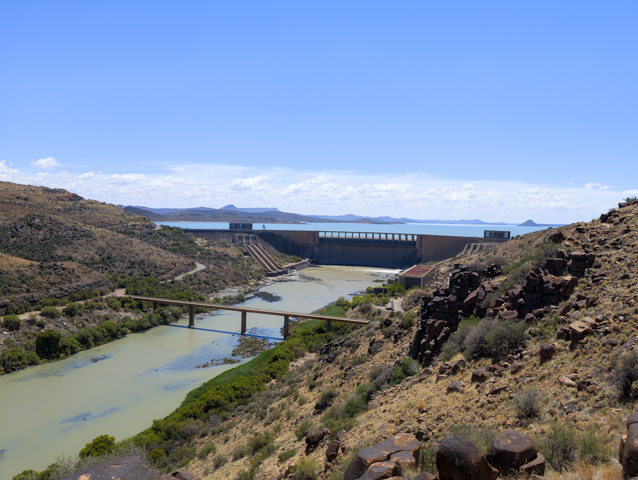
We stopped off on the way to see the Gariep Dam which is on the High Veld creating a bit of an oasis in a very hot area.
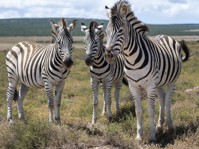
Our destination was the town of Cradock which was a dusty small town with what seemed like few merits. However it is right next door to Mountain Zebra National Park which we wanted to visit.
The gates opened at 7am so it was an early start for us as we wanted to spend a full day at the park.
The roads in the park are all gravel – apart from a short stretch of tarmac around the visitor centre. You have to go to the visitor centre at some stage during your visit as this is where you pay and receive an exit permit to enable you to get out of the park.
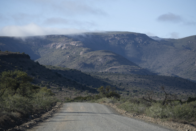
Mountain Zebra National Park is a fairly mountainous park of 284 km2 with a number of loop roads most of which are in pretty good condition although a little rough for our rather dainty hire car.

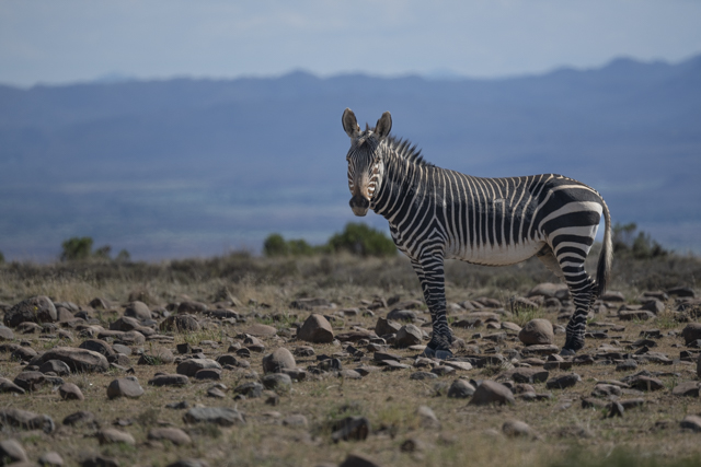
The park was set up to protect the endangered Cape Mountain Zebra which have been brought back from the brink of extinction. We were worried that we wouldn’t see any zebra but we shouldn’t have been because there were a lot of them and we had some fairly close encounters.
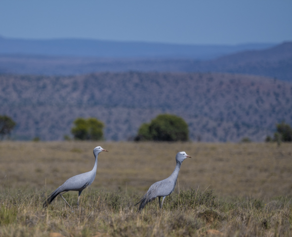
The park does have a few lions and cheetahs but we were not lucky enough to see them. However there are loads of deer including kudu, eland, springbok, steenbok, gemsbok, blesbok and we saw all of these.
After game viewing all morning we were ready for a break and we drove to the rest area which is a few km’s from the visitor centre. Apart from a couple of viewpoints this is the only place in the park that you are allowed to get out of your car. This is a safe fenced area with a lovely swimming pool.
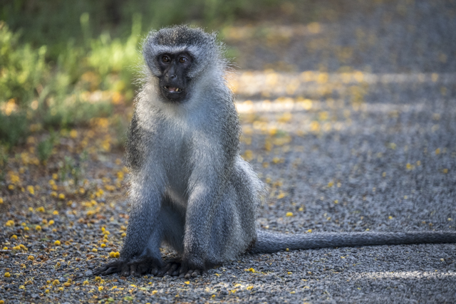
We were the only ones there and we proceeded to get some sandwiches out of the car to have lunch on a picnic table in the shade. At which point a monkey ran in grabbed the sandwiches and ran off with me chasing the little bugger to no effect. Ah well another lesson learned and one skipped lunch definitely won’t kill me.
We spent a couple of hours swimming and relaxing before heading back out for a late afternoon game drive.
While we were deep in the park the blue skies quickly darkened and fat drops of rain started falling. It wasn’t long until the rain was torrential and the roads all turned to rivers. We later learnt that this was the first rain in six months. Fearing that we would get stuck we started heading for the exit and after a fairly hairy drive we made it. Our little Toyota Starlet did us proud!
The next day we headed back into the park for another long game drive and it was amazing. Most of the water from the previous nights torrential rain was gone, the sun was back out and the roads were much easier to drive on.
We had a lovely morning in the park spotting some new animals and some familiar animals before heading off around lunchtime to get back on the road heading South towards Port Elizabeth and the start of the Garden Route.
The Long Road Home
Moving onto Montenegro we felt as if we were starting the proper part of our journey home, although there were a few outstanding places we still wanted to visit.
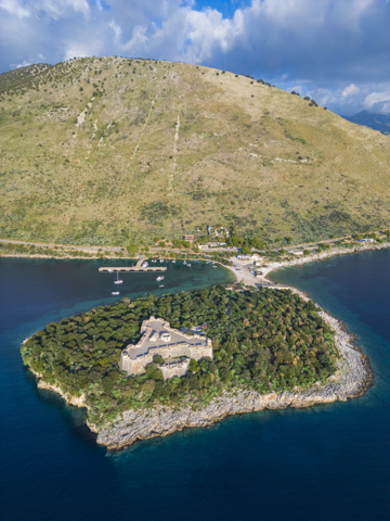
Our first port of call was Ulcinj. This was a small town that was founded in the 5th century BC. It has an old town and castle on top of one of the headlands but over the years the town has expanded and now wraps around the whole bay.
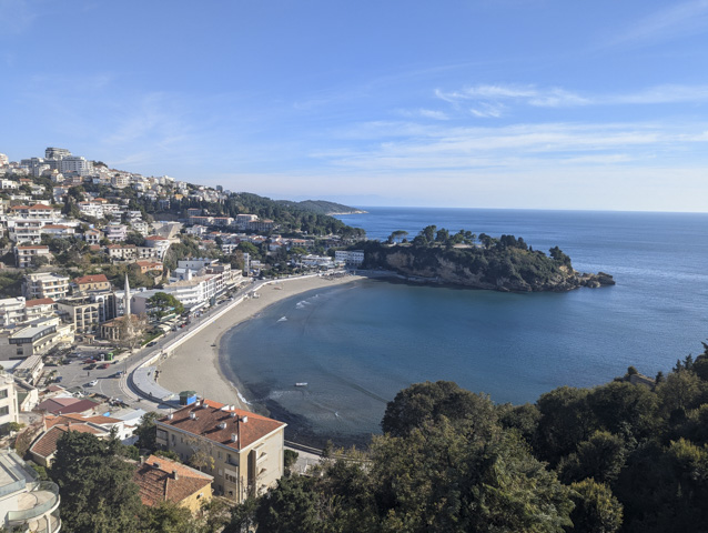
We explored the castle and old town but had to park well outside of the town centre and cycle in as the roads were becoming more and more narrow.
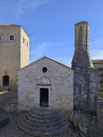
Ulcinj was just a quick stop and we continued on our way to the main attraction – Stari Bar, which is somewhere we have wanted to visit for a while. Stari Bar is actually a few kilometres inland from the new town – Bar, and sits atop a hill (of course it does!), overlooking the new town.
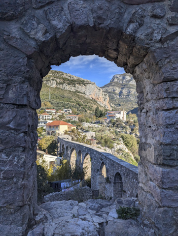
Stari Bar has changed hands many times over the years, being controlled by the Venetians, the Serbians, the Hungarians and the Ottoman Empire. It was finally captured back from the Turks in 1877 by the Montenegrins but it was eventually abandoned in 1977 after an earthquake destroyed the aqueduct that brought water to the city.
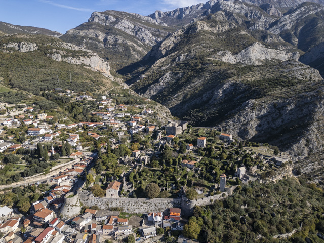
The old city has been restored in part and the overgrown ruins make a peaceful place to wander around but there are only a handful of buildings you can actually go in.
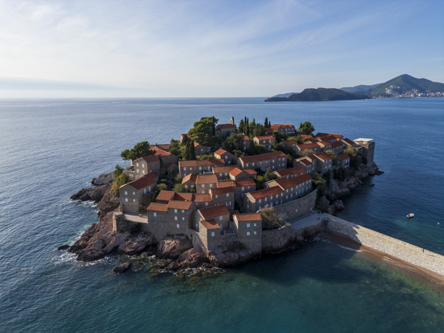
We couldn’t find anywhere to stay overnight here so we decided to drive to the old capital of the country, Cetinje. As we headed along the coast we drove past the island of Sveti Stefan which is now a very upscale hotel with rooms starting from €1,000 per night. Unsurprisingly we didn’t stop here for the night.
Cetinje was the Capital of independent Montenegro from 1878 to 1918, after which Montenegro became part of Yugoslavia. The capital of Montenegro was moved to Podgorica in 1946.
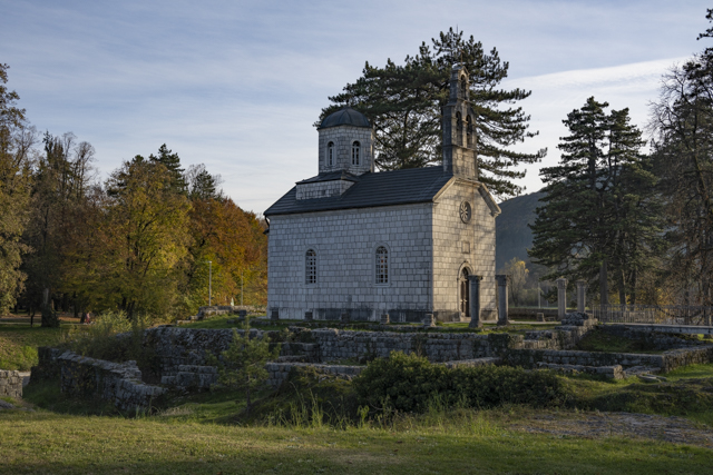
Despite being the old royal capital, Cetinje is a quiet, small town but, it is home to most of the museums of Montenegro and we were lucky as we arrived on a bank holiday when all the museums are free to enter. Not being able to resist a freebie, we got stuck in!
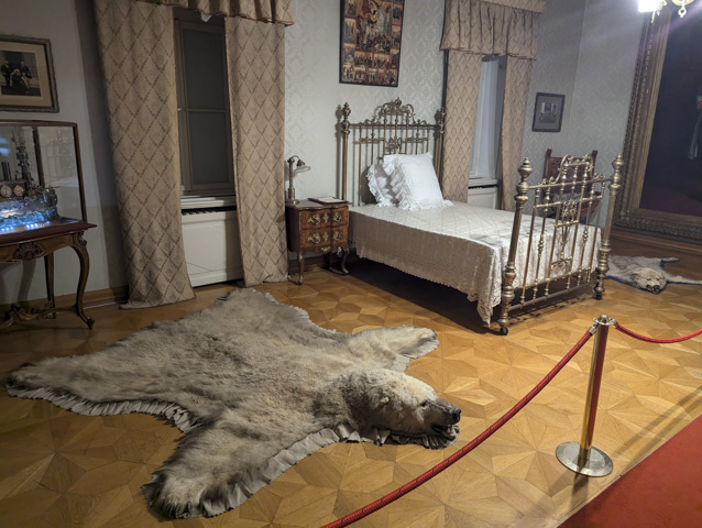
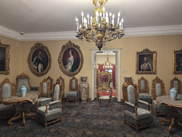
First on the list was King Nikola’s Palace. Nikola 1st was the reigning monarch in Montenegro from 1860 to 1918 when he was deposed and Montenegro joined the other Balkan states to form the Kingdom of Serbs, Croats and Slovenes, renamed Yugoslavia in 1929.
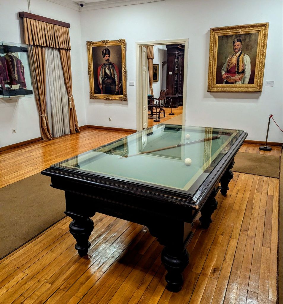
Many of the rooms of the palace were richly appointed and some of the furniture was very ornate. We then visited Billiard’s Palace, home of Prince-Bishop Petar II Petrovic-Njegos (more widely known as Njegos) who ruled from 1830 to 1851. If you find yourself in Cetinje and don’t want to visit all the museums, we found Billiard’s Palace to be the most interesting and informative.
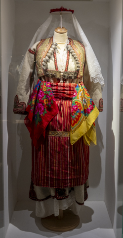
After visiting the two Palaces we moved onto the Ethnographic Museum, which has numerous traditional costumes from different regions of Montenegro.
We learnt that Montenegro had been a very poor country and that 19th century Montenegrin society was considered primitive by its neighbours meaning that Montenegro was fairly divorced from the politics of the region.
After all that exertion we took a pitstop at one of the cafes on the main square where we enjoyed a warming hot chocolate before heading back to the camper for the night.
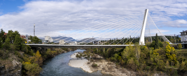
Early the next morning we drove onto the current Capital City, Podgorica.
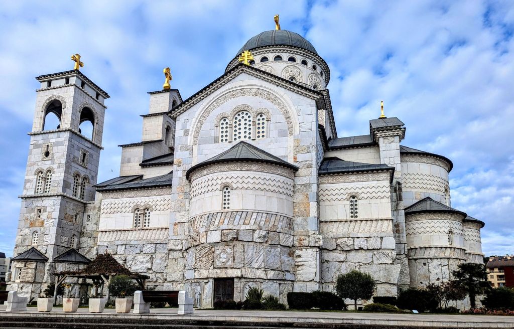
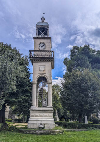
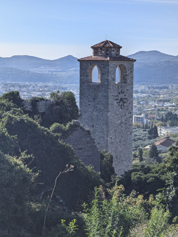
We were able to park right next to the Cathedral and then explored the town by bike. To be honest it didn’t take very long. For a Capital City we were surprised at how little there was to see here, other than the Cathedral, which is quite impressive, a new suspension bridge, the Old Roman Ribnica Bridge and an Ottoman era clock tower. You certainly wouldn’t be missing much if you decided to give this city a miss.
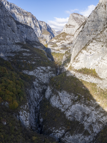
After visiting Podgorica we drove up into the mountains on a road we had already driven in the summer. We were heading to Mrtvica canyon which we had skipped in the summer because of the heat.
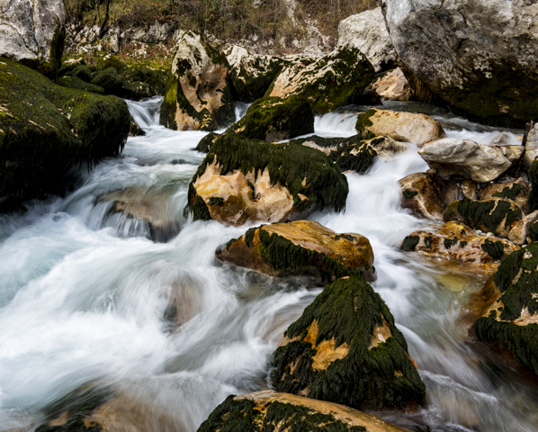
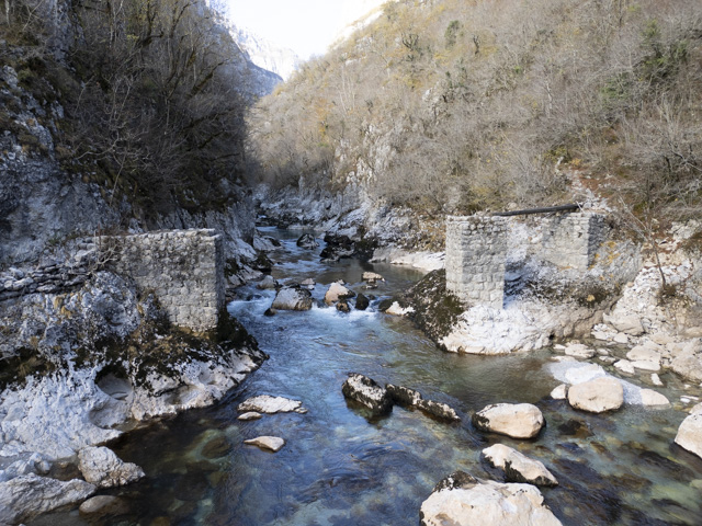
I got up early the next day and headed out for the hike from the main road to the canyon. It’s actually quite a hike to get to the start of the canyon, around 5km, and after that it was another 5km’s along the canyon to reach a channel that had been cut into the cliff walls which was part of an old military trail.
One of the first stops in the canyon is the ruin of a bridge – this actually links a couple of campsites with the trail but was washed away a few years ago.
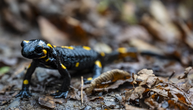
Next up was the “Gate of Wishes” where it is said that if you throw a coin through it your wish will be granted. I don’t know about wishes but I was pleasantly surprised to find a rare Fire Salamander crawling around right there.
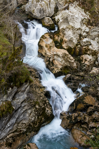
It was definitely a fun hike and I was glad to be here in the autumn rather than in the height of summer, as it was a 20km hike with over 700m of climbing – so quite hard work.
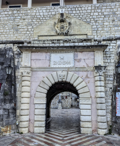
That afternoon we headed down out of the mountains and went right back to sea level to the town of Kotor. We had actually been here before a few years ago so we were just stopping off for the night.
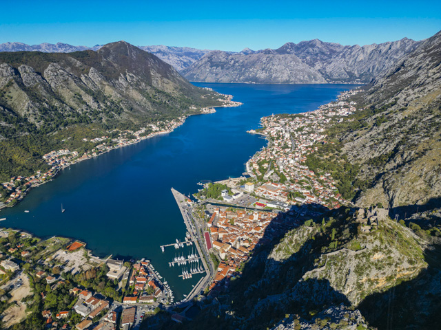
Kotor is a lovely city – like a small version of Dubrovnik – and, as there were no cruise ships in town, it was relatively deserted which was lovely. Parking here is at a premium, and we paid €20 to stay overnight in a car park with no services. However, the location was excellent, only 300m from the entrance to the city.
We were beginning to clock up the miles as we had that date with a ferry in our minds, so after only 1 night in Kotor we left Montenegro and headed back into Croatia.
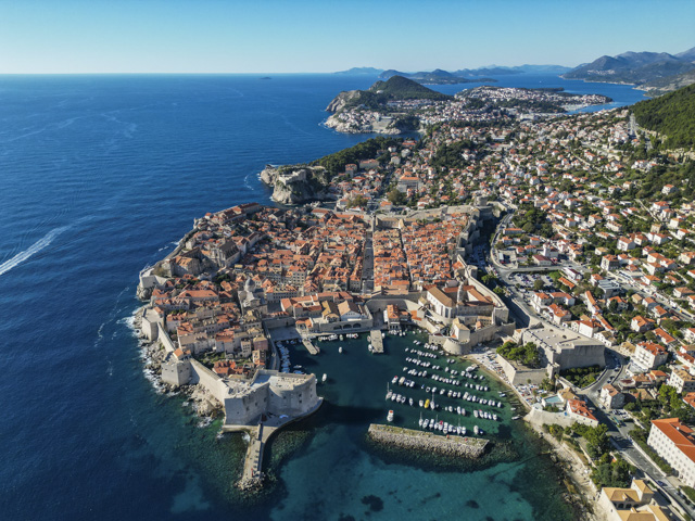
Having previously visited Dubrovnik and being on a tight deadline we drove right past it, stopping only for a quick photo opportunity. You used to have to drive through Bosnia to continue up the Croatian coast but a big new bridge links the Peljesac peninsula back to the mainland now making the journey much more straightforward.
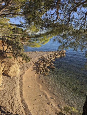
After reaching the Makarska coast we found a camp site for a couple of nights to take a break from the driving. The prices are much better in the off-season and we parked up in a pitch overlooking a pretty little cove. The beach was small so I am not sure how it would fare in the Summer months, but at this time of year it was perfect.
We were also really lucky with the weather and had a beautiful sunny day which was warm enough for us to spend on the beach swimming and sunbathing (in mid November), quite a shock as we were in hats and gloves the day before in Kotor. We had even packed away our shorts and swimsuits and dug out the hot water bottle as the weather had been much colder recently as we moved northwards.
Previously on our way through Croatia we missed out on visiting Split, so we wanted to pop in and take a look this time around. The only motorhome parking in town is near the football stadium, in an industrial area that felt pretty sketchy to say the least but there were other campers there so we weren’t alone.
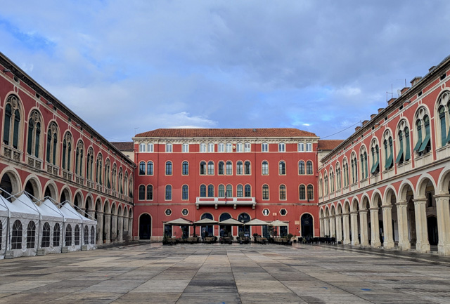
From the car park it was an easy cycle into town and we started by exploring the old town. It was a bit of a shock to the system as there were hordes of people everywhere. We soon realised that not only was their a huge cruise ship in the harbour but there was also a football match involving Croatia on that evening.

Fortunately in the afternoon the cruise ship passengers disappeared and the football fans seemed to settle into the harbour front bars so things calmed down enormously.
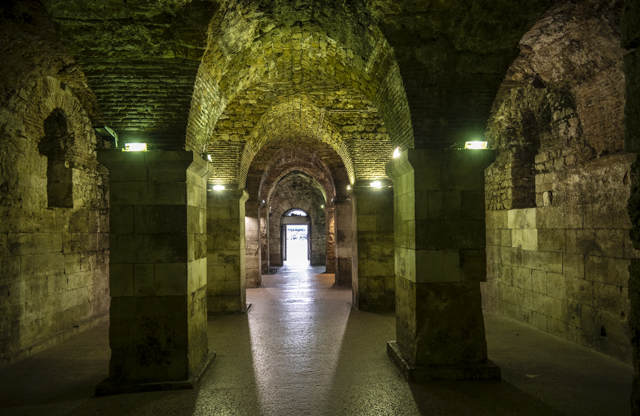
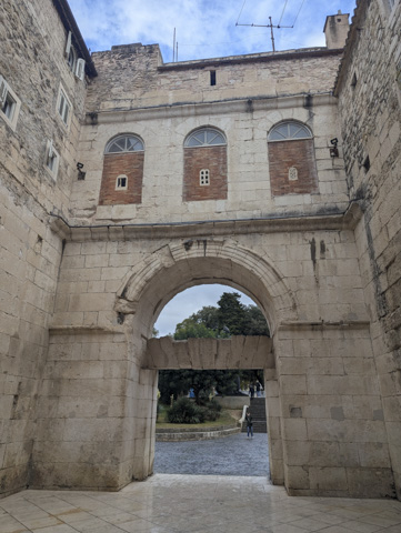
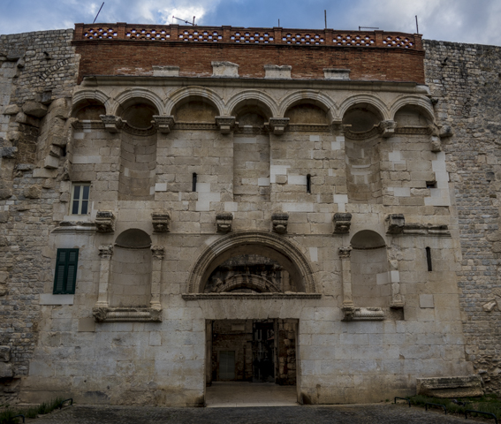
Split is the second biggest city in Croatia and was established as a Greek colony in the 2nd or 3rd century BC. In 305 AD it became the seat of Roman Emperor Diocletian and the heart of the old town is the Diocletian Palace.
We decided to stay in the vicinity of Split for another day and visit the Roman ruins of Solona which are on the outskirts of the town.
We parked near the old Ampitheatre of the city and walked across the site from there. There was no way to pay at this entrance so we were fortunate to have a free visit.
The ruins of the city are mostly just the foundations but there was a very interesting mass grave in a long trench that had a line of sarcophagi in it.
Above Salona is a cool castle called Klis Fortress. After the fall of the Romans this was the seat of a number of Croatian kings and was instrumental in defending Croatia from the Mongols and the Ottomans.
It has changed hands many times throughout history and has been controlled by the the Hungaro-Croatians, Turks, Romans, the Knights Templar, Venetians, Austrians, French and Yugoslavs.
This fortress was one of the locations for Game of Thrones and, if you were a fan of the series, it was the castle in Meereen where Daenerys freed the slaves.
After spending the night below the fortress we got back on the road. The weather was definitely turning against us and as we moved further North we drove through some absolutely foul weather that stopped us visiting some places on our list. Well that just leaves something for next time.
We had been planning to head inland to visit Zagreb and Ljubljana but decided against this when the weather forecast was predicting nighttime temperatures as low as -12c. We’d need more than 1 hot water bottle to cope with that! So we decided to stick near the coast and visit Trieste where the temperatures were significantly warmer.
On the way through Slovenia to get to Trieste the weather improved although we were driving with snow on either side of the road. This made us worry a bit about the journey to come from Trieste through Slovenia and Austria as we didn’t have chains or winter tyres, which are legally mandated.
We arrived in Trieste and by the next day the sun was shining and things had warmed up nicely. We hopped on our bikes and off we went.
First stop was the San Giusto Castle which sits on a small hill above the harbour front, where the city centre is located. After Trieste came under the control of the Austrian empire in 1382, the Imperial Court ordered the construction of the fortress. The building work was lengthy to say the least and lasted from 1468 to 1636. After the Austrian Imperial Captains ceased to reside in the castle in 1750 it was converted for use as a garrison and a prison.
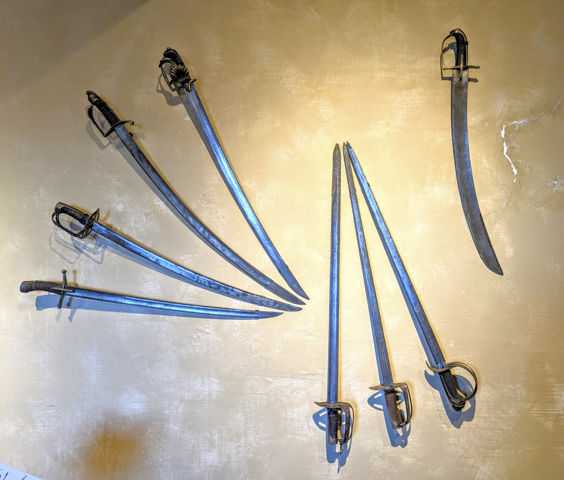
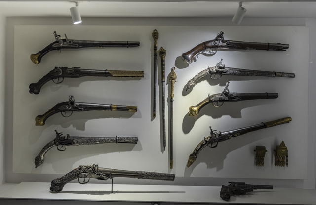
The castle has great views of the city from its ramparts and the museum room inside has a display of medieval weaponry which shows the development of weapons throughout history.
After gaining height to get to the castle we could free wheel back down to the harbour front – made only a little more difficult by the cobbled streets which were hard work on our wheels and our posteriors!
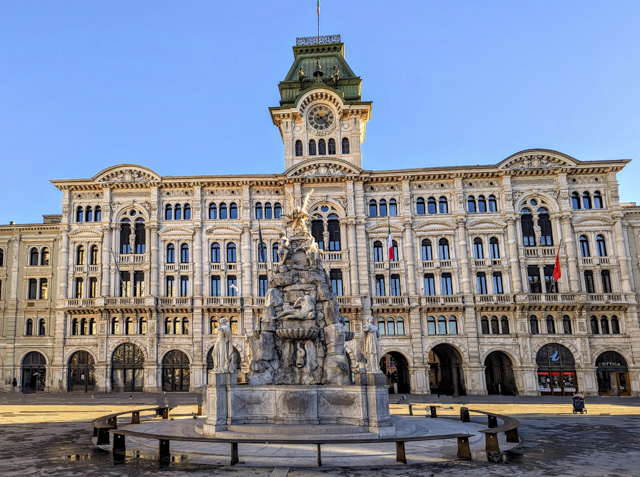
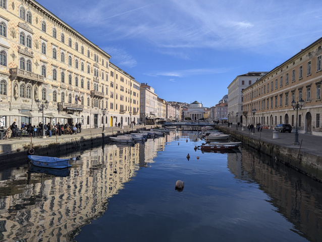
At the centre of Trieste is the Piazza Unita Italia, which is the largest square situated next to the sea in Europe. Several enormous and important buildings line the square including the Town Hall, the Palazzo del Lloyd Triestino, the Palazzo del Governo and the Palazzo Pitteri.
Running through the old town from here is the Canale Grande, which was a small waterway that allowed cargo barges to off load their goods directly into the city.
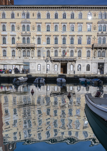
The Canal is lined with restaurants and we had a lovely lunch sitting in the sun and fending off the seagulls.
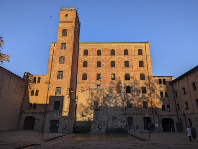
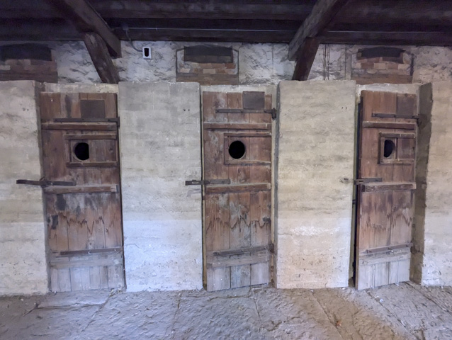
A few kilometres past the harbour is a national monument on the site of the an old Rice husking plant that became a concentration camp in WW2. It is called Risiera di San Sabba and was used for the detention and execution of political prisoners and also as a transit centre for Jews who were being transported mostly to Auschwitz. This was a sombre end to our stay in this beautiful town.
After leaving Trieste we had some big days of driving ahead of us. Our first drive day took us all the way from Trieste to Munich, where we travelled through a snowy landscape but thankfully with clear roads.
After a night in Munich we drove through Germany and stayed at a football stadium and bowls club close to the border with Luxembourg, before another big day where we ended up at Bruges. We had moved through the coldest part of Europe and Bruges was much warmer than it had been further South.
We had been to Bruges almost 20 years earlier but we thought it was time to revisit and see the Christmas decorations lighting up the town.
We made our way into town from the well-positioned Aire on the outskirts and spent a pleasant, if grey and drizzly day, wandering the sites, and eating and drinking. We visited the Torture museum which although very gruesome was actually really interesting. It’s quite horrific the medieval ways that were used to inflict pain.
As we were nearing the end of our trip we decided to splash out on a nice lunch and visited a gastro pub, which had 400 beers on the menu. This made choosing a beer to have with lunch much harder than picking what to eat. Most of the beers were 7% or higher alcohol so fortunately they only came in bottles. The beer I actually chose was called De Poes and very tasty it was too. The food was also excellent.
We did potter briefly around the Christmas market in the central square and although it was very pretty with the Christmas tree and the lights it was still disappointing, filled with the same gifts as all the other Christmas markets and selling overpriced food and drink.
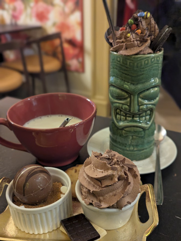
Belgium is of course renowned for its chocolate and by early evening we were in need of a pick-me-up, so we stopped off at a chocolate tea room for a much needed hot chocolate. The way they serve them is to give you a cup of hot milk and then you choose some additional plates of yummy things to add to the hot milk, including a bath bomb type ball of chocolate which melts in the milk. Needless to say they were delicious.
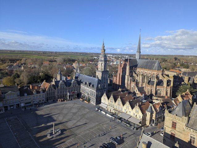
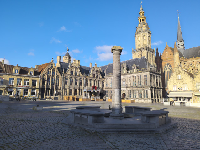
After Bruges it was almost time to head home and we only had one more stop to make on the way to France, in the town of Veurne. Veurne is a very small town but like many of the small towns in France and Belgium it has a lot of beautiful old buildings. In Veurne we visited the old townhall and court room and climbed the bell tower which was used during WW2 as a sniper and spotting tower.
We also stopped off for a cheeky sticky bun at a fantastic bakery in town but we had burnt a lot of calories climbing that tower!
After our brief visit to Veurne it was time to head to Calais and board our ferry home to spend Christmas with family and friends. And so ended our 7 month trip around the Balkans. We visited 15 countries in total and loved every single one of them (but definitely some more than others!).
Revisiting Albania
Leaving the Peloponnese after 6 weeks we felt like we still had unfinished business and with so much left to see, we look forward to returning to this region of Greece in the future. But, with a long way to go to get home and after taking six months to get to this point we only had 1 month to make it to Calais in time for our pre-booked ferry crossing.
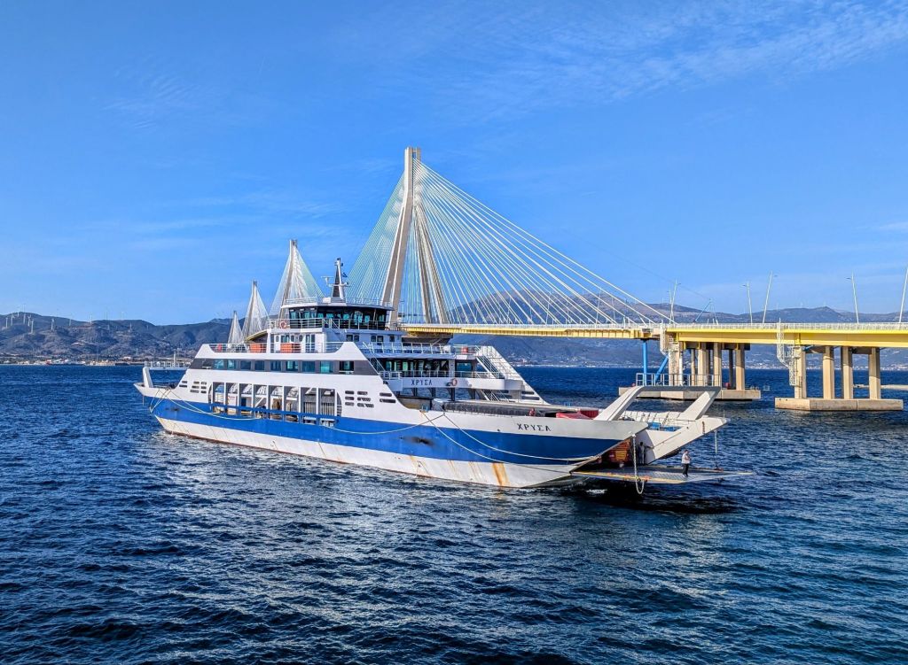
The first question was how to cross the Gulf of Patras. We had taken the bridge on the way over but this time we wanted to try out the cheaper ferry option. It was well sign posted – until you got down to the dockside, and then there were no signs at all and ferries in a number of different places. We somehow managed to figure it out and drove onto a waiting ferry – although we were a little nervous as to whether we had chosen correctly until a man appeared at our window with the tickets.
The ferry was much cheaper (you pay once onboard) and it only take 20 minutes. The views of the bridge are much better than when you are on the bridge and we were soon across to the other side.
We decided to spend the night in a free park-up on the beach just near the town of Nafpaxtos, where we were all alone and had a great view across to the Peloponnese. After a refreshing swim in the morning just a stones throw from the camper, we headed off to explore the town.
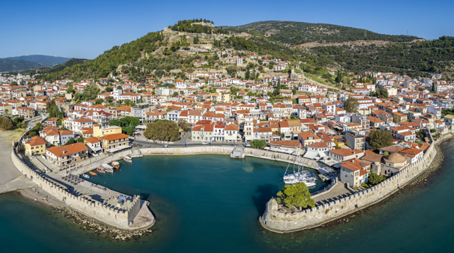
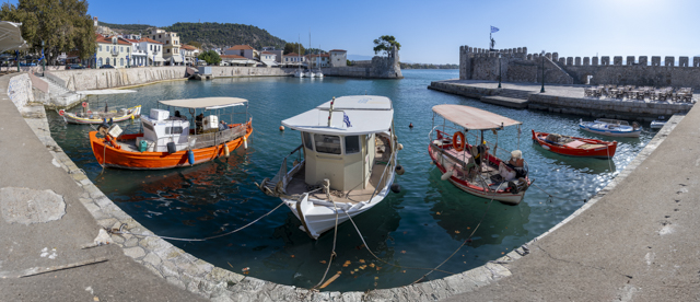
Nafpaxtos has a lovely old Venetian harbour where a few small fishing boats are moored surrounded by cafes and bars and just a short walk from the town square. We stopped here for what turned out to be a very good hot chocolate and some idle people watching.
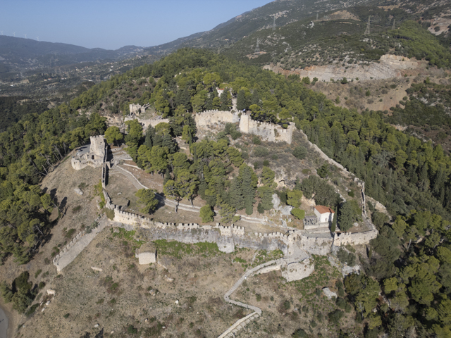
On a hill above the town sits an imposing Venetian Castle accessible via the narrow, ancient streets. It’s a very nice town for a stopover and I think in season the fish restaurants along the beach would be heaving.
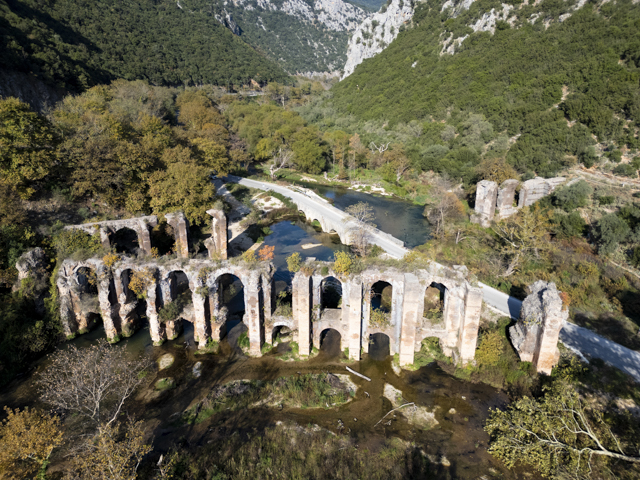
We needed to get some miles under our belt but couldn’t resist stopping off at the Roman Aqueduct of Nicopolis, near Preveza, for a quick poke around. The aqueduct was one of the most important structures of the Roman period in North Western Greece. It was built to provide Nicopolis with clean water and runs for 50 kms from the springs of Agios Georgios. If you take the staircase and then scramble up and along the hillside a short distance you can see the channel through which the water travelled, a short section of which is complete with an arched roof.
Our last pitstop in Greece before hitting the Albanian border was Ioannina, where we stayed in the same lakeside spot as last time when we were heading South. Only this time there were no other campers – the season is definitely over. We even revisited the same restaurant as before and enjoyed their amazing gyros, but this time we were sitting inside with the fire blazing.
We weren’t having the best weather this time around and late that night the wind really picked up. With the camper rocking from side to side sleep seemed unlikely, so we made a late night call to get up, get dressed and move away from the shoreline, finding shelter further along the road behind a huge hedge where we were better protected from the elements.
And that was it for Greece, the next day we drove the short distance to the Albanian border for some unfinished business.
This time around getting border insurance was much easier with sellers at the border. So after only 5 minutes we were across the border and on our way, with a plan to visit some of the lowland towns that we had avoided last time due to the extreme heat.
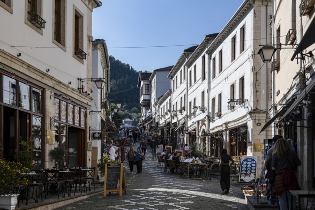
First stop – Gjirokaster, a regional capital and ancient town perched on the side of a very steep hill. Cycling into town from our campsite was a real challenge. We definitely took a wrong turn (or two) and ended up on a cobbled street with a gradient that must have been around 30%. Needless to say, we got off and pushed our bikes.
The old centre of town is lovely but very small, consisting of only a couple of streets lined with cafes and souvenir shops.
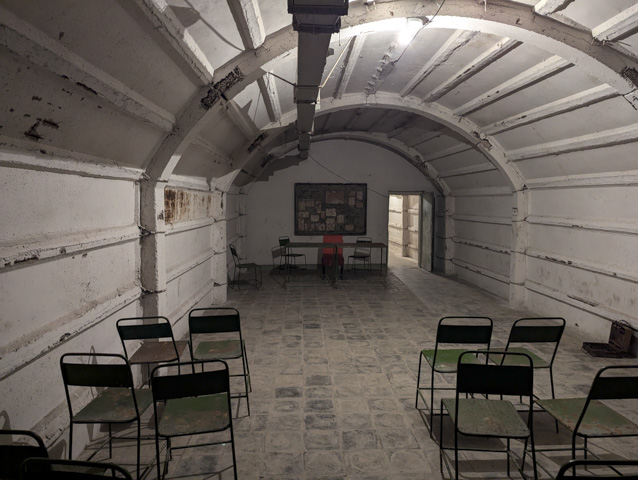
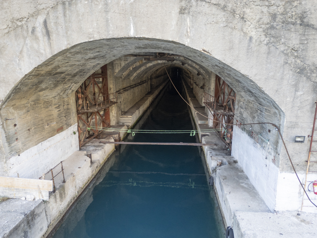
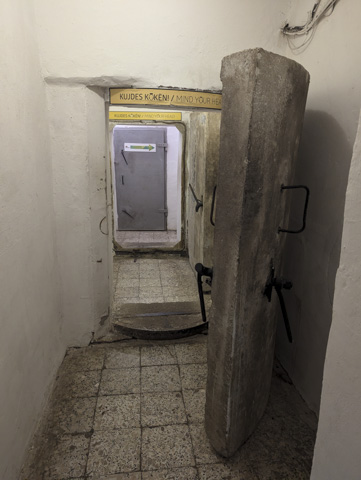
Our first destination was actually just outside the old centre behind the townhall, where the entrance to an extensive cold war nuclear bunker is located. Tours were on the hour and tickets can be bought from the townhall.
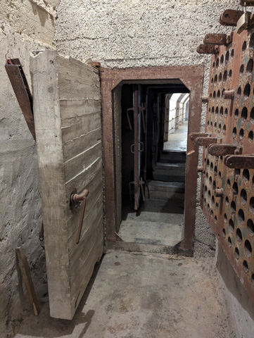
The nuclear bunker was built in the 1970’s to house 300 government officials and party elites. It was unknown to the locals until the 1990’s after the Hoxha government had fallen. When it was discovered, the angry local populace stripped most of the fittings from the bunker leaving the bare rooms and tunnels that we see today. Perhaps the most surprising thing about the bunker is that there were only 4 toilets for 300 men – I am not sure how they would have managed but luckily it was never put to the test as just like Tito’s bunker in Bosnia, it was never used.
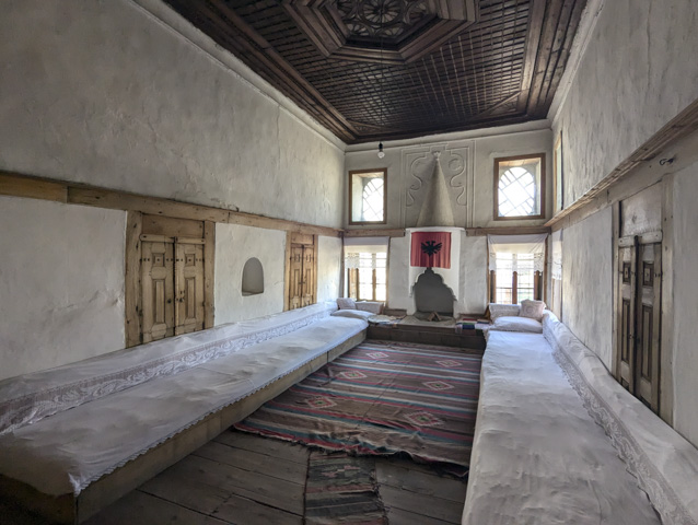
We also toured a really interesting traditional merchants house – the Skenduli house, which is still owned and run by descendants of the original owners. This was a traditional Ottoman townhouse of a wealthy family, that was built in the 18th century.
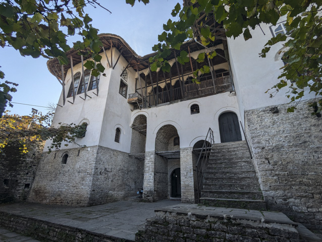
The woodwork, fireplaces and windows were beautiful and the secret stairways were fascinating but without doubt the most stunning feature of the house was the so called “Men’s Room” which was only used for family weddings. Unfortunately no pictures were allowed in this room but it was very ornate and richly decorated.
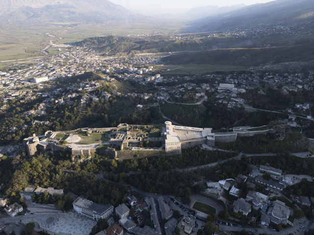
At the top of town, there is, like in most towns, a large castle, built from the 12th century onwards. The castle was built to defend the river valley it overlooks, which was a key strategic route. It fell into Ottoman hands in 1419 and Ali Pasha significantly expanded and remodelled it, including adding the clock tower which was built to enable people to see the time for prayers easily. During the communist era it was used as a prison but ever since has been refurbished as a heritage site.
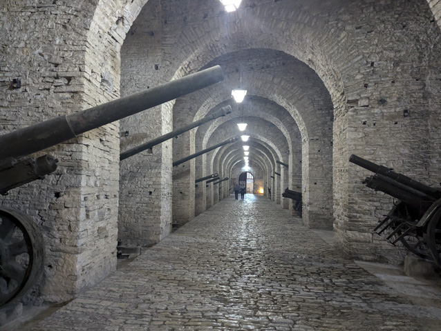
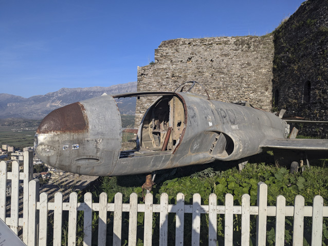
Displayed in the castle is the wreckage of an American fighter jet, a Lockheed T-33 Shooting Star, which was supposedly shot down during the cold war. The pilot was initially held as a spy but he was eventually released to return home.
Gjirokaster is a great little town and we really enjoyed our time there but if there is a next time, we definitely won’t be cycling!
Next up was the archaeological site of Butrint, but on our way through we stopped off at the famous Blue Eye Spring. This is the second Blue Eye that we have visited in Albania and was just as busy as the last one in Theth.

The Blue Eye itself is a 2km walk from the car park although they do rent bikes and escooters to make it easier and in peak season there is also a tourist bus. The site itself was fairly small and must get completely overwhelmed in the summer but the colour of the water was amazing.
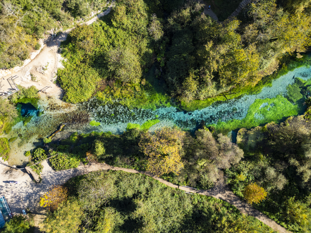
The water absolutely pumps out of the spring which is said to be more than 50m deep although no one has actually dived to the bottom. The flow rate is 18,400 litres per second and the water is only a few degrees above freezing, however this does not deter some locals from swimming despite the numerous no swimming signs.
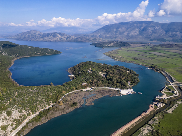
The Butrint Archaelogical park is well worth a visit and we spent a good few hours wandering around the site and museum. It was one of the most important Roman towns in Albania and is located on a headland on the coast that is surrounded by water on all sides other than a narrow access road. The town is directly across the sea from Corfu.
However Butrint remained important well after the Romans had departed as both the Venetians and the Ottomans used it as a port with their fleets sheltering in the lagoon behind the town. It did eventually fall into decline as rising water levels regularly flooded the area and it wasn’t rediscovered until the 1900’s.
Having explored Butrint, we drove along the coast and up over the scenic Llogara Pass at 1,027m. We found a lovely secluded meadow away from the road and while watching the sunset were treated to a sighting of a young deer. This was a great park-up for the night, our only problem was getting back to the road the next morning. It took a few attempts and some road re-building with rocks in the vicinity, but we eventually made it up the short but rough access path with grit, wet earth and loose stones flying everywhere. Sometimes we forget we are not still in The Beast and the poor Beastlet gets a real workout!
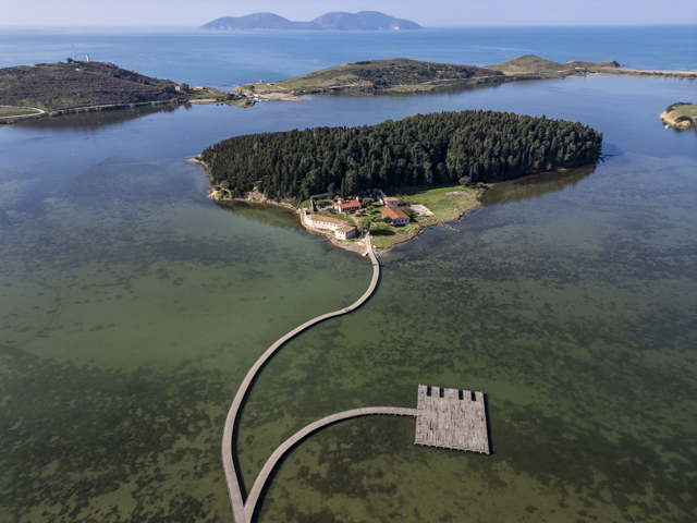
Once back on the road and down the other side of the pass you reach the busy town of Vlore. We didn’t explore Vlore itself but we did stop briefly to visit St Mary’s Monastery, which is built on an island in a lagoon and connected to the mainland by a boardwalk. It is a pretty location but the site itself is small and there were swarms of bugs, so with no reason to hang around we carried on to our next destination – Apollonia.
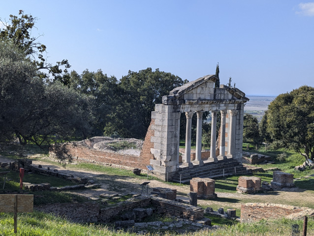
Apollonia was founded in the 7th century BC and was a prosperous city that flourished until it was partially destroyed in the 3rd Century AD by an earthquake. At its peak the city housed over 60,000 people.
The site is fairly small with much of the remains of the city unexcavated and under brush. There is however a decent small museum at the entrance to the site which is next to a church and the most interesting ruins are concentrated around the Bouleuterion or city council building which was modelled on a temple.
Apollonia makes a pleasant diversion but it is definitely not an essential stopover.
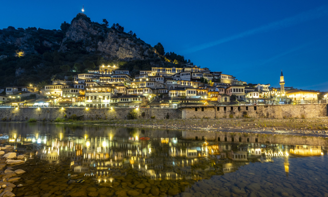
Inland from Apollonia is the city of Berat, otherwise known as the “City of a Thousand Windows” due to the architecture of the old town.
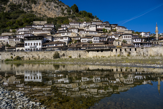
There is a new town that sits next to the river but from here you can’t actually see the old town and so, on first sight we were a little underwhelmed and wondered what all the fuss was about, especially having visited Gjirokaster which has similar buildings. However, if you follow the course of the river you reach the old town area where on both sides of the river, the old style buildings can be found which give the city its nickname.
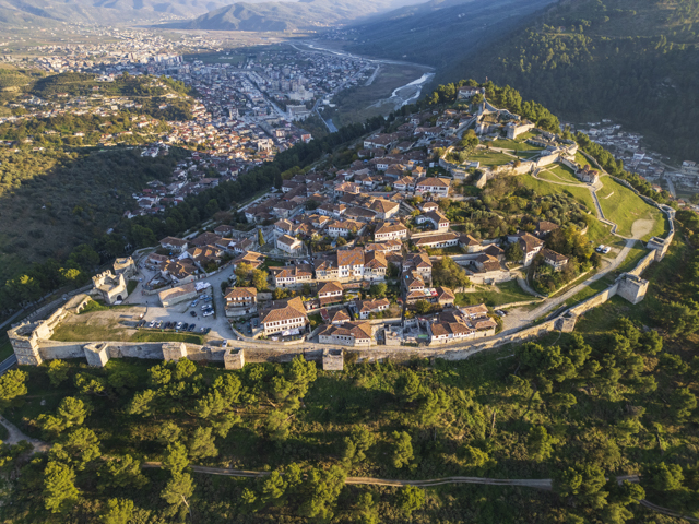
But first of course we cycled up yet another steep hill to a fortress overlooking a town, although this one also encompassed a town within its own walls. From here you get views across Berat new town but it is much more difficult to see the old town itself which is nestled directly below it at the foot of cliffs.
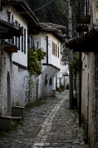
Unfortunately we were a little underwhelmed with Berat, which I find is often the case with the very touristy places where our expectations have been raised from all the hype. There isn’t actually much to do in Berat and although it was nice to wander the streets we felt Gjirokaster was without doubt the more interesting place to visit.
Having been on the move for a while we were feeling in need of some rest and laundry facilities, so we left Berat and set off back towards the coast where we settled down at Sunset Camping for a couple of nights. It was definitely low season as, apart from 1 other camper, we had the place to ourselves.
After a little time relaxing we girded are loins to head into Tirana, the capital of Albania but captured a couple of interesting sights on our way.
A remote castle and more interestingly an old cold war submarine base, although we got shouted at for photographing this so made a very hasty retreat! It is signposted and on google maps so we weren’t really sure what the problem was but with angry men gesticulating and shouting in a foreign language we weren’t about to stick around and find out.
We decided to spend a couple of days exploring Tirana and based ourselves at a hotel that let us park in the gated parking lot just a few kilometres from the centre of the city.
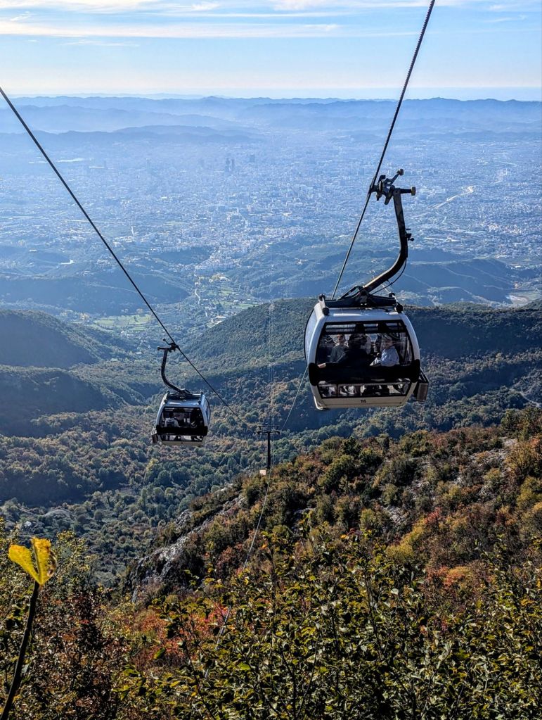
First up was the Djati Express cable car. A 4,670m long journey which takes you to the top of the Djati mountain at 1613m above sea level. There are views of the city from here but it was pretty hazy so they were not the best. At the top of the cable car there are a lot of things to do, although they are focussed mainly around families. The one thing we were tempted by (crazy golf) was closed. It was quite expensive to ride cable car and not really worth the money however it did get us a parking space in the area which we needed to go to the nearby Bunk’Art.
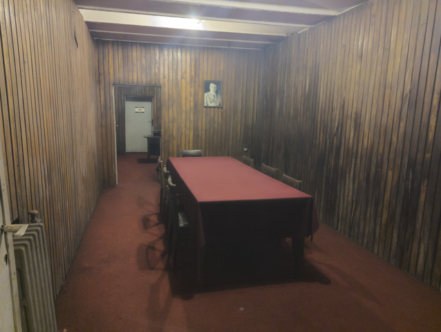
Bunk’Art is Hoxha’s main nuclear bunker for the government of Albania which has been preserved in good condition. There are a number of art installations in the bunker but most of it is just touring round the bunker as it was in the cold war era. The most surprising part was the full theatre which was designed to fit the entire Albanian government at one time.
It always surprises me in these bunkers how basic the accommodation is, even for the President. I think if it had ever come to it, trying to survive in these bunkers would have been pretty hard. They also only seem to have had three months worth of supplies so venturing out 3 months after the nuclear holocaust would have been pretty grim.
On our second day in Tirana we cycled from our hotel down a steep, fast and busy main road into the flat centre of town. We had gone in on a Sunday, our favourite day to explore capital cities as they are generally much quieter.
There are lots of modern buildings in the centre of the city and actually not many old structures. In fact the oldest building we saw was a mosque right off the central square. This was the busiest place in the city and seemed to be the no.1 destination for any tourists.
We enjoyed a really interesting visit to the House of Leaves museum, which started life as an Obstetrics Clinic, before being occupied by the Gestapo during WW11 and later as the headquarters of the secret police during the Hoxha years. This is a great museum which explores the surveillance and interrogation of the population during the communist years. The surveillance was widespread and very high tech for the times and a very large number of people were highlighted as a danger to the state. Of these a substantial number were arrested, interrogated and ultimately executed.
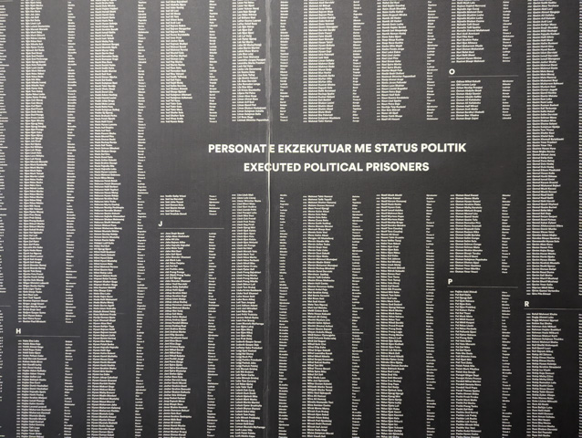
It was a good example of the way Communist states ruled by terror in those years.
On our way out of town we stopped off to look at Hoxha’s old house. You can only peer at it over the fences but it is quite nice. Apparently it was linked by tunnels to some of the key government buildings including the House of Leaves.
Not wanting to cycle back up the steep, busy main road to the hotel we decided to cycle back through Tirana Park just outside the centre of town. It is a lovely park with winding cycle and pedestrian paths but of course it was uphill and it became a bit challenging when our path became blocked by the President’s residence. Needless to say we got lost and ended up having to cycle/walk up a narrow trail through some gardens before finding the right road to get back to Hotel Baron where we had left the camper.
Tirana was our last place of interest to visit in Albania but before heading across the border back into Montenegro, we spent our last night in Albania at Camping Australia. This is a lovely new campsite set on the Buna river just outside Skhoder. We had a nice dinner here where we chatted with the friendly Albanian/Australian owner who was actually flying to Australia the next day to escape the winter. We have the same idea but first we need to head North and home.
The Peloponnese – Around the Fingers
When we finally managed to drag ourselves away from the beautiful beach in the Easternmost finger of the Peloponnese we decided we needed to pick up the pace a little bit or we would run out of our allotted time for Greece.
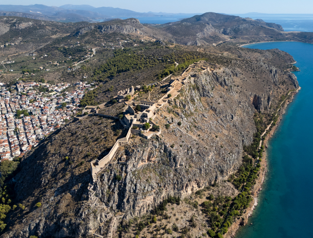
The next place to visit was the town of Nafplio. Nafplio is the regional capital of this part of the Peloponnese and although it is a small town, it has a large harbour.
There is a big castle overlooking the town called the Fortress of Palamidi. With 999 steps up to the castle from the town it could be a bit of a hike but fortunately there is also a road and small car park outside the main gate. Unlike many of the castles in this area this one is relatively new and was in fact built by the Venetians at the start of the 19th Century.
The fortress is actually huge with a number of terraces that stretch across the plateau on top of the hill overlooking the town. The further you go from the central keep the more run down it becomes.
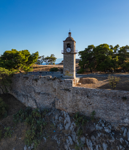
There used to be a link between this castle and another castle directly above the town but this has disappeared over the years. The second smaller castle is much less well preserved but is free to visit and you can see the clock tower that sits just above the town.
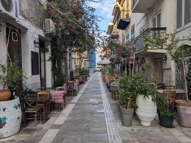
The town itself is very pleasant with narrow shady streets lined with cafes and restaurants which provide a welcome respite from the heat of the day.
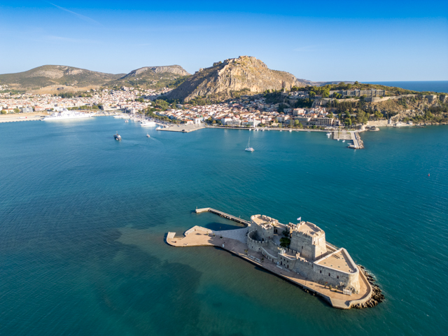
From up in the castle you can look down across the town and harbour and to the Bourtzi Castle, which is located on the island of Agioi Theodoroi.
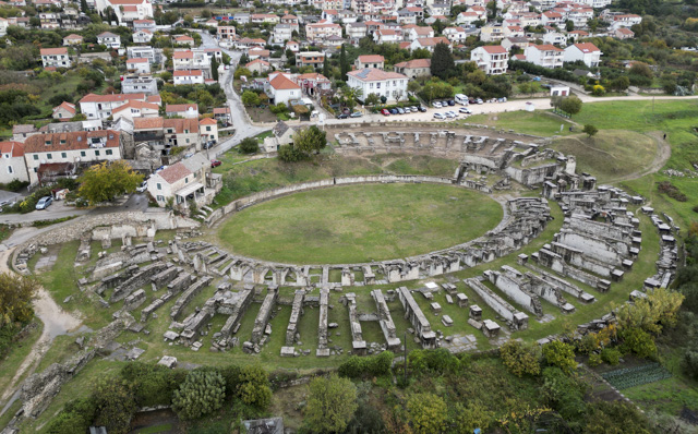
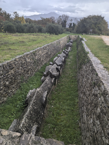
Inland from Nafplio are a couple of sites of ancient ruins. The first that we visited is Tiryns and the second and much bigger site is Mycenae. These two sites are famous for their well preserved Cyclopean masonry. This was a form of Mycenaean architecture using massive limestone boulders. We visited Tiryns first which has up to 17m thick walls where tunnels run through them. We managed to squeeze a short way into one of the tunnels but were unable to go any further. The walls are impressive but once you enter the site and climb to the top of the city there are only foundations to see.
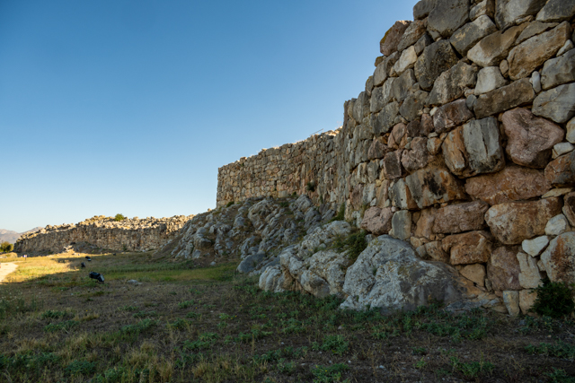
Tiryns is a hill fort which was occupied for 7,000 years from before the Bronze Age. It was part of the Mycenaean empire and in myth is said to be the location from which Hercules performed his Twelve Labours.
Unfortunately, like many of the Greek archaeological sites we have visited, there is a real lack of good informative signage so it is difficult to know what you are looking at without some prior research.
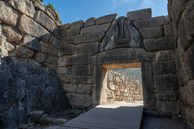
After Tiryns we moved on to Mycenae which is renowned for being the seat of Agamemnon who was responsible for the siege of Troy in the Trojan War. Between 1600 BC and 1100 BC Greek civilization is known as Mycenaen in reference to the dominance of Mycenae at this time.
These ruins are much more impressive and as such were quiet busy with coaches of tour groups. The ruins as we see them today have two main gates – the biggest of which, the Lion gate, is synonymous with the site itself.
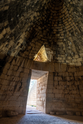
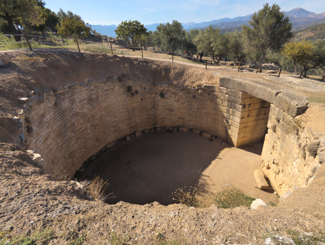
Perhaps the most notable thing for us at the site were the big circular Tholos tombs. In fact just off the site is one such tomb in which the structure is fully intact. These tombs were often used for more than one burial and personal possessions would also be placed inside the tomb to ease their journey to the afterlife or as offerings to Gods.
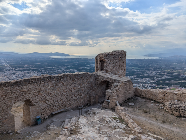
After the two ancient sites we headed to a more modern one, the Larissa Castle of Argos, which can be seen across the valley from Mycenae.
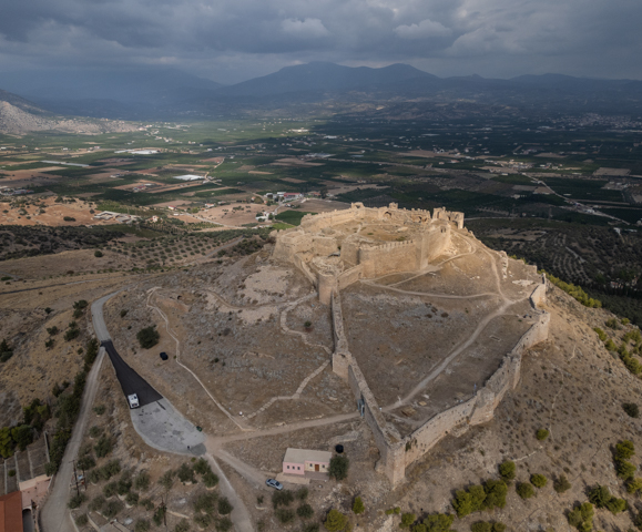
Although there has been a fortress here since Mycenaean times the modern castle was built in the 12th century.
Nafplio had held our attention for a few days but we were in need of a campsite to dump our waste and fill our water so we headed south to a well known and regarded campsite called Semeli Camping.
The campsite has a beautiful beach and free to use of their sun loungers (which isn’t always the case). We enjoyed a day lounging on the beach and sundowner beers while watching an amazing sunset.
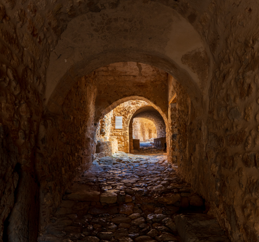
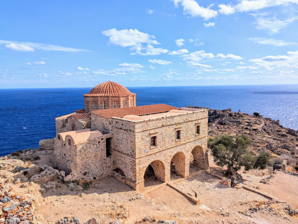
We had to keep moving though so the next port of call for us was right at the bottom of the second finger, the town of Monemvasia. There is no motorhome parking throughout the town except on a pier sticking out into the sea at one end of the town. During our visit in October this pier was full of motorhomes so it must be all but impossible to park in the high season. However we were now far enough from Athens to be out of the range of day tripping tourists so everything was much quieter.
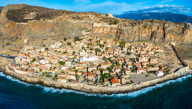
The modern town of Monemvasia is along the coast with a modern harbour. This isn’t the draw for this town though. The main draw is the narrow necked peninsula, which is the site of the ancient town of Monemvasia. The town is built entirely on the backside of the rocky cliffs of the promontory so it is entirely hidden from the mainland as a form of defence.
The old town of Monemvasia consists of a well restored and lived-in town with lots of bars, restaurants and hotels alongside old churches. This is a walled town and looks to be very well defended as the walls abut the rough seas and look all but impossible to breach. In fact, originally the only way to the city was by boat but eventually a paved pathway was built to provide access. The town is known as the “Gibraltar of the East” as a result of its location.
The second part of the city sits on a high plateau of the promontory, up 50m high cliffs.
The whole time we were at Monemvasia the wind blew strongly. I cautiously flew my drone for some shots but had to be very careful as the wind was almost too strong and on one attempt I wasn’t able to make it back to the start position so had to move along the city to get to a point where I could land it.
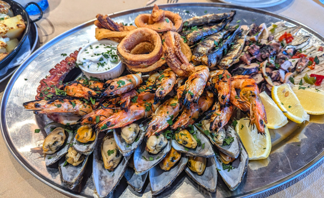
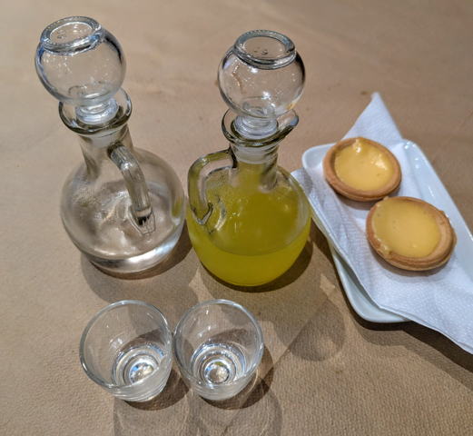
We decided to treat ourselves to a dinner of seafood while we were here and on a cold and windy evening went to a seafront restaurant in the new town which was practically deserted. The massive platter of seafood that we were served was superb and we thoroughly enjoyed it, not least because throughout the Balkans there had been very little fish on the menu. Afterwards of course there was the obligatory Limoncello and some custard tarts to finish.
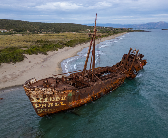
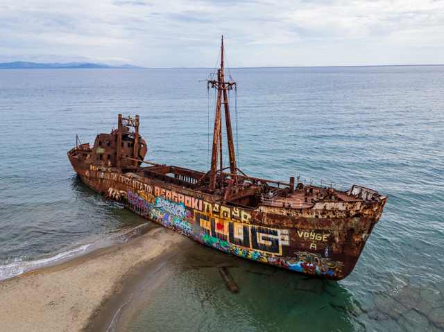
Leaving Monemvasia we drove West along the coast and stopped at a sandy beach to visit the shipwreck of the Dimitros. This is a 67m long 1000 ton cargo ship that was used to smuggle cigarettes between Turkey and Italy before being seized by port authorities. It was deliberately released from the port and set on fire to hide the evidence.
The port where it was released from was the town of Gythio which was where we headed next.
Gythio is a seaside town built up the hillside from the harbour but it only took an hour or two to wander around as there are no specific tourist spots.
We ended our day at Mani Camping, a huge campsite on a very long sandy beach. This was just a quick stop for us though as we wanted to keep moving.
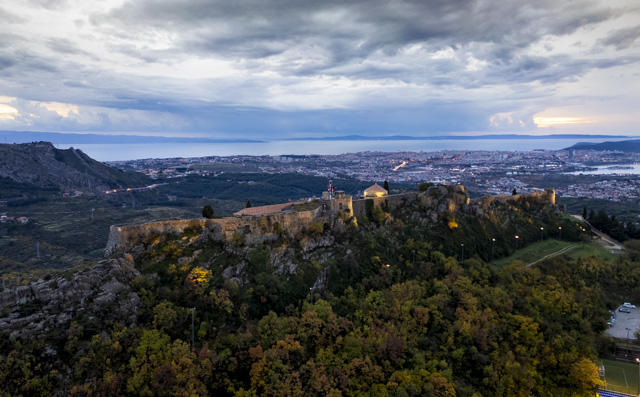
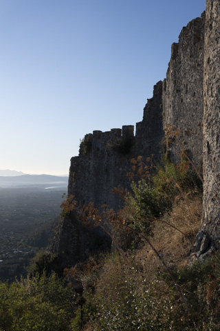
We drove inland to the ruined city of Mystras but first we stopped off at a mountain overlook for the night. There was a lovely view and when we arrived, a fire truck was parked there. It was a small space, only really big enough for two vehicles so we asked if they were happy for us to stay before settling down. It is quite common to see fire trucks parked at mountain lookouts, they spend the whole day there watching for fires and leave in the evening. We spent a quiet night here and in the morning headed to Mystras for opening time. Mystras is near the town of Sparta but there, all the ruins of Ancient Sparta have been destroyed.
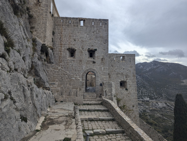
Mystras has two entrances, an upper and a lower gate. We went to the upper car park first, which accesses the fortress at the top of the city. This gives easy access to the Frankish Castle which caps the peak of the hill on which Mystras is located. The castle was built in 1249 by the Frankish leader Guillaume de Villehardouin. The castle itself is just bare walls these days with no remaining rooms but the views across the area are good and worth the climb.
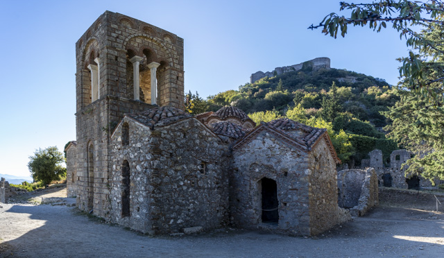
After exploring the fortress we moved the Beastlet down to the lower car park and explored the ruins of the Byzantine city from there. It was a good thing that we arrived early as the small car park was completely full by the time we left.
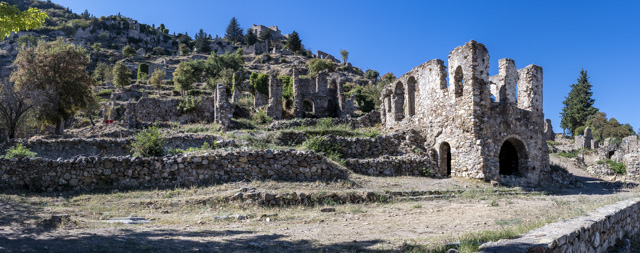
The town itself is largely just crumbling walls but there are a number of churches, monasteries and frescoes that have been preserved and it is definitely worth a visit. The majority of the city dates from 1271 to 1460 but it was a thriving town until 1715 when it was captured by the Turks and then burned during the Orlov uprising in 1720 and what wasn’t burnt then, was in 1825. It did remain inhabited until 1954 but was a shadow of its former self.
After leaving Mystras in the early afternoon we drove towards Kalamata which involved driving over Langadha Pass in the mountains which reaches over 1,300m. We decided to spend the night in this spot with beautiful views before dropping back down to the coast the next day.
In the morning we skirted the city of Kalamata before ending up at a campsite that we had been recommended, called Camping Loutsa. This was just outside the small fishing village of Foinikounta and was situated on a beautiful sandy beach. The campsite was due to shut for the season in a few days and wasn’t very busy meaning we found a spot on the front rank looking out over the sea.
We stayed a couple of nights and enjoyed swimming and lazing on the lovely fine golden sand. In fact if we had more time and they weren’t closing for the season we would have definitely stayed longer as this was probably our favourite ‘campsite beach’ so far, but time was running out and we needed to keep moving in order to meet our timetable, albeit self imposed.
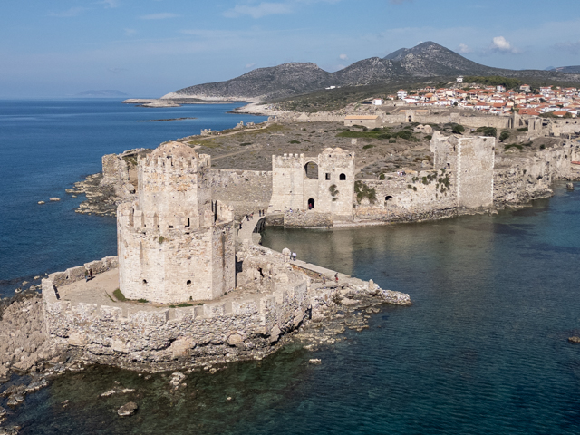
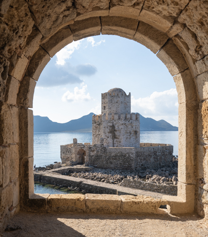
Only a few kilometres along the coast from here is the town of Methoni, which has a large castle on a promontory sticking out into the sea, built by the Venetians in the 13th century. It is one of the largest castles in the Mediterranean and off the tip of the mainland is a fortified inlet, which was used as a prison and place of execution during the Turkish occupation. Called Bourtzi it was built in 1500 and is connected to the main castle by a narrow paved walkway.
From Methoni it is only a short drive to the town of Pylos. This is a lovely town that I’ve visited a couple of times before by yacht as it makes a very convenient stop over on the way from the Ionian to Athens. Arriving by land provides a very different perspective although we parked up next to the marina, which was only a few minutes walk from the centre of town.
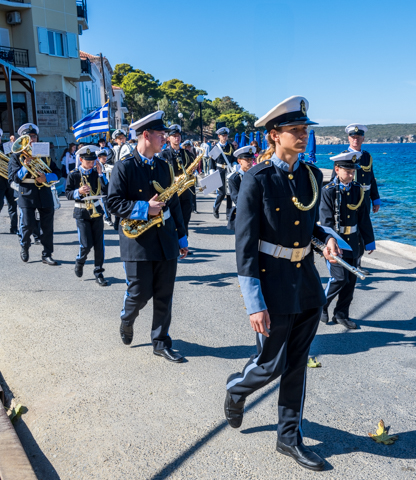
Unbeknown to us, we had arrived on a bank holiday and we were treated to parade of children in costume and a marching band with the whole town there to watch. The best thing about the bank holiday was that the entry to all the monuments and museums was free, so we headed to the castle on the headland above the town to have a look around.
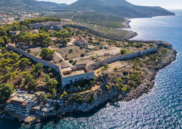
The castle was sprawling and little remained inside other than the outer walls and the inner keep. There were however a couple of small museums inside the walls to checkout.
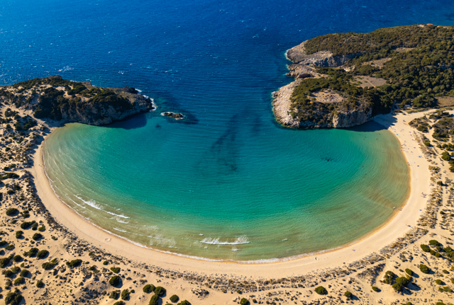
Only a couple of km’s down the road from Pylos is a well known, very pretty and popular beach called Voidokilia beach. The beach backs onto a lagoon, which hosts a large population of flamingos. Unfortunately we weren’t able to get close enough to the flamingos for a good photo as they stayed far enough away to remain undisturbed by any tourists.

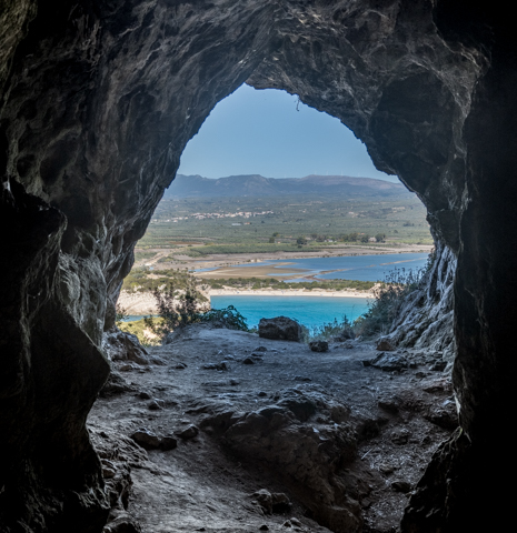
Above the beach is a cave called Nestor’s cave. Nestor was a king of Pylos who features in the Iliad.
Further up is the Old Navarino Castle which is a thirteenth century Frankish castle that was in use until around 1825. The castle is in some disrepair and is officially closed but there is a rough path up to it and a rope at the top to help you clamber over the walls into the interior of the castle.
Our last stop on the Peloponnese was the ancient Greek ruins of Olympia, the birthplace of the Olympics. Olympia didn’t function as a proper city but was a training camp for athletes that competed at the Olympics, which as in modern times, were held every four years, with “champions” attending from all the major cities across Greece.
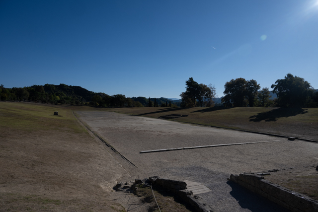
The original stadium where the games were held can be visited but it is just a depression in the ground. However, the original entrance to the stadium has been reconstructed and you can also see a row of 16 stone pedestals leading down to the entrance, which were engraved with the names of cheats to shame the athletes, their city and to dissuade others from cheating. In ancient times, bronze statues of Zeus (Zanes) would have sat atop the pedestals.
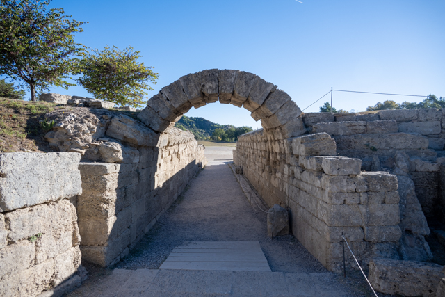
The ancient Olympics had far fewer sports than we are used to these days and in face started as only a single foot race. However, in the years following the first Olympics in 776 BC, other races were added and wrestling, boxing and chariot races were also included. The event that appealed to me most was the last foot race added in 520 BC, the Hoplitodromos, which was a race where the participants had to wear helmets, greaves (armoured shin protectors) and carry a heavy shield. The race was around 400m which must have been hard work with all that heavy metal.
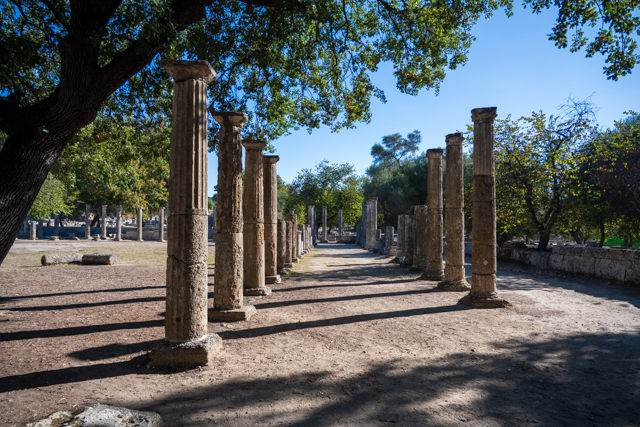
The site at Olympia is split into two places, firstly the ancient ruins and then a very good and informative museum.
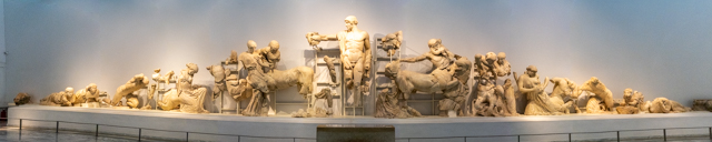
Olympia was the end of our time in the Pelponnese and we were also very close to the end of our time in Greece. We needed to start the long drive home and we had left ourselves a month to complete this but, we had unfinished business in Albania and Montenegro, where we wanted to finally visit all the places that had been too hot for us to visit at the height of the Summer.
The Peloponnese – Part One
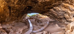
Having spent the best part of the last three months at altitude, it was time to descend the mountains and hit the coast where the temperatures were finally perfect for us, with the days in the high 20’s to early 30’s and cooler nights.
From Delphi we dropped down into the valley and drove along the coast, passing many tempting looking spots where we could have parked up on the water, until we reached the massive bridge which links the town of Patras with the mainland. The Rio-Antirrio Bridge is the longest fully suspended cable-stayed bridge in the world and was opened in 2004 (hitting its deadline of being opened by the Athens Olympics with 1 day to spare).
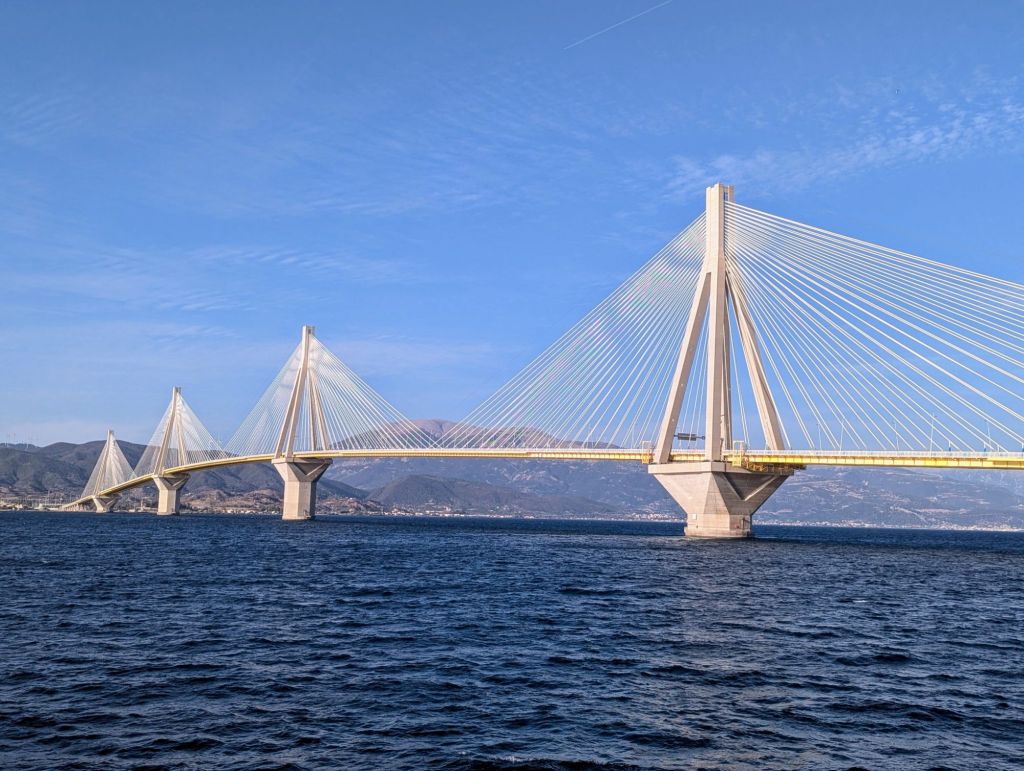
The toll for the bridge is pretty high and there are cheaper ferries which you can take to cross the Gulf of Corinth, however we missed the turn-off for the ferry and were stuck crossing the bridge.
Once across you are only a few kilometres from Patras and we had an appointment in the city. I had been suffering with fairly bad toothache recently so I managed to find an English speaking dentist in the city. We found free parking around 1 km from the centre, albeit in a fairly sketchy looking car park and I walked into town for my appointment leaving Sarah to guard the motorhome.
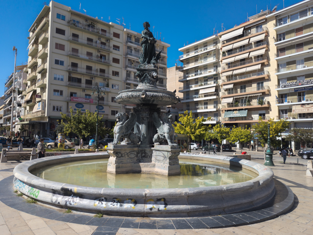
I took the opportunity for some sight seeing around town which is a busy port town with what felt like a real café culture in shady streets away from the still blazing daytime sun.
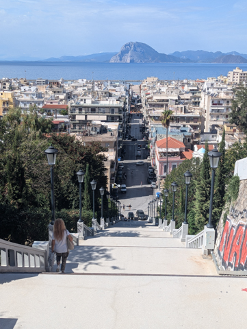
The dentist was super modern and although it turned out that I needed to have one of my wisdom teeth removed he dealt with it easily and it was probably the best dental experience I have ever had. Coincidentally, the dentist used to work in Fulham – London, very close to home, and spoke excellent English. The best bit was at the end when I was presented with the bill for €50! I actually did a comedy double take as in the UK this would probably have cost at least £300.
We didn’t intend to hang around Patras and we drove up into the mountains to the East of the city to visit a monastery which we knew allowed free overnight parking. Unfortunately the next day we woke to torrential rain and low cloud but it didn’t stop us touring the monastery first thing. This was to be the last we saw of rain for over a month so we shouldn’t complain.
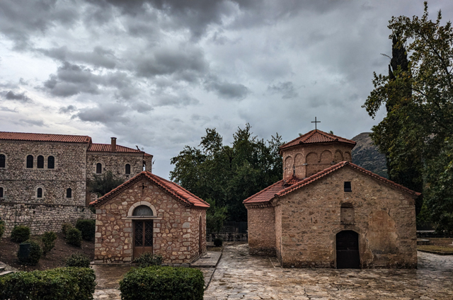
The Agias Lavras monastery is above the town of Kalavryta and sits at over 800m. It was built in the 10th century, although like many monasteries it has been repeatedly destroyed and rebuilt over the years. It is famous as it is credited by some as the birthplace of the Greek War of Independence in 1821.
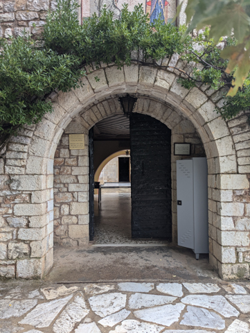
I enjoyed the warning sign on the gates of the monastery that prohibits women wearing provocative clothing, such as trousers – I shudder to think what they would think of a miniskirt.
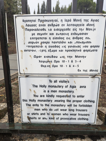
Upon leaving the monastery we immediately turned onto a very steep hill. The Beastlet was very cold and wet and as soon as we tried to accelerate up the hill the check engine light came on and we were plunged into limp mode. We managed to slowly grind our way to the top of the hillside where we visited a monument to the fallen heroes of the 1821 war of Independence.
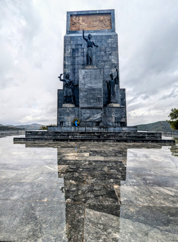
Not knowing much about engines we were hoping that while we were checking out the sights the Beastlet would rest, the electrics would reset and all would be well with the world again. Unfortunately that was not the case. The check-engine light reappeared and, being on top of a hill-side in the middle of nowhere, we had no other option than to limp on and hope for the best but there was drama to come.
Following our sat nav (big mistake) we limped along through the town of Kalavryta and then up yet another hill to get onto the main road to the Cave of the Lakes in Kastria where we had originally planned to spend the afternoon and stay the night. The hill got steeper and steeper and as we turned a corner we saw the road surface change to a slippery marble-like material and a pickup truck ahead wheel-spinning and struggling on the wet surface – I knew then we were in trouble. There were two strips of concrete down the middle for the tyres but we were too wide to fit on them. It wasn’t long before our wheels started spinning and we came to a halt.
The road was so steep that our handbrake wouldn’t hold us and we just started sliding backwards. The only thing we could do was reverse a bit and try and hit the steepest bit again as fast as we could in the hope that we would keep traction and get over it. No luck though, we just spun out time and time again and being in limp mode from the check engine light was definitely not helping. At this point an elderly gentleman from the house on the corner, who clearly has to do this all the time, came out to ‘help’ us. I’m not sure whether adding a third person into the mix helped at all but with some hand gestures and broken English he did explain that there was a driveway half-way down the hill where we could turn and for that little piece of information we were grateful.
So we started the long, slow reverse where we then got stuck on a bend and couldn’t make the corner. Thankfully the corner wasn’t on the steepest section of the road so after several wheel-spinning and stalling attempts and a terrible burning smell coming from the engine, tyres or maybe both, we finally found some traction to move forward enough to re-align ourselves so we could continue to reverse back down the hill. We came within a centimetre of knocking down a wall and destroying the side of the camper, not to mention what we were doing to the engine but we eventually we reached the driveway, took a huge sigh of relief and turned ourselves around. The fact that there were no other cars on this country road in the half-hour it took for this drama to play out was a blessing but also a sign that somewhere close by there was a better road that we should have taken. Yes sat nav, I’m talking to you!
Once we got back to the town we pulled into a parking spot where we called our break-down cover (no help at all) and did an internet search trying out a bunch of methods to reset the check engine light while waiting for our blood pressure to go back to normal. However nothing we tried made any difference so we decided our best option was to ditch the Cave of the Lakes and head out of the mountains (at least we would be going downhill) to a campsite on the coast near the town of Akrata, where we would have more chance of finding a mechanic. The campsite we found was almost full and the pitches were so small that our 6m camper was sticking out of the pitch but it was right on the beach and best of all, it had a bar which we happily collapsed into after a very long, stressful day. The next day the skies cleared, the sun came out and when we tried the engine it started up without any problems and no check-engine light – what a difference a day makes!
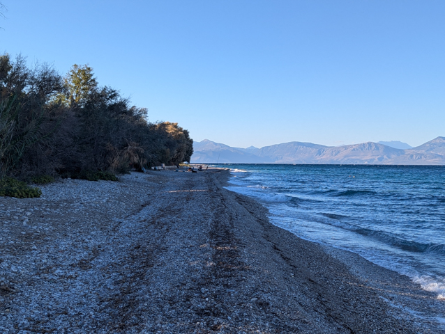
We decided to stay a couple of days turning the engine on each day in our paranoia just to check it was still OK before we gingerly drove off and thankfully put the engine problems behind us.
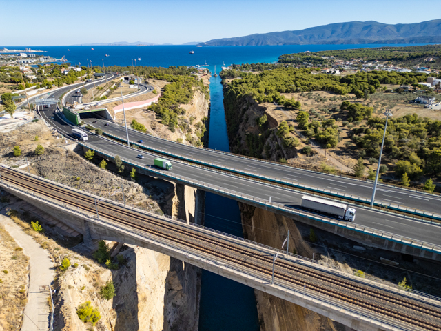
Our next port of call was the Corinth Area on the Eastern side of the Peloponnese where we visited the amazing Corinth Canal. This is a 6.4 km long narrow canal cut 90m deep through the isthmus of Corinth with near vertical cliff walls. It is only 24.6m wide at its narrowest bit and is therefore not suitable for most modern ships. However it cuts a significant distance off the journey from Athens to the West so it is still used by pleasure craft and some smaller commercial ships.
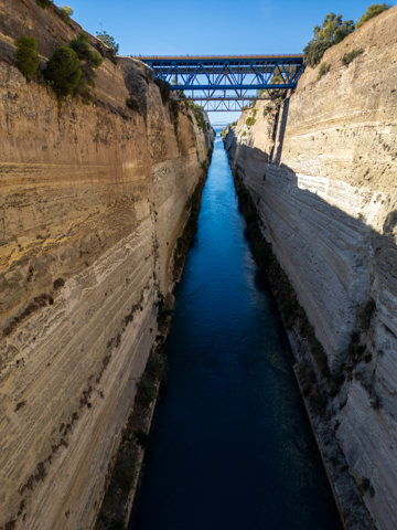
The canal originally started to be excavated in 67 AD but this attempt failed and despite other attempts over the years it wasn’t completed until 1893. It was never really a commercial success even in the early days and is prone to damage by seismic activity, in fact I was due to sail through it 2022 but it was closed due to earthquake damage and we had to go the long way around !
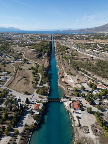
At both ends of the canal are submersible bridges which sink 8m down to provide for the draft of boats.
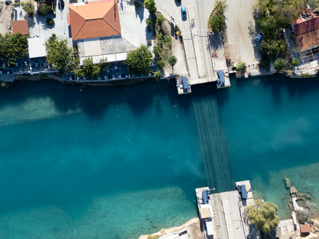
After spending some time at the canal we headed to the ruins of Ancient Corinth. The site of Ancient Corinth is 5 km’s away from the modern town and is a site that has been continuously occupied since 6500 BC. By classical times this was a big city and rivalled Athens in its wealth. It was known as “Sin City” in ancient times and was renowned for its large number of prostitutes.
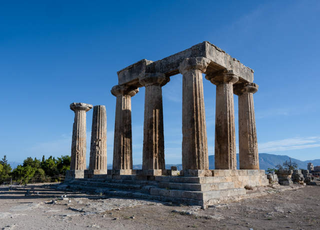
Built high on a hill at an altitude of 575m above ancient Corinth is a fortress known as Acrocorinth. The fortress has endured through many owners and Roman, Byzantine, Frankish, Ventian and Turkish construction is layered over and around each other.
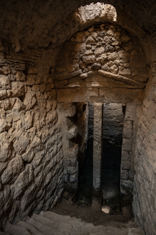
The castle surrounds the two peaks of the hill and beneath one is the Fountain of Peirene, supposedly the favoured watering hole of Pegasus.
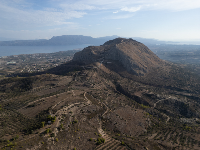
The castle allows for a good hike as it is large and built around the summits – there is a lot of climbing to be done in the castle itself to explore the ramparts and various ruined buildings.
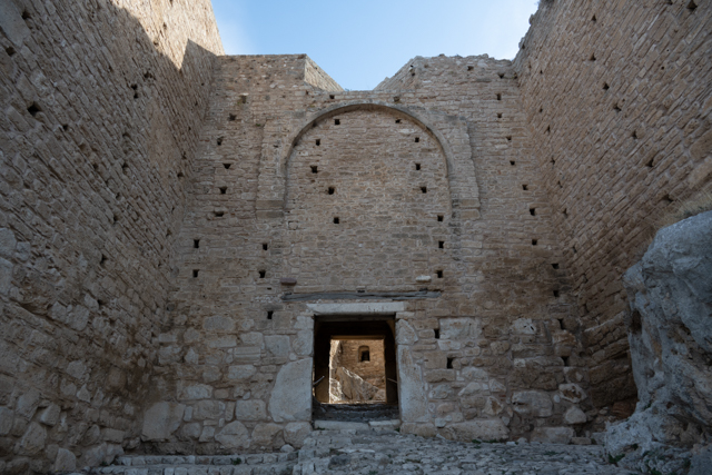
There is a tower near the top but unfortunately although it can be climbed you aren’t allowed out onto the roof to get views of the area and have to make do with the views from the base.
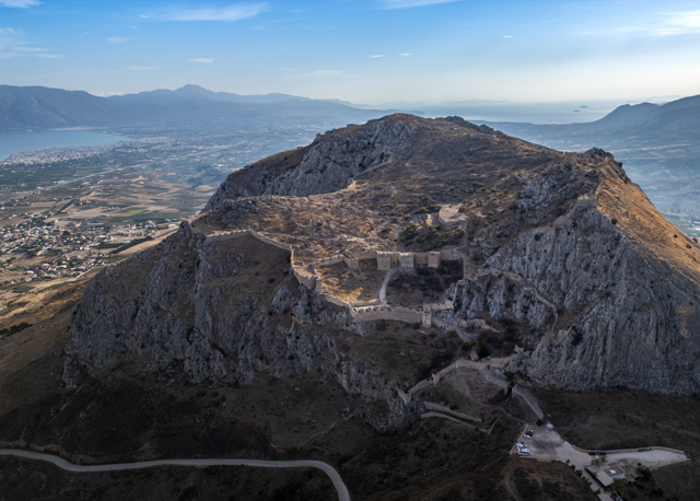
After exploring the Corinth area we carried on South along the coast of the Peloponnese to another busy campsite called Bekas Camping. There were a huge number of Large German campers here who were settled in all along the seafront pitches for long periods of time. We settled for a shaded spot away from the shore in a quieter part of the campsite.
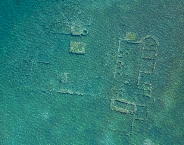
The campsite was on a long shingle beach but, about a 500m walk down the beach, there was easy access to snorkelling over the ruins of a Roman villa, where you could see the remains of large amphora. The outline of the walls were really obvious from a drone shot and even snorkelling you could see the walls up close.
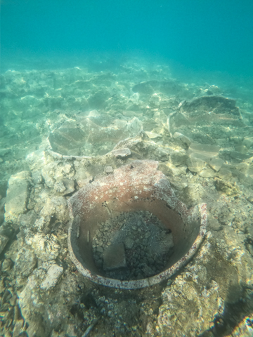
The campsite was also close to the Ancient city of Epidaurus, which is famous for its huge theatre and well preserved ball court. The rest of the ruins of the city are really only foundations and it is difficult to get too much of a sense of what they represent.
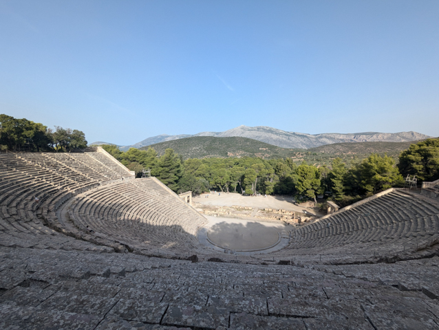
The theatre was constructed in the late 4th century BC and is considered to be one of the most perfect Ancient Greek theatres both in terms of acoustics and aesthetics. It was large enough to hold between 13 and 14 thousand spectators. There are 55 tiers of which 34 were reserved for priests and Lords.
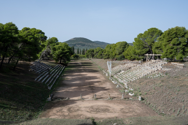
At this point we had been moving quite a lot and had stayed in some busy campsites so we were craving a little peace and solitude. We had done some research and found a remote beach that we thought we could camp on in the South of the Eastern-most finger of the Peloponnese, so we decided to investigate.
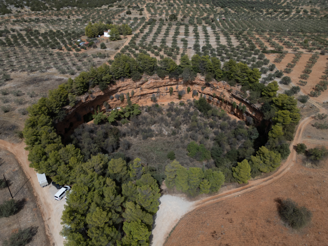
On the way there we stopped off at a pair of large sinkholes know as the Caves of the Twin Dolines. The smaller of the holes is accessed through a staircase that goes down a tunnel into the sinkhole and there are two rock cut churches within the hole itself.
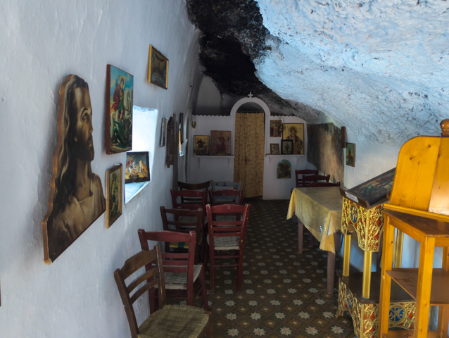
When we arrived in the sinkhole we found a television crew hard at work. They were from Poland and filming a TV series investigating what makes successful athletes such high achievers. We spoke to one of the producers and asked why they were filming there, he just shrugged and gestured around himself, because it’s beautiful. Well, we couldn’t argue with that.
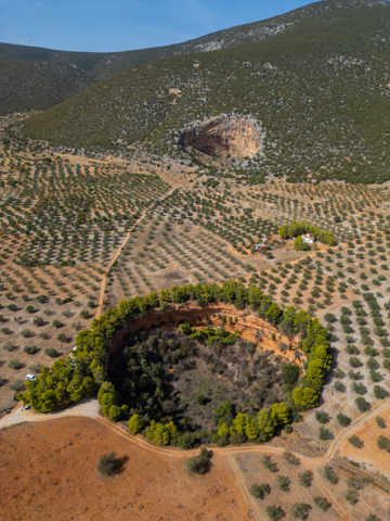
It was a really hot day and we were ready for a swim so we carried on to the beach where we hoped we could stay the night and when we arrived we were really pleased to find that there were only a couple of motorhomes there and that it was otherwise deserted.
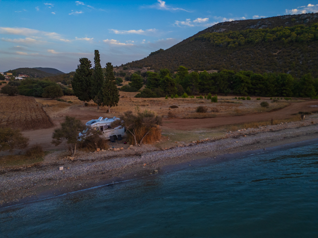
We found a spot only a couple of metres from the water, with some shade from some bamboo and what felt like our own little patio. We were to stay here for 4 nights, until a lack of food and drinking water (our planning had been poor) forced us to move on.
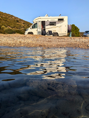
Apart from being a great location for swimming and snorkelling (I even saw a turtle), there is a cave around 500m around the cliffs from the beach (not accessible by vehicle), which has been inhabited since neolithic times. The cave has been well preserved and unusually for Greece there were some excellent signs explaining what we were seeing. The cave is called the Franchthi Cave and humans first occupied it in the Upper Paleolithic around 38,000 BC. It was occupied for 35,000 years until 3000 BC but even after that it was used as a shelter for shepherds and their flocks right up until the 20th century.
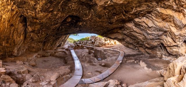
It was around this time that we realised we had woefully underestimated how long it would take us to drive around the Peloponnese and the one month we had allocated was never going to be enough. Still, it gives us the perfect excuse to come back another time!
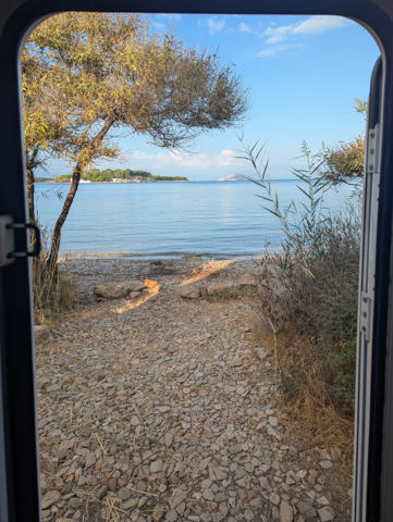
Meteora and Delphi
Having enjoyed the Greek mountains so much we decided to prolong our time there before heading towards the coast, so we made our way to the lovely mountain town of Metsovo.
Metsovo, in the Pindus mountains, is the main regional hub for the surrounding area despite only being a small town. The elderly gentlemen who gather in the small, bustling main square each day to watch the world go by are very friendly and were keen to tell us all about the history of the town, its church and the ancient trees in the churchyard that have grown into the shape of a cross (although we couldn’t really make it out ourselves).
Above the steep-sided town, close to where we parked, is a memorial to the fallen of the 40th Cavalry Division fighting Mussolini’s army in 1940, as well as a genuine M24 battle tank.
While below the town is the 14th century Holy Monastery of Saint Nicholas of Metsovo, which still has four resident monks. You can ring on the doorbell and a caretaker will appear and (somewhat grudgingly) show you to the beautifully painted church. There is also a little shop where you can buy some of their award-winning wine.
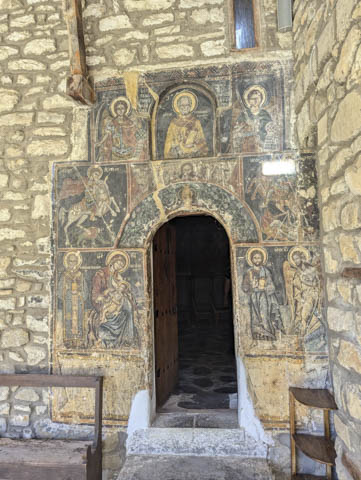
We decided to stay in the Metsovo area for a couple of days near an old ski resort, where we spent a peaceful couple of days with only the cows and a few stray dogs for company.
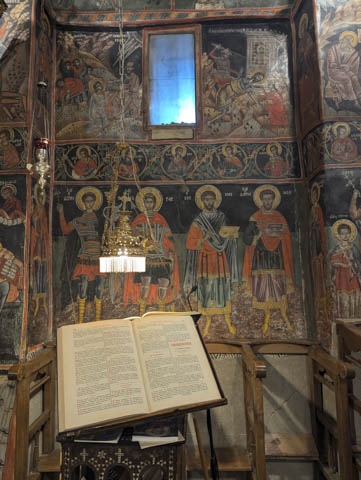
Not far from Metsovo but further up into the mountains is the reservoir of Aoos Spring Lake and this was a real gem. We drove all around the lake until we found the perfect spot for us.
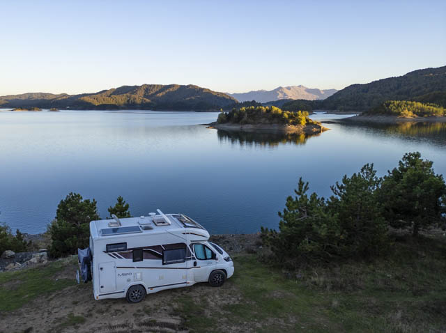
The view of the lake and its many islands was spectacular from here.
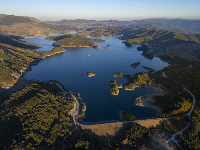
We loved this place so much that we stayed longer than expected. Each day in the morning a large flock of sheep was escorted passed us by a pack of flock guardian dogs and back the other way in the evening. There was no sign of a shepherd but the dogs seemed to have it well in hand. They were a mix of breeds and some were very friendly and others more wary. One dog, who we nicknamed Stavros, seemed to be less conscientious than the others and would spend the day with us, lazing in the shade of our camper, and then join his flock again on their way back in the evening.
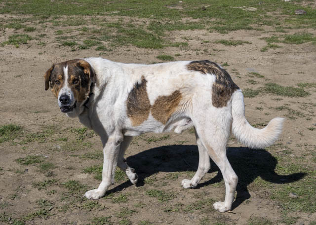
The highlight of our time at the lake was on our final evening when we built a fire ring from stones lying around and had a campfire from wood that we scavenged from the area.
We kept it burning all evening and it provided enough warmth to allow us to sit out and watch the stars appear. The stars here were beautiful, far as we were from any light pollution.
Unfortunately we couldn’t stay here forever and it was time to move on – our next stop was somewhere we had been looking forward to visiting ever since we had heard about it – Meteora.
Meteora is famous for its clifftop monasteries. Most people have heard of this place through the James Bond film, For Your Eyes Only, where Bond had to climb up the pinnacle to the monastery at the top.
At one time there were 30 monasteries built on the cliffs in Meteora. They were built in these inaccessible places (only accessed originally by a network of ropes, ladders and pulleys before the modern staircases were carved into the sides of the rocks), not only to allow the monks to be closer to God but also to provide protection from bandits and oppression.
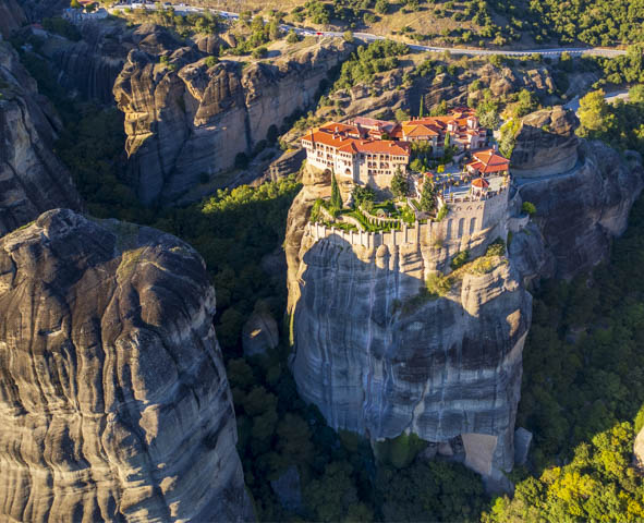
Monks have been living on these cliff tops since the 9th century but it wasn’t until the 14th century that the larger monasteries that we see today were constructed. The hey day of the monasteries was between the 15-17th centuries, after which time they started to decline mainly due to raids by thieves and conquerors. Many were abandoned and today only 6 monasteries are still active.
Staying the night in a motorhome near the monasteries themselves is prohibited, so we stayed in a campsite in the town of Kastraki, at the foot of the mountains. The campsite was absolutely heaving with around 100 campers each night. It did however have a nice swimming pool.
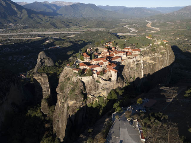
We got up very early to drive up to the monasteries for sunrise and to make sure we could get in the car parks before they filled up, which proved to be very sensible as it became very busy with tour buses as the day progressed.
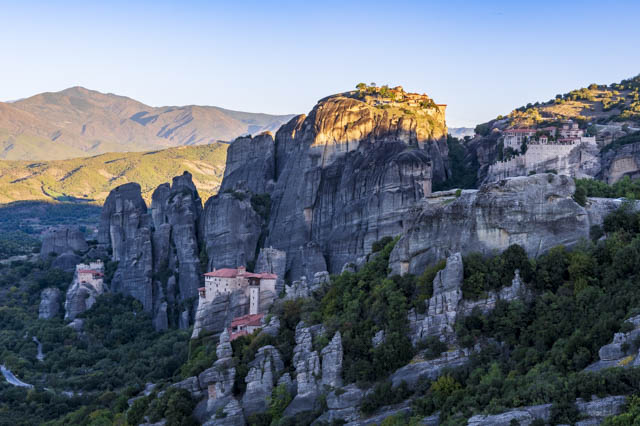
We visited two of the six monasteries and went to the major viewpoints to get a good look at the area. The interior of the monasteries wasn’t actually that interesting and they were very busy with big tour groups but the viewpoints definitely don’t disappoint.
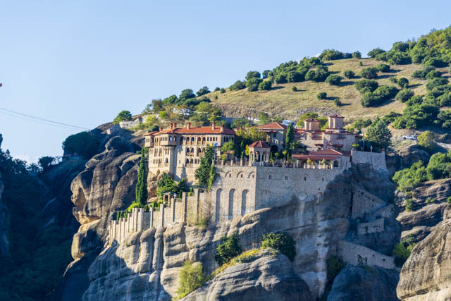
Only a 10 minute walk from out campground we found a monastery that is off the beaten track but it is not possible to visit the interior. The views from the outside were interesting and we saw a monk having his morning coffee on the balcony, safely ensconced above us. There were also old and broken down platforms around holes in the rock, where hermits used to live !
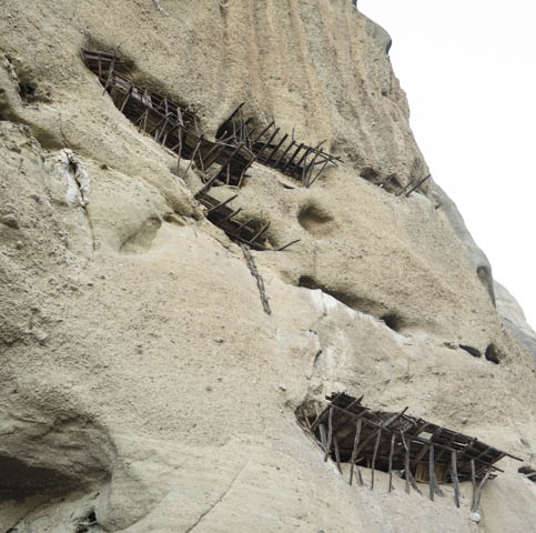
In the same area, and not connected to the monasteries, are some ancient rock dwellings that pre-date the monasteries themselves which can be visited and we enjoyed poking around in them.
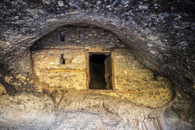
Meteora is definitely spectacular but it was very busy with tourists and after we had seen what we came for we were glad to get away and we continued driving towards the coast. But first we stopped at Delphi, an ancient Greek site, famous for the Oracle of Delphi.
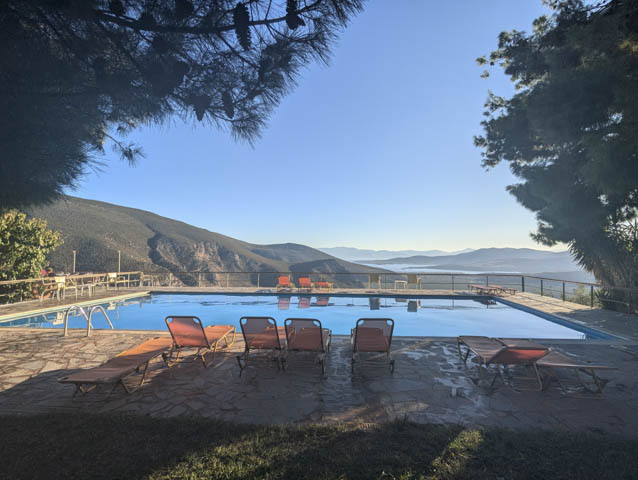
We stayed at a campsite which was perched on the hillside with an amazing view over a swimming pool to the coast far below. This was our first glimpse of the sea since May in Croatia.
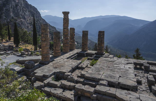
We visited Delphi first thing in the morning in order to get a parking place in the very small parking area and hopefully avoid the majority of the tour groups. We managed to get a place to park which wasn’t too far away from the entrance but we failed to avoid the tour groups and it was pretty busy.
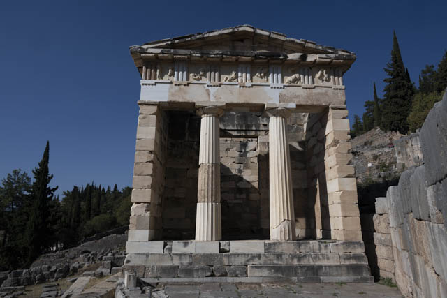
As we were to discover, there is minimal reconstruction at Greek ancient ruins and the signage is fairly poor so it is difficult sometimes to understand what you are looking at. Greek sites definitely require a tour guide or some internet research beforehand to understand what you are seeing.
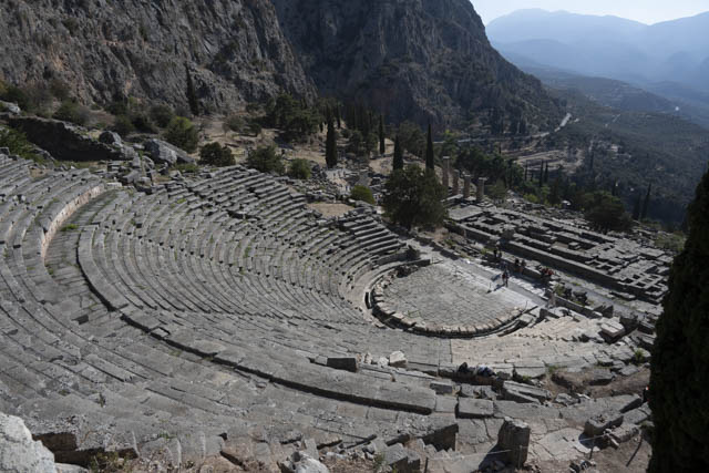
Delphi itself is built into a steep hillside with temples at the lower end, a theatre in the middle and a stadium right at the top. Delphi was a site built around the Temple to Apollo but it was also the site of the Oracle of Delphi. This was the most famous ancient Oracle, actually called Pythia, and was a woman over 50 who was supposed to communicate directly with Apollo. Pilgrims would seek Apollo’s wisdom and she was incredibly influential. The last prophecy was given in about 393 AD when the Romans passed laws to ban paganism.
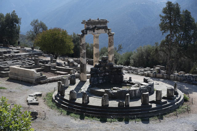
Down the road a few hundred metres from the main site is another site which holds the Athena Pronea Sancuary or Tholos which was the first temple that pilgrims to Delphi visited when they arrived.
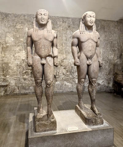
We were ultimately a bit underwhelmed by the site itself but the museum which is on site was very interesting with some very well preserved statues.
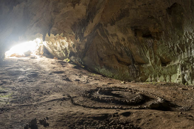
A few miles away from the site of Delphi, in the mountains above, is the Corycian Cave. The Corycian Cave was believed to be the home of the Corycian Nymphs and the ritual home of Dionysus. Even today some form of pagan worship is carried out here and the rock maze on the cave floor is testament to this. The cave can be accessed by a very rough 4×4 track but we parked up about 4km away and hiked up. The cave itself has an easy entrance and a large 1st chamber, however you can climb up the slope at the back of the cave and enter another chamber which is completely dark and then from there you can also go to a third chamber but it gets increasingly difficult to progress so I stopped at this point.
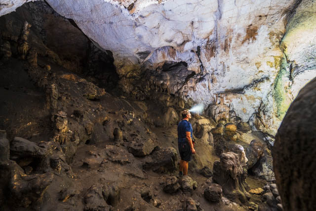
Next stop was the Peloponnese, more ruins and some lovely beaches but that is for the next post.
Finally Greece
After 3 months out of Schengen we were clear to go back into the Schengen zone once again and we wouldn’t have any problems with timings for the rest of our trip. It felt like we had been heading for Greece for a long time and it was exciting to finally get to the southernmost country of our journey.
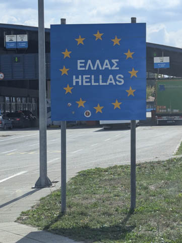
After a quick border crossing, where bizarrely there were peacocks roaming around the border security booths, we were back in the EU.
Hardly surprisingly, as we approached Greece from North Macedonia, we entered the country through the Macedonia region, which is fairly mountainous and seems to have more in common with the rest of the Balkans than the coastal regions of Greece that are more familiar to us.
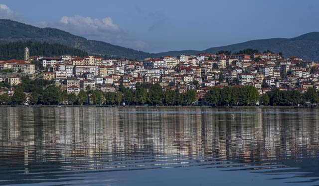
Our first port of call was Kastoria, a lakeside town on an isthmus, with an old town on the side of a steep hill. We parked up in a free lakeside car park for the night and were treated to beautiful sunset views across the lake.
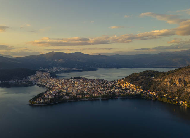
The following morning we jumped on our bikes to explore the old town. Kastoria is a town that grew rich on the fur trade using the pelts of local wild beavers. Unfortunately they were hunted too extinction in the area by the 19th century. Despite this, the fur trade was kept alive with farmed beavers and imported pelts and even today, we were surprised to see, that there are still many fur shops around the town.
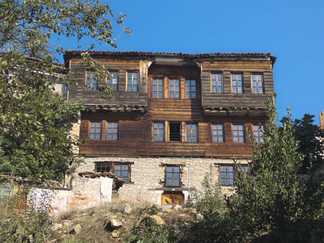
One of the highlights of Kastoria are the grand old mansions of the fur-trade families, which date from the 17th-19th century.
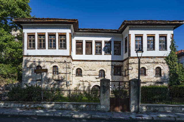
After exploring the town we headed to Dragon Cave where we did a self guided tour of the main chambers, one of which had more stalactites than I have ever seen before in one cave.
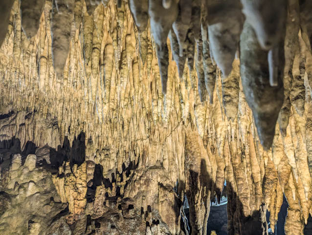
After Kastoria we continued to head South with the ultimate goal of getting to the Peloponnese but we were soon distracted by the beautiful Greek mountains.
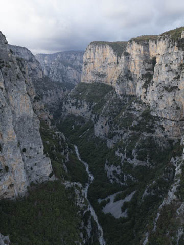
We headed to the village of Monodhendhri which overlooks Vikos Gorge and is a great starting point for a hike into the gorge. The village itself is a great example of a Greek mountain village with narrow stone paved streets.
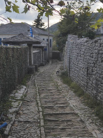
A short walk from the village itself is the monastery of Ayia Paraskevi which is perched right on the edge of the gorge and from here, there is a cliff edge walk that goes to a cave, Megali Spilia, which was once used as a safe haven for the villagers when they were under threat. A head for heights is definitely needed for this path as it is narrow and the drop off to the gorge would almost certainly be fatal.
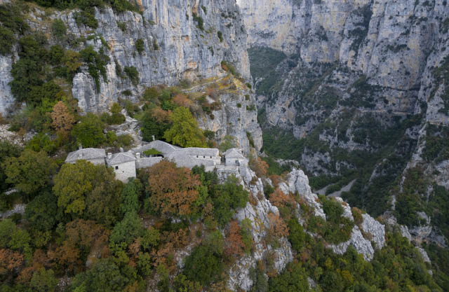
Vikos gorge itself is 1,000m deep in places but while we were there the river running through the gorge was dry with only some puddles along the way.
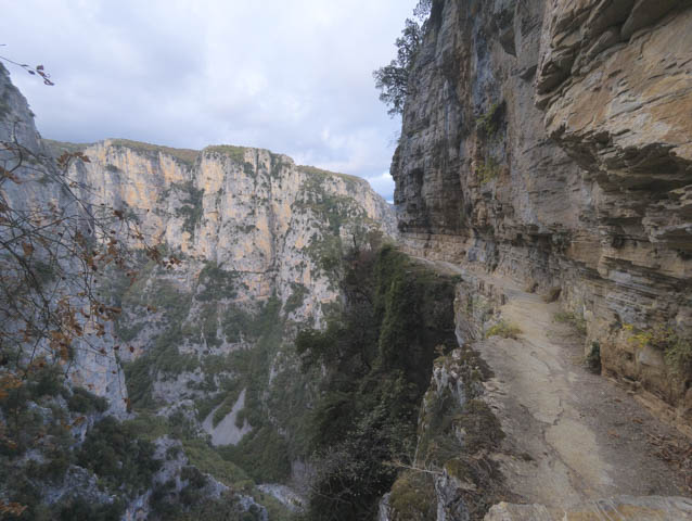
I hiked down into the gorge from Monodhendhri and walked around 8km along the river bed but the views were limited as much of the hike was under trees and the hike back up was fairly brutal, so I wouldn’t say it was particularly worthwhile.
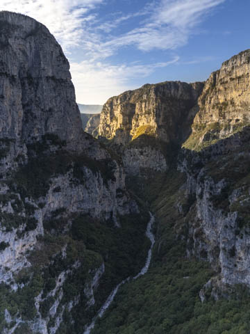
After leaving Monodhendhri we drove back down into the adjacent valley and headed around and back up to another village on the other side of the gorge – Vradeto. The road here was spectacular and the village felt much more authentic as it was far less touristy.
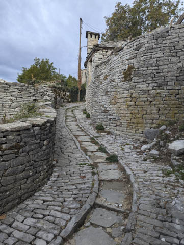
Vradeto is famous for the Vradeto steps which were the only way to reach the village until the road was built in the 1970’s. There are over 1200 steps and the staircase took over 20 years to build.
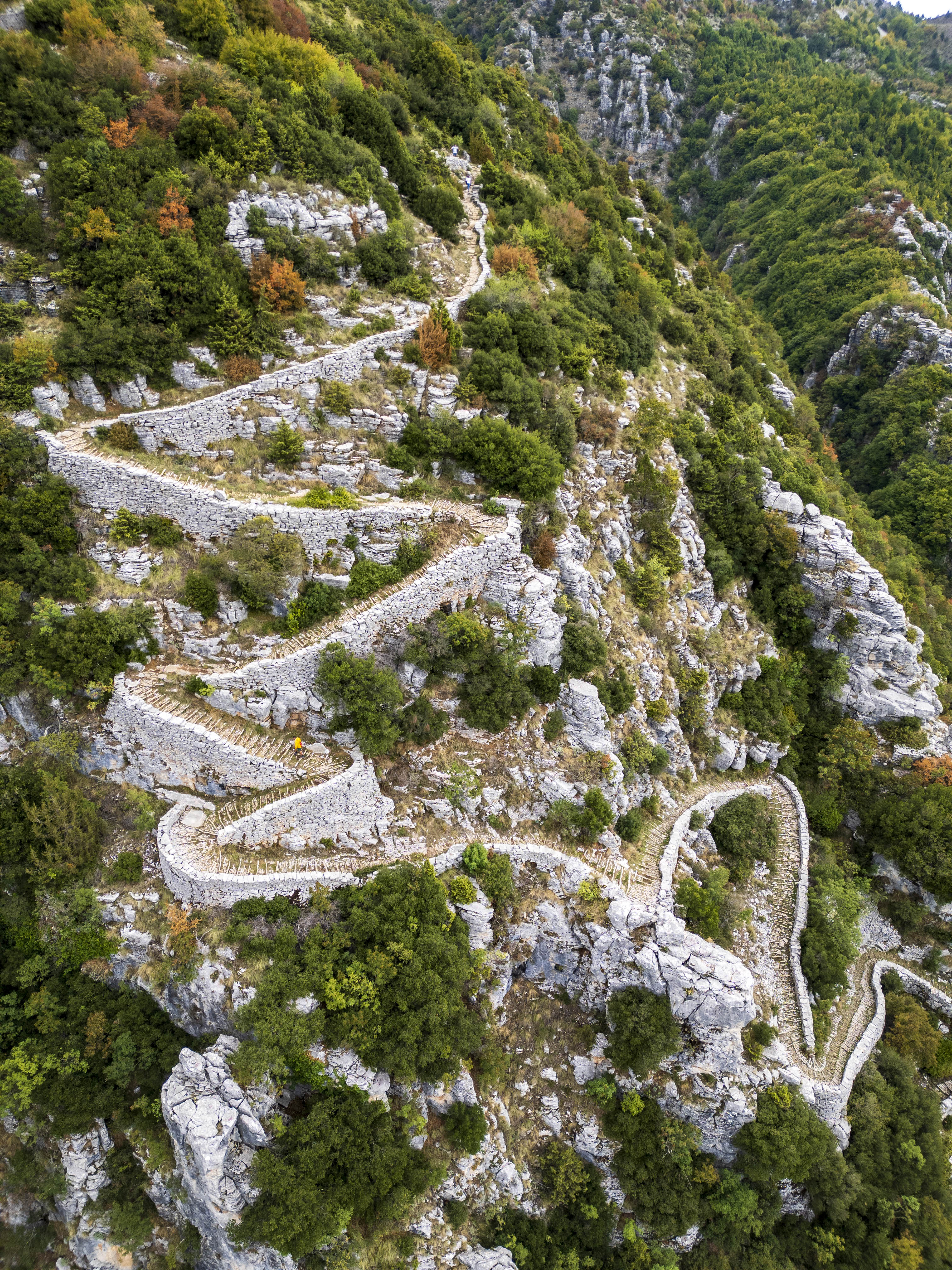
Vradeto is a great place to start the hike to the Beloi viewpoint over the Gorge which is one of the most spectacular places to see the canyon.
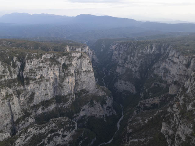
On the way to Vradeto we stopped off to see three stone bridges which date back to the 1700’s. The most visited of these is the Kokkoros bridge which is right next to the road. Unfortunately at this time of year the river beds were all dry. The other two were the Captain Bear Bridge and the Monk Bridge.
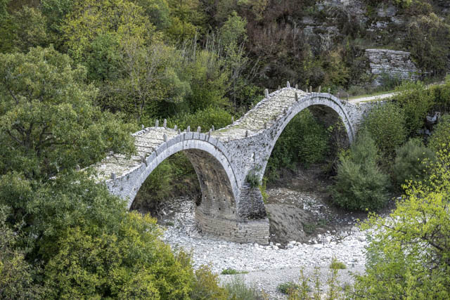
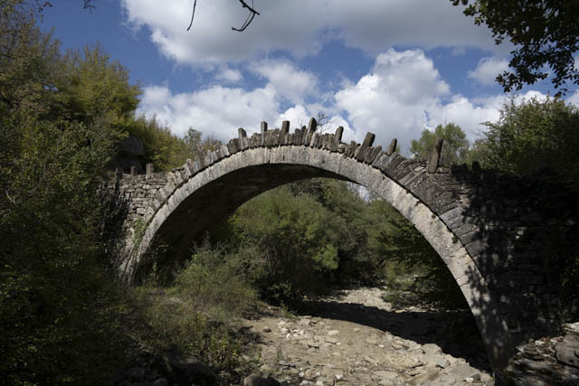
After leaving behind Vikos Gorge we headed to the regional capital town of Ioannina which is another lovely lakeside town. There is a great parking for motorhomes right beside the lake which is only a 5 minute walk from the old town.
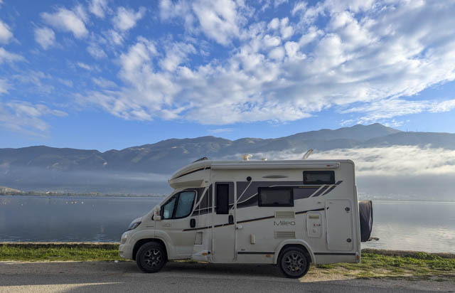
Ioannina is an easy city to explore with a walled old town that for once isn’t on top of a great big hill. Outside the walls of the old town Is a lively modern new town with a relaxed feel. Its not a particularly big town but one that we immediately felt comfortable in.
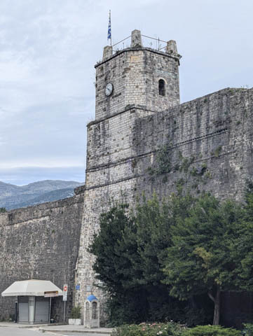
Within the walls of the old town the highlights include the silversmithing museum which was the town’s treasury in years gone past and the tomb of Ali Pasha.
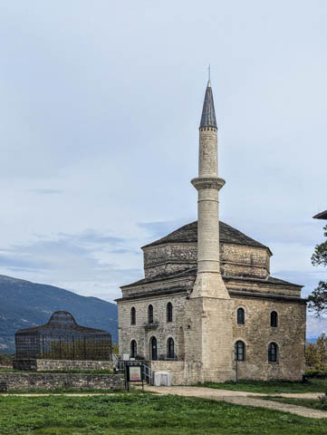
Ali Pasha was an Albania born in 1741 and he became a brutal leader, conquering Ioannina in 1787 which he then made the capital of a personal kingdom which he seized from the Ottomans. He showed no loyalty to any nation and in turn allied with the French, Turks and British depending on which suited him best at any one time. He managed to rule for 33 years until, in 1821, the Ottoman Sultan decided that enough was enough and sent an army of 50 thousand to capture him. He was duly decapitated and his head was sent Istanbul. His body is buried here in Ioannina.
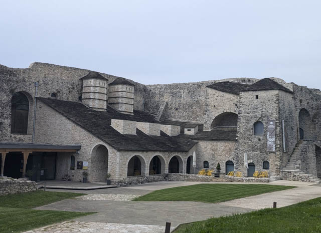
We capped off our day in Ioannina with a visit to a waterfront grill – although it was pretty windy so we actually sat on the terrace away from the water, where we had a great value meal which we thoroughly enjoyed. If you are passing this way we would recommend “Something is Grilling on the Corner” for a great cheap feed.